Toledo, Antioquia

Last updated
Toledo, Antioquia
Municipality and town
Flag of Toledo (Antioquia).svg
Escudo de Toledo (Antioquia).svg
Colombia - Antioquia - Toledo.svg
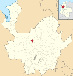
Location of the municipality and town of Toledo, Antioquia in the Antioquia Department of Colombia
Colombia location map.svg
Red pog.svg
Toledo, Antioquia
Location in Colombia
Coordinates: 7°0′37″N75°42′6″W / 7.01028°N 75.70167°W / 7.01028; -75.70167
CountryFlag of Colombia.svg  Colombia
Department Flag of Antioquia Department.svg Antioquia Department
Subregion Northern
Elevation
1,850 m (6,070 ft)
Time zone UTC-5 (Colombia Standard Time)

Toledo is a town and municipality in Antioquia Department, Colombia. Part of the subregion of Northern Antioquia, it lies at an altitude of 1,850 m (6,070 ft).

7°00′47″N75°41′43″W / 7.01306°N 75.6953°W / 7.01306; -75.6953

Related Research Articles

<span class="mw-page-title-main">Caicedo</span> Municipality and town in Antioquia Department, Colombia

Caicedo is a town and municipality in Antioquia Department, Colombia. It is part of the sub-region of Southwestern Antioquia. In 2002, the population was 7,608, with a density ratio of 34.5/km².

<span class="mw-page-title-main">Angostura, Antioquia</span> Municipality and town in Antioquia Department, Colombia

Angostura is a town and municipality in Antioquia Department, Colombia. It is part of the subregion of Northern Antioquia. The population was 10,500 at the 2018 census.

<span class="mw-page-title-main">Santa Fe de Antioquia</span> Municipality and town in Antioquia Department, Colombia

Santa Fe de Antioquia is a municipality in the Antioquia Department, Colombia. The city is located approximately 58 kilometres (36 mi) north of Medellín, the department capital. The population was 23,216 at the 2018 census.

<span class="mw-page-title-main">Buriticá</span> Municipality and town in Antioquia Department, Colombia

Buriticá is a town and municipality in Antioquia Department, Colombia.

<span class="mw-page-title-main">Caramanta</span> Municipality and town in Antioquia Department, Colombia

Caramanta is a town and municipality in the Colombian department of Antioquia. It is part of the sub-region of Southwestern Antioquia.

<span class="mw-page-title-main">Don Matías</span> Municipality and town in Antioquia Department, Colombia

Don Matías is a municipality in Antioquia Department, Colombia. Part of the subregion of Northern Antioquia. Bordered to the north by the municipality of Santa Rosa de Osos, to the east by the municipalities of Santa Rosa de Osos and Santo Domingo, to the south by the municipality of Barbosa, and to the west by the municipality of San Pedro de los Milagros.

<span class="mw-page-title-main">Entrerríos</span> Municipality and town in Antioquia Department, Colombia

Entrerrios is a municipality in the Colombian subregion of Northern Antioquia, in the department of Antioquia. The population was 8,820 at the 2018 census. The population, according to the 2002 census, was 8,305 inhabitants.

<span class="mw-page-title-main">Fredonia, Antioquia</span> Municipality and town in Antioquia Department, Colombia

Fredonia is a town and municipality in the Colombian department of Antioquia. It is part of the sub-region of Southwestern Antioquia. According to the 2018 census, the population comprises 18,790 people.

<span class="mw-page-title-main">Hispania, Antioquia</span> Municipality and town in Antioquia Department, Colombia

Hispania is a town and municipality in Antioquia Department, Colombia. It is part of the sub-region of Southwestern Antioquia.

<span class="mw-page-title-main">Ituango</span> Municipality and town in Antioquia Department, Colombia

Ituango is a town and municipality in the Colombian department of Antioquia. P\It is part of the subregion of Northern Antioquia. The population was 23,784 at the 2018 census.

<span class="mw-page-title-main">Montebello, Antioquia</span> Municipality and town in Antioquia Department, Colombia

Montebello is a town and municipality in Antioquia Department, Colombia. Located at an elevation of 2,350 m above sea level, it is part of the sub-region of Southwestern Antioquia.

<span class="mw-page-title-main">Santa Bárbara, Antioquia</span> Municipality and town in Antioquia Department, Colombia

Santa Bárbara is a town and municipality in the Colombian department of Antioquia. Part of the subregion of Southwestern Antioquia. Santa Barbara is located in a valley about 2.5 hours drive from Medellín by car or bus. It lies at an elevation of 1,800 m above sea level.

<span class="mw-page-title-main">Valdivia, Antioquia</span> Municipality and town in Antioquia Department, Colombia

Valdivia is a town and municipality in Antioquia Department, Colombia. Part of the subregion of Northern Antioquia, its population was 11,511 at the 2018 census.

<span class="mw-page-title-main">Peque, Antioquia</span> Municipality and town in Antioquia Department, Colombia

Peque is a municipality in the Colombian department of Antioquia. The population was 7,155 at the 2018 census.

<span class="mw-page-title-main">Pueblorrico</span> Municipality and town in Antioquia Department, Colombia

Pueblorrico is a town and municipality in Antioquia Department, Colombia. Part of the subregion of Southwestern Antioquia.

<span class="mw-page-title-main">Rionegro</span> City in Antioquia, Department of Colombia

Rionegro is a city and municipality in Antioquia Department, Colombia, located in the subregion of Eastern Antioquia. The official name of the city is "Ciudad Santiago de Arma de Rionegro". Rio Negro means "Black River" in Spanish, as the city received its name after a river that looks black because of the shadows cast by trees. The river traverses the city and it is the most prominent geographical feature of the municipality. Rionegro is also sometimes called the Cuna de la democracia as it was one of the most important cities during the era of the Colombia's struggle for independence and the 1863 constitution was written in the city.

<span class="mw-page-title-main">Briceño, Antioquia</span> Municipality and town in Antioquia Department, Colombia

Briceño is a town and municipality in Antioquia Department, Colombia. Part of the subregion of Northern Antioquia, it lies at an altitude of 1,200 m above sea level.

<span class="mw-page-title-main">Olaya, Antioquia</span> Municipality and town in Antioquia Department, Colombia

Olaya is a town and municipality located in the western region of the Department of Antioquia in the Republic of Colombia. It borders to the north with the municipality of Liborina, to the east with the municipalities of Belmira and Sopetrán and to the South with Sopetrán and by the West with the municipality of Santa Fe de Antioquia. It lies at an altitude of 500 m above sea level.

<span class="mw-page-title-main">Roman Catholic Archdiocese of Santa Fe de Antioquia</span> Catholic archdiocese in Colombia

The Roman Catholic Archdiocese of Santa Fe de Antioquia is an archdiocese located in the city of Santa Fe de Antioquia in Colombia.

<span class="mw-page-title-main">Antioquia State</span>

Antioquia State was one of the states of Colombia. Today the area of the former state makes up most of modern day Antioquia Department, Colombia.