Our Lady of Guadalupe, also known as the Virgin of Guadalupe, is a Catholic title of Mary, mother of Jesus associated with a series of five Marian apparitions to a Mexican peasant named Juan Diego and his uncle, Juan Bernardino, which are believed to have occurred in December 1531, when the Mexican territories were under the Spanish Empire.
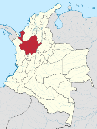
Antioquia is one of the 32 departments of Colombia, located in the central Northwestern part of Colombia with a narrow section that borders the Caribbean Sea. Most of its territory is mountainous with some valleys, much of which is part of the Andes mountain range. Antioquia has been part of many territorial divisions of former countries created within the present-day territory of Colombia. Prior to adoption of the Colombian Constitution of 1886, Antioquia State had its own sovereign government.

Medellín, officially the Special District of Science, Technology and Innovation of Medellín, is the second-largest city in Colombia after Bogotá, and the capital of the department of Antioquia. It is located in the Aburrá Valley, a central region of the Andes Mountains, in northwestern South America. The city's population was 2,508,452 at the 2018 census. The metro area of Medellín is the second-largest urban agglomeration in Colombia in terms of population and economy, with more than 4 million people.
Guadalupe or Guadeloupe may refer to:

Amalfi is a town and municipality of the Colombian Andes, northern part of the Central Mountain Range in the Antioquia Department and part of the subregion of Northeastern Antioquia. The territory of Amalfi is bordered by the municipalities of Anorí and Segovia at its north; Segovia, Remedios and Vegachí at the east; Vegachí, Yalí, Yolombó and Gómez Plata at the south and Anorí and Guadalupe at the west. The town is served by Amalfi Airport.

Santa Fe de Antioquia is a municipality in the Antioquia Department, Colombia. The city is located approximately 58 kilometres (36 mi) north of Medellín, the department capital. The population was 23,216 at the 2018 census.

Bello is a city and municipality in Antioquia Department, Colombia and a suburb of Medellín, the department capital. Bello is part of the Metropolitan Area of the Aburrá Valley in the department of Antioquia. It is bordered on the north by the municipality of San Pedro de los Milagros, on the east by the municipality of Copacabana, on the south by the municipality of Medellín and on the west by the municipalities of Medellín and San Jerónimo.
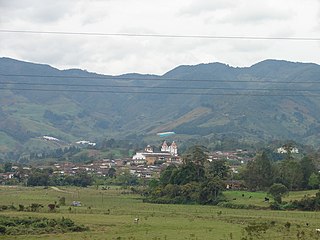
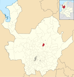
Carolina del Príncipe is a town and municipality in the Colombian department of Antioquia, located 105 km north of Medellín, with an altitude of 1,807 m above sea level. Carolina del Príncipe is part of the subregion of Northern Antioquia.
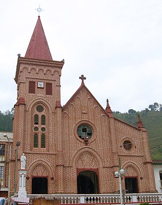
Montebello is a town and municipality in Antioquia Department, Colombia. Located at an elevation of 2,350 m above sea level, it is part of the sub-region of Southwestern Antioquia.

Santa Rosa de Osos is a middle city and municipality of Colombia located in the northern of the department of Antioquia. Bounded on the north with the municipalities of Yarumal and Angostura, on the east with Guadalupe and Carolina del Principe, on the south with the municipalities of Donmatías, San Pedro de los Milagros and Entrerríos, and on the west with Belmira and San José de la Montaña.

San Roque is a town and municipality in the Colombian department of Antioquia. Part of the subregion of Northeastern Antioquia, it is located 1,475 m above sea level. The municipality was founded by Francisco Martinez de Ospina on the 8 February 1880. The town is located between the Nare River and the Nus River. The town was created due to the presence of gold in the areas around the town. The town is located 121 km north of Medellín. The people of this town celebrate most of the traditional festivals that are celebrated in Colombia.

Puerto Berrío is a municipality and town in the Colombian department of Antioquia. It is part of the Magdalena Medio Antioquia sub-region.

The University of Antioquia, also called UdeA, is a public, departmental, coeducational, research university located primarily in the city of Medellín, Antioquia, Colombia, with regional campuses in Amalfi, Andes, Caucasia, Carmen de Viboral, Envigado, Puerto Berrío, Santa Fe de Antioquia, Segovia, Sonsón, Turbo and Yarumal. It is the oldest departmental university in Colombia, founded in 1803 by a Royal Decree issued by King Charles IV of Spain under the name Franciscan College. It is considered one of Colombia's best universities, receiving a high quality accreditation from the Ministry of Education for 9 years. Along with the University of the Andes, the two universities hold the second longest term, behind the National University of Colombia. UdeA and the Tecnológico de Antioquia have the largest number of seats in the department of Antioquia. It is also renowned for its prestigious Faculty of Medicine, which is acknowledged as one of the best medical schools in Colombia.

The Cordillera Occidental is the lowest in elevation of the three branches of the Colombian Andes. The average altitude is 2,000 m (6,600 ft) and the highest peak is Cerro Tatamá at 4,100 m (13,500 ft). The range extends from south to north dividing from the Colombian Massif in Nariño Department, passes north through Cauca, Valle del Cauca, Risaralda, Chocó, and Caldas Departments to the Paramillo Massif in Antioquia and Córdoba Departments. The cordillera is paralleled on the east by the Cauca river. From this massif the range divides further to form the Serranías de Ayapel, San Jerónimo and Abibe. Only to recede into the Caribbean plain and the Sinú River valley.

The Colombia national rugby union team is classified as a tier three nation by World Rugby. They have thus far not qualified for a Rugby World Cup, but have participated in qualifying tournaments. Colombia made their debut against Mexico in 1996. In 2018, the Colombians won their first significant international honour, winning the inaugural Americas Rugby Challenge, the 'B' championship to the Americas Rugby Championship.

Eastern Antioquia is subregion of the Colombian Department of Antioquia. The region consists of 23 municipalities.
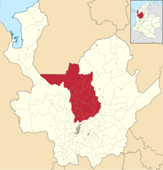
Northern Antioquia is a subregion in the Colombian Department of Antioquia. The region is made up of 17 municipalities.
The History of the Department of Antioquia began with the arrival of the first human settlers into what is now the Antioquia Department in Colombia. These first settlers are presumed to have arrived from mesoamerica in Central America, some 10,500 years BC, although there is some evidence of human vestiges that may date to 22,000 years BC.

Antioquia State was one of the states of Colombia. Today the area of the former state makes up most of modern day Antioquia Department, Colombia.

