Cajamarca is a town and municipality in the Tolima Department of Colombia. The population of the municipality was 17,309 as of the 2018 census. The municipality has two populated centres, the town centre of Cajamarca and the locality of Anaime. It is located along the Pan-American Highway.

Angostura is a town and municipality in Antioquia Department, Colombia. It is part of the subregion of Northern Antioquia. The population was 10,500 at the 2018 census.

Santa Fe de Antioquia is a municipality in the Antioquia Department, Colombia. The city is located approximately 58 kilometres (36 mi) north of Medellín, the department capital. The population was 23,216 at the 2018 census.
Don Matías is a municipality in Antioquia Department, Colombia. Part of the subregion of Northern Antioquia. Bordered to the north by the municipality of Santa Rosa de Osos, to the east by the municipalities of Santa Rosa de Osos and Santo Domingo, to the south by the municipality of Barbosa, and to the west by the municipality of San Pedro de los Milagros.

Ebéjico is a town and municipality in the West of Antioquia Department, Colombia.

Envigado is a city and municipality southeast of Medellín, Colombia in the department of Antioquia. It is located in the Metropolitan Area of the Aburrá Valley. It borders El Poblado, Medellín to the north, Sabaneta to the south, El Retiro and Caldas to the east, and Itagüí to the west.
Fredonia is a town and municipality in the Colombian department of Antioquia. It is part of the sub-region of Southwestern Antioquia. According to the 2018 census, the population comprises 18,790 people.
Gómez Plata is a town and municipality in the Colombian department of Antioquia. It is part of the subregion of Northern Antioquia. The population was 8,235 at the 2018 census.
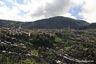
Ituango is a town and municipality in the Colombian department of Antioquia. P\It is part of the subregion of Northern Antioquia. The population was 23,784 at the 2018 census.
Liborina is a town and municipality in the Colombian department of Antioquia. The population was 7,928 at the 2018 census.
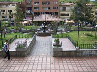
La Unión is a town and municipality in the Colombian department of Antioquia. The population was 20,769 at the 2018 census. It is part of the subregion of Eastern Antioquia.

Sopetrán is a municipality of Colombia, located in the subregion west of the state of Antioquia. It is bounded to the north by the municipality of Olaya, to the east by the municipality of Belmira, to the south by the municipalities of San Jerónimo and Ebéjico, and to the west by the municipality of Santa Fe de Antioquia. The population was 13,748 at the 2018 census. It is 59 kilometers from the city of Medellin, the state capital of Antioquia. The municipality of Sopetrán has an area of 223 square kilometers.

Valdivia is a town and municipality in Antioquia Department, Colombia. Part of the subregion of Northern Antioquia, its population was 11,511 at the 2018 census.

Venecia is a town and municipality in Antioquia Department, Colombia. According to the 2018 census, the population comprised 10,280 people.

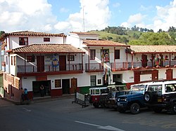
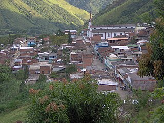
Peque is a municipality in the Colombian department of Antioquia. The population was 7,155 at the 2018 census.

El Retiro is a town and municipality in Antioquia Department, Colombia. Part of the subregion of Eastern Antioquia, its population was 20,700 at the 2018 census.

Rionegro is a city and municipality in Antioquia Department, Colombia, located in the subregion of Eastern Antioquia. The official name of the city is "Ciudad Santiago de Arma de Rionegro". Rio Negro means "Black River" in Spanish, as the city received its name after a river that looks black because of the shadows cast by trees. The river traverses the city and it is the most prominent geographical feature of the municipality. Rionegro is also sometimes called the Cuna de la democracia as it was one of the most important cities during the era of the Colombia's struggle for independence and the 1863 constitution was written in the city.

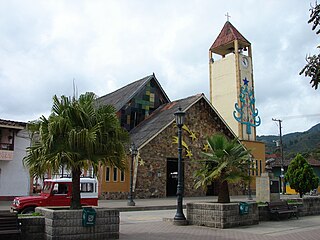
San Rafael is a town and municipality in Antioquia Department, Colombia. Part of the subregion of Eastern Antioquia.

San Pedro de los Milagros is a town and municipality in the Colombian department of Antioquia. Part of the subregion of Northern Antioquia, its population was 17,119 at the 2018 census.

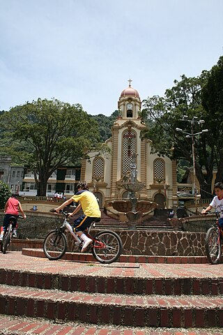
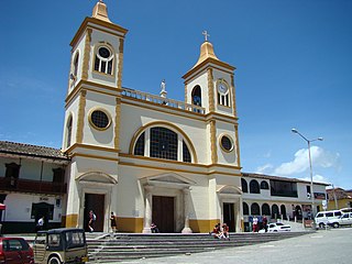
La Ceja del Tambo, known as La Ceja, is a town and municipality in the Antioquia Department of Colombia. It is part of the subregion of Eastern Antioquia. La Ceja borders the Rionegro and Carmen de Viboral municipalities to the north, La Unión to the east, and Montebello and Retiro to the west. It is located approximately 41 kilometers from Medellín, the department capital.