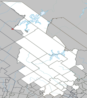
Les Lacs-du-Témiscamingue is a vast unorganized territory in the Abitibi-Témiscamingue region of Quebec, Canada. With a surface area of 10,410 square kilometres (4,020 sq mi), it takes up over 60% of the eastern portion of the Témiscamingue Regional County Municipality.

Lac-Douaire is an unorganized territory of Quebec, Canada. It is the largest geo-political division in the Laurentides region, and one of eleven unorganized areas in the Antoine-Labelle Regional County Municipality.

Lac-des-Dix-Milles is an unorganized territory in the Lanaudière region of Quebec, Canada, part of the Matawinie Regional County Municipality. This square-shaped territory is entirely within the Mont-Tremblant National Park.

Lake Lapeyrère is a municipal unorganized territory, part of Portneuf in Quebec, (Canada). The RCM is included in the administrative region of the Capitale-Nationale. This area of the north shore of St. Lawrence river and the west bank of the Batiscan River is located about 75 kilometers northeast of Shawinigan, Quebec. The unorganized territory Lac-Lapeyrère includes Lapeyrère Township, which was established in 1907. The canton is one sector of Portneuf Wildlife Reserve and Zec Tawachiche. Territory Lac-Lapeyrère has several major water bodies including lakes Garneau, Travers, Robinson, Casgrain, Tage and Lapeyrère, and is drained to the east by the Batiscan River.

Lac-Blanc is an unorganized territory in the Capitale-Nationale region of Quebec, Canada, in the north-east of the Portneuf Regional County Municipality. This unorganized territory covers 567.80 km ². The main lake, designated "White Lake" has the shape of a fine, oriented north-south. The discharge of this lake is on the southern tip, where it flows into the White River.
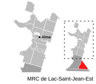
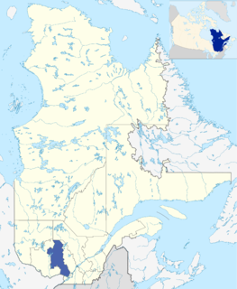
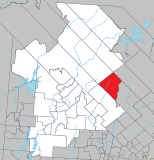
Lac-Achouakan is an unorganized territory in the Canadian province of Quebec, located in the regional county municipality of Lac-Saint-Jean-Est. It had a population of zero in the Canada 2006 Census, and covered a land area of 227.35 km2, entirely within the Laurentides Wildlife Reserve. The western boundary of the territory is Bark River, while Quebec Route 169 forms the eastern boundary.

Lac-Legendre is an unorganized territory in the Lanaudière region of Quebec, Canada, part of the Matawinie Regional County Municipality.

Lac-Santé is an unorganized territory in the Lanaudière region of Quebec, Canada, part of the Matawinie Regional County Municipality.

Lac-Matawin is an unorganized territory in the Lanaudière region of Quebec, Canada, part of the Matawinie Regional County Municipality.

Lac-Minaki is an unorganized territory in the Lanaudière region of Quebec, Canada, part of the Matawinie Regional County Municipality.

Lac-Devenyns is an unorganized territory in the Lanaudière region of Quebec, Canada, part of the Matawinie Regional County Municipality.

Lac-Oscar is an unorganized territory in the Laurentides region of Quebec, Canada, and one of eleven unorganized areas in the Antoine-Labelle Regional County Municipality.
Lac-de-la-Maison-de-Pierre is an unorganized territory in the Laurentides region of Quebec, Canada, and one of eleven unorganized areas in the Antoine-Labelle Regional County Municipality.

Lac-De La Bidière is an unorganized territory in the Laurentides region of Quebec, Canada, and one of eleven unorganized areas in the Antoine-Labelle Regional County Municipality.
Lac-de-la-Pomme is an unorganized territory in the Laurentides region of Quebec, Canada, and one of eleven unorganized areas in the Antoine-Labelle Regional County Municipality.

Lac-Bazinet is an unorganized territory in the Laurentides region of Quebec, Canada, and one of the two most northerly of eleven unorganized areas in the Antoine-Labelle Regional County Municipality.

Lac-Wagwabika is an unorganized territory in the Laurentides region of Quebec, Canada, and one of eleven unorganized areas in the Antoine-Labelle Regional County Municipality.
Lac-du-Taureau is an unorganized territory in the Lanaudière region of Quebec, Canada, part of the Matawinie Regional County Municipality.

Lac-Cabasta is an unorganized territory in the Lanaudière region of Quebec, Canada, part of the Matawinie Regional County Municipality.