Lac-De La Bidière | |
---|---|
Unorganized territory | |
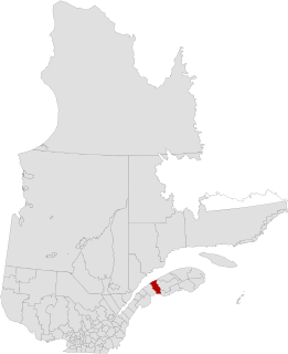
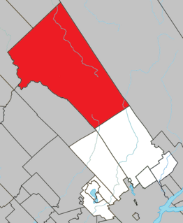
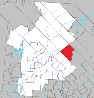
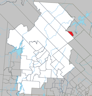
Location within Antoine-Labelle RCM. | |
Coordinates: 47°26′N75°05′W / 47.433°N 75.083°W Coordinates: 47°26′N75°05′W / 47.433°N 75.083°W [1] | |
Country | |
Province | |
Region | Laurentides |
RCM | Antoine-Labelle |
Constituted | January 1, 1986 |
Government [2] | |
• Federal riding | Laurentides—Labelle |
• Prov. riding | Labelle |
Area [2] [3] | |
• Total | 1,665.90 km2 (643.21 sq mi) |
• Land | 1,554.49 km2 (600.19 sq mi) |
Population (2011) [3] | |
• Total | 0 |
• Density | 0.0/km2 (0/sq mi) |
• Pop 2006-2011 | |
• Dwellings | 1 |
Time zone | EST (UTC−5) |
• Summer (DST) | EDT (UTC−4) |
Highways | No major routes |
Lac-De La Bidière is an unorganized territory in the Laurentides region of Quebec, Canada, and one of eleven unorganized areas in the Antoine-Labelle Regional County Municipality.
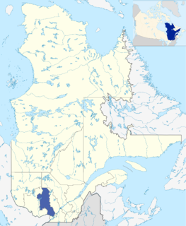
The Laurentides is a region of Quebec. While it is often called the Laurentians in English, the region includes only part of the Laurentian mountains. It has a total land area of 20,744.29 km2 (8,009.42 sq mi) and a 2011 census population of 555,614 inhabitants.
Quebec is one of the thirteen provinces and territories of Canada. It is bordered to the west by the province of Ontario and the bodies of water James Bay and Hudson Bay; to the north by Hudson Strait and Ungava Bay; to the east by the Gulf of Saint Lawrence and the province of Newfoundland and Labrador; and to the south by the province of New Brunswick and the U.S. states of Maine, New Hampshire, Vermont, and New York. It also shares maritime borders with Nunavut, Prince Edward Island, and Nova Scotia. Quebec is Canada's largest province by area and its second-largest administrative division; only the territory of Nunavut is larger. It is historically and politically considered to be part of Central Canada.
Canada is a country in the northern part of North America. Its ten provinces and three territories extend from the Atlantic to the Pacific and northward into the Arctic Ocean, covering 9.98 million square kilometres, making it the world's second-largest country by total area. Canada's southern border with the United States is the world's longest bi-national land border. Its capital is Ottawa, and its three largest metropolitan areas are Toronto, Montreal, and Vancouver. As a whole, Canada is sparsely populated, the majority of its land area being dominated by forest and tundra. Consequently, its population is highly urbanized, with over 80 percent of its inhabitants concentrated in large and medium-sized cities, many near the southern border. Canada's climate varies widely across its vast area, ranging from arctic weather in the north, to hot summers in the southern regions, with four distinct seasons.
Antoine-Labelle is a regional county municipality located in the Laurentides region of Quebec, Canada. Its seat is Mont-Laurier. It is named for Antoine Labelle.
La Mitis is a regional county municipality in the Bas-Saint-Laurent region in eastern Quebec, Canada on the Gaspé peninsula. It is named for the Mitis River which has its source in the region and flows through the central part of the region before emptying into the Saint Lawrence River.
Rivière-Héva is a municipality in northwestern Quebec, Canada in the MRC de La Vallée-de-l'Or. It is named after the Héva River that flows through the municipality.
Lac-Pythonga is an unorganized territory in the Outaouais region of Quebec, Canada. It surrounds Lake Pythonga and is the largest of the five unorganized territories in the La Vallée-de-la-Gatineau Regional County Municipality.
Lac-Lenôtre is an unorganized territory in the Outaouais region of Quebec, Canada. It is one of the five unorganized territories in the La Vallée-de-la-Gatineau Regional County Municipality. It is named after Lake Lenôtre.
Lac-Granet is an unorganized territory in the Abitibi-Témiscamingue region of Quebec, Canada. It is one of five unorganized territories in the La Vallée-de-l'Or Regional County Municipality.
Lac-Metei is an unorganized territory in the Abitibi-Témiscamingue region of Quebec, Canada. It is one of five unorganized territories in the La Vallée-de-l'Or Regional County Municipality.
Lake Lapeyrère is a municipal unorganized territory, part of Portneuf in Quebec, (Canada). The RCM is included in the administrative region of the Capitale-Nationale. This area of the north shore of St. Lawrence river and the west bank of the Batiscan River is located about 75 kilometers northeast of Shawinigan, Quebec. The unorganized territory Lac-Lapeyrère includes Lapeyrère Township, which was established in 1907. The canton is one sector of Portneuf Wildlife Reserve and Zec Tawachiche. Territory Lac-Lapeyrère has several major water bodies including lakes Garneau, Travers, Robinson, Casgrain, Tage and Lapeyrère, and is drained to the east by the Batiscan River.
Lac-Blanc is an unorganized territory in the Capitale-Nationale region of Quebec, Canada, in the north-east of the Portneuf Regional County Municipality. This unorganized territory covers 567.80 km ². The main lake, designated "White Lake" has the shape of a fine, oriented north-south. The discharge of this lake is on the southern tip, where it flows into the White River.
Belle-Rivière is an unorganized territory in the Canadian province of Quebec, located in the regional county municipality of Lac-Saint-Jean-Est. It had a population of zero in the Canada 2006 Census, and covered a land area of 610.30 km2. The Métabetchouane River forms its western boundary.
Lac-Croche is an unorganized territory in the Capitale-Nationale region of Quebec, Canada, in the north of La Jacques-Cartier Regional County Municipality, taking up more than 50% of this regional county. It is unpopulated and undeveloped, almost entirely part of the Laurentides Wildlife Reserve.
Lac-Jacques-Cartier is a large unorganized territory in the Capitale-Nationale region of Quebec, Canada, in the La Côte-de-Beaupré Regional County Municipality, making up more than 85% of this regional county. It is unpopulated and undeveloped, almost entirely part of the Jacques-Cartier National Park and the Laurentides Wildlife Reserve.
Lac-Matapédia is an unorganized territory in the Bas-Saint-Laurent region of Quebec, Canada. It is named after and located on the northern shores of Lake Matapedia in the Matapédia Valley.
Lac-Alfred is an unorganized territory in the Bas-Saint-Laurent region of Quebec, Canada.
Lac-à-la-Croix is an unorganized territory in the Canadian province of Quebec, located in the La Mitis Regional County Municipality.
Lac-Normand is an unorganized territory in the Mauricie region of Quebec, Canada, part of the Mékinac Regional County Municipality. Most of the territory la "Lac-Normand" is included in the Saint-Maurice Wildlife Reserve.
Lac-de-la-Maison-de-Pierre is an unorganized territory in the Laurentides region of Quebec, Canada, and one of eleven unorganized areas in the Antoine-Labelle Regional County Municipality.
Lac-de-la-Pomme is an unorganized territory in the Laurentides region of Quebec, Canada, and one of eleven unorganized areas in the Antoine-Labelle Regional County Municipality.
Lac-Bazinet is an unorganized territory in the Laurentides region of Quebec, Canada, and one of the two most northerly of eleven unorganized areas in the Antoine-Labelle Regional County Municipality.
Lac-des-Eaux-Mortes is an unorganized territory in the Canadian province of Quebec, located in the La Mitis Regional County Municipality.
This Quebec location article is a stub. You can help Wikipedia by expanding it. |