Qinghai Lake or Ch'inghai Lake,also known by other names,is the largest lake in China. Located in an endorheic basin in Qinghai Province,to which it gave its name,Qinghai Lake is classified as an alkaline salt lake. The lake has fluctuated in size,shrinking over much of the 20th century but increasing since 2004. It had a surface area of 4,317 km2 (1,667 sq mi),an average depth of 21 m (69 ft),and a maximum depth of 25.5 m (84 ft) in 2008.

The Badain Jaran Desert is a desert in China which spans the provinces of Gansu,Ningxia and Inner Mongolia. It covers an area of 49,000 square kilometers. By size it is the third largest desert in China.

Onekotan is an uninhabited volcanic island located near the northern end of the Kuril Islands chain in the Sea of Okhotsk in the northwest Pacific Ocean. Its name is derived from the Ainu language for "large village”. It is the second largest island,after Paramushir,in the northern subgroup of the Kurils. It is administratively included in the Severo-Kurilsky District of Sakhalin oblast,Russia.

Hongze Lake,previously known as Lake Hungtze or Hung-tse,is the fifth-largest freshwater lake in China. Although it is known to have existed from antiquity,it drastically increased in size during the Qing when the Yellow River—then still flowing south of Shandong—merged with the Huai. The increased sediment and flow combined to greatly expand the lake,swallowing the previous regional center of Sizhou and the Ming Zuling tombs. During the imperial and republican periods,the lake formed part of the border between Jiangsu and Anhui provinces but since 1955 the previous borders have been shifted to place it entirely under Jiangsu's administration. It is now encompassed by the counties of Sihong and Siyang in Suqian Prefecture and Xuyi and Hongze in Huai'an Prefecture. Since the establishment of the People's Republic of China,the lake has generally decreased in size as more of its inflow has been diverted for irrigation.

Yangcheng Lake is a freshwater lake about 3 km (1.9 mi) northeast of the city of Suzhou in Jiangsu Province,and ranges in depth from 1.5–2 m. The lake is 17 kilometers (11 mi) long from north to south,with an average width of 8 kilometers (5.0 mi) from east to west. It is the most famous area of origin for the Chinese mitten crab,which is considered a delicacy.

Dai County,also known by its Chinese name Daixian,is a county in Xinzhou,Shanxi Province,China. Its county seat at Shangguan is also known as Daixian. The county has an area of 1,729 km2 (668 sq mi) and had a population of 178,870 at the time of the 2020 census. The county is the home of the AAAAA-rated Yanmen Pass Scenic Area along the Great Wall,as well as the Bianjing Drum Tower,the Ayuwang Pagoda,and the Zhao Gao Forest Park.

The Bohai Sea is a gulf/inland sea approximately 77,000 km2 (30,000 sq mi) in area on the east coast of Mainland China. It is the northwestern and innermost extension of the Yellow Sea,to which it connects to the east via the Bohai Strait. It has a mean depth of approximately 18 meters (59 ft),with a maximum depth of about 80 meters (260 ft) located in the northern part of the Bohai Strait.

Lake Ogawara is Japan's eleventh largest lake and the largest in Aomori Prefecture. It spans the boundaries of the city of Misawa,the town of Tōhoku,and the village of Rokkasho in Kamikita District.

Lake Prokljan is a lake in the Croatian region of Dalmatia,located near the cities of Skradin and Šibenik.

Yanmen Pass,also known by its Chinese name Yanmenguan and as Xixingguan,is a mountain pass which includes three fortified gatehouses along the Great Wall of China. The area was a strategic choke point in ancient and medieval China,controlling access between the valleys of central Shanxi and the Eurasian Steppe. This made it the scene of various important battles,extending into World War II,and the area around the gatehouses and this stretch of the Great Wall is now a AAAAA-rated tourist attraction. The scenic area is located just outside Yanmenguan Village in Yanmenguan Township in Dai County,Xinzhou City,Shanxi Province,China.

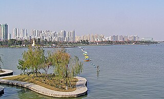
Jinji Lake is a fresh water lake located in the central part of Suzhou Industrial Park,Jiangsu,China. It occupies an area of 7.18 square kilometers (2.77 sq mi) and its average depth is about 2.5–3 meters. There are two man-made islands in the lake.

Dushu Lake is a freshwater lake in the southern part of Suzhou Industrial Park. It is located in the junction of four towns:Guoxiang (郭巷),Chefang (车坊),Xietang (斜塘) and Loufeng (娄葑). The area of Dushu Lake is 9.19 square kilometers with an average depth of 6.5 meters. The lake connects the Jinji Lake (金鸡湖) at its north end,the Fengmen Pond (葑门塘) at its west,and is fed by the Wusong River (吴淞江) from the south-east. The earliest proof of possible human activity around Dushu Lake can be traced back 5500 years,according to an archaeology report conducted in 2001. The findings were significant in analyzing Suzhou's climate,geography,and environment in ancient times. Suzhou Dushu Lake Higher Education Town is located by the east bank of the lake,and two tunnels run through the lake,connecting the east and west bank.

Dai Prefecture,also known by its Chinese name Daizhou,was a prefecture (zhou) of imperial China in what is now northern Shanxi. It existed intermittently from AD 585 to 1912. Its eponymous seat Daizhou was located at Shangguan in Dai County. The territory it administered included all or part of what are now the counties of Dai,Wutai,Fanshi,and Yuanping in Shanxi's Xinzhou Prefecture.
Yanmen Commandery was an administrative subdivision (jùn) of the state of Zhao established c. 300 BC and of northern imperial Chinese dynasties until AD 758. It occupied lands in what is now Shanxi and Inner Mongolia. Its first seat was at Shanwu;its later seats moved southeast to the more defensible sites at Yinguan and Guangwu.

Dai Commandery was a commandery (jùn) of the state of Zhao established c. 300 BC and of northern imperial Chinese dynasties until the time of the Emperor Wen of the Sui dynasty. It occupied lands in what is now Hebei,Shanxi,and Inner Mongolia. Its seat was usually at Dai or Daixian,although it was moved to Gaoliu during the Eastern Han.

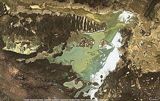
Lake Huangqi,also known by its Chinese name as the Huangqi Hai,is a lake in Chahar Right Front Banner,Ulanqab Prefecture,Inner Mongolia,China.

The Bianjing Drum Tower,also known as the Bianjing Pavilion and by its Chinese name as the Bianjing Lou,is a drum tower in Shangguan,the seat of Dai County,Xinzhou Prefecture,Shanxi,in the People's Republic of China. It dates to 1476 and is 39.3 meters (129 ft) high.

Shalkarteniz is a salt lake in the Yrgyz District,Aktobe Region,Kazakhstan.

Sarykopa is a bittern salt lake in the Kostanay Region,Kazakhstan.

Saumalkol is a salt lake in northwestern Karkaraly District,Karaganda Region,Kazakhstan.


