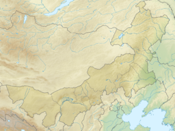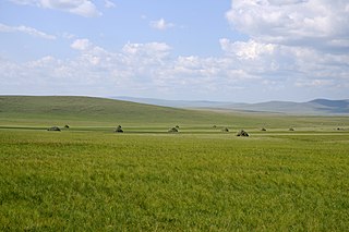
Inner Mongolia,officially the Inner Mongolia Autonomous Region,is an autonomous region of the People's Republic of China. Its border includes two-thirds of the length of China's border with the country of Mongolia. Inner Mongolia also accounts for a small section of China's border with Russia. Its capital is Hohhot;other major cities include Baotou,Chifeng,Tongliao,and Ordos.

Qinghai Lake,also known by other names,is the largest lake in China. Located in an endorheic basin in Qinghai Province,to which it gave its name,Qinghai Lake is classified as an alkaline salt lake. The lake has fluctuated in size,shrinking over much of the 20th century but increasing since 2004. It had a surface area of 4,317 km2 (1,667 sq mi),an average depth of 21 m (69 ft),and a maximum depth of 25.5 m (84 ft) in 2008.
A banner is an administrative division of the Inner Mongolia Autonomous Region in China,equivalent to a county-level administrative division.

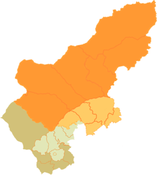
Ulanqab or Ulan Chab is a region administered as a prefecture-level city in south-central Inner Mongolia,China. Its administrative centre is in Jining District,which was formerly a county-level city. It was established as a prefecture-level city on 1 December 2003,formed from the former Ulanqab League. The Ulanqab Stadium is located in the city.

Jining District is an urban district that serves as the administrative seat of Ulanqab,a region governed as a prefecture-level city in the mid-western part of Inner Mongolia,China. It has an area of approximately 114.2 km2 and is in the southern foothills of the Yinshan mountains.

The Badain Jaran Desert is a desert in China which spans the provinces of Gansu,Ningxia and Inner Mongolia. It covers an area of 49,000 square kilometers. By size it is the third largest desert in China.
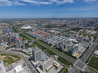
Ordos,also known as Ih Ju,is one of the twelve major subdivisions of Inner Mongolia,China. It lies within the Ordos Plateau of the Yellow River. Although mainly rural,Ordos is administered as a prefecture-level city. Its population was 2,153,638 as of the 2020 census,and its built-up area made up of Ejin Horo Banner and Kangbashi District was home to 366,779 inhabitants,as Dongsheng District is not a conurbation yet.

Dorbod Banner or Siziwang Banner is a banner in Ulanqab,Inner Mongolia,China,bordering Mongolia's Dornogovi Province to the northwest. It is located about 80 km (50 mi) north of Hohhot,the capital of Inner Mongolia.

Manzhouli is a sub-prefectural city located in Hulunbuir prefecture-level city,Inner Mongolia Autonomous Region,China. Located on the border with Russia,it is a major land port of entry. It has an area of 696.3 square kilometres (268.8 sq mi) and a population of almost 250,000.
Huangqi (Huang-ch’i) can refer to:
Hongor or Khongor is a frequent compound of toponymics both in Mongolia and in Inner Mongolia,China,for example:
Hongort is a town (镇) of the Chahar Right Back Banner,which in turn is part of Ulanqab prefecture-level city in Inner Mongolia,China. It is located about 30 km northwest of Shangdu county. In 2000,when it was still classified as township (乡),it had 11860 inhabitants.
Chakhar is a variety of Mongolian spoken in the central region of Inner Mongolia. It is phonologically close to Khalkha and is the basis for the standard pronunciation of Mongolian in Inner Mongolia.

Youyu County,also known by its Chinese name Youyuxian,is a county under the administration of the prefecture-level city of Shuozhou,in the northwest of Shanxi Province,China. It borders Inner Mongolia to the north and west.
Xinghe County is a county of south-central Inner Mongolia,China,bordering the provinces of Hebei to the east and Shanxi to the south. It is under the administration of Ulanqab City,and is situated on the China National Highway 110 between Ulanqab and Zhangjiakou in Hebei province. Bordering county-level divisions include Fengzhen City to the southwest,Chahar Right Front Banner to the west,Chahar Right Back Banner to the northwest,and Shangdu County to the north.
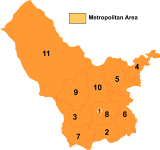
Chahar Right Front Banner or Qahar Right Front Banner is a Banner of Inner Mongolia,China,surrounding Jining District and bordering Xinghe County to the east,Fengzhen City to the south,Zhuozi County to the west,and Chahar Right Back Banner to the north. Its territory includes Lake Huangqi. It is under the administration of Ulaan Chab City. Its most important settlement is Tugin Ul (Tuguiwula),where Tuguiwula railway station is located.

Chahar Right Rear Banner is a banner of Inner Mongolia,China,bordering Shangdu County to the northeast,Xinghe County to the southeast,Qahar Right Front Banner to the south,Zhuozi County to the southwest,Qahar Right Rear Banner to the west,Dorbod Banner to the northwest,and Xilingol League to the north. It is under the administration of Ulanqab City,which lies to the south along the G55 Erenhot–Guangzhou Expressway. The most important settlement in the banner is Bayan Qagan.

Yanmen Pass,also known by its Chinese name Yanmenguan and as Xixingguan,is a mountain pass which includes three fortified gatehouses along the Great Wall of China. The area was a strategic choke point in ancient and medieval China,controlling access between the valleys of central Shanxi and the Eurasian Steppe. This made it the scene of various important battles,extending into World War II,and the area around the gatehouses and this stretch of the Great Wall is now a AAAAA-rated tourist attraction. The scenic area is located just outside Yanmenguan Village in Yanmenguan Township in Dai County,Xinzhou City,Shanxi Province,China.
Yanmen Commandery was an administrative subdivision (jùn) of the state of Zhao established c. 300 BC and of northern imperial Chinese dynasties until AD 758. It occupied lands in what is now Shanxi and Inner Mongolia. Its first seat was at Shanwu;its later seats moved southeast to the more defensible sites at Yinguan and Guangwu.

Lake Dai,also known by its Chinese name Daihai,is a lake in Liangcheng County,Ulanqab Prefecture,Inner Mongolia,China.

