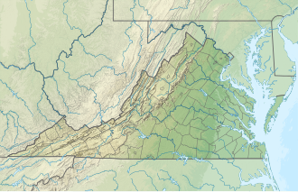
Lake Monticello, Virginia | |
---|---|
Coordinates: 37°55′6″N78°19′36″W / 37.91833°N 78.32667°W Coordinates: 37°55′6″N78°19′36″W / 37.91833°N 78.32667°W | |
Country | United States |
State | Virginia |
County | Fluvanna |
Area | |
• Total | 9.5 sq mi (24.5 km2) |
• Land | 8.8 sq mi (22.9 km2) |
• Water | 0.6 sq mi (1.6 km2) |
Elevation | 377 ft (115 m) |
Population (2020) | |
• Total | 10,126 |
• Density | 1,100/sq mi (410/km2) |
Time zone | UTC-5 (Eastern (EST)) |
• Summer (DST) | UTC-4 (EDT) |
ZIP code | 22963 |
Area code | 434 |
FIPS code | 51-43424 [2] |
GNIS feature ID | 1867591 [1] |
Lake Monticello | |
---|---|
Location | Fluvanna County, Virginia |
Coordinates | 37°54′50″N78°18′00″W / 37.91389°N 78.30000°W |
Type | mesotrophic to eutrophic |
Catchment area | 5,480 acres (22.2 km2) |
Basin countries | United States |
Surface area | 317 acres (128 ha) |
Surface elevation | 315 ft (96 m) |
Lake Monticello, a private gated community, is a census-designated place (CDP) in Fluvanna County, Virginia, United States. The population was 10,126 at the 2020 census. [3] The community is centered on a lake of the same name, which is formed by a dam on a short tributary of the nearby Rivanna River. Lake Monticello is part of the Charlottesville Metropolitan Statistical Area. Lake Monticello was developed in the 1960s as a summer vacation home community but quickly evolved into a bedroom community of Charlottesville, and to a smaller extent of Richmond. It also has a sizable retirement age population.
Lake Monticello is located in northwestern Fluvanna County at 37°55′6″N78°19′36″W / 37.91833°N 78.32667°W (37.918286, -78.326803). [4] It is bordered to the northwest by the Albemarle County line, to the northeast by the Rivanna River, to the south by Riverside Drive and South Boston Road, and to the southwest by Virginia State Route 53, the Thomas Jefferson Parkway. [5] VA 53 leads northwest 14 miles (23 km) to Charlottesville, passing Monticello, the estate of Thomas Jefferson, along the way. According to the United States Census Bureau, the CDP has a total area of 9.5 square miles (24.5 km2), of which 8.8 square miles (22.9 km2) is land and 0.62 square miles (1.6 km2), or 6.59%, is water. [6] Via the Rivanna River, Lake Monticello is part of the James River watershed.
Census | Pop. | Note | %± |
---|---|---|---|
2000 | 6,852 | — | |
2010 | 9,920 | 44.8% | |
2020 | 10,126 | 2.1% | |
Source: [2] |
As of the census [2] of 2000, there were 6,852 people, 2,754 households, and 2,194 families residing in the CDP. The population density was 780.9 people per square mile (301.7/km2). There were 2,950 housing units at an average density of 336.2/sq mi (129.9/km2). The racial makeup of the CDP was 94.06% White, 3.50% African American, 0.16% Native American, 0.51% Asian, 0.03% Pacific Islander, 0.28% from other races, and 1.46% from two or more races. Hispanic or Latino of any race were 1.49% of the population.
There were 2,754 households, out of which 32.1% had children under the age of 18 living with them, 70.8% were married couples living together, 6.7% had a female householder with no husband present, and 20.3% were non-families. 15.8% of all households were made up of individuals, and 5.7% had someone living alone who was 65 years of age or older. The average household size was 2.49 and the average family size was 2.77.
In the CDP, the population was spread out, with 23.6% under the age of 18, 3.7% from 18 to 24, 31.0% from 25 to 44, 23.4% from 45 to 64, and 18.3% who were 65 years of age or older. The median age was 39 years. For every 100 females there were 92.6 males. For every 100 females age 18 and over, there were 89.3 males.
The median income for a household in the CDP was $55,556, and the median income for a family was $63,641. Males had a median income of $43,319 versus $30,332 for females. The per capita income for the CDP was $25,226. About 1.2% of families and 1.8% of the population were below the poverty line, including 1.1% of those under age 18 and 1.3% of those age 65 or over.
Fluvanna County is a county located in the Piedmont region of the Commonwealth of Virginia. As of the 2020 census, the population was 27,249. Its county seat is Palmyra, while the most populous community is the census designated place of Lake Monticello.
Albemarle County is a county located in the Piedmont region of the Commonwealth of Virginia. Its county seat is Charlottesville, which is an independent city and enclave entirely surrounded by the county. Albemarle County is part of the Charlottesville Metropolitan Statistical Area. As of the 2020 census, the population was 112,395.
Willow Valley is an unincorporated community and census-designated place (CDP) in Mohave County, Arizona, United States. The population was 1,059 as of the 2020 census.
East Sahuarita was a census-designated place (CDP) in Pima County, Arizona, United States. The population was 1,419 at the 2000 census. The CDP comprises the unincorporated neighborhoods east of incorporated Sahuarita.
Pine Lakes is an unincorporated community and census-designated place (CDP) in Lake County, Florida, United States. The population was 862 at the 2010 census, up from 755 at the 2000 census. It is part of the Orlando–Kissimmee Metropolitan Statistical Area.
Pittman is an unincorporated community and census-designated place (CDP) in Lake County, Florida, United States. The population was 180 at the 2010 census. It is part of the Orlando–Kissimmee Metropolitan Statistical Area.
Sorrento is an unincorporated community and census-designated place in Lake County, Florida, United States. The population was 861 at the 2010 census, up from 765 at the 2000 census. It is part of the Orlando–Kissimmee Metropolitan Statistical Area.
Cypress Lake is an unincorporated community and census-designated place (CDP) in Lee County, Florida, United States. The population was 13,727 at the 2020 census. It is part of the Cape Coral-Fort Myers, Florida Metropolitan Statistical Area.
Grandwood Park is a census-designated place (CDP) in Warren Township, Lake County, Illinois, United States. Per the 2020 census, the population was 5,297.
Monticello is a census-designated place (CDP) in East Baton Rouge Parish, Louisiana, United States. The population was 5,172 at the 2010 census, up from 4,763 in 2000. It is part of the Baton Rouge Metropolitan Statistical Area.
Treasure Lake is a census-designated place (CDP) in Clearfield County, Pennsylvania, United States. The population was 5,460 at the 2020 census. Treasure Lake is a semi-private, gated community centered around its namesake.
Columbia, formerly known as Point of Fork, is an unincorporated community and census designated place in Fluvanna County, Virginia, United States, at the confluence of the James and Rivanna rivers. Following a referendum, Columbia was dissolved as an incorporated town – until that time the smallest in Virginia – on July 1, 2016. As of the 2010 census, the town's population was 83, up from 49 at the 2000 census.
Westlake Corner is a census-designated place in Franklin County, Virginia, United States. The population was 976 at the 2010 census. It is part of the Roanoke Metropolitan Statistical Area.
Montclair is a census-designated place (CDP) in Prince William County, Virginia, United States. The population was 22,279 in the 2020 census. An affluent residential community surrounding a man-made lake and golf course, development began in the late 1960s and new home construction ended during the 1990s.
Lake Marcel-Stillwater is a census-designated place (CDP) in King County, Washington, United States. The population was 1,277 at the 2010 census.
Union Hill-Novelty Hill is a census-designated place (CDP) in King County, Washington, United States. The area was first recognized by the Census Bureau in the 2000 census. The population was 18,805 at the 2010 census.
Switzer is an unincorporated community and census-designated place (CDP) in Logan County, West Virginia, United States. The CDP includes the neighboring unincorporated community of Micco. The total CDP population was 595 at the 2010 census.
Wiley Ford is a census-designated place (CDP) in Mineral County, West Virginia, United States and part of the 'Cumberland, MD-WV Metropolitan Statistical Area'. The population was 1,026 at the 2010 census.
Palmyra is a census-designated place (CDP) in and the county seat of Fluvanna County, Virginia, United States. The population as of the 2010 census was 104. Palmyra lies on the eastern bank of the Rivanna River along U.S. Route 15. The ZIP code for Palmyra and surrounding rural land is 22963.
Ruckersville is a census-designated place (CDP) in Greene County, Virginia, United States, located in a rural area north of Charlottesville. The population as of the 2020 estimate was 1,321, a 17.7% increase from the 2010 census with 1,141. The community lies amidst hills, mountain views, trees, and farmland. It is located at the intersection of two major highways, north–south U.S. Route 29 and east–west U.S. Route 33. It was founded in 1732, by the same family that established Ruckersville, Georgia.