Lambeth, London, Ontario

Last updated
Lambeth
Neighbourhood
Highway4Lambeth.JPG
Highway 4 looking north towards Lambeth from the Highway 402 interchange
Coordinates: 42°54′36″N81°18′0″W / 42.91000°N 81.30000°W / 42.91000; -81.30000
Country Canada
Province Ontario
City London
Settled Lambeth1885
Incorporated (town)1988 (as Westminster)
Amalgamation (city)1993 (as London)
Government
  TypeMunicipal (Ward 9)
  Administrative body London City Council
  CouncillorAnna Hopkins
Population
 (2011)
  Total4,410
   Average Income
$42,004
Time zone UTC-5 (Eastern Time Zone)
  Summer (DST) UTC-6 (Eastern Time Zone)
Postal Code
N6P

Lambeth is a neighbourhood in the City of London, Ontario, Canada. It is immediately north of Highway 402, and east of Colonel Talbot Road. Almost all of its residents live in low-density, single detached dwellings. As of 2011, the area is home to 4,410 residents. [1] The neighbourhood is considered a middle to upper-income area, with an average family income of $129,685 an average dwelling value of $340,707 and a home ownership rate of 93%. [1]

Contents

History

Lambeth was formerly a population centre in Westminster Township, Middlesex County, Ontario, Canada. It held the status of Police Village (lacking corporate status as a village, but administered by a board of trustees) until an effort was made by the local Reeve, David Murray, to stop annexation by the City of London which brought about the creation of the Town of Westminster in 1988, which itself ceased to exist on December 31, 1992. [2] On January 1, 1993, the Town of Westminster, including the village of Lambeth, became part of the City of London. [3] [4] As Lambeth is still somewhat separated from the city's urban area, some residents still think of the neighbourhood as a distinct town, and there still official town limit signs when entering it.

Its post office dates from 1857. [5]

During World War II, the Royal Canadian Navy set up a radio direction finding (radar) station at Lambeth. Its purpose was to acquire a bearing whenever a German U-boat transmitted a radio messages back to their HQ. The resultant bearing was then sent to the Officer-In-Charge in Ottawa over a dedicated teletype line. Direction finding equipment was housed in a white shack located at an airfield in what is now a big box retail complex at the northwest corner of Wharncliffe Road and Wonderland Road (formerly Airport Road) a couple of kilometres from Lambeth. The station began operating in the first few days of January 1943 and closed war’s end. Nothing remains of the runways or the buildings.

Arts and culture

The neighbourhood comes together to celebrate its agricultural past each fall. This celebration is called Harvestfest and it usually takes place the first week after Labour Day, beginning on the Thursday and running until late Sunday. [6] It features many events such as a baseball tournament, an adult dance, teen dance, and pre-teen dance, parade, occasional rides for kids, pancake breakfast for the town, auto show and shine, as well as two beer tents in different locations featuring a live band all day and night. [7] Lambeth celebrated its 200th anniversary of settlement throughout 2009.

Government and politics

Lambeth exists within the federal electoral district of Elgin—Middlesex—London. It is currently represented by Karen Vecchio of the Conservative Party of Canada, first elected in 2015.

Provincially, the area is within the constituency of Elgin—Middlesex—London. It is currently represented by Rob Flack of the Progressive Conservative Party, first elected in 2022.

In London's non-partisan municipal politics, Lambeth lies within ward 9. It is currently represented by Councillor Anna Hopkins, first elected in 2014.

Infrastructure

Until 1960, Lambeth was served by the Byron Telephone Company. The Byron Telephone Company had installed its first automatic dial exchange in Lambeth in the late 1950s, the Oliver 2 exchange, which replaced the manual magneto phone system that continued to operate in the Byron area until September 1963. The Byron company was sold to Bell Canada in August 1960, and Byron itself, a population centre, was annexed to London on January 1, 1961. Immediately prior to the conversion to dial, the Byron operator was reached from London telephones by dialing 471, which became the exchange prefix upon conversion to dial.

Education

Lambeth Public School
Address
Lambeth, London, Ontario
6820 Duffield Street

, ,
N6P 1A4

Information
TypeElementary
School board Thames Valley District School Board
PrincipalJohn Richmond
GradesKindergarten to Grade 8
Education systemPublic
LanguageEnglish
Website Lambeth Public School
Covenant Christian School
Address
Lambeth, London, Ontario
7 Howard Avenue

, ,
N6P 1B3

Information
TypeElementary
Religious affiliation(s) Christian
Opened1976 (1976) [8]
School boardCanadian Reformed School Society of London and District
GradesPre-Kindergarten to Grade 8
Enrollment65 [8]  (2015)
Education system Separate
LanguageEnglish
Website Covenant Christian School

Related Research Articles

<span class="mw-page-title-main">London, Ontario</span> City in Ontario, Canada

London is a city in southwestern Ontario, Canada, along the Quebec City–Windsor Corridor. The city had a population of 422,324 according to the 2021 Canadian census. London is at the confluence of the Thames River, approximately 200 km (120 mi) from both Toronto and Detroit; and about 230 km (140 mi) from Buffalo, New York. The city of London is politically separate from Middlesex County, though it remains the county seat.

<span class="mw-page-title-main">Middlesex County, Ontario</span> County in Ontario, Canada

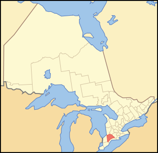
Middlesex County is a primarily rural county in Southwestern Ontario, Canada. Landlocked, the county is bordered by Huron and Perth counties on the north, Oxford County on the east, Elgin County on the south, and Chatham-Kent and Lambton County on the west.

<span class="mw-page-title-main">St. Thomas, Ontario</span> City in Ontario, Canada

St. Thomas is a city in southwestern Ontario, Canada. It gained its city charter on March 4, 1881. The city is also the seat for Elgin County, although it is independent of the county.

<span class="mw-page-title-main">Maida Vale</span> Residential district in Paddington, London

Maida Vale is an affluent residential district which is north of Paddington in West London, England. It is to the south-west of St John's Wood and south of Kilburn. It is also the name of its main road, on the continuous Edgware Road. Maida Vale is part of the City of Westminster, 3.1 miles (5.0 km) north-west of Charing Cross. It has many late Victorian and Edwardian blocks of mansion flats. The area is home to the BBC Maida Vale Studios.

<span class="mw-page-title-main">Area codes 416, 647, and 437</span> Telephone area codes for Toronto, Ontario

Area codes 416, 647, and 437 are telephone area codes in the North American Numbering Plan (NANP) for the city of Toronto, Ontario, Canada. Area code 416 is one of the original North American area codes created by the American Telephone and Telegraph Company (AT&T) in 1947. Area codes 647 and 437 are additional area codes for the same numbering plan area (NPA), forming an overlay numbering plan.

<span class="mw-page-title-main">Middlesex Centre</span> Municipality in Ontario, Canada

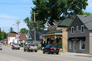
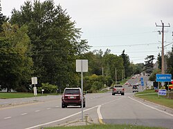
Middlesex Centre is a township in Middlesex County, in southwestern Ontario, Canada, north and west of London. The Corporation of the Township of Middlesex Centre formed on January 1, 1998, with the amalgamation of the former Townships of Delaware, Lobo, and London. It is part of the London census metropolitan area.

<span class="mw-page-title-main">Byron, London, Ontario</span> Neighbourhood in London, Ontario, Canada

Byron is a neighbourhood in the City of London, Ontario, Canada. It is adjacent to the Thames River in the south-west of London. Almost all of its residents live in low-density, single detached dwellings. As of 2011, the area is home to 15,525 residents. The neighbourhood is considered a high-income area, with an average family income of $130,587 an average dwelling value of $312,896 and a home ownership rate of 93%.

Highbury Avenue is an arterial road located in the Canadian province of Ontario. In addition to serving as a primary north–south thoroughfare in eastern London – through which part of it is a limited-access freeway – the road also provides access to Highway 401 and continues south to St. Thomas. The southern terminus of Highbury Avenue is an intersection with South Edgeware Road, just north of Highway 3 and the eastern end of the St. Thomas Expressway. From there, it travels 45.6 kilometres (28.3 mi) north to Highway 7, east of Elginfield. Outside of London and St. Thomas, the road also passes through the communities of Ballymote and Bryanston. It is designated as Elgin County Road 30 within Central Elgin, and as Middlesex County Road 23 within Middlesex Centre, the two rural municipalities through which the route passes.

Westminster refers to both a neighbourhood in the City of London, Ontario, Canada, and a much larger area within which the neighbourhood lands have been situated.

The Thames Valley District School Board is a public school board in southwestern Ontario, Canada. It was created on January 1, 1998, by the amalgamation of the Elgin County Board of Education, The Board of Education for the City of London, Middlesex County Board of Education, and Oxford County Board of Education.

<span class="mw-page-title-main">Dorchester, Ontario</span> Place in Ontario, Canada

Dorchester is a town in Ontario whose name first applied to the township and honours Sir Guy Carleton, Lord Dorchester (1724-1808). The name was changed from Dorchester Station on May 3, 1961. Dorchester is the residential and commercial core of the municipality of Thames Centre, in Southwestern Ontario, Canada, a few kilometres directly east of the city of London, Ontario. According to the 2016 census, the town has a population of 3,911.

<span class="mw-page-title-main">A3036 road</span> Road in southwest London

The A3036 is an A road in London, England, running from Waterloo to Wandsworth.

<span class="mw-page-title-main">West Elgin, Ontario</span> Municipality in Ontario, Canada

West Elgin is a municipality in Elgin County, Ontario, Canada. The township was created on January 1, 1998, through the amalgamation of the former township of Aldborough with the village of West Lorne.

<span class="mw-page-title-main">Wonderland Road</span>

Wonderland Road is a major north-south arterial road in London, Ontario, designated as Ontario Highway 4 between Highway 401 and Sunningdale Road. Outside of the City limits, the road extends north into Middlesex Centre as Middlesex County Road 56 and south into Southwold. It is one of the busiest roads in London, carrying over 43,000 vehicles per day between Springbank Drive and Riverside Drive as of 2013.

<span class="mw-page-title-main">Uplands, London, Ontario</span> Neighbourhood in London, Ontario, Canada

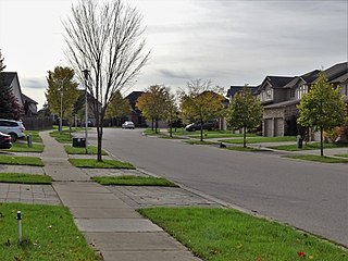
Uplands is a neighbourhood in the City of London, Ontario, Canada. The neighbourhood is located in the northern part of the city. Almost all of its residents live in low-density, single detached dwellings. As of 2011, the area is home to 7,835 residents. The neighbourhood is considered a middle to upper-income area, with an average family income of $128,806 an average dwelling value of $371,210 and a home ownership rate of 85%.

<span class="mw-page-title-main">Fanshawe Pioneer Village</span>

Fanshawe Pioneer Village is an open-air museum established in 1959 and located in the Fanshawe Conservation Area in London, Ontario. The village uses historical re-enactments to communicate the history of rural communities in the former townships of Westminster, London, North Dorchester, Delaware, West Nissouri and Lobo in Middlesex County from 1820 to 1920 and the founding and development of the City of London up to 1840.

Huron Heights is a neighbourhood in the City of London, Ontario, Canada. Located in the northeast part of the city, development began around 1960 and continued to the late 1960s in four distinct phases, and included three public elementary schools, and provided students to one Catholic elementary in the area and one public secondary school just northwest of the development. A large commercial plaza with anchor grocery and department stores was developed at the west edge, and a neighbourhood plaza was developed in the central part. A city arena was built and later supplemented with a public swimming pool.

References

  1. 1 2 "Lambeth" (PDF). Neighbourhood Profiles. City of London - Planning Division. 2014. Retrieved 2016-04-24.
  2. Curtis, Bruce. "The Boundary Adjustment Process: The Case of Arbitration In The Greater London Area" (PDF). University of Western Ontario. Retrieved 24 April 2016.
  3. Meligrana, John F. (2000). "The Politics of Municipal Annexation: The Case of the City of London's Territorial Ambitions during the 1950s and 1960s". Urban History Review. 29 (1): 3–20. doi: 10.7202/1016421ar .
  4. Symons, Evelyn. "Lambeth Harvestfest". Londoner. Retrieved 24 April 2016.
  5. Hamilton, William (1978). The Macmillan Book of Canadian Place Names . Toronto: Macmillan. pp.  155. ISBN   0-7715-9754-1.
  6. Pedro, Kelly. "Drinking violations halt Harvestfest". The London Free Press. Retrieved 24 April 2016.
  7. "Lambeth & Community Harvest Festival" . Retrieved 24 April 2016.
  8. 1 2 3 Covenant Christian School (PDF), retrieved 2015-07-01
  9. "Lambeth Public School". Thames Valley District School Board . Retrieved 2016-04-21.