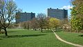
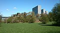
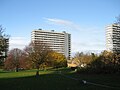
Brabrand is a postal district of Aarhus Municipality, Denmark. South of Brabrand, in the Aarhus river-valley, is the largest recreational area of Aarhus Municipality, comprising the Brabrand Lake and the meadow-lake of Årslev, with surrounding natural sites.

Aarhus Municipality, until 2011 formerly known as Århus Municipality, is a municipality in Central Denmark Region, on the east coast of the Jutland peninsula in central Denmark.
Frederiksbjerg is a borough in Aarhus, Denmark.

Aarhus N is a postal district in the city of Aarhus, consisting of Trøjborg, Risskov, Vejlby, Skejby, Vorrevangen and Christiansbjerg, all with postal code 8200. Aarhus N is an abbreviation for Aarhus Nord and is located north of the city centre. It is the highest lying area of Aarhus.
Marselisborg is a small borough of Aarhus, Denmark. Being small and situated just south of Frederiksbjerg, Marselisborg is often considered part of Frederiksbjerg.
Indre By is a neighborhood in the city of Aarhus, Denmark. The neighborhood is bounded by Nørre Allé, Vester Allé and Sønder Allé and is composed of the neighborhood and historical centre of the Latin Quarter and the areas around the Central Station and the City Hall Park. The neighborhood is one of the three main neighborhoods in the district of Aarhus C, along with Frederiksbjerg and Vesterbro.
Skanseparken is one of the oldest parks in the city of Aarhus. It is situated in the neighborhood of Frederiksbjerg in Midtbyen. Skanseparken was constructed in the years 1901 to 1902 between the streets Strandvejen, Marselisborg Allé and Heibergsgade. The park is typical of the parks in the city with large, open areas bounded by beech trees, raised flower beds and playgrounds. It is a popular area for festivals, concerts and other cultural events.

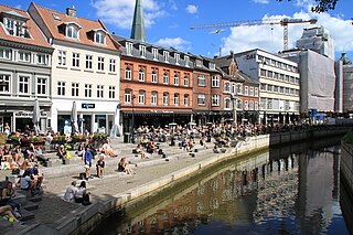
Åparken is a public park in central Aarhus, Denmark. The park is situated by the Aarhus River in the Vesterbro neighborhood in Midtbyen close to CeresByen, bounded by the streets Carls Blochs Gade and Thorvaldsensgade. The park is divided by a central pedestrian pathway which runs from the urban center and connects to the recreational path Brabrandstien towards the west, circumventing Brabrand Lake area. Åparken is the first of a number of green areas extending from the city centre along the river and the pathway of Brabrandstien. The long distance "Aarhus-Silkeborg hiking route" starts off from Åparken.

Mejlen or Asylet Børnely is a house, former asylum and a listed building in Aarhus, Denmark. The house was built in 1768 and was listed in the national Danish registry of protected buildings and places by the Danish Heritage Agency on 8 November 2008. The building originally functioned as a kindergarten but is today home to an art gallery.

Skansepalæet is a residential building in Aarhus, Denmark situated in the Frederiksbjerg neighborhood. The building comprises Standvejen 34-36 and Heibergsgade 25-27. Skansepalæet was built in 1908 by designs of the Danish architect Hjalmar Kjær as a hotel in connection with the Danish National Exhibition of 1909. Today the building is an apartment complex owned by its residents.

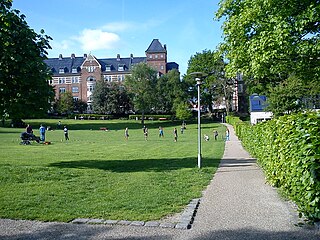
The Concert Hall Park is a public park in central Aarhus, Denmark. The park is situated by the City Hall in the Indre By neighborhood in Midtbyen, along the street Frederiks Allé to the east, Thomas Jensen's Allé to the south and Vester Allé to the north, behind the remaining buildings of the former Vester Allés Barracks. The park is named for the Aarhus Concert Hall which is prominently situated on its western border. The park forms a center-point between some of the most prominent buildings in the city, the ARoS Aarhus Art Museum, Vester Allé Barracks, the concert hall and Aarhus City Hall in view behind the City Hall Park across Frederiks Allé. The park was designed by the landscape architect Sven Hansen and was established in the 1980s.
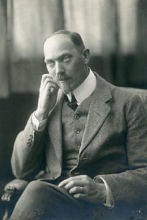
Frederik Marius Draiby was a Danish architect and the first city engineer of Aarhus. He was born in Kirke Helsinge on western Zealand 28 April 1877 and died in Aarhus on 16 April 1966. Until his retirement in 1943 Frederik Draiby impacted the architecture in Aarhus through his job where he approved building designs and with several notable buildings of his own designs. The municipal Spanien Public Baths, the harbor warehouse Stykgodspakhuset and Store Kapel on Vestre Cemetery are his best known works although he also worked on urban planning designs.

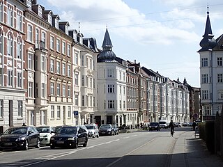
The architecture of Aarhus comprises numerous architectural styles and works from the Middle Age to present day. Aarhus has a well-preserved medieval city center with the oldest dwellings dating back to the mid-1500s and some ecclesiastical structures such as St. Clemen's Cathedral and numerous smaller churches that can be traced back to the 1100s. The industrialization of the 19th nd 20th centuries left distinctive industrial structures, important National romantic works and some of the best examples of Functionalist architecture in the country. The history of the city as a Viking fort is evidenced in the street layout of the Latin Quarter, the wider Indre By neighborhood testifies to its later role as a Market town and center of commerce while the Frederiksbjerg, Trøjborg and Marselisborg districts showcase the first cohesive urban planning efforts of the early 20th century.

DGI-Huset or DGI Huset Aarhus is a sports center located in Aarhus, Denmark. Parts of the buildings are historic, built in 1910 as part of the Aarhus Central Workshops for the Danish national railway company DSB. In 1990, DSB closed and sold their repair facilities to Aarhus Municipality and in 1997 the sports organization of DGI bought the building. An extensive renovation and construction project was completed on 11 October 2003, including new extensions. The buildings now serves as the primary facility for the sports organization Danske Gymnastik- & Idrætsforeninger in Aarhus, featuring a number of sports facilities, conference rooms. It is also home to some local sports clubs. The organization DGI-Århusegnen, the local chapter of the national organization DGI, took initiative to establish the sports center in the building.

Marienlyst Park is a public park in Hasle in the Aarhus V district, north-west Aarhus, Denmark. The park is situated west of the Herredsvang neighborhood along the street Fjældevænget Busvej to the south and Brendstrup Forest to the west. Marienlyst Park is one of the largest parks in Aarhus and features both landscaped lawns and artificial forested hills. Facilities include an amphitheatre, soccer fields, playgrounds and a 6-hole golf course. Marienlyst Park was established in connection with the development of western Hasle in the 1970s and today forms part of a green corridor extending from Vestereng to Brabrand Lake. The park is owned by Aarhus Municipality and is managed by the municipal department Natur og Miljø. Marienlyst Park can be rented for public events.

Ballehage Beach is an urban, public beach in the southern parts of Aarhus, Denmark and from 1929 it is one of the oldest sea baths in Denmark. Ballehage Beach is situated in the Marselisborg Forests on the Bay of Aarhus in the suburb of Højbjerg, south of Marselisborg Yacht Harbour and the Aarhus River mouth. Helgenæs lies across the bay to the east, a bit inland to the west is the Marselisborg Deer Park and to the north is the Varna Palace. The beach area is some 1,000 metres long and between 10 and 30 metres wide. It is a white sandy beach with occasional rows of boulders extending into the sea, for coastal erosion protection. Ballehage Beach is popular for sunbathing and swimming due to the shielding effect and scenic view of the nearby forest on the steep hillsides to the west. The beach has a single jetty extending some 20 metres into the sea, offering a platform to jump from or relax on. There are outdoor changing facilities, toilets and storage areas. The Beach is open year-round for everyone at no charge.
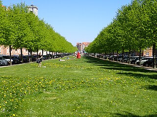
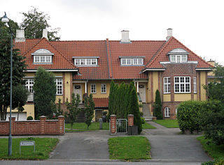
Ingerslevs Boulevard is a street in Aarhus, Denmark. It is 500 meters long and runs west to east from Harald Jensen's Plads to Skt. Anna Gade. The street is situated in the Frederiksbjerg neighborhood where it is functionally the main street but parts of it also acts as a public green space owing to width and central lawn. Ingerslevs Boulevard is home to St. Luke's Church and two schools, N.J. Fjordgade's School and Frederiksbjerg School. It is a mostly residential area but the street itself hosts a farmer's markets twice a week. Ingerslevs Boulevard was developed in the early 20th century as a main component of Frederiksbjerg when the neighborhood was created based on a unified urban planning design.