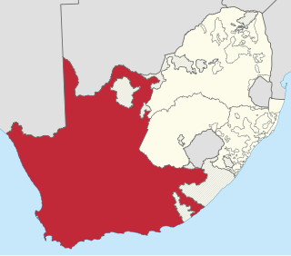
The Province of the Cape of Good Hope, commonly referred to as the Cape Province and colloquially as The Cape, was a province in the Union of South Africa and subsequently the Republic of South Africa. It encompassed the old Cape Colony, as well as Walvis Bay, and had Cape Town as its capital. In 1994, the Cape Province was divided into the new Eastern Cape, Northern Cape and Western Cape provinces, along with part of the North West.

Springs is a former independent city that is now part of the City of Ekurhuleni, based in the east of Johannesburg, in Gauteng Province, South Africa. It lies 50 km (31 mi) east of Johannesburg and 72 km (45 mi) southeast from Pretoria. Its name derives from the large number of springs in the area, and its estimated population is more than 121,610 in 2011. It is situated at 1,628 m (5,341 ft) above sea level.
Kinross is a small gold mining town in Mpumalanga, South Africa with four gold mines in the region. Village on the watershed between the Atlantic and Indian Oceans, between Devon and Trichardt, 42 km west of Bethal, 19 km east of Leslie and about 70 km north-north-east of Standerton.
The following lists events that happened during 1961 in South Africa.

The R29 is a provincial route in South Africa that connects Johannesburg with Leandra and Kinross via Germiston, Boksburg, Benoni and Springs. For much of its route it is named Main Reef Road. The R29 used to end near the Golela border post with Eswatini, however the section from Evander to Ermelo is now part of the N17 and the section from Ermelo to the Golela border post just after Pongola is now part of the N2.

The R50 is a provincial route in South Africa that connects Pretoria with Standerton via Delmas and Leandra.
Doornfontein is an inner-city suburb of Johannesburg, South Africa, located to the east of the city centre. It is in Region F of the City of Johannesburg Metropolitan Municipality. In the 1930s, it attracted many Jewish immigrants, becoming the main hub for the city's Jewish community. Black African residents, then a minority in the suburb, lived in slum-yards. Under the Slums Clearance Act 1934, the slum-yards were cleared and many residents were relocated to Orlando, Soweto. Since the late 1970s, Doornfontein and other inner-city suburbs of Johannesburg have underdone high levels of white flight to the city's northern suburbs.
Ndabeni is an industrial suburb of Cape Town, South Africa, mainly occupied by light industries such as textiles and clothing. It is located about 6 km east of Cape Town city centre and is serviced by a railway station. Ndabeni is bordered to the south east by Pinelands and to the north by Maitland. Its postcode is 7405.
R and W Hawthorn Ltd was a locomotive manufacturer in Newcastle upon Tyne, England, from 1817 until 1885.

The N17 is a national route in South Africa which runs from Johannesburg to Oshoek (Ngwenya) on the border with Eswatini. It passes through Springs, Bethal and Ermelo.
The Wilge River (iKuthu) is a river in Mpumalanga and Gauteng provinces, South Africa. It is a tributary of the Olifants River.
Bothasig is a suburban area of the City of Cape Town in Western Cape, South Africa. It is located north of Edgemead and east of Milnerton. It is located approximately 15 km north-east of the Cape Town city centre.
Trichardt is a town on the N17 national route in Gert Sibande District Municipality in the Mpumalanga province of South Africa. The village is 34 km west of Bethal and 32 km east-south-east of Leandra, adjacent to Secunda.
Leslie is a town in Gert Sibande District Municipality in the Mpumalanga province of South Africa. It is part of Leandra. The village is 63 km west of Bethal and 56 km east-south-east of Springs. Administered by a village council, it was laid out on the farm Brakkefontein and proclaimed in December 1939, an extension being proclaimed in December 1957. The village is thought to be named after Leslie in Fife, Scotland.
Leandra is a genus of plant in the family Melastomataceae.
The R580 is a Regional Route in Mpumalanga, South Africa that connects the R50 north of Leandra with Secunda and Evander.

Philadelphia is a village in the Western Cape province of South Africa.
Leandra Wiloma Smeda is a South African soccer player who plays as a winger for South Africa women's national team.
The Animation Industry in South Africa encompasses traditional 2D animation, 3D animation and visual effects for feature films.

The Marine biodiversity of South Africa is the variety of living organisms that live in the seas off the coast of South Africa. It includes genetic, species and ecosystems biodiversity in a range of habitats spread over a range of ecologically varied regions, influenced by the geomorphology of the seabed and circulation of major and local water masses, which distribute both living organisms and nutrients in complex and time-variable patterns.


