Related Research Articles

Route 59 is the shortest state highway in New Jersey, United States, at 0.15-mile (0.24 km) long. The route consists entirely of a short block of Lincoln Avenue from Union County Route 610 in Cranford to New Jersey Route 28 along the Cranford–Garwood border. The route functions as an underpass under the Raritan Valley Line of NJ Transit, under which it crosses about halfway down the block, along the municipal border. Route 59 was originally a proposed alignment of Route 22, which was supposed to head from an intersection with current day New Jersey Route 159 in Morris County at the Pine Brook Bridge before heading through several counties, terminating at an intersection with New Jersey Route 27 in Rahway. Most of the route was not constructed, and a portion in Garwood and Cranford was re-designated Route 59 in the 1953 New Jersey state highway renumbering on January 1, 1953.

Cranford is a township in Union County, in the U.S. state of New Jersey, located 18 miles (29 km) southwest of Manhattan. As of the 2020 United States census, the township's population was 23,847, an increase of 1,222 (+5.4%) from the 2010 census count of 22,625, which in turn reflected an increase of 47 (+0.2%) from the 22,578 counted in the 2000 census.

Union County is a county in the northern part of the U.S. state of New Jersey. As of the 2020 United States census, the county was the state's seventh-most-populous county with a population of 575,345, its highest decennial count ever and an increase of 38,846 (+7.2%) from the 2010 census count of 536,499. Its county seat is Elizabeth, which is also the most populous municipality in the county, with a 2020 census population of 137,298, and the largest by area, covering 13.46 square miles (34.9 km2). The county serves as a transition point between the Central Jersey and North Jersey regions of the state.

Kenilworth is a borough in Union County, in the U.S. state of New Jersey. As of the 2020 United States census, the borough's population was 8,427, an increase of 513 (+6.5%) from the 2010 census count of 7,914, which in turn reflected an increase of 239 (+3.1%) from the 7,675 counted in the 2000 census.
Westfield is a town in Union County, in the U.S. state of New Jersey, located 16 miles (26 km) southwest of Manhattan. As of the 2020 United States census, the town's population was 31,032, an increase of 716 (+2.4%) from the 2010 census count of 30,316, which in turn reflected an increase of 672 (+2.3%) from the 29,644 counted in the 2000 census.

The Raritan River is the longest and largest river of the U.S. state of New Jersey. Its watershed drains much of the mountainous area of the central region and a smaller portion of the northern region of the state, emptying into the Raritan Bay near Staten Island on the Atlantic Ocean.
The Rahway River is a river in Essex, Middlesex, and Union Counties, New Jersey, United States, The Rahway, along with the Elizabeth River, Piles Creek, Passaic River, Morses Creek, the Fresh Kills River, has its river mouth at the Arthur Kill.

The Rahway Valley Railroad (RVRR) was a short-line railroad in the Northeastern United States which connected the Lehigh Valley Railroad in Roselle Park and the Central Railroad of New Jersey in Cranford with the Delaware, Lackawanna and Western in Summit. Operating over a span of 95 years from 1897 until 1992 in Union County, New Jersey, in its prime it was one of the most successful short line railroads in U.S. history, turning a profit during the Great Depression.
County Route 509 is a county highway in the U.S. state of New Jersey. The highway exists in two segments– one 0.95-mile (1.53 km) unsigned segment exists in northern Middlesex County while the signed mainline extends 25.78 miles (41.49 km) from North Avenue in Westfield to Straight Street in Paterson.

Watchung Reservation is the largest nature reserve in Union County, New Jersey, United States. The Watchung area is located on a ridge within northern-central New Jersey, as it consists mainly of the upper valley of Blue Brook, between the ridges of the First Watchung Mountain and Second Watchung Mountains. A dam near the headwaters of the creek creates Lake Surprise.
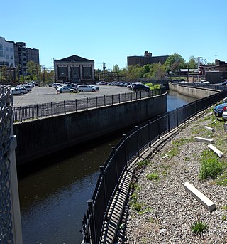
The Elizabeth River runs through Essex and Union counties, New Jersey in the United States for 11.9 miles (19.2 km) before draining into the Arthur Kill.
Cranford, New Jersey is home to a diverse number of historic architectural styles, historically significant buildings, and landmarks. Structures dating from 1740 through the present can be found in a relatively small area of the township.
The Lenape Trail is a trail through Essex County, connecting many county parks and reservations, wooded spaces, and historical sites. It begins in Newark, New Jersey and ends in Millburn, New Jersey. It was established in 1982. It is the fifth longest trail in the state behind the Delaware and Raritan Canal Trail, the Appalachian Trail, the completed section of the Highlands Trail in the state and the Batona Trail. The Lenape trail traverses Newark and its suburbs, as well as the Watchung Mountains and Passaic Meadows. Because of the steepness of the Watchung Mountains and the flood-prone nature of the Passaic Meadows, the former basin of Glacial Lake Passaic, these areas have remained much less developed than the rest of the northeastern part of the state. This trail therefore offers hikers an opportunity to see cultural and historical sites of an urban trail, as well as large natural and undeveloped areas. The trail's proximity to New York City and the various ridges it traverses, including Forest Hill, Orange Mountain, and Second Watchung Mountain, offer many views of the skyline. The Lenape Trail forms a segment of the Liberty-Water Gap Trail and incorporates the West Essex Trail, the Lenape Trail's only rail-to-trail section. The Lenape Trail also connects with Morris County's Patriots Path trail system on its western terminus.
Droescher's Mill is located at 347 Lincoln Avenue East in the township of Cranford in Union County, New Jersey, United States. The mill was added to the National Register of Historic Places on January 8, 1974, for its significance in commerce. It is the oldest continuously operated commercial building in New Jersey.

The members of the New Jersey Legislature are chosen from 40 electoral districts. Each district elects one senator and two assemblymen.
William Miller Sperry (1858–1927) is the namesake of the William Miller Sperry Observatory in Cranford, New Jersey. According to his sworn passport application, he was born on September 14, 1858, in Bristol, Tennessee. He moved to Cranford in 1898 and succeeded his brother Thomas Sperry as president of S&H Green Stamps. Buried in Fairview Cemetery, Sperry was the donor behind Sperry Park bordering the Rahway River in Cranford. The site is also part of the Rahway River Parkway, a greenway of the Union County Department of Parks and Recreation Sperry's great-granddaughter, Frances Beinecke, is an environmentalist and the former president of Natural Resources Defense Council, and his grandson is William Sperry Beinecke.

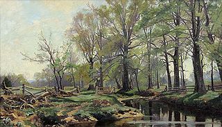
The Rahway River Parkway is a greenway of parkland along the banks the main stem Rahway River and its tributaries in Union County, New Jersey, United States. Created in the 1920s, it was one of the inaugural projects of the newly created Union County Parks Commission. It was designed by the Olmsted Brothers firm, sons of landscape architect Frederick Law Olmsted. The Rahway River Greenway plan expands on the original design. Many of the crossings of the river are late 19th century or early 20th century bridges. The East Coast Greenway uses paths and roads along the parkway.

Warinanco Park is a county park in Union County, New Jersey. It is 205 acres (83 ha) in size. It is located in Roselle at the border with the neighboring cities of Elizabeth and Linden.
Renna Media is an American publishing company based in Cranford, New Jersey, that owns and publishes various local newspapers in Union County and neighboring parts of Essex, Morris, and Somerset counties.
References
- ↑ "Geography". 30 June 2014. Retrieved November 4, 2018.
- ↑ "Union county begins deer management program" . Retrieved January 8, 2015.
- ↑ Hutchinson, Viola L. The Origin of New Jersey Place Names, New Jersey Public Library Commission, May 1945. Accessed September 21, 2015.
- 1 2 "Construction employee killed in work accident at Lenape Park in Union".
- ↑ "French-Richards Burying Ground in Springfield, New Jersey - Find A Grave Cemetery". www.findagrave.com. Retrieved 16 June 2018.
- ↑ "DNA Group 1 Theories for surname French". www.frenchfamilyassoc.com. Retrieved 16 June 2018.
- ↑ "The Westfield Record Press" (PDF). Retrieved August 6, 2018.
- ↑ "OpenStreetMap".
- ↑ "Elizabeth Through the Ages" . Retrieved 16 June 2018.
- ↑ 1993 Township of Cranford National Resources Inventory, pg. IV-6.
- ↑ "Bones located in artificial lake" (PDF). Retrieved August 29, 2018.
- ↑ Location of Union County College campus pond.
- ↑ Mastodon tusk unearthed in Cranford is now on display (giving location of find at Lenape Park).
- ↑ Geocaching. "Lenape Park - Bunker" . Retrieved 16 June 2018.
- ↑ "LENAPE PARK". nynjctbotany.org. Retrieved 16 June 2018.
- ↑ "Westfield leaders and fires" (PDF). Retrieved August 9, 2018.
- ↑ "Levee system faces 'potential failure'". 22 November 2011.
- ↑ "Civil works army projects" (PDF). Retrieved August 4, 2018.
- ↑ "Park species" (PDF). Retrieved December 5, 2012.