Limey-Remenauville

Last updated

Limey-Remenauville
Eglise Limey.JPG
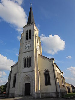
"Nativité-de-la-Vierge" Church in Limey
Blason Limey-Remenauville 54.svg
Location of Limey-Remenauville
Limey-Remenauville
France location map-Regions and departements-2016.svg
Red pog.svg
Limey-Remenauville
Grand Est region location map.svg
Red pog.svg
Limey-Remenauville
Coordinates: 48°53′13″N5°53′45″E / 48.8869°N 5.8958°E / 48.8869; 5.8958
Country France
Region Grand Est
Department Meurthe-et-Moselle
Arrondissement Toul
Canton Le Nord-Toulois
Intercommunality Mad et Moselle
Government
  Mayor (20202026) Éliane Dubois [1]
Area
1
18.33 km2 (7.08 sq mi)
Population
 (2022) [2]
312
  Density17/km2 (44/sq mi)
Time zone UTC+01:00 (CET)
  Summer (DST) UTC+02:00 (CEST)
INSEE/Postal code
54316 /54470
Elevation235–340 m (771–1,115 ft)
(avg. 295 m or 968 ft)
1 French Land Register data, which excludes lakes, ponds, glaciers > 1 km2 (0.386 sq mi or 247 acres) and river estuaries.

Limey-Remenauville is a commune in the Meurthe-et-Moselle department in north-eastern France. [3]

Contents

History

The origin of the name "Limey" is said to come from the Celtic word "lemos" meaning "elm [tree]". This particular tree was previously common in the area but has since disappeared.

The town has several memorials from the First World War. Remenauville is a former commune, whose village was totally destroyed during the First World War. Never rebuilt, it was attached to Limey in 1942. In 1962 the name Remenauville was added to that of Limey to form "Limey-Remenauville". [3] [4]

See also

References

  1. "Répertoire national des élus: les maires". data.gouv.fr, Plateforme ouverte des données publiques françaises (in French). 9 August 2021.
  2. "Populations de référence 2022" (in French). The National Institute of Statistics and Economic Studies. 19 December 2024.
  3. 1 2 "Commune de Limey-Remenauville". INSEE. Retrieved 23 September 2024.
  4. Des villages de Cassini aux communes d'aujourd'hui: Commune data sheet Limey-Remenauville , EHESS (in French).