Mont-Bonvillers

Last updated

Mont-Bonvillers
Chapelle Mont Bonvillers.JPG
The chapel in Mont-Bonvillers
Blason ville fr Mont-Bonvillers (Meurthe-et-Moselle).svg
Location of Mont-Bonvillers
Mont-Bonvillers
France location map-Regions and departements-2016.svg
Red pog.svg
Mont-Bonvillers
Grand Est region location map.svg
Red pog.svg
Mont-Bonvillers
Coordinates: 49°19′39″N5°50′09″E / 49.3275°N 5.8358°E / 49.3275; 5.8358
Country France
Region Grand Est
Department Meurthe-et-Moselle
Arrondissement Briey
Canton Pays de Briey
Intercommunality Cœur du Pays-Haut
Government
  Mayor (20202026) Robert Clesse [1]
Area
1
7.44 km2 (2.87 sq mi)
Population
 (Jan. 2021) [2]
942
  Density130/km2 (330/sq mi)
Time zone UTC+01:00 (CET)
  Summer (DST) UTC+02:00 (CEST)
INSEE/Postal code
54084 /54111
Elevation270–361 m (886–1,184 ft)
(avg. 325 m or 1,066 ft)
1 French Land Register data, which excludes lakes, ponds, glaciers > 1 km2 (0.386 sq mi or 247 acres) and river estuaries.

Mont-Bonvillers is a commune in the Meurthe-et-Moselle department in north-eastern France. [3]

Contents

Population

Historical population
YearPop.±% p.a.
1968 1,064    
1975 1,241+2.22%
1982 1,081−1.95%
1990 1,010−0.85%
1999 955−0.62%
2009 1,011+0.57%
2014 963−0.97%
2020 943−0.35%
Source: INSEE [4]

See also

Related Research Articles

<span class="mw-page-title-main">Meurthe-et-Moselle</span> Department of France

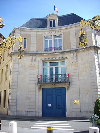
Meurthe-et-Moselle is a department in the Grand Est region of France, named after the rivers Meurthe and Moselle. Its prefecture and largest city is Nancy and it borders the departments of Meuse to the west, Vosges to the south, Moselle and Bas-Rhin and it borders the Belgian province of Luxembourg and the country of Luxembourg by the canton of Esch-sur-Alzette to the north. It had a population of 733,760 in 2019.

<span class="mw-page-title-main">Arrondissement of Val-de-Briey</span> Arrondissement in Grand Est, France

The arrondissement of Val-de-Briey is an arrondissement of France in the Meurthe-et-Moselle department in the Grand Est region. It has 128 communes. Its population is 166,309 (2016), and its area is 1,142.7 km2 (441.2 sq mi).

<span class="mw-page-title-main">Arrondissement of Lunéville</span> Arrondissement in Grand Est, France

The arrondissement of Lunéville is an arrondissement of France in the Meurthe-et-Moselle department in the Grand Est region. It has 164 communes. Its population is 78,662 (2016), and its area is 1,450.7 km2 (560.1 sq mi).

<span class="mw-page-title-main">Aboncourt, Meurthe-et-Moselle</span> Commune in Grand Est, France

Aboncourt is a commune in the Meurthe-et-Moselle department in northeastern France.

<span class="mw-page-title-main">Boncourt, Meurthe-et-Moselle</span> Commune in Grand Est, France

Boncourt is a commune in the Meurthe-et-Moselle department in northeastern France.

<span class="mw-page-title-main">Bonviller</span> Commune in Grand Est, France

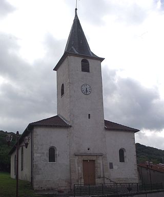
Bonviller is a commune in the Meurthe-et-Moselle department in northeastern France.

<span class="mw-page-title-main">Damelevières</span> Commune in Grand Est, France

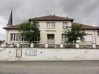
Damelevières is a commune in the Meurthe-et-Moselle department in north-eastern France.

<span class="mw-page-title-main">Francheville, Meurthe-et-Moselle</span> Commune in Grand Est, France

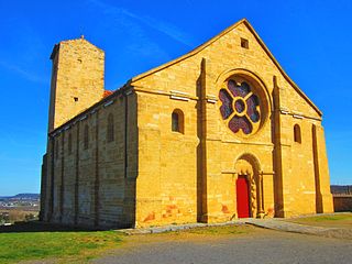
Francheville is a commune in the Meurthe-et-Moselle department in north-eastern France.

<span class="mw-page-title-main">Giraumont, Meurthe-et-Moselle</span> Commune in Grand Est, France

Giraumont is a commune in the Meurthe-et-Moselle department in north-eastern France.

<span class="mw-page-title-main">Mont-l'Étroit</span> Commune in Grand Est, France

Mont-l'Étroit is a commune in the Meurthe-et-Moselle department in North-Eastern France.

<span class="mw-page-title-main">Mont-le-Vignoble</span> Commune in Grand Est, France

Mont-le-Vignoble is a commune in the Meurthe-et-Moselle department in north-eastern France.

<span class="mw-page-title-main">Mont-sur-Meurthe</span> Commune in Grand Est, France

Mont-sur-Meurthe is a commune in the Meurthe-et-Moselle department in north-eastern France.

<span class="mw-page-title-main">Othe</span> Commune in Grand Est, France

Othe is a commune in the Meurthe-et-Moselle department in north-eastern France. It is an exclave of the Meurthe-et-Moselle department, surrounded by the Meuse department.

<span class="mw-page-title-main">Saint-Germain, Meurthe-et-Moselle</span> Commune in Grand Est, France

Saint-Germain is a commune in the Meurthe-et-Moselle department in north-eastern France.

<span class="mw-page-title-main">Saint-Martin, Meurthe-et-Moselle</span> Commune in Grand Est, France

Saint-Martin is a commune in the Meurthe-et-Moselle department in north-eastern France.

<span class="mw-page-title-main">Serres, Meurthe-et-Moselle</span> Commune in Grand Est, France

Serres is a commune in the Meurthe-et-Moselle department in north-eastern France.

<span class="mw-page-title-main">Bures, Meurthe-et-Moselle</span> Commune in Grand Est, France

Bures is a commune in the Meurthe-et-Moselle department in northeastern France.

<span class="mw-page-title-main">Chavigny, Meurthe-et-Moselle</span> Commune in Grand Est, France

Chavigny is a commune in the Meurthe-et-Moselle department in north-eastern France.

<span class="mw-page-title-main">Mont-Saint-Martin, Meurthe-et-Moselle</span> Commune in Grand Est, France

Mont-Saint-Martin is a commune in the Meurthe-et-Moselle department in north-eastern France. It is part of the urban area of Longwy.

<span class="mw-page-title-main">Valleroy, Meurthe-et-Moselle</span> Commune in Grand Est, France

Valleroy is a commune in the Meurthe-et-Moselle department in north-eastern France.

References

  1. "Répertoire national des élus: les maires". data.gouv.fr, Plateforme ouverte des données publiques françaises (in French). 2 December 2020.
  2. "Populations légales 2021". The National Institute of Statistics and Economic Studies. 28 December 2023.
  3. "Accueil". www.mont-bonvillers.mairie54.fr. Retrieved 9 December 2016.
  4. Population en historique depuis 1968, INSEE