List of Ramsar sites in the Republic of Ireland

Last updated • a couple of secsFrom Wikipedia, The Free Encyclopedia

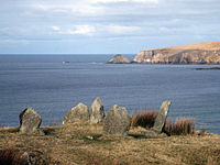
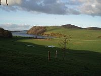
This list of Ramsar sites in the Republic of Ireland includes wetlands that are considered to be of international importance under the Ramsar Convention. Ireland currently has 45 sites designated as "Wetlands of International Importance" with a surface area of 66,994 hectares (669.94 km2). [1] [2] [3] For a full list of all Ramsar sites worldwide, see List of Ramsar wetlands of international importance.

Contents

Map all coordinates using: OpenStreetMap  
Download coordinates as: KML

List of Ramsar sites

Name [4] LocationArea (km2)DesignatedDescriptionImage
Baldoyle Bay Dublin
53°24′N6°8′W / 53.400°N 6.133°W / 53.400; -6.133 (Baldoyle Bay)
2.0325 October 1988
Ballyallia Lough County Clare

52°53′N8°55′W / 52.883°N 8.917°W / 52.883; -8.917 (Ballyallia Lough)

3.0811 June 1996Lowest lake on the River Fergus
Ballycotton Bay County Cork
51°50′N8°0′W / 51.833°N 8.000°W / 51.833; -8.000 (Ballycotton Bay)
0.9211 June 1996
Ballymacoda County Cork
51°52′N7°55′W / 51.867°N 7.917°W / 51.867; -7.917 (Ballymacoda)
3.7511 June 1996
Bannow Bay County Wexford
52°27′N6°17′W / 52.450°N 6.283°W / 52.450; -6.283 (Bannow Bay)
9.5811 June 1996
Blacksod Bay and Broadhaven Bay County Mayo
54°03′N10°0′W / 54.050°N 10.000°W / 54.050; -10.000 (Blacksod Bay and Broadhaven Bay)
6.8311 June 1996Broadhaven Bay includes Atlantic salt marsh, tidal mudflats, reefs and shallow bays. Glengad Stone circle overlooking Broadhaven Bay Kilcommon, Erris North Mayo.jpg
Blackwater Estuary County Cork,
County Waterford 51°57′N7°48′W / 51.950°N 7.800°W / 51.950; -7.800 (Blackwater Estuary)
4.6811 June 1996
Broadmeadow Estuary 53°27′N6°10′W / 53.450°N 6.167°W / 53.450; -6.167 (Broadmeadow Estuary) 5.4611 June 1996
Castlemaine Harbour County Kerry
52°7′N9°55′W / 52.117°N 9.917°W / 52.117; -9.917 (Castlemaine Harbour)
29.7330 May 1990
Clara Bog County Offaly
53°19′N7°37′W / 53.317°N 7.617°W / 53.317; -7.617 (Clara Bog)
4.606 December 1988
Coole Lough and Garryland Wood County Galway
53°5′N8°51′W / 53.083°N 8.850°W / 53.083; -8.850 (Coole Lough and Garryland Wood)
3.6430 May 1990
Cork Harbour County Cork
51°50′N8°15′W / 51.833°N 8.250°W / 51.833; -8.250 (Cork Harbour)
14.3611 June 1996
Cummeen Strand County Sligo
54°17′N8°30′W / 54.283°N 8.500°W / 54.283; -8.500 (Cummeen Strand)
14.9111 June 1996
Dundalk Bay County Louth
54°00′N6°20′W / 54.000°N 6.333°W / 54.000; -6.333 (Dundalk Bay)
47.6811 June 1996
Dungarvan Harbour County Waterford 52°3′N7°35′W / 52.050°N 7.583°W / 52.050; -7.583 (Dungarvan Harbour) 10.4111 June 1996
Easky Bog County Sligo
54°11′N8°49′W / 54.183°N 8.817°W / 54.183; -8.817 (Easky Bog)
6.0730 May 1990
The Gearagh County Cork
51°52′N9°1′W / 51.867°N 9.017°W / 51.867; -9.017 (The Gearagh)
3.0730 May 1990
Inner Galway Bay 53°12′N9°10′W / 53.200°N 9.167°W / 53.200; -9.167 (Inner Galway Bay) 119.0511 June 1996
Killala Bay and Moy Estuary County Mayo,
County Sligo
54°15′N9°10′W / 54.250°N 9.167°W / 54.250; -9.167 (Killala Bay and Moy Estuary)
10.6111 June 1996
Knockmoyle and Sheskin County Mayo
54°12′N9°33′W / 54.200°N 9.550°W / 54.200; -9.550 (Knockmoyle and Sheskin)
11.981 June 1987
Lough Barra Bog County Donegal
54°57′N8°7′W / 54.950°N 8.117°W / 54.950; -8.117 (Lough Barra Bog)
1.761 June 1987
Lough Corrib 53°30′N9°15′W / 53.500°N 9.250°W / 53.500; -9.250 (Lough Corrib) 177.2811 June 1996 Loughcorrib.jpg
Lough Derravaragh County Westmeath
53°40′N7°20′W / 53.667°N 7.333°W / 53.667; -7.333 (Lough Derravaragh)
11.2011 June 1996 Knockeyon 07.jpg
Lough Ennell County Westmeath
53°27′N7°23′W / 53.450°N 7.383°W / 53.450; -7.383 (Lough Ennell)
14.0411 June 1996 IMG LoughEnnel5368a.jpg
Lough Gara County Sligo, County Roscommon
53°56′N8°25′W / 53.933°N 8.417°W / 53.933; -8.417 (Lough Gara)
17.4211 June 1996
Lough Glen County Westmeath
53°25′N7°23′W / 53.417°N 7.383°W / 53.417; -7.383 (Lough Glen)
0.8111 June 1996
Lough Iron County Westmeath
53°37′N7°17′W / 53.617°N 7.283°W / 53.617; -7.283 (Lough Iron)
1.8211 June 1996
Lough Oughter 54°2′N7°25′W / 54.033°N 7.417°W / 54.033; -7.417 (Lough Oughter) 14.6411 June 1996 November 2003LoughOughter 080.jpg
Lough Owel County Westmeath
53°35′N7°23′W / 53.583°N 7.383°W / 53.583; -7.383 (Lough Owel)
10.3211 June 1996 Lough Ennel5490s.jpg
Meenachullion Bog County Donegal
54°54′N8°7′W / 54.900°N 8.117°W / 54.900; -8.117 (Meenachullion Bog)
1.9430 May 1990
Mongan Bog County Offaly
53°19′N7°58′W / 53.317°N 7.967°W / 53.317; -7.967 (Mongan Bog)
1.276 December 1988
North Bull Island Dublin
53°22′N6°8′W / 53.367°N 6.133°W / 53.367; -6.133 (North Bull Island)
14.366 September 1988 IMGDollymountStrand 3649w.JPG
Owenboy County Mayo
54°6′N9°28′W / 54.100°N 9.467°W / 54.100; -9.467 (Owenboy)
3.971 June 1987
Owenduff catchment County Mayo
54°3′N9°40′W / 54.050°N 9.667°W / 54.050; -9.667 (Owenduff catchment)
13.8231 July 1986
Pettigo Plateau County Donegal
54°37′N7°57′W / 54.617°N 7.950°W / 54.617; -7.950 (Pettigo Plateau)
9.0031 July 1986
Pollardstown Fen County Kildare
53°11′N6°51′W / 53.183°N 6.850°W / 53.183; -6.850 (Pollardstown Fen)
1.3030 May 1990 Pollardstown Fen.jpg
Raheenmore Bog County Offaly
53°20′N7°21′W / 53.333°N 7.350°W / 53.333; -7.350 (Raheenmore Bog)
1.626 December 1988
The Raven County Wexford
52°20′N6°19′W / 52.333°N 6.317°W / 52.333; -6.317 (The Raven)
5.8931 July 1986 Raven Point Nature Reserve.jpg
Rogerstown Estuary Dublin
53°30′N6°8′W / 53.500°N 6.133°W / 53.500; -6.133 (Rogerstown Estuary)
1.9525 October 1988
Sandymount Strand and Tolka Estuary 53°20′N6°12′W / 53.333°N 6.200°W / 53.333; -6.200 (Sandymount Strand and Tolka Estuary) 6.5411 June 1996 IMG SandymountStrabd1461.jpg
Slieve Bloom Mountains County Offaly,
County Laois
53°3′N7°38′W / 53.050°N 7.633°W / 53.050; -7.633 (Slieve Bloom Mountains)
22.3031 July 1986 SlieveBloomMountains.jpg
Tralee Bay County Kerry
52°16′N9°48′W / 52.267°N 9.800°W / 52.267; -9.800 (Tralee Bay)
8.6110 July 1989 Traleebay.jpg
Tramore Backstrand County Waterford
52°10′N7°7′W / 52.167°N 7.117°W / 52.167; -7.117 (Tramore Backstrand)
3.6711 June 1996
Trawbreaga Bay County Donegal
55°17′N7°15′W / 55.283°N 7.250°W / 55.283; -7.250 (Trawbreaga Bay)
10.0311 June 1996
Wexford Wildfowl Reserve County Wexford
52°30′N6°20′W / 52.500°N 6.333°W / 52.500; -6.333 (Wexford Wildfowl Reserve)
1.9415 November 1984

See also

Related Research Articles

Ramsar Convention International treaty for the conservation and sustainable utilization of wetlands

The Ramsar Convention on Wetlands of International Importance Especially as Waterfowl Habitat is an international treaty for the conservation and sustainable use of wetlands. It is also known as the Convention on Wetlands. It is named after the city of Ramsar in Iran, where the convention was signed in 1971.

Important Bird Area Area recognized as a habitat for bird population conservation

An Important Bird and Biodiversity Area (IBA) is an area identified using an internationally agreed set of criteria as being globally important for the conservation of bird populations.

Mana Pools National Park

Mana Pools National Park is a 219,600 ha wildlife conservation area and national park in northern Zimbabwe. It is a region of the lower Zambezi River in Zimbabwe where the flood plain turns into a broad expanse of lakes after each rainy season. As the lakes gradually dry up and recede, the region attracts many large animals in search of water, making it one of Africa's most renowned game-viewing regions.

Lake Sibhayi

Lake Sibhayi, also known as Lake Sibaya, a freshwater lake in South Africa, with a surface area of 64 km². The lake is also known as Sibaya or Sibhaya.

Munster Blackwater River in southern Ireland

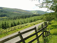
The Blackwater or Munster Blackwater is a river which flows through counties Kerry, Cork, and Waterford in Ireland. It rises in the Mullaghareirk Mountains in County Kerry and then flows in an easterly direction through County Cork, through Mallow and Fermoy. It then enters County Waterford where it flows through Lismore, before abruptly turning south at Cappoquin, and finally draining into the Celtic Sea at Youghal Harbour. In total, the Blackwater is 169 km (105 mi) long. The total catchment area of the River Blackwater is 3,324 km2. The long term average flow rate of the River Blackwater is 89.1 cubic metres per second (m3/s) The Blackwater is notable for being one of the best salmon fishing rivers in the country. Like many Irish and British rivers, salmon stocks declined in recent years, but the Irish government banned commercial netting of salmon off the coast of Ireland in November 2006.

Jeannette Kawas National Park

Jeannette Kawas National Park is a national park located in the municipality of Tela, on the northern Caribbean coast of the Atlántida department of Honduras, established on 4 November 1994. The park covers an area of 781.62 square kilometres and has an altitude of 900 metres. The park was created and is managed by the PROLANSATE foundation.

Old Crow Flats Canadian wetland & archaeological site

Old Crow Flats is a 6,170 km2 (2,382 sq mi) wetland complex in northern Yukon, Canada along the Old Crow River. It is north of the Arctic Circle and south of the Beaufort Sea, and is nearly surrounded by mountains.

Lake Butrint

Lake Butrint is a salt lagoon south of Saranda, Albania, located in direct proximity of the Ionian Sea. It is surrounded by dense forested hills, rocky coast and complemented by saltwater and freshwater marshlands. The lake has a length of 7.1 km (4.4 mi) and a width of 3.3 km (2.1 mi), with a surface area of 16 km2 (6.18 sq mi). The maximum depth of the lake is 24.4 m (80 ft). At the south, the Vivari Channel connects the lagoon to the sea.

Moreton Bay Marine Park Protected area in Queensland, Australia

The Moreton Bay Marine Park was established in 1992 to protect ecologically significant habitats in Moreton Bay. The marine park extends from Caloundra south to the southern tip of South Stradbroke Island. The marine park's border extends up to the highest tidal mark and covers a total of 3,400 km2.

The Lake Chad Basin Commission is an intergovernmental organization that oversees water and other natural resource usage in the basin. There are eight member governments—i.e., Cameroon, Chad, Niger, Nigeria, Algeria, the Central African Republic, Libya, and Sudan—chosen for their proximity to Lake Chad.

Hunter Estuary Wetlands Australian wetlands

The Hunter Estuary Wetlands comprise a group of associated wetlands at and near the mouth of the Hunter River in the city of Newcastle, New South Wales, Australia. Some 30 km2 of the wetlands has been recognised as being of international importance by designation under the Ramsar Convention. It was listed on 21 February 1984 as Ramsar site 287. A larger area of the wetlands has been identified by BirdLife International as an Important Bird Area (IBA). The wetlands are recognised as the most important area in New South Wales for waders, or shorebirds.

Chippenham Fen and Snailwell Poors Fen

Chippenham Fen and Snailwell Poor's Fen is a 155.9 hectare biological Site of Special Scientific Interest south-east of Fordham in Cambridgeshire, England. It is a Nature Conservation Review site, Grade I, a Ramsar wetland site and a Special Area of Conservation. It is managed by Natural England.

Studenčište Marsh

Studenchishte Marsh is the last remains of a previously extensive wetland habitat on the eastern shore of ancient Lake Ohrid in North Macedonia. It is also the final major coastline wetland at Lake Ohrid and one of only seven marshes with relict communities that still exist in North Macedonia. With several millennia of natural history, it is a site of key conservation interest and part of the Lake Ohrid Wetland of International Importance under the Ramsar Convention.

Eskandar Firouz Iranian botanist

Eskandar Firouz was an Iranian environmentalist and politician. He was the first director of the Department of Environment in Iran. He developed Iran's ecological conservation and management program. Eskandar Firouz is recognized as the founder of environmental protection and conservation in Iran.

The Gediz Delta is the river delta at the confluence of the Gediz River with the Gulf of İzmir, in İzmir Province in western Turkey. It is a 14,900 ha area of land that occupies coastal parts of Foça, Menemen, and Çiğli districts. It is one of the largest areas of coastal wetlands in Turkey and has a biodiversity of plants and birds. It is a Ramsar site since 1998 and an Important Bird Area since 2000. It is 26 km from İzmir city center.

References

  1. "Discover Ramsar Wetlands in the Republic of Ireland | Title". www.wetlandsurveysireland.com. 7 September 2017. Retrieved 30 August 2020.{{cite web}}: CS1 maint: url-status (link)
  2. "Ramsar Sites In Ireland". Ramsar Sites Information Service. Retrieved 30 August 2020.{{cite web}}: CS1 maint: url-status (link)
  3. "Annotated List of Wetlands of International Importance: Ireland" (PDF). Ramsar Sites Information Service. Retrieved 30 August 2020.{{cite web}}: CS1 maint: url-status (link)
  4. "Ramsar List" (PDF). Ramsar.org. Retrieved 1 April 2013.