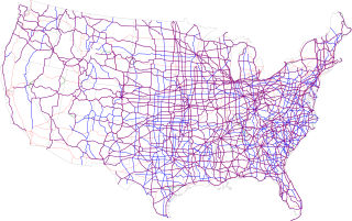
The United States Numbered Highway System is an integrated network of roads and highways numbered within a nationwide grid in the contiguous United States. As the designation and numbering of these highways were coordinated among the states, they are sometimes called Federal Highways, but the roadways were built and have always been maintained by state or local governments since their initial designation in 1926.

U.S. Route 56 is an east–west United States highway that runs for approximately 640 miles (1,030 km) in the Midwestern United States. US 56's western terminus is at Interstate 25 Business, US 412 and New Mexico State Road 21 in Springer, New Mexico and the highway's eastern terminus is at US 71 in Kansas City, Missouri. Much of it follows the Santa Fe Trail.

U.S. Route 197 (US 197) is a north–south United States Highway, of which all but 2.76 miles of its 69.93 miles are within the state of Oregon. The highway starts in rural Wasco County in Central Oregon at an intersection with US 97. US 197 travels north as a continuation of The Dalles-California Highway No. 4 through the cities of Maupin, Tygh Valley, and Dufur to The Dalles. Within The Dalles, the highway becomes concurrent with US 30 and intersects Interstate 84 (I-84) before it crosses over the Columbia River on The Dalles Bridge into Washington. The highway continues through the neighboring city of Dallesport in Klickitat County and terminates at a junction with State Route 14 (SR 14).

U.S. Route 195 (US 195) is a north–south United States Highway, of which all but 0.65 miles of its 94.02 miles are within the state of Washington. The highway starts in rural Idaho north of the city of Lewiston as a state highway in an interchange with US 95. As the road crosses into Washington it becomes a state highway that connects communities in the Palouse region of Eastern Washington. US 195 travels north, serving the cities of Pullman, Colfax and Rosalia in Whitman County before continuing into Spokane County to its terminus in the city of Spokane at an interchange with Interstate 90 (I-90).
The U.S. Route shield is the highway marker used for United States Numbered Highways. Since the first U.S. Route signs were installed in 1926, the general idea has remained the same, but many changes have been made in the details. Originally, the shield included the name of the state in which the sign was erected and the letters "U S" on a shield-shaped sign. Over time, the shield has been simplified to consist of a white shield outline on a black square background, containing only a black route number. However, because each state is responsible for the production and maintenance of U.S. Route shields, several variants of the shield have existed over the years.

U.S. Route 730 (US 730) is an east–west United States Numbered Highway, of which all but 6.08 miles of its 41.78 miles are within the state of Oregon. The highway starts in rural Morrow County in Eastern Oregon at an interchange with Interstate 84 (I-84) and US 30, located east of the city of Boardman. US 730 travels east along the Columbia River as a continuation of Columbia River Highway No. 2 into Umatilla County, intersecting I-82 and US 395 in the city of Umatilla. US 730 and US 395 form a short concurrency within the city before the highways part, and US 730 continues northeast into Washington. The highway travels through rural Walla Walla County and ends at an intersection with US 12 south of Wallula.

State Route 14 (SR 14) is a 180.66-mile-long (290.74 km) state highway in the U.S. state of Washington. The highway travels east-west on the north side of the Columbia River, opposite Interstate 84 (I-84) to the south in Oregon. SR 14 forms a section of the Lewis and Clark Trail Scenic Byway and begins at an interchange with I-5 in Vancouver. The highway travels east as a four-lane freeway through Camas and Washougal and intersects I-205. SR 14 continues east as a two-lane highway through Clark, Skamania, Klickitat, and Benton counties before it ends at an interchange with I-82 and U.S. Route 395 (US 395) near Plymouth.

U.S. Route 60 (US 60) is a major U.S. Highway in the American state of Kentucky. In the early days of the U.S. Highway System, US 60 was originally to be numbered as US 62. Following extensive lobbying and complaints filed by Kentucky governor William J. Fields to the American Association of State Highway Officials, the route was re-designated as US 60 before the system was finalized. In Kentucky, US 60 parallels the Ohio River. US 60 enters Kentucky from Cairo, Illinois, traveling northeast to Louisville, then takes a direct eastward route to rejoin the Ohio River in downtown Ashland, Kentucky. Both US 60 and US 23 run concurrently from Ashland to Catlettsburg where US 60 turns east and enters Kenova, West Virginia. US 60 is the longest route in Kentucky, running 495 miles (797 km) across the width of the state, passing through 22 of Kentucky's counties and through the cities of Paducah, Henderson, Owensboro, Louisville, the state capital of Frankfort, and Lexington.

State Route 127 (SR 127) is a 27.05-mile-long (43.53 km) state highway serving the eastern region of the U.S. state of Washington. The highway, listed on the National Highway System, begins in rural Garfield County at U.S. Route 12 (US 12) and travels north across the Snake River on the Elmer Huntley Bridge. The roadway continues into Whitman County before it ends at SR 26 in Dusty. SR 127 formed a section of the Inland Empire Highway and Primary State Highway 3 (PSH 3) prior to becoming US 295 in 1926. US 295 was decommissioned in 1968 and replaced by a longer SR 127, traveling its full length from Dodge to Colfax from its establishment in 1970 until an extension of SR 26 to Colfax in 1979.

U.S. Route 101 (US 101) is a United States Numbered Highway that runs along the West Coast from Los Angeles, California to Tumwater, Washington. Within the state of Washington, US 101 connects cities on the coast of the Pacific Ocean and encircles the Olympic Peninsula around the Olympic Mountains. It also serves as the main access for Olympic National Park, several state parks, and other scenic and recreational areas.

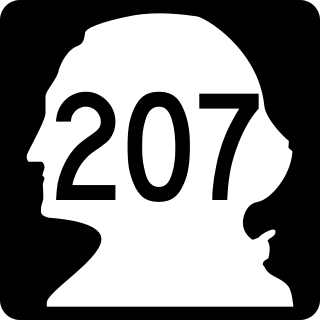
State Route 207 (SR 207) is a 4.38-mile-long (7.05 km) state highway serving Wenatchee National Forest and Lake Wenatchee State Park in Chelan County, located within the U.S. state of Washington. The highway travels north along Nason Creek from an intersection with U.S. Route 2 (US 2) at Coles Corner to Chiwawa Loop Road on the eastern shore of Lake Wenatchee. SR 207 was previously signed as part of Secondary State Highway 15C (SSH 15C) and SSH 15D until the 1964 highway renumbering, when SSH 15C was split between SR 207 and SR 209. SR 209 was removed from the highway system in 1991 and SR 207 was shortened to end at the former terminus of SR 209.

U.S. Route 20 is a transcontinental east–west U.S. Highway that travels between Newport, Oregon, and Boston, Massachusetts. It passes through southern Montana for approximately 10 miles (16 km), connecting Targhee Pass at the Idaho state line to the town of West Yellowstone and the West Entrance of Yellowstone National Park near the Wyoming border.


