
Portia is a town in Lawrence County, Arkansas, United States. The population was 437 at the 2010 census.

Laconia is a town in Boone Township, Harrison County, Indiana, United States. The population was 50 at the 2010 census.

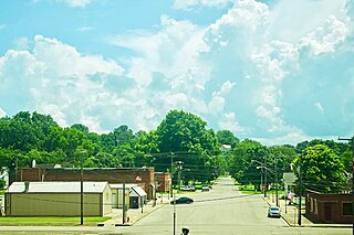
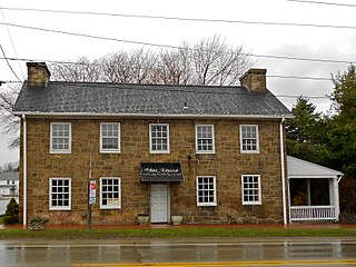
Ladoga is a town in Clark Township, Montgomery County, in the U.S. state of Indiana. The population was 1,081 at the 2020 census, up from 985 in 2010.
New Ross is a town in Walnut Township, Montgomery County, in the U.S. state of Indiana. As of the 2020 census, the town population was 309.
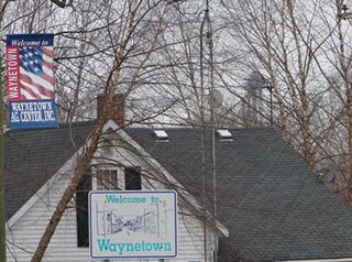
Waynetown is a town in Wayne Township, Montgomery County, in the U.S. state of Indiana. The population was 960 at the 2020 census.

Bronson is a city in Bourbon County, Kansas, United States. As of the 2020 census, the population of the city was 304.
Uniontown is a home rule-class city in Union County, Kentucky, United States. The population was 929 at the 2020 census. The John T. Myers Locks and Dam, once known as Uniontown Locks and Dam, is located downriver 3½ miles.

Barnesville is a town in Montgomery County, Maryland, United States. It was incorporated in 1888. The population was 144 at the 2020 census.

Laytonsville is a town in Montgomery County, Maryland, United States. The population was 572 at the 2020 census, up from 353 in 2010. Laytonsville was incorporated in 1892.

Farnham is a village in the town of Brant, Erie County, New York, United States. The population of Farnham was 381 at the 2020 census. It is part of the Buffalo–Niagara Falls Metropolitan Statistical Area. The village is named after Leroy Farnham, a local landowner and merchant.

Uniontown is a census-designated place (CDP) in Stark County, Ohio, United States. The population was 7,173 at the 2020 census.
Cornwells Heights-Eddington was a census-designated place (CDP) in Bucks County, Pennsylvania, United States. The population was 3,406 at the 2000 census. For the 2010 census, the area was split into two CDPs, Cornwells Heights and Eddington, that are adjacent unincorporated communities within Bensalem Township. Cornwells Heights is located a bit southwest of Eddington. Both communities use the Bensalem ZIP code, 19020.
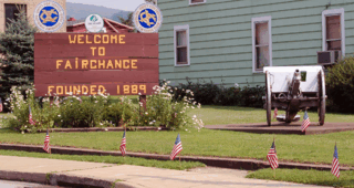
Fairchance is a borough in Fayette County, Pennsylvania, United States. The population was 1,889 at the 2020 census, a decline from the figure of 1,975 tabulated in 2010. It is served by the Albert Gallatin Area School District.
North Union Township is a township in Fayette County, Pennsylvania, United States. The population was 11,829 at the 2020 census, a decline from the figure of 12,728 tabulated in 2010. The Laurel Highlands School District serves the township.

Perryopolis is a borough in Fayette County, Pennsylvania, United States. The borough is part of the Pittsburgh metropolitan area. The population was 1,705 at the 2020 census.
South Union Township is a township in Fayette County, Pennsylvania, United States. The population was 10,897 at the 2020 census, an increase over the figure of 10,681 tabulated in 2010.

New Waverly is a city in Walker County, Texas, United States. The population was 914 at the 2020 census.

Colton is a town in Whitman County, Washington, United States. The population was 401 at the 2020 census.

Eleanor is a town in Putnam County, West Virginia, United States, along the Kanawha River. Its population was 1,548 at the 2020 census. It is part of the Huntington–Ashland metropolitan area. The town, named for Eleanor Roosevelt, was established as a New Deal project in the 1930s like other Franklin D. Roosevelt towns around the nation.

Chevy Chase —formally, the Town of Chevy Chase—is an incorporated town in Montgomery County, Maryland, United States. The population was 2,904 at the 2020 census.


