Malden, Washington | |
---|---|
Coordinates: 47°13′37″N117°28′23″W / 47.22694°N 117.47306°W | |
Country | United States |
State | Washington |
County | Whitman |
Area | |
• Total | 0.66 sq mi (1.70 km2) |
• Land | 0.66 sq mi (1.70 km2) |
• Water | 0.00 sq mi (0.00 km2) |
Elevation | 2,126 ft (648 m) |
Population (2020) | |
• Total | 216 |
• Density | 330/sq mi (130/km2) |
Time zone | UTC-8 (Pacific (PST)) |
• Summer (DST) | UTC-7 (PDT) |
ZIP code | 99149 |
Area code | 509 |
FIPS code | 53-42275 [3] |
GNIS feature ID | 2412933 [2] |
Malden is a town in Whitman County, eastern Washington, United States. The population was 216 at the 2020 census. [4] 80 percent of the buildings were destroyed by a wildfire on September 7, 2020.
Malden was officially incorporated on December 20, 1909. Established as a station stop, it was named by railway officials after Malden, Massachusetts. [5] The rural town had a small population.
On September 7, 2020, a large wildfire destroyed approximately 80 percent of buildings in Malden and nearby Pine City. The town's fire station, post office, city hall, library, Masonic Lodge, and several houses were among the buildings destroyed. [6] Most of the town's population was evacuated as the fire approached, while access after the fire was restricted due to a leaking propane tank. [7] [8]
According to the United States Census Bureau, the town has a total area of 0.67 square miles (1.74 km2), all of it land. [9]
This region experiences warm (but not hot) and dry summers, with no average monthly temperatures above 71.6 °F. According to the Köppen Climate Classification system, Malden has a warm-summer Mediterranean climate, abbreviated "Csb" on climate maps. [10]
Census | Pop. | Note | %± |
---|---|---|---|
1910 | 798 | — | |
1920 | 1,005 | 25.9% | |
1930 | 375 | −62.7% | |
1940 | 325 | −13.3% | |
1950 | 332 | 2.2% | |
1960 | 292 | −12.0% | |
1970 | 219 | −25.0% | |
1980 | 200 | −8.7% | |
1990 | 189 | −5.5% | |
2000 | 215 | 13.8% | |
2010 | 203 | −5.6% | |
2020 | 216 | 6.4% | |
U.S. Decennial Census [11] |
As of the 2010 census, [12] there were 203 people, 90 households, and 57 families residing in the town. The population density was 303.0 inhabitants per square mile (117.0/km2). There were 118 housing units at an average density of 176.1 per square mile (68.0/km2). The racial makeup of the town was 92.1% White, 2.0% Native American, 1.0% from other races, and 4.9% from two or more races. Hispanic or Latino of any race were 3.9% of the population.
There were 90 households, of which 27.8% had children under the age of 18 living with them, 50.0% were married couples living together, 11.1% had a female householder with no husband present, 2.2% had a male householder with no wife present, and 36.7% were non-families. 34.4% of all households were made up of individuals, and 20% had someone living alone who was 65 years of age or older. The average household size was 2.26 and the average family size was 2.91.
The median age in the town was 50.8 years. 23.6% of residents were under the age of 18; 4% were between the ages of 18 and 24; 18.7% were from 25 to 44; 28.2% were from 45 to 64; and 25.6% were 65 years of age or older. The gender makeup of the town was 50.7% male and 49.3% female.
As of the 2000 census, [3] there were 215 people, 93 households, and 65 families residing in the town. The population density was 326.1 people per square mile (125.8/km2). There were 108 housing units at an average density of 163.8 per square mile (63.2/km2). The racial makeup of the town was 96.28% White, 0.47% African American, 2.33% Native American, and 0.93% from two or more races. Hispanic or Latino of any race were 0.93% of the population.
There were 93 households, out of which 30.1% had children under the age of 18 living with them, 49.5% were married couples living together, 15.1% had a female householder with no husband present, and 30.1% were non-families. 29.0% of all households were made up of individuals, and 10.8% had someone living alone who was 65 years of age or older. The average household size was 2.31 and the average family size was 2.82.
In the town, the age distribution of the population shows 26.5% under the age of 18, 5.6% from 18 to 24, 23.3% from 25 to 44, 26.0% from 45 to 64, and 18.6% who were 65 years of age or older. The median age was 42 years. For every 100 females, there were 90.3 males. For every 100 females age 18 and over, there were 92.7 males.
The median income for a household in the town was $26,250, and the median income for a family was $26,250. Males had a median income of $30,000 versus $31,250 for females. The per capita income for the town was $12,477. About 18.0% of families and 17.4% of the population were below the poverty line, including 17.9% of those under the age of eighteen and 4.7% of those 65 or over.
Deatsville is a town in Elmore County, Alabama, United States. Although Deatsville initially incorporated in 1903, it lapsed at some point after the 1910 U.S. Census and did not appear again as incorporated until 2000. As of the 2020 census, the population was 1,679.
Rudy is a town in Crawford County, Arkansas, United States. It is part of the Fort Smith, Arkansas-Oklahoma Metropolitan Statistical Area. As of the 2020 Census the population was 130. The population was 72 at the 2000 census.
Hardinsburg is a town in Posey Township, Washington County, in the U.S. state of Indiana. The population was 222 at the 2020 census.
North Washington is a city in Chickasaw County, Iowa, United States. The population was 112 at the time of the 2020 census.
Martinsburg is a city in Keokuk County, Iowa, United States. The population was 110 at the time of the 2020 census. The only businesses open to the public in Martinsburg is McBeth Wrecker and Auto Service and a gas station/convenience store.
Upton is a town in Oxford County, Maine, United States. The population was 69 at the 2020 census. Totally.
Topsfield is a town in Washington County, Maine, United States. The population was 179 at the 2020 census.
Kensington is a city in Douglas County, Minnesota, United States. The population was 266 at the 2020 census. The city is notable in Minnesota history for being the place where the Kensington Runestone was first displayed. It is now at a museum in nearby Alexandria, Minnesota.
Bainville is a town in Roosevelt County, Montana, United States. The population was 271 at the 2020 census. It is named for Charles M. Bain, an early resident and the town's first postmaster. Bainville celebrated its centennial on July 4, 2006.
Ong is a village in Clay County, Nebraska, United States. The population was 49 at the 2020 census. It is part of the Hastings, Nebraska Micropolitan Statistical Area.
Wales is a city in Cavalier County, North Dakota, United States. The population was 10 at the 2020 census. Wales was founded in 1897. Gavilon is Wales' largest employer.
Elliott is a city in Ransom County, North Dakota, United States. The population was 24 at the 2020 census. Elliott was founded in 1883.
Old Washington is a village in Guernsey County, Ohio, United States. The population was 223 at the 2020 census.
Batesville is a village in Noble County, Ohio, United States. The population was 101 at the 2020 census. Batesville was originally called Williamsburg, and under the latter name was laid out in 1827.
New Washington is a borough in Clearfield County, Pennsylvania, United States. The population was 50 at the 2020 census.
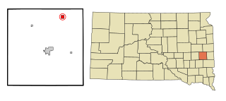
Nunda is a village in Lake County, South Dakota, United States. The population was 46 at the 2020 census. Located there are a post office, grainery, bar and grill, and an American Legion post.
Ward is a town in Moody County, South Dakota, United States. The population was 34 at the 2020 census.
Akaska is a town in Walworth County, South Dakota, United States. The population was 77 at the 2020 census. The community name derives from a Sioux word meaning "uncertain".
Granger is a city in Yakima County, Washington, United States. The population was 3,624 at the 2020 census. Although it was classified as a town in 2000, it has since been reclassified as a city.
Shanagolden is a town in Ashland County in the U.S. state of Wisconsin. The population was 125 at the 2010 census. The unincorporated community of Shanagolden is located in the town.