Tanzania comprises many lakes, national parks, and Africa's highest point, Mount Kilimanjaro. Northeast Tanzania is mountainous, while the central area is part of a large plateau covered in grasslands. The country also contains the southern portion of Lake Victoria on its northern border with Uganda and Kenya.

The Serengeti National Park is a large national park in northern Tanzania that stretches over 14,763 km2 (5,700 sq mi). It is located in eastern Mara Region and northeastern Simiyu Region and contains over 1,500,000 hectares of virgin savanna. The park was established in 1940.

A geopark is a protected area with internationally significant geology within which sustainable development is sought and which includes tourism, conservation, education and research concerning not just geology but other relevant sciences.

Ngorongoro Conservation Area is a protected area and a UNESCO World Heritage Site located in Ngorongoro District, 180 km (110 mi) west of Arusha City in Arusha Region, within the Crater Highlands geological area of northern Tanzania. The area is named after Ngorongoro Crater, a large volcanic caldera within the area. The Ngorongoro Conservation Area Authority administers the conservation area, an arm of the Tanzanian government, and its boundaries follow the boundary of the Ngorongoro District in Arusha Region. The western portion of the park abuts the Serengeti National Park, and the area comprising the two parks and Kenya's Maasai Mara game reserve is home to Great Migration, a massive annual migration of millions of wildebeest, zebras, gazelles, and other animals. The conservation area also contains Olduvai Gorge, one of the most important paleoanthropological sites in the world.

Arusha Region is one of Tanzania's 31 administrative regions and is located in the north of the country. The region's capital and largest city is the city of Arusha. The region is bordered by Kajiado County and Narok County in Kenya to the north, the Kilimanjaro Region to the east, the Manyara and Singida Regions to the south, and the Mara and Simiyu regions to the west. Arusha Region is home to Ngorongoro Conservation Area, a UNESCO World Heritage Site. The region is comparable in size to the combined land and water areas of the state of Maryland in the United States.

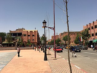
Azilal is a provincial capital in central Morocco, in the Atlas Mountains. It is also the capital of the M'Goun Conservation Area.

The Lesvos Petrified Forest is a petrified wood forest on the island of Lesbos, Greece.

Geotourism is tourism associated with geological attractions and destinations. Geotourism deals with the abiotic natural and built environments. Geotourism was first defined in England by Thomas Alfred Hose in 1995.

Tanzania is a country with many tourist attractions. Approximately 38 percent of Tanzania's land area is set aside in protected areas for conservation. There are 17 national parks, 29 game reserves, 40 controlled conservation areas and marine parks. Tanzania is also home to Mount Kilimanjaro, the highest point in Africa.
The European Geoparks Network (EGN) functions as the regional organization of the Global Geoparks Network (GGN) and the UNESCO International Geosciences and Geoparks Programme (UNESCO-IGGP). Its main objective is to ensure cooperation between geoparks for the protection of geological heritage and the promotion of sustainable development of their territories in Europe. In 2020 January, the EGN had 75 institutional members from 26 European countries and there are several aspiring geopark projects, applying for a UNESCO label and therefore the permanent EGN membership.

UNESCO Global Geoparks (UGGp) are geoparks certified by the UNESCO Global Geoparks Council as meeting all the requirements for belonging to the Global Geoparks Network (GGN). The GGN is both a network of geoparks and the agency of the United Nations Educational, Scientific and Cultural Organization (UNESCO). that administers the network.
Geoheritage is the geological aspect of natural and cultural heritage. A geosite is a particular geological heritage asset. It is a heritage category comparable to other forms of natural heritage, such as biodiversity.

The San'in Kaigan Geopark (山陰海岸ジオパーク) is a geopark in Japan. The area was declared a Japanese Geopark in 2008, and a UNESCO Global Geopark in 2010. The underlying themes of the geopark are "geological features, the natural environment, people's lives, and the formation of the Sea of Japan". This geologically diverse area contains records of the process from when Japan was part of the Asian continent to its present-day formation of the Sea of Japan. People's lives are also diverse in this area because of its geodiversity.

The Azores Geopark is a network of 121 geographically-dispersed sites of geographic heritage and marine areas that covers the nine volcanic islands of the archipelago of the Azores. This network is managed by the Azores Geopark Association, a non-profit association, with its headquarters in Horta on the island of Faial, established 19 May 2010. It is part of the European Geoparks Network and the UNESCO Global Geoparks Network. The Association's mission is to ensure the geological conservation, environmental education and sustainable development, while promoting the well-being of the population and a respect for the environment.

The Asia Pacific Geoparks Network (APGN) is the regional geopark network of the Global Geoparks Network (GGN) and the UNESCO International Geosciences and Geoparks Programme (UNESCO-IGGP). Its main role is to coordinate the activities of GGN in the UNESCO regions of Asia and the Pacific, to promote networking between global geoparks and geopark professionals in the region and to provide support for sustainable economic development in geopark areas. As of 2020 February, the APGN had 60 institutional members in countries. The Pacific region is currently not represented by a global geopark, but there are ongoing geopark projects, just as in other countries of Asia.
Geoconservation is the practice of recognising, protecting and managing sites and landscapes which have value for their geology or geomorphology. The conservation of these geological sites is through government agencies and local geological societies in areas such as Europe and Africa. The designation of these sites is done through an analysis of the site, and the production of proper management infrastructure. The principles of geoconservation are to create a means of protection for the sites, and assess their value to the geological community. Typically the conservation of geodiversity at a site or within a landscape takes place alongside that of biodiversity.


