List of districts by zone
| Gamo Zone | |
|---|---|
| Gedeo Zone | |
| Gurage Zone | |
| Hadiya Zone | |
| Kembata Tembaro Zone | |
| Silt'e Zone | |
| South Omo Zone | |
| Wolayita Zone | |
| Special zones | |
| Special woredas | |
This is a list of the woredas, or districts, in the Southern Nations, Nationalities, and Peoples' Region of Ethiopia, compiled from material on the Central Statistical Agency website.
| Gamo Zone | |
|---|---|
| Gedeo Zone | |
| Gurage Zone | |
| Hadiya Zone | |
| Kembata Tembaro Zone | |
| Silt'e Zone | |
| South Omo Zone | |
| Wolayita Zone | |
| Special zones | |
| Special woredas | |

Itta Bena is a city in Leflore County, Mississippi, United States. The population was 2,049 at the 2010 census. The town's name is derived from the Choctaw phrase iti bina, meaning "forest camp". Itta Bena is part of the Greenwood, Mississippi micropolitan area. It developed as a trading center of an area of cotton plantations.

The Southern Nations, Nationalities, and Peoples' Region is a regional state in southwestern Ethiopia. It was formed from the merger of five kililoch, called Regions 7 to 11, following the regional council elections on 21 June 1992. Its government is based in Hawassa.

South Omo Zone is a zone in the Ethiopian Southern Nations, Nationalities and Peoples' Region (SNNPR). Debub Omo is bordered on the south by Kenya, on the southwest by the South Sudan, on the west by Bench Maji, on the northwest by Keffa, on the north by Konta, Gamo Gofa and Basketo, on the northeast by Dirashe and Konso, and on the east by the Oromia Region. The administrative center of Debub Omo is Jinka.
The Bena are Bantu ethnolinguistic group based in the Njombe Region of south-central Tanzania who speak the Bantu Bena language. In 2001, the Bena population was estimated to number 670,000.
Selamago is a woreda in the Southern Nations, Nationalities, and Peoples' Region of Ethiopia. Part of the Debub Omo Zone, Selamago is bordered on the south by Nyangatom, on the west and north by the Omo River which separates it from the Bench Maji, Keffa and Konta, on the northeast by the Gamo Gofa, on the east by the Basketo and Bako Gazer, and on the southeast by the Usno River which separates it from Bena Tsemay; the Mago River defines part of the boundary with Bako Gazer. The administrative center of Selamago is Hana.
Hamer is a woreda in Southern Nations, Nationalities, and Peoples' Region, Ethiopia. It is named after Hamer people who live in this woreda. Part of the Debub Omo Zone, Hamer is bordered to the south by Kenya, to the southwest by Kuraz, to the west by Nyangatom, to the north by Bena Tsemay, and to the east by the Oromia Region; the Weito River separates it from the Oromia Region. Hamer includes part of Lake Chew Bahir along its southeastern border. The administrative center is Dimeka; other towns in include Turmi. Hamer was part of former Hamer Bena woreda.
Bako Gazer is one of the woredas in the Southern Nations, Nationalities, and Peoples' Region of Ethiopia. It is also called Southern Aari as it is part of the homeland of Aari people. Part of the Debub Omo Zone, Bako Gazer is bordered on the south by Bena Tsemay, on the west by the Mago River which separates it from Selamago, on the north by the Basketo special woreda and Gelila, on the northeast by the Gamo Gofa Zone, and on the east by Male. The administrative center of this woreda is Jinka; other towns in Bako Gazer include Tolta and Wub Hamer. Gelila and Male woredas were separated from Bako Gazer.
The Tsamai people are an ethnic group of southwestern Ethiopia. They speak a Cushitic language called Tsamai, which is one of the Dullay languages, and thus related to the Bussa and Gawwada languages.
The Weito River is a river in the Southern Nations, Nationalities, and Peoples' Region of Ethiopia. It rises in the Guge Mountains, flowing south into Lake Chew Bahir at latitude and longitude 4°49′58″N36°58′54″E.
Sawla is a town in southern Ethiopia. Located in Gofa Zone of the Southern Nations, Nationalities and Peoples' Region, this town has a latitude and longitude of 6°18′N36°53′E with an elevation of 1,395 metres (4,577 ft) above sea level. It is surrounded by Demba Gofa woreda.
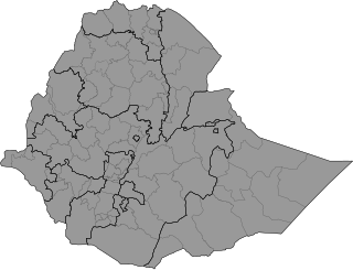
Districts of Ethiopia, also called woredas, are the third-level of the administrative division of Ethiopia – after zones and the regional states.
Bena is a Bantu language spoken by the Bena people of the Iringa region of Tanzania.
Bena is a town in the South Gippsland region of Victoria, Australia. It is located 100 km south-east of Melbourne and 8 km from Korumburra.
Bena is an Adamawa language of Nigeria.
Hamer Bena was one of the 77 woredas in the Southern Nations, Nationalities, and Peoples' Region of Ethiopia. Part of the Debub Omo Zone, Hamer Bena was bordered on the south by Kenya, on the southwest by Kuraz, on the northwest by the Usno River which separates it from Selamago, on the north by Bako Gazer, on the northeast by the Konso special woreda, and on the east by the Oromia Region; the Weito River separated it from Konso and the Oromia Region and the Neri River defined part of the boundary with Bako Gazer. Hamer Bena included part of Lake Chew Bahir along its southeastern border. The administrative center was Dimeka; other towns in Hamer Bena included Arbore, Key Afer, and Turmi. Hamer Bena was separated for Hamer and Bena Tsemay woredas.
Bena Tsemay is one of the woredas in the Southern Nations, Nationalities, and Peoples' Region of Ethiopia. It is named after Banna and Tsamai people who are living at this woreda. Part of the Debub Omo Zone, Bena Tsemay is bordered on the south by Hamer, on the west by Selamago, on the north by Bako Gazer and Male, on the northeast by the Dirashe special woreda, on the east by the Konso special woreda, and on the southeast by the Oromia Region; the Weito River separates it from Konso special woreda and Oromia Region. Western part of this woreda is included in the Mago National Park. The administrative center is Key Afer. Bena Tsemay was part of former Hamer Bena woreda.
Maale is one of the woredas in the Southern Nations, Nationalities, and Peoples' Region of Ethiopia. It is named after the Maale people who are living at this woreda. Part of the Debub Omo Zone, Male is bordered on the south by Bena Tsemay, on the west by Bako Gazer, on the north by the Basketo special woreda and Gelila, on the north and east by the Gamo Gofa Zone, and on the southeast by Dirashe special woreda. Male was separated from Bako Gazer woreda.
Qarah Benas is a village in Khezel-e Gharbi Rural District, in the Central District of Kangavar County, Kermanshah Province, Iran. At the 2006 census, its population was 292, in 65 families.
Hobicha is woredas in Wolaita Zone of Southern Nations, Nationalities, and Peoples' Region, Ethiopia. The woreda is established in 2019 from the surrounding woredas. And those surrounding woredas formed border to the Hobicha woreda. Hobicha is bordered on the south by Bilate River and Lake Abaya, on the west by the Abala Abaya woreda, on the north by the Damot Weyde woreda, on the east by Diguna Fango woreda and Bilate River. The administrative center of this woreda is Bada Town.