Demographics
Based on the 2019 population projection conducted by the CSA, [2] this woreda has a total population of 136,412, of whom 66,546 are men and 69,866 women; 6,590 or 6.3% of its population are urban dwellers. The majority of the inhabitants were Protestants, with 79.82% of the population reporting that belief, 16.73% practiced Ethiopian Orthodox Christianity, 1.52% were Catholic, and 1.18% observed traditional religions. [3]
The 1994 national census reported a total population for this woreda of 140,687 of whom 69,980 were men and 70,707 were women; 3,606 or 2.56% of its population were urban dwellers. The largest ethnic group reported in Damot Weyde was the Welayta (99.46%); all other ethnic groups made up 0.54% of the population. Welayta was the dominant first language, spoken by 99.66% of the inhabitants; the remaining 0.34% spoke all other primary languages reported. Concerning religious beliefs, the 1994 census reported that 39.74% of the population said they were Protestants, 32.49% practiced Ethiopian Orthodox Christianity, 13.83% observed traditional religions, 12.86% were Muslim, and 1.08% were Roman Catholic. [4]

North Omo Zone was a zone in the Southern Nations, Nationalities, and Peoples' Region of Ethiopia. It was named after the Omo River, which flows in the western area of the former zone. In 2000 it was split into three zones: Dawro, Gamo Gofa, and Wolayita; and Basketo and Konta became special woredas.

Amaro Zone (Kore) is a zone in the south-west Ethiopian Regional State of Ethiopia, and the people are called Kore, and their language is Korigna. The Amaro Kore people are the descendants of the Christian missioners of the north Ethiopian sematic peoples of Gonder, who were moved gradually through the northern shewa (menze) to the central and south-western Ethiopian lands of Damot (wolayta), Dawuro, Gamo Gofa, and surrounding areas of the region with their Christian traditions and heritages around the eleventh, twelfth, and thirteenth centuries. As the native of kore nation Theologian Jebdu kassahun evidentially assured and narrated, that was a time of ST. Abune Gebremenfes kidus, st.tekle Haymanot, and emperor Yikuno Amlak, who were preached and expanded Christianity to central and south western Ethiopian lands. Amaro is one of the areas in which members of Kore nations widely live in. Amaro Kore people got zonal status in August 2023 A.D upon the formation of the South west Ethiopia Regional State. In 2011 A.D, the Segen Area Peoples Zone was established, which includes Amaro woreda and the three former special woredas surrounding it. Located in the Great Rift Valley, Amaro kore peoples land is bordered on the south by Burji Zone, on the southwest by Konso Zone, on the west by Dirashe Zone, on the northwest by Gamo Zone and Lake Chamo, and on the north by Lake Abaya and in east and northeast by Oromia Region. It is divided into 35 kebeles. The administrative center of the woreda is Kelle, and Jijola woreda, Derba Menena woreda, and Kereda are other growing municipals of the zone. The highest peak in the zone is Mount Dello, which is part of the Kore mountains, the highest in Jemjem plateau and the second from the region. Much of the western part of this zone lies inside the Nechisar National Park. The major crops grown in Amaro are enset, teff, maize, wheat, barley, navy beans, and coffee. Amaro has 39 kilometers of all-weather roads and 16 kilometers of dry-weather roads, for an average road density of 36 kilometers per 1000 square kilometers. The Central Statistical Agency (CSA) reported that 1,082 tons of coffee were produced in the year ending in 2005, based on inspection records from the Ethiopian Coffee and Tea authority. This represented 0.48% of the Southern Nations, Nationalities and Peoples' Region (SNNPR)'s output and 1.08% of Ethiopia's total output.

Damot Weyde is a woreda in South Ethiopia Regional State of Ethiopia. It is a Part of the Wolayita Zone located in the Great Rift Valley, Damot Weyde is bordered on the south by Hobicha, on the west by Sodo Zuria, on the northwest by Damot Gale, on the north and northeast by Diguna Fango wordas. The administrative center of the woreda is Bedessa.
Damot Gale is a woreda in South Ethiopia Regional State, Ethiopia. Part of the Wolayita Zone, Damot Gale is bordered on the southwest by Sodo Zuria, on the northwest by Boloso Sore and Damot Pulasa, on the north by the Hadiya Zone, on the east by Diguna Fango, and on the southeast by Damot Weyde. The administrative center of Damot Gale is Boditi. Damot Pulasa woreda was separated from Damot Gale.
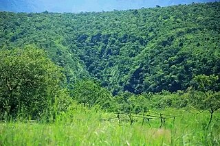
Angacha is one of the woredas in the Southern Nations, Nationalities, and Peoples' Region of Ethiopia.
Kacha Bira is a woreda in the Southern Nations, Nationalities, and Peoples' Region of Ethiopia. Part of the Kembata Tembaro Zone, Kacha Bira is bordered on the south by an exclave of the Hadiya Zone, on the southwest by the Wolayita Zone, on the west by Hadero Tunto, on the northwest by the Hadiya Zone, on the north by Doyogena and Angacha, and on the east by Kedida Gamela. Towns in Kacha Bira include Shinshicho and Hadero.
Shebedino is a woreda in Southern Nations, Nationalities, and Peoples' Region, Ethiopia. Part of the Sidama Zone located in the Great Rift Valley, Shebedino is bordered on the south by Dale, on the west by Boricha, on the north by Awasa Zuria, on the east by Gorche, and on the southeast by Wensho. Towns in Shebedino include Leku. Boricha and Gorche woredas were separated from Shebedino woreda.
Boloso Sore is a woreda in South Ethiopia Regional State, Ethiopia. Part of the Wolayita Zone, Boloso Sore is bordered on the south by Sodo Zuria and Damot Sore, on the west by Boloso Bombe, on the northeast by the Kembata Tembaro Zone, on the northeast by the Hadiya Zone, on the east by Damot Pulasa, and on the southeast by Damot Gale. The administrative center is at Areka. Boloso Bombe and Damot Sore woredas were separated from Boloso Sore.
Sodo Zuria is one of the woredas in the South Ethiopia Regional State of Ethiopia. Part of the Wolayita Zone, Sodo Zuria is bordered on the southwest by Offa, on the west by Kindo Koysha, on the northwest by Damot Sore, on the north by Boloso Sore, on the northeast by Damot Gale, on the east by Damot Weyde, on the west by Bayra Koysha and on the southeast by Humbo. Sodo city is an administrative center for Sodo Zuria woreda.
Offa is one of the woredas in the South Ethiopia Regional State of Ethiopia. It is a Part of the Wolayita Zone. Offa is bordered on the south by the Gamo Zone, on the west by Kindo Didaye, on the north by Kindo Koysha, on the northeast by Sodo Zuria, on the north by Kawo Koysha and on the east by Humbo woredas. The administrative center of Offa is Gesuba. Western part of Offa was added to Kindo Didaye woreda in 1998 E.C.
Humbo is one of the woredas in the South Ethiopia Regional State of Ethiopia. It is a Part of the Wolayita Zone located in the Great Rift Valley, Humbo is bordered on the southeast by Abala Abaya, on the south by the Gamo Zone, on the west by Offa, on the north by Sodo Zuria and Bayra Koysha. The administrative center of Humbo is Tebela.
Bonke is one of the woredas in the Southern Nations, Nationalities, and Peoples' Region of Ethiopia. Part of the Gamo Gofa Zone, Bonke is bordered on the south by the Dirashe special woreda, on the west by the Weito River which separates it from Kemba, on the northwest by Deramalo, on the north by Dita, and on the east by Arba Minch Zuria. The major town in Bonke is Gerese.
Arba Minch Zuria is a woreda in Southern Nations, Nationalities, and Peoples' Region, Ethiopia. A part of the Gamo Zone located in the Great Rift Valley, Arba Minch Zuria is bordered on the south by the Dirashe special woreda, on the west by Bonke, on the north by Dita and Chencha, on the northeast by Mirab Abaya, on the east by the Oromia Region, and on the southeast by the Amaro special woreda. This woreda also includes portions of two lakes and their islands, Abaya found in Lante kebele and Chamo found in all Ganta Kanchama Ochole and Zeyise kebeles. Nechisar National Park is located between these lakes. City of Arba Minch is surrounded by Arba Minch Zuria.
Seraro is one of the woredas in the Oromia Region of Ethiopia. Part of the West Arsi Zone located in the Great Rift Valley, Seraro is bordered on the south and west by the Southern Nations, Nationalities and Peoples' Region, on the north by Shala, and on the east by Naannawa Shashamane; its western boundary is defined by the course of the Bilate River. The administrative center of this woreda is Loke.
Fentale is one of the districts in the Oromia of Ethiopia. Part of the East Shewa Zone located in the Great Rift Valley, Fentale is bordered on the southeast by the Arsi Zone, on the southwest by Boset, on the northwest by the Amhara Region, and on the northeast by the Afar Region. The administrative center of Fentale is Metehara; other towns include Haroo Adii.
Merti is one of the Aanaas in the Oromia Regional State of Ethiopia. Part of the Arsi Zone, Merti is bordered on the south by Sude, on the west by Jeju, on the northwest by the East Shewa Zone, on the north by the Afar Region, on the east by Aseko, and on the southeast by Chole. The administrative center of this woreda is Abomsa; other towns in Merti include Reye. Guna woreda was separated from Merti.
Kokosa is one of the Aanaas in the Oromia of Ethiopia. Being part of the West Arsi Zone, Kokosa is bordered on the south and west by the Sidama Region, on the north by the Kofele, on the northeast by Dodola, and on the southeast by Nensebo. The administrative center of this woreda is Kokosa; other towns include Diki, Gata, BokoreHebano, Hogiso.
Boloso Bombe is one of the woredas in the South Ethiopia Regional State of Ethiopia part of the Wolayita Zone. Boloso Bombe is bordered on the south by Kindo Koysha, on the west by the Dawro Zone, on the north by the Kembata Zone, on the east by Boloso Sore, northwest by Tembaro Special Woreda and on the southeast by Damot Sore. The administrative center of this woreda is Bombe, which has a latitude and longitude of 7°08′15.1"N 37° 34'54.1"E.
Damot Sore is a woreda in South Ethiopia Regional State of Ethiopia. Part of the Wolayita Zone Damot Sore is bordered on the southeast by Sodo Zuria, on the west by Kindo Koysha, on the northwest by Boloso Bombe, and on the north by Boloso Sore. The administrative town of the wereda is Gununo. Damot Sore was separated from Boloso Sore woreda.

Kindo Didaye is one of the woredas in the South Ethiopia Regional State of Ethiopia. It is a Part of the Wolayita Zone. Kindo Didaye is bordered on the south by the Gamo Zone, on the west by the Dawro Zone, on the northeast by Kindo Koysha, and on the east by Offa and Kawo Koysha woredas. Kindo Didaye was separated from Offa woreda and Kindo Koysha woreda in 1998 E.C.
