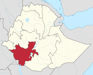
The Southern Nations, Nationalities, and Peoples' Region was a regional state in southwestern Ethiopia. It was formed from the merger of five kililoch, called Regions 7 to 11, following the regional council elections on 21 June 1992. Its government was based in Hawassa.
Mieso is a woreda in Somali Region, Ethiopia. Part of the Shinile Zone, this woreda is bordered on the south by the Oromia Region, on the northwest by the Afar Region, and on the east by the Afdem woreda. The administrative center for this woreda is Mulu town.
Gidan is a woreda in the Amhara Region of Ethiopia. Part of the Semien Wollo Zone, Gidan is bordered on the south by Guba Lafto, on the southwest by Meket, on the west by Lasta, on the north by the Tigray Region, and on the east by Kobo. The administrative center of the woreda is Muja town, another small towns in Gidan include Debre Tsehay, Densa, Bekilo Mneqia, Iyella, Dildiy, Asikit, and Wonday.
Wadla is a woreda in Amhara Region, Ethiopia. It is named for the former district which lay roughly in the same area. Part of the Semien Wollo Zone, Wadla is bordered on the southeast by Delanta, on the southwest by Dawunt, on the north by Meket, and on the northeast by Guba Lafto. The major town in Wadla is Gashena. Other towns include Kone and Arbit.
Boloso Sore is a woreda in South Ethiopia Regional State, Ethiopia. Part of the Wolayita Zone, Boloso Sore is bordered on the south by Sodo Zuria and Damot Sore, on the west by Boloso Bombe, on the northeast by the Kembata Tembaro Zone, on the northeast by the Hadiya Zone, on the east by Damot Pulasa, and on the southeast by Damot Gale. The administrative center is at Areka. Boloso Bombe and Damot Sore woredas were separated from Boloso Sore.
Nunu Kumba is one of 180 woredas in the Oromia Region of Ethiopia. Part of the East Welega Zone, Nunu Kumba is bordered on the southwest by the Didessa River which separates it from the Illubabor Zone, on the northwest by Jimma Arjo, on the north by Guto Wayu, on the northeast by Wama Bonaya, and on the southeast by the Wama which separates it from the Jimma Zone. The administrative center of this woreda is Nunu.
Naannawa Ambo is one of the districts in the Oromia of Ethiopia. Part of the West Shaggar Zone, it is bordered on the southwest by Gurraacha Enchini, on the west by Cheliya, on the north by Kutaye-Liban, on the northeast by Jeldu, on the east by Dendi, and on the southeast by the Southwest Shewa Zone. The administrative center of this woreda is Ambo; other towns include Gorosile and Meti. Ambo Zuria and Toke Kutaye woredas and Ambo town were part of former Ambo woreda.
Tiro Afeta, also known as Nedi Gibe, is a woreda in Oromia Region, Ethiopia. Part of the Jimma Zone, Tiro Afeta is bordered on the south by Omo Nada, on the west by Kersa, on the north by Limmu Kosa, and on the east by Sokoru. The administrative center of the woreda is Dimtu.
Setema is one of the woredas in the Oromia Region of Ethiopia. Located in the western part of the Jimma Zone, Setema is bordered on the south by Gera, on the west by Sigmo, on the north by the Illubabor Zone, and on the southeast by Gomma. The administrative center of the woreda is Gatira.
Bedeno is a District of Ethiopia in Oromia, Ethiopia. It is named after the administrative center of the district, Bedeno. Part of the East Hararghe Zone, Bedeno is bordered on the south by Gola Odana Meyumuluke, on the southwest by Malka Balo, on the west by Deder, on the northwest by Meta, on the north by Jarso, on the northeast by Kurfa Chele, and on the east by Girawa. Towns include Furda.
Kombolcha is a woreda in Oromia Region, Ethiopia. Part of the East Hararghe Zone, Kombolcha is bordered on the south by the Harari Region, on the southwest by Haro Maya, on the northwest by Dire Dawa, on the north by the Somali Region, and on the east by Jarso. The administrative center of the woreda is Melka Rafu.
Jarso is a woreda in Oromia Region, Ethiopia. Part of the East Hararghe Zone, Jarso is bordered on the south by the Harari Region, on the west by Kombolcha, on the north by the city of Dire Dawa, on the east by the Somali Region, and on the southeast by Gursum. The administrative center of this district is Ejersa Goro.
Kurfa Chele is a District in the Oromia of Ethiopia. It is named after its administrative center, Kurfa Chele. Part of the East Hararghe Zone, Kurfa Chele is bordered on the south by Girawa, on the west by Bedeno, on the northwest by Kersa, and on the northeast by Haro Maya. Towns include Dawe.
Malka Balo is a Districts of Ethiopia in Oromia, Ethiopia. Part of the East Hararghe Zone, Malka Balo is bordered on the west by the West Hararghe Zone, on the north by Deder, on the northeast by Bedeno, and on the southeast by Gola Odana Meyumuluke; part of the boundary with the West Hararghe Zone is defined by the Galetti River. The administrative center for this woreda is Jaja; other towns include Bareda,Harawacha and Harew.
Berbere is a woreda in Oromia Region, Ethiopia. Part of the Bale Zone, Berbere is bordered on the south by Mennana Harena Buluk, on the northwest by Goba, on the north by Sinanana Dinsho, on the northeast by Goro, and on the east by Guradamole; the Mena River separates it from Shinanana Dinsho and Goro. The administrative center of the woreda is Haro Dumal.
Guradamole is one of the woredas in the Somali Region of Ethiopia. Part of the Liben Zone, Guradamole is bordered on the south by the Ganale Dorya River which separates it from the Liben Zone, on the southwest by Meda Welabu, on the west by Mennana Harena Buluk, on the northwest by Berbere, on the northeast by the Mena River and on the southeast by the Somali Region. The administrative center of the woreda is Liben Zone.
Moyale(Oromo: Moyyaalee) is one of the Districtss in the Oromia Region of Ethiopia. It is named after the administrative center of the woreda, Moyale. Located in the southeast corner of the Borena Zone, Moyale is bordered on the south by Kenya, on the west by Dire, on the northwest by Arero, on the north by the Dawa River which separates it from Liben, and on the east by Dawa Zone Somali Region.

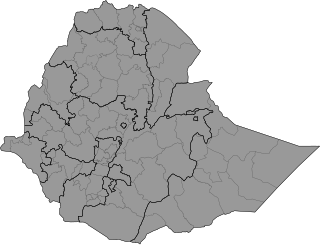
Districts of Ethiopia, also called woredas, are the third level of the administrative divisions of Ethiopia – after zones and the regional states.

Ari is an administrative zone in South Ethiopia Regional State. Until August 2023, Ari was a part of the South Omo Zone. It is named for the Aari people, whose homeland is in the zone. Ari is bordered on the south by South Omo Zone, on the Northeast by the Gofa Zone and North by the Basketo Zone. The administrative centre of Ari Zone is Jinka.


