Demographics
Based on the 2007 Census conducted by the Central Statistical Agency of Ethiopia (CSA), this zone has a total population of 56,689, of whom 28,532 men and 28,157 women. With an area of 411.09 square kilometers, Basketo has a population density of 137.90; 5,215 or 9.20% are urban inhabitants. A total of 13,424 households were counted in this woreda, which results in an average of 4.22 persons to a household, and 13,069 housing units. The four largest ethnic groups reported in Basketo were the namesake Basketo people (87.75%), the Wolayta (4.28%), the Amhara (3.73%), and the Konso (1.92%); all other ethnic groups made up 2.32% of the population. Basketo is spoken as a first language by 89.06%, 4.18% Wolaytta, 3.09% Amharic, and 1.92% speak Konso; the remaining 1.75% spoke all other primary languages reported. 64.06% were Protestants, 30.73% of the population said they were Ethiopian Orthodox Christians, 2.13% practiced traditional beliefs, 1.51% embraced Roman Catholicism, and 1.25% were Muslim. [5]
The 1994 national census reported a total population for this zone of 33,672 of whom 16,739 were men and 16,933 were women; 2,191 or 6.51% of its population were urban dwellers. The four largest ethnic groups reported in Basketo were the namesake Basketo people (90.75%), the Amhara (4.04%), the Aari (2.74%), and the Gofa (0.81%); all other ethnic groups made up 1.66% of the population. Basketo is spoken as a first language by 93.2%, 2.94% Amharic, and 2.46% speak Aari; the remaining 1.4% spoke all other primary languages reported. [6]

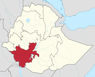
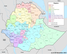
The Southern Nations, Nationalities, and Peoples' Region was a regional state in southwestern Ethiopia. It was formed from the merger of five kililoch, called Regions 7 to 11, following the regional council elections on 21 June 1992. Its government was based in Hawassa.

Bench Sheko is a zone in the South West Ethiopia Peoples' Region of Ethiopia. Bench Sheko is bordered on the south and southeast by West Omo, on the west by the Gambela Region on the north by Sheka, and on the east by Keffa. The administrative center of Bench Sheko is Mizan Teferi.

South Omo Zone is a zone in the Ethiopian South Ethiopia Regional State. South Omo is bordered to the south by Kenya, to the west by West Omo Zone, to the northwest by Keffa Zone, to the north by Ari Zone and Gofa Zone, to the northeast by Gardula, Ale Zone and Konso and to the east by the Oromia Region. The administrative center of South Omo is Dimeka.

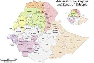
North Omo Zone was a zone in the Southern Nations, Nationalities, and Peoples' Region of Ethiopia. It was named after the Omo River, which flows in the western area of the former zone. In 2000 it was split into three zones: Dawro, Gamo Gofa, and Wolayita; and Basketo and Konta became special woredas.

Amaro Zone (Kore) is a zone in the south-west Ethiopian Regional State of Ethiopia, and the people are called Kore, and their language is Korigna. The Amaro Kore people are the descendants of the Christian missioners of the north Ethiopian sematic peoples of Gonder, who were moved gradually through the northern shewa (menze) to the central and south-western Ethiopian lands of Damot (wolayta), Dawuro, Gamo Gofa, and surrounding areas of the region with their Christian traditions and heritages around the eleventh, twelfth, and thirteenth centuries. As the native of kore nation Theologian Jebdu kassahun evidentially assured and narrated, that was a time of ST. Abune Gebremenfes kidus, st.tekle Haymanot, and emperor Yikuno Amlak, who were preached and expanded Christianity to central and south western Ethiopian lands. Amaro is one of the areas in which members of Kore nations widely live in. Amaro Kore people got zonal status in August 2023 A.D upon the formation of the South west Ethiopia Regional State. In 2011 A.D, the Segen Area Peoples Zone was established, which includes Amaro woreda and the three former special woredas surrounding it. Located in the Great Rift Valley, Amaro kore peoples land is bordered on the south by Burji Zone, on the southwest by Konso Zone, on the west by Dirashe Zone, on the northwest by Gamo Zone and Lake Chamo, and on the north by Lake Abaya and in east and northeast by Oromia Region. It is divided into 35 kebeles. The administrative center of the woreda is Kelle, and Jijola woreda, Derba Menena woreda, and Kereda are other growing municipals of the zone. The highest peak in the zone is Mount Dello, which is part of the Kore mountains, the highest in Jemjem plateau and the second from the region. Much of the western part of this zone lies inside the Nechisar National Park. The major crops grown in Amaro are enset, teff, maize, wheat, barley, navy beans, and coffee. Amaro has 39 kilometers of all-weather roads and 16 kilometers of dry-weather roads, for an average road density of 36 kilometers per 1000 square kilometers. The Central Statistical Agency (CSA) reported that 1,082 tons of coffee were produced in the year ending in 2005, based on inspection records from the Ethiopian Coffee and Tea authority. This represented 0.48% of the Southern Nations, Nationalities and Peoples' Region (SNNPR)'s output and 1.08% of Ethiopia's total output.

Burji Zone is one of the zones in the South Ethiopia Regional State of Ethiopia. In August 2023 Burji special Woreda got zonal status upon the formation of South Ethiopia Region. In 2011, the Segen Area Peoples Zone was established, which includes Burji woreda and the 3 former special woredas surrounding it. It is named for the Burji people, who have their homeland in this zone. Burji is bordered on the east and south by the Oromia Region, on the west by the Konso Zone, and on the north by the Amaro Zone. The administrative center of Burji is Soyama.

Dirashe Zone is one of the zones in the South Ethiopia Regional State of Ethiopia. In 2011, the Segen Area Peoples Zone was established, which includes Dirashe woreda and the 3 former special woredas surrounding it. It is named for the Dirashe people, whose homelands lie in the eastern part of this woreda. Dirashe got zonal status when the South Ethiopia Regional State formed in August 2023.

Konso is a zone in the South Ethiopia Regional State, Ethiopia. It was formerly a woreda. Prior to 2011, Konso was not part of any Zone in the Southern Nations, Nationalities and Peoples' Region (SNNPR) and was therefore considered a special woreda, an administrative subdivision which is similar to an autonomous area. In 2011, the Segen Area Peoples Zone was established, which includes Konso special woreda and the 3 former woredas surrounding it. This special woreda is named after the Konso people. Located in the Great Rift Valley, Konso is bordered on the south by the Oromia Region, on the west by the South Omo Zone, on the northwest by Alle special woreda, on the north by Dirashe special woreda, on the northeast by Amaro special woreda, and on the east by Burji special woreda. The Sagan River, which flows south then west to join the Weito, defines part of the woreda's boundary with Burji and the entire length of the boundary with the Oromia Region. The administrative center is Karati; other towns in Konso include Fasha and Sagen. After protesting by residents to become a zone for several years, Konso became a zone in November 2018.
Kuraz is one of the woredas in the South Ethiopia Regional State. It is the homeland of Daasanach people. Part of the Debub Omo Zone, Kuraz is bordered on the south by Kenya, on the west by the Ilemi Triangle, on the north by Nyangatom, and on the east by Hamer. The Omo River is flowing through Kuraz to Lake Turkana at the border of Kenya. The administrative center of this woreda is Omorate. Nyangatom woreda was separated from Kuraz.

Konta, previously called Ela, is a zone in the Southwest Region of Ethiopia. It is named after Konta people who speak the dialects called Kontatsuwa, Omotic languages. Before joining to Southwest Ethiopia Regional states, Konta was special woreda. This zone is bordered on the south by the Omo River which separates it from the Gamo Zone, Gofa Zone, and Selamgo woreda, Debub Omo Zone, on the west by the Keffa Zone, on the north by Oromia Region,Dedo and Mancho woreda, and on the east by the Dawro Zone; the Denchya River defines the southern part of the boundary with the Keficho Shekicho Zone. The administrative center is Ameya; other towns include Chida.
Isara Tocha was one of the 77 woredas in the Southern Nations, Nationalities, and Peoples' Region of Ethiopia. Part of the Dawro Zone, Isara Tocha was bordered on the south by the Omo River which separates this woreda from the Gamo Gofa Zone, on the west by the Konta special woreda, on the north by the Gojeb River which separates it from the Oromia Region, on the east by Mareka Gena, and on the southeast by Loma Bosa. Towns in Isara Tocha included Bale and Tocha. Isara Tocha was separated to Isara and Tocha woredas.
Gofa Zuria is a zone in the South Ethiopia Regional State of Ethiopia. It was previously one of the 17 Zones in the Southern Nations, Nationalities, and Peoples' Region (SNNPR) of Ethiopia. Within the SNNPR, Gofa Zone was bordered to the south by Kamba and Daramalo woredas, to the southwest by the Debub (South) Omo Zone, to the west by the Basketo special woreda, to the northwest by Dawro Zone, to the north by the Dawro Zone, and to the east by Kucha. The administrative center of Gofa Zone is Sawla; other towns included Bulki. Gofa Zone is administratively subdivided into the aforementioned towns of Bulki and Sawla and the seven woredas of Demba Gofa, Gada, Geze Gofa, Melokoza, Oyda, Uba Debretsehay, and Zala.
Zala Ubamale was one of the 77 woredas in the Southern Nations, Nationalities, and Peoples' Region of Ethiopia. Part of the Gamo Gofa Zone, Zala Ubamale was bordered on the south and west by the Debub Omo Zone, on the northwest by Gofa Zuria, on the northeast by Kucha, on the east by Dita Dermalo and on the southeast by Kemba. Towns in Zala Ubamale included Beto and Meleante. Zala Ubamale was divided for Uba Debretsehay and Zala woredas.
Kemba is one of the woredas in the Southern Nations, Nationalities, and Peoples' Region of Ethiopia. Part of the Gamo Gofa Zone, Kemba is bordered on the southwest by the Debub Omo Zone, on the west by Uba Debretsehay, on the northwest by Zala, on the northeast by Deramalo, on the east by Bonke, and on the southeast by the Dirashe special woreda; the Weito River defines the boundary with Bonke and Dirashe. The major town in this woreda is Kemba.
Bonke is one of the woredas in the Southern Nations, Nationalities, and Peoples' Region of Ethiopia. Part of the Gamo Gofa Zone, Bonke is bordered on the south by the Dirashe special woreda, on the west by the Weito River which separates it from Kemba, on the northwest by Deramalo, on the north by Dita, and on the east by Arba Minch Zuria. The major town in Bonke is Gerese.
Selamago is a woreda in the South Ethiopia Regional State. Part of the South Omo Zone, Selamago is bordered on the south by Nyangatom, on the west and north by the Omo River which separates it from the Bench Maji, Keffa and Konta, on the northeast by the Gamo Gofa, on the east by the Basketo and Bako Gazer, and on the southeast by the Usno River which separates it from Bena Tsemay; the Mago River defines part of the boundary with Bako Gazer. The administrative center of Selamago is Hana.
Bako Gazer is one of the woredas in the South Ethiopia Regional State. It is also called Southern Aari as it is part of the homeland of Aari people. Part of the Debub Omo Zone, Bako Gazer is bordered on the south by Bena Tsemay, on the west by the Mago River which separates it from Selamago, on the north by the Basketo special woreda and Gelila, on the northeast by the Gamo Gofa Zone, and on the east by Male. The administrative center of this woreda is Jinka; other towns in Bako Gazer include Tolta and Wub Hamer. Gelila and Male woredas were separated from Bako Gazer.
Melokoza is one of the woredas in the Southern Nations, Nationalities, and Peoples' Region of Ethiopia. Part of the Gamo Gofa Zone, Melokoza is bordered on the south by Basketo special woreda, on the southwest by the Debub (South) Omo Zone, on the northwest by the Konta special woreda, on the north by the Dawro Zone, and on the east by Demba Gofa and Geze Gofa; the Omo River defines its northwestern boundary separating the woreda from Konta and the Dawro Zone. The major town in Melokoza is Leha.
Gamo Zone is a zone in the South Ethiopia Regional State of Ethiopia. Gamo is bordered on the south by the Dirashe special woreda, on the southwest by Debub (South) Omo and the Basketo special woreda, on the northwest by Konta special woreda, on the north by Dawro and Wolayita, on the northeast by the Lake Abaya which separates it from the Oromia Region, and on the southeast by the Amaro special woreda. The administrative center of Gamo is Arba Minch.
Hamer Bena was one of the 77 woredas in the Southern Nations, Nationalities, and Peoples' Region of Ethiopia. Part of the Debub Omo Zone, Hamer Bena was bordered on the south by Kenya, on the southwest by Kuraz, on the northwest by the Usno River which separates it from Selamago, on the north by Bako Gazer, on the northeast by the Konso special woreda, and on the east by the Oromia Region; the Weito River separated it from Konso and the Oromia Region and the Neri River defined part of the boundary with Bako Gazer. Hamer Bena included part of Lake Chew Bahir along its southeastern border. The administrative center was Dimeka; other towns in Hamer Bena included Arbore, Key Afer, and Turmi. Hamer Bena was separated for Hamer and Bena Tsemay woredas.


