The South African coastline stretches for some 3000km from Kosi Bay near the Mozambique border in the east to the Gariep (Orange) River at the Namibian border in the west. Some 300 river outlets intersect this coastline and these range from small water bodies that are only occasionally connected to the ocean, to large, permanently open systems, and coastal lakes connected to the sea via a narrow channel (Heydorn, 1991). Being places where rivers meet the sea, estuaries are one of the most important features of the South African coastline; they are tranquil areas of high productivity and play a vital role in the life cycles of many plants and animals. Apart from their ecological importance, estuaries are also popular sites for human activity and development. Recreational uses of estuaries include bait collection, bird watching, boating, fishing and swimming. Because of their great aesthetic value, areas around estuaries are often favoured for housing and tourist developments.
Kosi Bay (26° 54' S; 32° 53’E) drains into the Indian Ocean, and is situated on the east (KwaZulu-Natal) coast near the Mozambique border. This system has a catchment area of approximately 304km2.
The St Lucia estuary (28° 23' S; 32° 25’E) drains into the Indian Ocean, and is situated north of the coastal town of Richards Bay in KwaZulu-Natal. It is the largest estuarine system in the country and has a catchment area of approximately 9 542km2.
The Mfolozi/Msunduzi estuary (28° 24' S; 32° 25’E) drains into the Indian Ocean, and is located north of the coastal town of Richards Bay in KwaZulu-Natal. This system has a catchment area of approximately 11 068km2.
The Richards Bay/Mhlathuze system (28° 51' S; 32° 03’E) is situated at the coastal town of Richards Bay in KwaZulu-Natal. Prior to the construction of a deep-water harbour in the 1970s, the system comprised a large shallow, expanse of water, fed primarily by the Mhlathuze River, with a catchment area of approximately 3670km2. The system today consists two separate components, a harbour (Richards Bay) and a sanctuary area (Mhlathuze estuary) into which the Mhlathuze River flows. The harbour and sanctuary are separated by a 4km long causeway or berm and each has its own separate opening to the sea. Both drain into the Indian Ocean.
The Mlalazi estuary (28° 57' S; 31° 49’E) drains into the Indian Ocean, and is located just south of Richards Bay in KwaZulu-Natal. The river is approximately 54km long with a catchment area of 492km2.
The Matigulu/Nyoni system (29° 05' S; 31° 38’E) drains into the Indian Ocean, and is situated south of Richards Bay in KwaZulu-Natal. This system drains a catchment area of over 900km2.
The Thukela system (29° 13' S; 31° 30’E) drains into the Indian Ocean, and is situated in KwaZulu-Natal, approximately midway between Richards Bay and the coastal city of Durban. The Thukela is the largest river system in KwaZulu-Natal. The river is approximately 405km long with a catchment area of 29 101km2.
The Mvoti estuary (29° 24' S; 31° 20’E) drains into the Indian Ocean, and is situated north of the coastal city of Durban in KwaZulu-Natal. The river is approximately 197km long with a catchment area of 2 829km2.
The Mgeni estuary (29° 48' S; 31° 02’E) drains into the Indian Ocean, and is situated near the coastal city of Durban in KwaZulu-Natal. The river is approximately 232km long with a catchment area of 4 432km2.
Durban Bay (29° 52' S; 31° 04’E) drains into the Indian Ocean, and is located in the coastal city of Durban in KwaZulu-Natal. This important industrial harbour has a catchment area of approximately 264km2.
The Mkomazi estuary (30° 12' S; 30° 48’E) drains into the Indian Ocean, and lies south of the city of Durban in KwaZulu-Natal. The river is approximately 298km long with a catchment area of 4 310km2.
The Mzimkulu estuary (30° 44' S; 30° 27’E) drains into the Indian Ocean, and is situated near the coastal town of Port Shepstone in KwaZulu-Natal. The river is approximately 329km long with a catchment area
The Mtamvuna estuary (31° 04' S; 30° 12’E) drains into the Indian Ocean, and is situated just south of the coastal town of Port Edward at the KwaZulu-Natal, Eastern Cape provincial border. The river is approximately 162km long with a catchment area of 1 553km2.
The Mzamba estuary (31° 06' S; 30° 10’E) drains into the Indian Ocean, and is situated on the former Transkei coast of the Eastern Cape, just south of Port Edward near the KwaZulu-Natal, Eastern Cape provincial border. This system drains a catchment area of approximately 505km2.
The Mtentu estuary (31° 15' S; 30° 03’E) drains into the Indian Ocean, and is situated north of the coastal town of Port St Johns on the former Transkei coast of the Eastern Cape. This system drains a catchment area of approximately 965km2.
The Msikaba system (31° 18' S; 29° 58’E) drains into the Indian Ocean, and lies north of the coastal town of Port St Johns on the former Transkei coast of the Eastern Cape. This system drains a catchment area of approximately 1 011km2.
The Mzintlava estuary (31° 32' S; 29° 41’E) drains into the Indian Ocean, and is situated north of the coastal town of Port St Johns on the former Transkei coast of the Eastern Cape. This system drains a catchment area of approximately 280km2.
The Mntafufu estuary (31° 34' S; 29° 38’E) lies north of the coastal town of Port St Johns on the former Transkei coast of the Eastern Cape. This system drains a catchment area of approximately 178km2.
The Mzimvubu estuary (31° 38' S; 29° 33’E) drains into the Indian Ocean, and is situated near the coastal town of Port St Johns on the former Transkei coast of the Eastern Cape. This system drains a catchment area of approximately 19 853km2.
The Mngazi estuary (31° 41' S; 29° 27’E) drains into the Indian Ocean, and lies just south of the coastal town of Port St Johns on the former Transkei coast of the Eastern Cape. This system drains a catchment area of approximately 561km2.
The Mngazana estuary (31° 42' S; 29° 25’E) drains into the Indian Ocean, and is situated south of the town of Port St Johns on the former Transkei coast of the Eastern Cape. This system drains a catchment area of approximately 285km2.
The Mtakatye estuary (31° 51' S; 29° 16’E) drains into the Indian Ocean, and lies south of the coastal town of Port St Johns on the former Transkei coast of the Eastern Cape. This system drains a catchment area of approximately 493km2.
The Mdumbi estuary (31° 56' S; 29° 13’E) drains into the Indian Ocean, and is situated south of the coastal town of Port St Johns on the former Transkei coast of the Eastern Cape. This system drains a catchment area of approximately 2 338km2.
The Mtata estuary (31° 57' S; 29° 10’E) drains into the Indian Ocean, and lies south of the coastal town of Port St Johns on the former Transkei coast of the Eastern Cape. This system drains a catchment area of approximately 2 585km2.
The Xora estuary (32° 10' S; 29° 00’E) drains into the Indian Ocean, and is situated south of the coastal town of Port St Johns on the former Transkei coast of the Eastern Cape. This system drains a catchment area of approximately 438km2.
The Mbashe estuary (32° 15' S; 28° 54’E) drains into the Indian Ocean, and is situated south of the coastal town of Port St Johns on the former Transkei coast of the Eastern Cape. This system drains a catchment area of approximately 6 030km2.
The Nqabara estuary (32° 20' S; 28° 47’E) drains into the Indian Ocean, and lies south of the coastal town of Port St Johns on the former Transkei coast of the Eastern Cape. This system drains a catchment area of approximately 578km2.
The Shixini system (32° 24' S; 28° 43’E) drains into the Indian Ocean, and lies south of the coastal town of Port St Johns on the former Transkei coast of the Eastern Cape. This system drains a catchment area of approximately 332km2.
The Qora estuary (32° 27' S; 28° 40’E) drains into the Indian Ocean, and is situated south of the coastal town of Port St Johns on the former Transkei coast of the Eastern Cape. This system drains a catchment area of approximately 700km2.
The Ngqusi/Inxaxo system (32° 35' S; 28° 31’E) drains into the Indian Ocean, and is situated south of the coastal town of Port St Johns on the former Transkei coast of the Eastern Cape. This system drains a total catchment area of approximately 134km2.
The Kobonqaba estuary (32° 36' S; 28° 29’E) drains into the Indian Ocean, and is situated on the former Transkei coast of the Eastern Cape, south of Port St Johns. This system drains a catchment area of approximately 321km2.
The Great Kei estuary (32° 41' S; 28° 23’E) drains into the Indian Ocean, and is situated north of the coastal city of East London and forms the southern border of the former Transkei coast of the Eastern Cape. The river is approximately 520km long with a catchment area of 20 566km2.
The Kwelera estuary (32° 55' S; 28° 05’E) drains into the Indian Ocean, and is situated north of the coastal city of East London in the Eastern Cape. The river is approximately 86km long with a catchment area of 418km2.
The Gqunube estuary (32° 56' S; 28° 02’E) drains into the Indian Ocean, and lies just north of the coastal city of East London in the Eastern Cape. The river is approximately 109km long with a catchment area of 665km2.
The Nahoon estuary (32° 59' S; 27° 57’E) drains into the Indian Ocean, and is situated near the coastal city of East London in the Eastern Cape. The river is approximately 77km long with a catchment area of 584km2.
The Buffalo estuary (33° 02' S; 27° 55’E) drains into the Indian Ocean, and is situated at the coastal city of East London in the Eastern Cape. The river is approximately 133km long with a catchment area of 1 279km2.
The Tyolomnqa estuary (33° 14' S; 27° 35’E) drains into the Indian Ocean, and lies southwest of the coastal city of East London and forms the northern border of the former Ciskei coast of the Eastern Cape. The river is approximately 78km long with a catchment area of 441km2.
The Keiskamma estuary (33° 17' S; 27° 29’E) drains into the Indian Ocean, and is found on the former Ciskei coast of the Eastern Cape and is situated approximately midway between the City of East London in the north and the coastal town of Port Alfred in the south. The river is approximately 263km long with a catchment area of 2 745km2.
The Great Fish estuary (33° 30' S; 27° 08’E) drains into the Indian Ocean, and is situated northeast of the coastal town of Port Alfred and forms the southern border of the former Ciskei coast of the Eastern Cape. The river is approximately 730km long with a catchment area of 30 366km2.
The Kowie estuary (33° 36' S; 26° 54’E) drains into the Indian Ocean, and is located at the coastal town of Port Alfred in the Eastern Cape. The river is approximately 94km long with a catchment area of 800km2.
The Kariega estuary (33° 41' S; 26° 44’E) drains into the Indian Ocean, and is situated southwest of the coastal town of Port Alfred in the Eastern Cape. The river is approximately 138km long with a catchment area of
The Bushmans system (33° 42' S; 26° 40’E) drains into the Indian Ocean, and is situated southwest of the coastal town of Port Alfred in the Eastern Cape. The river is approximately 293km long with a catchment area of 2 675km2.
The Sundays estuary (33° 43' S; 25° 51’E) drains into the Indian Ocean, and is located northeast of the coastal city of Port Elizabeth in the Eastern Cape. The river is approximately 481km long with a catchment area of 20 990km2.
The Swartkops estuary (33° 52' S; 25° 38’E) drains into the Indian Ocean, and is situated near the coastal city of Port Elizabeth in the Eastern Cape. The river is approximately 134km long with a catchment area of 1 303km2.
The Gamtoos estuary (33° 58' S; 25° 04’E) drains into the Indian Ocean, and lies to the west of the coastal city of Port Elizabeth in the Eastern Cape. The river is approximately 645km long with a catchment area of 34 635km2.
The Kromme estuary (34° 09' S; 24° 51’E) drains into the Indian Ocean, and lies to the west of the coastal city of Port Elizabeth in the Eastern Cape. The river is approximately 109km long with a catchment area of 1 085km2.
The Keurbooms system (34° 02' S; 23° 23’E) drains into the Indian Ocean, and is located in the Western Cape province near the coastal town of Plettenberg Bay. The river is approximately 85km long with a catchment area of 1 080km2.
The Knysna estuary (34° 05' S; 23° 04’E) drains into the Indian Ocean, and is situated near the coastal town of the Knysna in the Western Cape. The river is approximately 60km long with a catchment area of 525km2.
The Swartvlei system (34° 00' S; 22° 48’E) drains into the Indian Ocean, and is located on the Sedgefield River, approximately midway between the coastal towns of Knysna and Mossel Bay in the Western Cape. The river is approximately 38km long with a catchment area of 455km2.
The Gourits estuary (34° 21' S; 22° 33’E) drains into the Indian Ocean, and lies southwest of the coastal town of Mossel Bay in the Western Cape. The river is approximately 416km long with a catchment area of 45 715km2.
The Goukou system (34° 23' S; 21° 25’E) drains into the Indian Ocean, and lies west of the coastal town of Mossel Bay in the Western Cape. The river is approximately 67km long with a catchment area of 1 550km2.
The Duiwenhoks estuary (34° 22' S; 21° 00’E) drains into the Indian Ocean, and is situated west of the coastal town of Mossel Bay in the Western Cape. The river is approximately 83km long with a catchment area of 1 340km2.
The Breë estuary (34° 24' S; 20° 51’E) drains into the Indian Ocean, and lies west of the coastal town of Mossel Bay in the Western Cape, near Cape Infanta. The river is approximately 337km long with a catchment area of 12 384km2.
The Heuningnes system (34° 43' S; 20° 07’E) drains into the Indian Ocean, and is the southernmost estuary in South Africa, situated near Cape Agulhas. The catchment area that feeds this system is approximately 1 400km2.
The Klein estuary (34° 25' S; 19° 18’E) drains into the Atlantic Ocean, and is located near the coastal town of Hermanus in the Western Cape. The river is approximately 66km long with a catchment area of 906km2.
The Bot system (34° 21' S; 19° 05’E) drains into the Atlantic Ocean, and is situated just northwest of the coastal town of Hermanus in the Western Cape. The river is approximately 54km long with a catchment area of 920km2.
The Palmiet estuary (34° 21' S; 19° 00’E) drains into the Atlantic Ocean, and is located west of the coastal town of Hermanus in the Western Cape. The river is approximately 73km long with a catchment area of 535km2.
The Diep estuary (33° 53' S; 18° 28’E) drains into the Atlantic Ocean, and is situated near the coastal city of Cape Town in the Western Cape. The river is approximately 87km long with a catchment area of 1 495km2.
The Berg estuary (32° 46' S; 18° 09’E) drains into the Atlantic Ocean, and is located in the Western Cape and is found on the west coast, north of the coastal city of Cape Town, in fact north of Saldanha Bay. The river is approximately 294km long with a catchment area of 7 715km2.
The Verlore system (32° 19' S; 18° 20’E) is located in the Western Cape and is found on the west coast, north of the coastal city of Cape Town, south of Lamberts Bay. The river is approximately 101km long with a catchment area of 1 895km2.
The Olifants estuary (31° 42' S; 18° 11’E) is located in the Western Cape and is found on the west coast, north of the coastal city of Cape Town, north of Lamberts Bay. The river is approximately 285km long with a catchment area of 46 220km2.
The Gariep (Orange) system (28° 38' S; 16° 27’E) is situated just north of the coastal town of Port Nolloth in the Northern Cape and forms the border between South Africa and Namibia. The Gariep (Orange) River is the largest in southern Africa and drains most of the western part of southern Africa including parts of Namibia and Lesotho. The river is approximately 2 173km with a catchment area of about 549,700km2.
The geography of Mozambique consists mostly of coastal lowlands with uplands in its center and high plateaus in the northwest. There are also mountains in the western portion. The country is located on the east coast of southern Africa, directly west of the island of Madagascar. Mozambique has a tropical climate with two seasons, a wet season from October to March and a dry season from April to September.
South Africa occupies the southern tip of Africa, its coastline stretching more than 2,850 kilometres from the desert border with Namibia on the Atlantic (western) coast southwards around the tip of Africa and then northeast to the border with Mozambique on the Indian (eastern) coast. The low-lying coastal zone is narrow for much of that distance, soon giving way to a mountainous escarpment that separates the coast from the high inland plateau. In some places, notably the province of KwaZulu-Natal in the east, a greater distance separates the coast from the escarpment. Although much of the country is classified as semi-arid, it has considerable variation in climate as well as topography. The total land area is 1,220,813 km2 (471,359 sq mi). It has the 23rd largest Exclusive Economic Zone of 1,535,538 km2 (592,875 sq mi).
The Thames Estuary is where the River Thames meets the waters of the North Sea, in the south-east of Great Britain.
The meridian 20° east of Greenwich is a line of longitude that extends from the North Pole across the Arctic Ocean, Europe, Africa, the Atlantic and Indian oceans, the Southern Ocean, and Antarctica to the South Pole.
Woodgate is a coastal locality in the Bundaberg Region, Queensland, Australia. In the 2016 census Woodgate had a population of 1,165 people.
The River Brador flows into the city of Blanc-Sablon in the regional county municipality (MRC) Le Golfe-du-Saint-Laurent Regional County Municipality, in the administrative region of North Shore, in Quebec, Canada.
The river Chimenticook is a tributary of the Saint John River, flowing in the canton T13 R13 Wels, in the Aroostook County, in North of Maine, in United States.
The Depot River is a tributary of the Big Black River, flowing in the townships T12 R17 Wels, T13 R16 Wels and T14 R15 Wels, in the Aroostook County in North Maine Woods in Maine, in United States.
The West Branch Pocwock Stream is a tributary of the Pocwock River flowing in:
The Iroquois River is a tributary of the Saint John River emptying in New Brunswick, in Canada. This river flows into the Notre Dame Mountains, in the municipality of Dégelis, Quebec, in Temiscouata Regional County Municipality (RCM), in administrative region of Bas-Saint-Laurent, in Quebec; and in the Madawaska County, in New Brunswick, in Canada.
The Little Iroquois River is a tributary of the Iroquois River, flowing in Notre Dame Mountains, the Madawaska County, in Northwest of New Brunswick, in Canada.
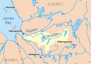
The Wawagosic River is a tributary of the Turgeon River flowing the municipality of Eeyou Istchee James Bay (Municipality), in the administrative region of Nord-du-Québec, in Quebec, in Canada.
The Lake Dana is a freshwater body of the territory of Eeyou Istchee Baie-James (municipality), in the administrative region of Nord-du-Québec, in the province of Quebec, at Canada.
The Simoncouche Lake is a fresh body of water crossed by the Simoncouche River on the watershed of the Saguenay River. The Simoncouche Lake straddles the unorganized territory of Lac-Ministuk, and that of the city of Saguenay, in the administrative region of Saguenay–Lac-Saint-Jean, in the province of Quebec, in Canada.
The Saint-Louis river is a tributary of the south shore of the Saint Lawrence River. This river flows through the municipalities of Sainte-Barbe, Saint-Stanislas-de-Kostka, Saint-Louis-de-Gonzague, Saint-Étienne-de-Beauharnois and Beauharnois, in the Beauharnois-Salaberry Regional County Municipality, in the administrative region of Montérégie, in the Southwest of province of Quebec, in Canada.
This page is based on this Wikipedia article Text is available under the CC BY-SA 4.0 license; additional terms may apply. Images, videos and audio are available under their respective licenses.