List of forests managed by Forestry and Land Scotland

Last updated • 1 min readFrom Wikipedia, The Free Encyclopedia

Forestry and Land Scotland (FLS) (Scottish Gaelic : Coilltearachd agus Fearann Alba) was formed on 1 April 2019 and is responsible for managing and promoting the National Forest Estate in Scotland. [1] The national forest estate owned by FLS covers 6,400 km2, being roughly 8% of the land area of Scotland. Around two-thirds of this land is forested, with the remaining land consisting of a mixture of agricultural land and open areas such as moorland. [2]

As of January 2020 there were 307 individual forests listed on the FLS website; [3] there are also 6 designated forest parks.

List of Forests

NameLocationSize (hectares)DescriptionReferences
Aberfoyle Forest Stirling Part of the Queen Elizabeth Forest Park. [4]
Achnabreac Argyll and Bute An area of open woodland close to the prehistoric sites of Kilmartin Glen. [5]
Achnashellach Forest Highland 1,535Achnashellach Forest does not have recreational facilities that many other FLS forests have. It is in a remote part of the Scottish Highlands and is fairly mountainous. The forest was originally part of the Caledonian Forest. [6] [7]
Aldie Burn Highland Has woodland trails along the glen of the Aldie burn. [8]
Allean Forest Perth and Kinross Site of an ancient Pictish fort overlooking Loch Tummel. [9]
Allt Mor Highland Part of Glenmore Forest Park. [10]
Allt na Crìche Highland North of Fort Augustus, overlooking Loch Ness. [11]
Aoineadh Mòr Highland In the Morvern district, the forest has waymarked trails that highlight the impact of the Highland Clearances on the area. [12]
Ard Hill Highland A trail leads to a viewpoint overlooking Loch Alsh. [13]
Àrd-Àirigh Highland Semi-natural Atlantic oakwoods in the Sunart district. [14]
Ardcastle Argyll and Bute Forest on the shore of Loch Fyne, with cycling, horse-riding and walking trails. [15]
Ardentinny Argyll and Bute Part of the Argyll Forest Park, this forest borders Cowal's longest sandy beach, on the shore of Loch Long. [16]
Ardgartan Argyll and Bute Part of the Argyll Forest Park, this forest covers the northern and eastern slopes of The Brack. [17]
Ardmolich Highland Rocky wooded hills, covered mostly in conifer plantations, in the Moidart district. [18]
Ardmore Argyll and Bute In the northern part of the Isle of Mull, Ardmore Forest holds the remains of the ruined settlements of Ardmore and Penalbanach. [19]
Ardyne Argyll and Bute Part of the Argyll Forest Park, this forest lies to the south of Dunoon. [20]
Argyll Forest Park Argyll and Bute 21,133In 1935, Argyll Forest became the first Forest Park in Britain. It lies on the border between the Scottish Highlands and the Scottish Lowlands. [21] [22]
Ariundle Highland The Atlantic oakwoods of Airundle have been a national nature reserve since 1977. [23] [24]
Aros Park Argyll and Bute On the outskirts of Tobermory on the Isle of Mull, Aros Park has walking trails, trout fishing and a barbecue area. [25]
Arrochar Argyll and Bute Part of the Argyll Forest Park, FLS property at Arrochar includes the summits of The Cobbler and Beinn Narnain. [26]
Auchenshuggle Glasgow An urban forest in Glasgow's East End, lying between the M74 and the West Coast Main Line. [27]
Back o'Bennachie Aberdeenshire On the northern slopes of Bennachie, trails here provide a route to hill's highest summit, Oxen Craig. [28]
Balblair Wood Highland Lying to the north of the Kyle of Sutherland, Balblair Wood is laid out with walking and mountain bike trails. [29] [30]
Balgownie Wood Fife Balgownie Wood was once owned by Culross Abbey, and was first planted with trees during the middle ages. [31]
Balkello Community Woodland Angus Balkello was first planted with trees in the 1990s, and there are now 150,000 young trees growing at the site. [32] [33]
Ballachulish Highland Located above the former slate quarries on the shores of Loch Leven. [34]
Craik Forest Scottish Borders Craik Forest is primarily a commercial forest with timber being processed at facilities nearby. There are some recreational facilities within the forest. [35] [36]
Dalbeattie Forest Dumfries and Galloway 1100Dalbeattie Forest has primarily been a commercial forest, though the Forestry Commission has worked with local organisations to expand recreational facilities. The forest now hosts one of the 7stanes biking trails. [37] [38]
Forest of Ae Dumfries and Galloway 9100Ae was created by the Forestry Commission soon after it was established. While it is mainly a commercial forest, it is also one of the 7stanes forests. [39] [40]
Galloway Forest Park Dumfries and Galloway 97000Galloway Forest is the largest forest in Britain. In 2009 it became the first Dark Sky Park in the UK. [41] [42] [43]
Garscadden Wood Glasgow 16.94Garscadden Wood lies within the Drumchapel Woodlands, slightly north west of Glasgow. [44] [45]
Glen Affric Highland 9000Glen Affric is home to a large area of Caledonian Forest and is designated a national nature reserve. [46] [47]
Glencoe Lochan Highland Glencoe Lochan forest was established by 1st Baron Strathcona in the 19th century. It is a coniferous forest. [48]
Glenmore Forest Park Highland 3500Glenmore contains some Caledonian woodland. It became the second Forest Park to be created by the Commission in 1948. [49] [50]
Knapdale Forest Argyll and Bute 19800Knapdale has a colony of beavers as part of the Scottish Beaver Trial. [51] [52] [53]
Mabie Forest Dumfries and Galloway Mabie Forest has been owned by the Forestry Commission since 1943. It has become a recreational forest, with walking routes and 7stanes biking trails. [54]
Queen Elizabeth Forest Park Stirling 16780The Queen Elizabeth Forest Park consists of several forests. It became a forest park in 1953 as part of the coronation of Queen Elizabeth II. [55] [56]
Tay Forest Park Perthshire The Tay Forest Park is made up of several different forests. The forest has been visited by several royals, including Queen Victoria and Queen Isabella of Scotland. [57]
Tweed Valley Forest Park Scottish Borders 6800The Tweed Valley Forest Park is made up of seven forests around the Scottish Borders. Glentress and Innerleithen forests are part of the 7stanes biking trail project. [58] [59]

Related Research Articles

<span class="mw-page-title-main">National nature reserve (Scotland)</span> Protected area designation in Scotland

The national nature reserves (NNRs) of Scotland are areas of land or water designated under the Wildlife and Countryside Act 1981 as containing habitats and species of national importance. National nature reserves can be owned by public, private, community or voluntary organisations but must be managed to conserve their important habitats and species, as well as providing opportunities for the public to enjoy and engage with nature. There are currently 43 NNRs in Scotland, which cover 154,250 hectares (1,542.5 km2), or less than 1.5% of the land area of Scotland. They range in size from Corrieshalloch Gorge at 7 ha to Mar Lodge Estate, which covers 29,324 ha.
<span class="mw-page-title-main">Dumfries and Galloway</span> Council area of Scotland

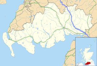
Dumfries and Galloway is one of the 32 unitary council areas of Scotland, located in the western part of the Southern Uplands. It is bordered by East Ayrshire, South Ayrshire, and South Lanarkshire to the north; Scottish Borders to the north-east; the English county of Cumbria, the Solway Firth, and the Irish Sea to the south, and the North Channel to the west. The administrative centre and largest settlement is the town of Dumfries. The second largest town is Stranraer, located 76 miles (122 km) to the west of Dumfries on the North Channel coast.
<span class="mw-page-title-main">Knapdale</span> Parishes and area in Scotland

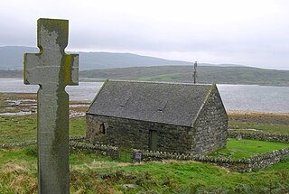
Knapdale forms a rural district of Argyll and Bute in the Scottish Highlands, adjoining Kintyre to the south, and divided from the rest of Argyll to the north by the Crinan Canal. It includes two parishes, North Knapdale and South Knapdale. The area is bounded by sea to the east and west, whilst the sea loch of West Loch Tarbert almost completely cuts off the area from Kintyre to the south. The name is derived from two Gaelic elements: Cnap meaning hill and Dall meaning field.

<span class="mw-page-title-main">Loch Rannoch</span> Freshwater loch in Perth and Kinross, Scotland

Loch Rannoch is a freshwater loch in Perth and Kinross, Scotland. It is over 15 kilometres (9.3 mi) long in a west–east direction with an average width of about 1.2 kilometres (0.75 mi), and is deepest at its eastern end, reaching a depth of 130 metres (440 ft). The River Tummel begins at its eastern end, where the small village of Kinloch Rannoch can be found, whilst the wild expanse of Rannoch Moor extends to the west of the loch. The area surrounding Loch Rannoch, along with Rannoch Moor itself, was formerly part of the native Caledonian Forest that stretched across much of Northern Scotland. Native forest is now largely absent from much of the area, due partly to logging, and partly to the climate becoming wetter, and Loch Rannoch is now largely surrounded by commercial forestry and open hillsides, although a small area remains at the Black Wood of Rannoch on the southern shore of the loch.

<span class="mw-page-title-main">Dalbeattie</span> Town in Dumfries and Galloway

Dalbeattie (, Scots: Dawbeattie, Scottish Gaelic: Dail Bheithe meaning 'haugh of the birch', or Dail Bhàite 'drowned haugh' is a town in the historical county of Kirkcudbrightshire in Dumfries and Galloway, Scotland. Dalbeattie is in a wooded valley on the Urr Water 4 miles east of Castle Douglas and 12 miles south west of Dumfries.

<span class="mw-page-title-main">Caledonian Forest</span> Ecoregion in the British Isles

The Caledonian Forest is the ancient (old-growth) temperate forest of Scotland. The forest today is a reduced-extent version of the pre-human-settlement forest, existing in several dozen remnant areas.

<span class="mw-page-title-main">Trees for Life (Scotland)</span> Rewilding charitable company in the UK

Trees for Life is a registered charity working to rewild the Scottish Highlands.

<span class="mw-page-title-main">Glen Affric</span> Valley in northern Scotland

Glen Affric is a glen south-west of the village of Cannich in the Highland region of Scotland, some 15 miles west of Loch Ness. The River Affric runs along its length, passing through Loch Affric and Loch Beinn a' Mheadhoin. A minor public road reaches as far as the end of Loch Beinn a' Mheadhoin, but beyond that point only rough tracks and footpaths continue along the glen.

<span class="mw-page-title-main">7stanes</span> Seven mountain biking centres in Scotland

The 7stanes are seven mountain biking centres spanning the south of Scotland, from the heart of the Scottish Borders to Dumfries and Galloway. They are all in Forestry and Land Scotland forests and are known as the 7stanes because each venue features a 'stane', created by artist Gordon Young, somewhere along the forest trails.

<span class="mw-page-title-main">Galloway Forest Park</span> Dark-sky preserve in Dumfries and Galloway, Scotland, UK

Galloway Forest Park is a forest park operated by Forestry and Land Scotland, principally covering woodland in the historic counties of Kirkcudbrightshire and Wigtownshire in the administrative area of Dumfries and Galloway. It is claimed to be the largest forest in the UK. The park was granted Dark Sky Park status in November 2009, being the first area in the UK to be so designated.

<span class="mw-page-title-main">Forestry in Scotland</span>

Scotland is ideal for tree growth, thanks to its mild winters, plentiful rainfall, fertile soil and hill-sheltered topography. As of 2019 about 18.5% of the country was wooded. Although this figure is well below the European Union (EU) average of 43%, it represents a significant increase compared to the figure of 100 years previously: in 1919 it was estimated that only 5% of the country's total land area was covered in forest. The Scottish Government's Draft Climate Change Plan has set an aim of increasing coverage to 21% of Scotland by 2032, with the rate of afforestation rising to 15,000 hectares per year by 2024.

<span class="mw-page-title-main">Mullach Fraoch-choire</span> Mountain in Scotland

Mullach Fraoch-choire is a 1,102-metre (3,615 ft) mountain – a Munro – in the Northwest Highlands of Scotland on a ridge extending north for 8 kilometres (5.0 mi) between Loch Cluanie in Glenmoriston and upper Glen Affric. It is within the Glen Affric National Scenic Area and Glen Affric National Nature Reserve.

<span class="mw-page-title-main">Taynish National Nature Reserve</span>

Taynish National Nature Reserve is situated southwest of the village of Tayvallich in the council area of Argyll and Bute on the west coast of Scotland. The reserve encompasses almost all of the Taynish peninsula, which is around 5 km long and 1 km wide. The woodlands at Taynish are often described as a 'temperate rainforest', benefiting from the mild and moist climate brought about by the Gulf Stream. Taynish is owned and managed by NatureScot and was declared a national nature reserve (NNR) in 1977. The reserve was formerly also a biosphere reserve, but this status was withdrawn in 2014.
<span class="mw-page-title-main">Forest parks of Scotland</span>

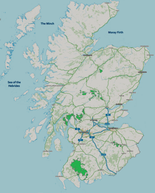
Forest parks are areas of forest managed by Forestry and Land Scotland (FLS) that are managed for multiple benefits, with an emphasis on recreation facilities for visitors. There are currently six forest parks in Scotland.

<span class="mw-page-title-main">Glen Nant</span> Woodland and nature reserve in Argyll and Bute, Scotland

Glen Nant is a glen lying to the south of Taynuilt in the Argyll and Bute council area of Scotland. An area of woodland of 339 hectares on the western side of the River Nant is designated as national nature reserve (NNR), which is owned and managed by Forestry and Land Scotland (FLS). It is an example of an Atlantic Oakwood, and is one of largest areas of upland oak woodland in north Argyll.

<span class="mw-page-title-main">Forestry and Land Scotland</span> Executive Agency of the Scottish Government

Forestry and Land Scotland (FLS) is responsible for managing and promoting Scotland's national forest estate: land, predominantly covered in forest, owned by the Scottish Government on behalf of the nation. It was formed on 1 April 2019, to take over some of the responsibilities of Forestry Commission Scotland, which was dissolved. The organisation exists alongside Scottish Forestry, also established on 1 April 2019, which is responsible for regulation, policy and support to landowners. Forestry and Land Scotland's key functions are to look after the national forest estate, including unforested land within this portfolio, and to produce and supply timber. Within this remit they are expected to enhance biodiversity, increase public access to the outdoors, encourage tourism and support the rural economy.
<span class="mw-page-title-main">Scottish Forestry</span>

Scottish Forestry is the public body responsible for forestry regulation, policy and support to private landowners in Scotland. It was formed on 1 April 2019, to take over some of the responsibilities of Forestry Commission Scotland, which was dissolved. Scottish Forestry exists alongside Forestry and Land Scotland, also established on 1 April 2019, which is responsible for managing and promoting the National Forest Estate.

<span class="mw-page-title-main">Last Ent of Affric</span> Ancient elm in the Scottish Highlands

The Last Ent of Affric is an ancient elm in the Scottish Highlands, designated a Tree of National Special Interest (TNSI) by the Woodland Trust and named Scotland's Tree of the Year in 2019. It is probably the last surviving tree of an ancient forest, and by virtue of its isolation has remained safe from Dutch elm disease.

References

  1. "Forestry Commission Scotland and Forest Enterprise Scotland no longer exist". Scottish Government. 1 April 2019. Retrieved 1 April 2019.
  2. "Report setting out the administrative arrangements that the Scottish Ministers intend to make for the carrying out of their functions under the Forestry and Land Management (Scotland) Act 2018". March 2019. pp. 2–3. Retrieved 1 April 2019.
  3. "Forest search results". Forestry and Land Scotland. Retrieved 27 January 2020.
  4. "Aberfoyle". Forestry and Land Scotland. Retrieved 23 January 2020.
  5. "Achnabreac". Forestry and Land Scotland. Retrieved 23 January 2020.
  6. "Achnashellach". Forestry and Land Scotland. Retrieved 23 January 2020.
  7. "Achnashellach Land Management Plan Summary" (PDF). Forest Enterprise Scotland. 16 November 2015. Retrieved 27 January 2020.
  8. "Aldie Burn". Forestry and Land Scotland. Retrieved 23 January 2020.
  9. "Allean Forest". Forestry and Land Scotland. Retrieved 23 January 2020.
  10. "Allt Mor". Forestry and Land Scotland. Retrieved 27 January 2020.
  11. "Allt na Crìche". Forestry and Land Scotland. Retrieved 27 January 2020.
  12. "Aoineadh Mòr". Forestry and Land Scotland. Retrieved 27 January 2020.
  13. "Ard Hill". Forestry and Land Scotland. Retrieved 28 January 2020.
  14. "Àrd-Àirigh". Forestry and Land Scotland. Retrieved 27 January 2020.
  15. "Ardcastle". Forestry and Land Scotland. Retrieved 28 January 2020.
  16. "Ardentinny". Forestry and Land Scotland. Retrieved 28 January 2020.
  17. "Ardgartan". Forestry and Land Scotland. Retrieved 28 January 2020.
  18. "Ardgartan". Forestry and Land Scotland. Retrieved 30 January 2020.
  19. "Ardmore". Forestry and Land Scotland. Retrieved 30 January 2020.
  20. "Ardyne". Forestry and Land Scotland. Retrieved 30 January 2020.
  21. "Argyll Forest Park". Forestry and Land Scotland. Retrieved 27 January 2020.
  22. "National Forest Estate Forest Parks GB". Scottish Government Spatial Data Infrastructure. 2 September 2017. Retrieved 27 January 2020.
  23. "Ariundle". Forestry and Land Scotland. Retrieved 30 January 2020.
  24. "The Story of Ariundle Oakwood National Nature Reserve" (PDF). Scottish Natural Heritage. 2008. Retrieved 30 January 2020.
  25. "Aros Park". Forestry and Land Scotland. Retrieved 3 February 2020.
  26. "Arrochar". Forestry and Land Scotland. Retrieved 3 February 2020.
  27. "Auchenshuggle". Forestry and Land Scotland. Retrieved 3 February 2020.
  28. "Back o'Bennachie". Forestry and Land Scotland. Retrieved 5 February 2020.
  29. "Balblair". Forestry and Land Scotland. Retrieved 5 February 2020.
  30. "Venue: Balblair". MTBtrails.info. Retrieved 5 February 2020.
  31. "Balgownie". Forestry and Land Scotland. Retrieved 5 February 2020.
  32. "Balkello Community Woodland". Forestry and Land Scotland. Retrieved 13 March 2020.
  33. "Welcome to Balkello Community Woodland" (PDF). Forestry and Land Scotland. Retrieved 13 March 2020.
  34. "Ballachulish". Forestry and Land Scotland. Retrieved 13 March 2020.
  35. "Craik". Forestry Commission. Retrieved 1 July 2012.
  36. "Craik Forest project receives funding to improve timber haulage". Dumfries and Galloway Council. 2 October 2009. Retrieved 1 July 2012.
  37. "Introduction to the Partnership". Dalbeattie Community Council & Dalbeattie Community Initiative. Retrieved 1 July 2012.
  38. "Dalbeattie Forest". Forestry Commission. Retrieved 1 July 2012.
  39. "Ae windfarm proposal". Forestry Commission. 27 January 2003. Retrieved 1 July 2012.
  40. "Forest of Ae". Forestry Commission. Retrieved 1 July 2012.
  41. "Galloway Forest Park project seeks business interests". BBC News. 16 May 2012. Retrieved 1 July 2012.
  42. "Galloway Forest Park". Forestry Commission. Retrieved 1 July 2012.
  43. "Forest park given Dark Sky honour". BBC News. 16 November 2009. Retrieved 1 July 2012.
  44. "Garscadden Wood West". Forestry Commission. Retrieved 1 July 2012.
  45. "Garscadden Wood". Living in Glasgow. 24 August 2009. Retrieved 1 July 2012.
  46. "Trees are the glory of Glen Affric". Forestry Commission. Retrieved 1 July 2012.
  47. "The AGREEMENT between FORESTRY ENTERPRISE and TREES FOR LIFE on work in the GLEN AFFRIC CALEDONIAN FOREST RESERVE". Caledonian Centre for Social Development. Retrieved 1 July 2012.
  48. "Glencoe Lochan". Forestry Commission. Retrieved 2 July 2012.
  49. "Glenmore Forest Park". Forestry Commission. Retrieved 2 July 2012.
  50. James Reynolds (30 January 2008). "Unique woodland conservation scheme helps black grouse recovery". Royal Society for Protection of Birds. Retrieved 2 July 2012.
  51. "Knapdale Forest". Forestry Commission. Retrieved 2 July 2012.
  52. "Visit Knapdale". Scottish Wildlife Trust. Retrieved 2 July 2012.
  53. "Knapdale Forest". Wild about Britain. Archived from the original on 5 May 2013. Retrieved 2 July 2012.
  54. "Mabie Forest". Forestry Commission. Retrieved 2 July 2012.
  55. "Queen Elizabeth Forest Park". Gazetteer for Scotland. Retrieved 2 July 2012.
  56. "Queen Elizabeth Forest Park". Forestry Commission. Retrieved 2 July 2012.
  57. "Tay Forest Park". Forestry Commission. Retrieved 2 July 2012.
  58. "New Forest Park Seeks Friends". Forestry Commission. 13 October 2003. Retrieved 1 July 2012.
  59. "Welcome to Tweed Valley Forest Park". Forestry Commission. Retrieved 1 July 2012.