Arrochar Alps

Last updated

Arrochar Alps
Kilcreggan & Arrochar alps2.jpg
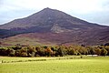
View across the Firth of Clyde, from about 29 km (18 mi) south of Arrochar. From the left, The Brack, the snowy mass of Beinn Ìme, the peaks of the Cobbler and Beinn Narnain. See a wider view.
Highest point
PeakBeinn Ìme
Elevation 1,011 m (3,317 ft)
Coordinates 56°14′10″N04°49′01″W / 56.23611°N 4.81694°W / 56.23611; -4.81694
Geography
Arrochar Alps
CountryScotland
Region Argyll and Bute
OS grid NN 25499 08399

The Arrochar Alps are a group of mountains located around the heads of Loch Long, Loch Fyne, and Loch Goil. They are part of the Grampian mountains range, which stretch across Scotland. [1] The villages of Arrochar and Lochgoilhead are the nearest settlements. Many of the mountains are located on the Cowal Peninsula in Argyll and Bute, west of Scotland. [2]

Contents

The mountains are especially popular due to their proximity and accessibility from the central belt of Scotland including Glasgow. They are mostly within both the Loch Lomond and The Trossachs National Park and also in the Argyll Forest Park. [3] [4]

The Glens that give access into the heart of the mountain range include: Glen Croe, Hell's Glen, Glen Mhor and Glen Kinglas.

The A83, a main trunk road to the west coast of Scotland passes through the area. There is a train station nearby at Arrochar and Tarbet railway station. [5] [6]

List

The list below includes the Munros, Munro Tops, Corbetts, Corbett Tops and Grahams.

Areas

Lochs

Glens

Parks

See also

Related Research Articles

<span class="mw-page-title-main">Argyll and Bute</span> Council area of Scotland

Argyll and Bute is one of 32 unitary council areas in Scotland and a lieutenancy area. The current lord-lieutenant for Argyll and Bute is Jane Margaret MacLeod. The administrative centre for the council area is in Lochgilphead at Kilmory Castle, a 19th-century Gothic Revival building and estate. The current council leader is Councillor Jim Lynch.

<span class="mw-page-title-main">A83 road</span> Road in Scotland

The A83 is a major road in the south of Argyll and Bute, Scotland, running from Tarbet, on the western shore of Loch Lomond, where it splits from the A82, to Campbeltown at the southern end of the Kintyre peninsula. The road is best known for its section across the Rest and be Thankful pass through the Arrochar Alps between the heads of Loch Long and Loch Fyne.

<span class="mw-page-title-main">Cowal</span> Peninsula in Argyll and Bute, Scotland

Cowal is a rugged peninsula in Argyll and Bute, on the west coast of Scotland. It is connected to the mainland to the north, and is bounded by Loch Fyne to the west, by Loch Long and the Firth of Clyde to the east, and by the Kyles of Bute to the south.

<span class="mw-page-title-main">Loch Lomond and The Trossachs National Park</span> National park in Scotland

Loch Lomond and The Trossachs National Park is a national park in Scotland centred on Loch Lomond and the hills and glens of the Trossachs, along with several other ranges of hills. It was the first of the two national parks established by the Scottish Parliament in 2002, the second being the Cairngorms National Park. The park extends to cover much of the western part of the southern highlands, lying to the north of the Glasgow conurbation, and contains many mountains and lochs. It is the fourth-largest national park in the British Isles, with a total area of 1,865 km2 (720 sq mi) and a boundary of some 350 km (220 mi) in length. It features 21 Munros and 20 Corbetts.

<span class="mw-page-title-main">The Cobbler</span>

The Cobbler is an 884 metres (2,900 ft) mountain located near the head of Loch Long in Argyll and Bute, Scotland. It is a Corbett, and is an important site for rock climbing in the Southern Highlands. Many maps include the name Ben Arthur, but the name The Cobbler is more widely used. In the 19th century it was referred to as The Cobbler and his Wife.

<span class="mw-page-title-main">Tarbet, Argyll</span> Human settlement in Scotland

Tarbet is a small village in Argyll and Bute, Scotland. Located within the Loch Lomond and The Trossachs National Park.

<span class="mw-page-title-main">Beinn Ìme</span> Highest mountain in the Arrochar Alps, in the Southern Highlands of Scotland

Beinn Ìme is the highest mountain in the Arrochar Alps of Argyll, in the Southern Highlands of Scotland. It reaches 1,011 metres (3,317 ft), making it a Munro.

<span class="mw-page-title-main">Beinn an Lochain</span> Mountain in the Arrochar Alps, Scotland

Beinn an Lochain is a mountain in the Arrochar Alps on the Cowal Peninsula, in western Scotland and is a Corbett at 901.7 metres (2,958 ft). Beinn an Lochain is situated within the Argyll Forest Park which is itself within the Loch Lomond and the Trossachs National Park.

<span class="mw-page-title-main">Loch Goil</span> Sea Loch in Scotland.

Loch Goil; is a small sea loch forming part of the coast of the Cowal peninsula in Argyll and Bute, Scotland. The sea loch is entirely within the Loch Lomond and The Trossachs National Park.

<span class="mw-page-title-main">The Brack</span>

The Brack is a mountain, located in the Arrochar Alps, on the south side of Glen Croe, near Loch Goil in Argyll and Bute in Scotland. The Brack has two summits: the lower peak, Cruach Fhiarach, can be seen from the shores of Loch Long, and the main peak is seen from Glen Croe and Loch Goil.

<span class="mw-page-title-main">Glen Croe</span> Glen in Argyll and Bute


Glen Croe is a glen in the heart of the Arrochar Alps on the Cowal Peninsula, in Argyll and Bute, west of Scotland. The glen is surrounded by large and rugged mountains characterised by huge boulders. The Croe Water flows through the glen and into Loch Long.

<span class="mw-page-title-main">Ben Donich</span>

Ben Donich or Beinn Dòmhnaich is a mountain located in the Arrochar Alps, near Loch Goil in Argyll and Bute. It is a Corbett and part of the Ardgoil range with its sister The Brack. The closest settlement to Ben Donich is the village of Lochgoilhead.

<span class="mw-page-title-main">Binnein an Fhidhleir</span>

Binnein an Fhidhleir, is one of the Arrochar Alps, a mountain in Argyll and Bute, western Scotland. Located in the Loch Lomond and The Trossachs National Park.

<span class="mw-page-title-main">Beinn Luibhean</span> Mountain of Scotland

Beinn Luibhean is one of the Arrochar Alps in the Argyll Highlands of Scotland, located to the northern side of Glen Croe between Loch Long in Dunbartonshire to the East and Loch Fyne in the Remote Highlands of Argyll to the West. The landscape to the West of Loch Long changes as the shoreline provides the gateway to Argyll, the district in the Western Highlands of Scotland that form the first ingredients to a wilderness and has a real sense of remoteness and isolation from the Lowlands and Populated parts of the Central Belt. The Arrochar Alps are a Mountain Range which Run from the Loch Goil in the South and West towards Tyndrum in the North. Beinn Luibhean stands at a height of 2821 ft, 860 m. The Nearest Mountains to Beinn Luibhean include The Cobbler, Beinn Ime and Beinn Narnain.

<span class="mw-page-title-main">Stob an Eas</span> Mountain in Scotland

Stob an Eas is a 2401 ft (732m) Graham in the Arrochar Alps, Argyll and Bute, Scotland.

<span class="mw-page-title-main">Beinn Chorranach</span> One of the Arrochar Alps, in the Argyll Highlands, Scotland

Beinn Chorranach is one of the Arrochar Alps, a mountain range that marks the start of the Argyll Highlands and provides a wilderness of long coastlines and high mountains with forested hill sides. Beinn Chorranach's parent peak is Beinn Ìme, the biggest mountain in the range. Beinn Chorranach lies at the head of lower Glen Kinglas and is located between Loch Fyne and Loch Lomond. East of Beinn Chorranach is Loch Lomond as the mountain can be seen from Inversnaid and further east to The Trossachs wilderness. Further west is the rest of the wild Argyll scenery and marks the first real sense of isolation and wilderness after arriving in the Highlands at Loch Lomond.

<span class="mw-page-title-main">Hell's Glen</span> Glen in Argyll and Bute

Hell's Glen is a glen on the Cowal Peninsula, in Argyll and Bute, west of Scotland, within the Arrochar Alps. The B839 single track road passes through the glen. To the west, the glen leads to Loch Fyne and to the east Lochgoilhead. Glen Mhor (B828) joins the glen about half way along and leeds to Glen Croe at the Rest & be Thankful viewpoint.

<span class="mw-page-title-main">Glen Kinglas</span> Glen in Argyll and Bute

Glen Kinglas is a glen located on the Cowal Peninsula, in Argyll and Bute, west of Scotland. The glen is one of the main glens in the Arrochar Alps, the A83 road from Arrochar and Loch Lomond passes through the glen. At the north end of the glen, a pass leads to Glen Croe, passing Loch Restil. At the south of the glen the A815 road leaves the A83 and leads through the Cowal peninsula to Dunoon on the Firth of Clyde coast. The A83 continues on past Cairndow and Loch Fyne Oysters to Inveraray and Inveraray Castle on Loch Fyne.

Glen Mhor is a short glen located in the Arrochar Alps, within the Cowal Peninsula, Argyll and Bute, west of Scotland. The B828 goes through the glen, linking the top of Glen Croe (A83) at the Rest & be Thankful viewpoint in the east, in the west with the Hell's Glen (B839).

References

  1. "Grampian Mountains". PeakVisor.
  2. Ordnance Survey: Landranger map sheet 56 Loch Lomond & Inveraray (Map). Ordnance Survey. 2012. ISBN   978-0-319-22981-1.
  3. Lomond, Loch; G83 8EG, The Trossachs National Park Authority Carrochan Carrochan Road Balloch. "Here. Now. All of us". Loch Lomond & The Trossachs National Park.{{cite web}}: CS1 maint: numeric names: authors list (link)
  4. "Argyll Forest Park". Forestry and Land Scotland.
  5. "Arrochar & Tarbet Station | ScotRail".
  6. "A83 Rest and Be Thankful | Traffic Scotland". www.traffic.gov.scot.
  7. "Ardno". scotlandsgardens.org.

Purge