
Argyll and Bute is one of 32 unitary council areas in Scotland and a lieutenancy area. The current lord-lieutenant for Argyll and Bute is Jane Margaret MacLeod. The administrative centre for the council area is in Lochgilphead at Kilmory Castle, a 19th-century Gothic Revival building and estate. The current council leader is Councillor Jim Lynch.
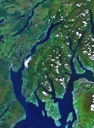
Cowal is a rugged peninsula in Argyll and Bute, on the west coast of Scotland. It is connected to the mainland to the north, and is bounded by Loch Fyne to the west, by Loch Long and the Firth of Clyde to the east, and by the Kyles of Bute to the south.

Loch Lomond and The Trossachs National Park is a national park in Scotland centred on Loch Lomond and the hills and glens of the Trossachs, along with several other ranges of hills. It was the first of the two national parks established by the Scottish Parliament in 2002, the second being the Cairngorms National Park. The park extends to cover much of the western part of the southern highlands, lying to the north of the Glasgow conurbation, and contains many mountains and lochs. It is the fourth-largest national park in the British Isles, with a total area of 1,865 km2 (720 sq mi) and a boundary of some 350 km (220 mi) in length. It features 21 Munros and 20 Corbetts.

The Trossachs generally refers to an area of wooded glens, braes, and lochs lying to the east of Ben Lomond in the Stirling council area of Scotland. The name is taken from that of a small woodland glen that lies at the centre of the area, but is now generally applied to the wider region.

The Arrochar Alps are a group of mountains located around the heads of Loch Long, Loch Fyne, and Loch Goil. They are part of the Grampian mountains range, which stretch across Scotland. The villages of Arrochar and Lochgoilhead are the nearest settlements. Many of the mountains are located on the Cowal Peninsula in Argyll and Bute, west of Scotland.
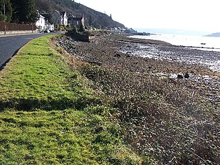
Kilmun is a linear settlement on the north shore of the Holy Loch, on the Cowal Peninsula in Argyll and Bute, Scottish Highlands. It takes its name from the 7th-century monastic community founded by an Irish monk, St Munn. The ruin of a 12th-century church still stands beside the Kilmun Parish Church and Argyll Mausoleum.
Beinn an Lochain is a mountain in the Arrochar Alps in western Scotland. A Corbett, reaching 901.7 metres (2,958 ft), Beinn an Lochain is situated within the Argyll Forest Park, which is itself within the Loch Lomond and the Trossachs National Park.

Loch Goil; is a small sea loch forming part of the coast of the Cowal peninsula in Argyll and Bute, Scotland. The sea loch is entirely within the Loch Lomond and The Trossachs National Park.

Glen Croe is a glen in the heart of the Arrochar Alps on the Cowal Peninsula, in Argyll and Bute, west of Scotland. The glen is surrounded by large and rugged mountains characterised by huge boulders. The Croe Water flows through the glen and into Loch Long.

Binnein an Fhidhleir, is one of the Arrochar Alps, a mountain in Argyll and Bute, western Scotland. Located in the Loch Lomond and The Trossachs National Park.
Ardgartan is a hamlet, on the Cowal Peninsula, in Argyll and Bute, Scottish Highlands. It is located on the shores of Loch Long, at the bottom of Glen Croe.

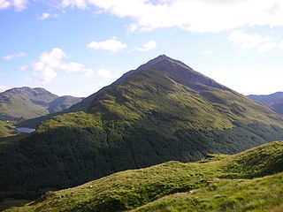
Beinn Mhòr is the highest mountain on the Cowal Peninsula, west of Loch Eck in Argyll and Bute, west of Scotland. It has a high topographic prominence to height ratio and consequently commands a good all round view.

Beinn Chorranach is one of the Arrochar Alps, a mountain range that marks the start of the Argyll Highlands and provides a wilderness of long coastlines and high mountains with forested hill sides. Beinn Chorranach's parent peak is Beinn Ìme, the biggest mountain in the range. Beinn Chorranach lies at the head of lower Glen Kinglas and is located between Loch Fyne and Loch Lomond. East of Beinn Chorranach is Loch Lomond as the mountain can be seen from Inversnaid and further east to The Trossachs wilderness. Further west is the rest of the wild Argyll scenery and marks the first real sense of isolation and wilderness after arriving in the Highlands at Loch Lomond.

Hell's Glen is a glen on the Cowal Peninsula, in Argyll and Bute, west of Scotland, within the Arrochar Alps. The B839 single track road passes through the glen. To the west, the glen leads to Loch Fyne and to the east Lochgoilhead. Glen Mhor (B828) joins the glen about half way along and leeds to Glen Croe at the Rest & be Thankful viewpoint.
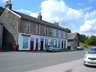
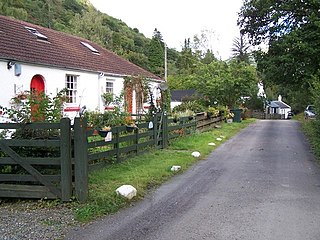
Blairmore is a village located on the Cowal Peninsula, in Argyll and Bute, west of Scotland. Blairmore lies within the Loch Lomond and The Trossachs National Park. It is situated on the western shore of Loch Long and around 1 mile (1.6 km) north of Strone. The village was largely built during the Victorian era and has a small wooden pier which dates to 1855.

Glen Finart is a glacially formed glen on the Cowal Peninsula, in Argyll and Bute, west of Scotland. The glen is within the Argyll Forest Park, which is itself within the Loch Lomond and The Trossachs National Park.
Glenbranter is a hamlet and former estate, once owned by Sir Harry Lauder, on the northwest shore of Loch Eck in the Argyll Forest Park, on the Cowal Peninsula, in Argyll and Bute, West of Scotland.
Rashfield is a hamlet on the Cowal peninsula, situated between Loch Eck and the head of Holy Loch, in Argyll and Bute, Scotland. The hamlet is on the A815 road and the River Eachaig flows past from Loch Eck to the Holy Loch. Rashfield is within the Argyll Forest Park, which is itself within the Loch Lomond and The Trossachs National Park.

Glen Kinglas is a glen located on the Cowal Peninsula, in Argyll and Bute, west of Scotland. The glen is one of the main glens in the Arrochar Alps, the A83 road from Arrochar and Loch Lomond passes through the glen. At the north end of the glen, a pass leads to Glen Croe, passing Loch Restil. At the south of the glen the A815 road leaves the A83 and leads through the Cowal Peninsula to Dunoon on the Firth of Clyde coast. The A83 continues on past Cairndow and Loch Fyne Oysters to Inveraray and Inveraray Castle on Loch Fyne.
Glen Mhor is a short glen located in the Arrochar Alps, within the Cowal Peninsula, Argyll and Bute, west of Scotland. The B828 goes through the glen, linking the top of Glen Croe (A83) at the Rest & be Thankful viewpoint in the east, in the west with the Hell's Glen (B839).

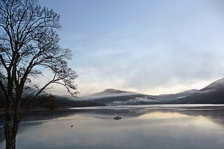
 Loch Restil
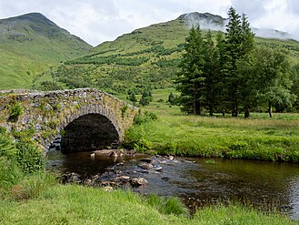 Butter Bridge


