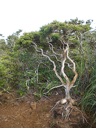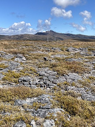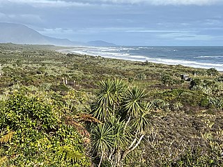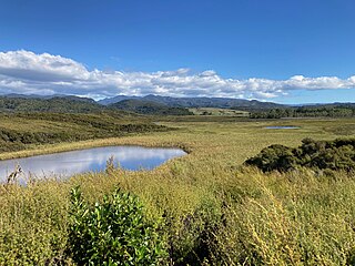
Pakihi or pākihi is a vegetation association unique to the West Coast of the South Island of New Zealand, characterised by flat boggy land with infertile, waterlogged soil on which only rushes, ferns, moss, and mānuka grow.

Pakihi or pākihi is a vegetation association unique to the West Coast of the South Island of New Zealand, characterised by flat boggy land with infertile, waterlogged soil on which only rushes, ferns, moss, and mānuka grow.
The Māori word pākihi can mean "open country" or "barren land", or alternatively "a clearing in forest" or "place where fern root was dug up". [1] Both these ideas are encompassed by the use of pakihi in New Zealand English to refer to open country, mainly on the West Coast of the South Island, from which forest was once cleared but which no longer allows tree growth. [2]

Pakihi habitat ranges over 540 km (340 mi) of the west of the South Island, from Golden Bay in the north to Awarua Bay in the south, being particularly common in the central West Coast between Westport and Hokitika, usually near the coast but sometimes extending some 50 km (30 mi) inland. [2] Pakihi can be both natural or induced. Some pakihi has existed for thousands of years, even back to glacial times—for example, the Dismal or Sponge Swamp near Haast studied in the 1960s–1970s, where the base peat layer dates back 10,000 years. [2] [3] The anoxic pakihi soil can halt the decomposition of fossil pollen and fragments of wood, allowing the study of ancient forest types on the site. [4]
Conversely, land cleared of forest by early European settlers on the West Coast can become waterlogged and infertile, and regular fires can prevent forest returning and maintain pakihi vegetation, particularly in Golden Bay and the northern West Coast. [2] Forest clearance by the first Polynesian settlers and later by Māori also created pakihi sites; Abel Tasman reported seeing fires as he sailed off the West Coast. Most pakihi seems to have been created by fire, but they are hard to distinguish from those that predate human arrival. [5]
Pakihi sites are almost always flat to undulating in topography, rarely sloping. [2] They mostly occur on outwash plains and terraces formed of sediment left behind by retreating ice, usually at the end of the last glacial period: these terraces can be 10,000 to 250,000 years old. [2] [5] Pakihi soils, usually gleys or podzols, are infertile and leached of most nutrients by constant water flow. They are acidic, with a pH of less than 4.5. They are also extremely waterlogged, usually only found where rainfall is greater than 2,200 mm (87 in) a year. [2] One way pakihi can arise is through the formation of an iron pan in the subsoil, which prevents free drainage and "drowns" forest trees, until only ferns, moss, and scrub can survive. Iron pans are not required for pahiki soils to form, but poor drainage is: any soil characteristics that keep the ground waterlogged can maintain pakihi. [4]
Pakihi has a characteristic suite of plant species, usually including: [2] [4]
This mix of species can also include orchids (such as Thelymitra pulchella ), bryophytes, sundews ( Drosera ), introduced Canada rush ( Juncus canadensis ), tamingi ( Epacris pauciflora), [6] and mountain flax ( Phormium colensoi ). [5] Around the margins of pakihi are found mānuka, mountain toatoa ( Phyllocladus alpinus ) and silver pine ( Manoao colensoi ), which grade into rimu (Dacrydium cupressinum) and kahikatea (Dacrycarpus dacrydioides) swamp forest. [4] The key determinants of a pakihi area's vegetation are how long since it has been burnt, climate, and age of the glacial terrace. Many pakihi are dynamic ecosystems undergoing a transition to mānuka scruband, and all but the wettest areas will eventually revert to forest. [5]
When the West Coast was settled by Europeans, pakihi seemed like ideal farmland, with no forest to clear: it merely required draining and sowing with grass seed. This was easier said than done in flat areas with high rainfall, and much pakihi was abandoned as too difficult to farm. For many years, farmers tried to turn pakihi into productive land, experimenting with sowing different pasture grasses, liming, adding large amounts of fertiliser, and even using explosives to break up the iron pan. [7] [8] Different techniques were explored by the Cawthron Institute on experimental plots near Westport starting in the 1920s, when 1,100 acres were "reclaimed" and turned into dairy pasture in the 1930s, largely unsuccessfully. [9] Today pakihi can be converted into pasture by "flipping" the top two or three metres with a digger to break up any soil pan and allow free drainage, or by "humping and hollowing": both require heavy application of fertiliser such as superphosphate for years to increase soil carbon and nitrogen. [10] [11] One side effect of such large scale land conversion is pest outbreaks, as the "blank slate" created allows insects to multiply rapidly, free of natural enemies. After "flipping" at Cape Foulwind, mānuka beetle larvae ( Pyronota festiva ), usually present at a density of 80 per m2, were recorded at over 3500 per m2. [10] [12]
Sphagnum moss is a common component of pakihi, and on the West Coast is now being harvested and exported for horticulture and growing indoor plants. [4]
A major threat to pakihi is agriculture, especially with the New Zealand economy increasingly turning to dairy farming. As the technology for developing pakihi land for farming or forestry became more efficient in the 1970s, calls for its conservation began. Pakihi swampland is an important habitat for the fernbird, especially where there is mānuka scrub at least 2 m (6.6 ft) tall, and some pakihi areas have been set aside as reserves. [5] Pakihi reserves may need to be regularly burnt off to allow low herbaceous plants to survive and prevent mānuka scrubland establishing, but fernbirds prefer low shrubby vegetation that would be destroyed by fire. [5]

Muskeg is a peat-forming ecosystem found in several northern climates, most commonly in Arctic and boreal areas. Muskeg is approximately synonymous with bog or peatland, and is a standard term in Western Canada and Alaska. The term became common in these areas because it is of Cree origin; maskek (ᒪᐢᑫᐠ) meaning "low-lying marsh".

Leptospermum scoparium, commonly called mānuka, mānuka myrtle, New Zealand teatree, broom tea-tree, or just tea tree, is a species of flowering plant in the myrtle family Myrtaceae, native to New Zealand and south-east Australia. Its nectar produces Mānuka honey.

A savanna or savannah is a mixed woodland-grassland biome and ecosystem characterised by the trees being sufficiently widely spaced so that the canopy does not close. The open canopy allows sufficient light to reach the ground to support an unbroken herbaceous layer consisting primarily of grasses. Four savanna forms exist; savanna woodland where trees and shrubs form a light canopy, tree savanna with scattered trees and shrubs, shrub savanna with distributed shrubs, and grass savanna where trees and shrubs are mostly nonexistent.

The Tasmanian temperate rain forests are a temperate broadleaf and mixed forests ecoregion in western Tasmania. The ecoregion is part of the Australasian realm, which includes Tasmania and Australia, New Zealand, New Guinea, New Caledonia, and adjacent islands.

Ōkārito Lagoon is a coastal lagoon on the West Coast of New Zealand's South Island. It is located 130 kilometres (81 mi) south of Hokitika, and covers an area of about 3,240 hectares (12.5 sq mi), making it the largest unmodified coastal wetland in New Zealand. It preserves a sequence of vegetation types from mature rimu forest through mānuka scrub to brackish water that has been lost in much of the rest of the West Coast. The settlement of Ōkārito is at the southern end of the lagoon.

The Western Gulf coastal grasslands are a subtropical grassland ecoregion of the southern United States and northeastern Mexico. It is known in Louisiana as the "Cajun Prairie", Texas as "Coastal Prairie," and as the Tamaulipan pastizal in Mexico.

Dwarf forest, elfin forest, or pygmy forest is an uncommon ecosystem featuring miniature trees, inhabited by small species of fauna such as rodents and lizards. They are usually located at high elevations, under conditions of sufficient air humidity but poor soil. There are two main dwarf forest ecosystem types, involving different species and environmental characteristics: coastal temperate and montane tropical regions. Temperate coastal dwarf forest is common for parts of Southern California. Montane tropical forests are found across tropical highlands of Central America, northern South America and Southeast Asia. There are also other isolated examples of dwarf forests scattered across the world, while the largest dwarf forest is found in the Philippines.

Scotstown Moor is in the north of Aberdeen, Scotland.

Barren vegetation describes an area of land where plant growth may be sparse, stunted, and/or contain limited biodiversity. Environmental conditions such as toxic or infertile soil, high winds, coastal salt-spray, and climatic conditions are often key factors in poor plant growth and development. Barren vegetation can be categorized depending on the climate, geology, and geographic location of a specific area.

The Coast Range ecoregion is a Level III ecoregion designated by the Environmental Protection Agency (EPA) in the U.S. states of Washington, Oregon, and California. It stretches along the Pacific Coast from the tip of the Olympic Peninsula in the north to the San Francisco Bay in the south, including Grays Harbor, Willapa Bay, and the Long Beach Peninsula in Washington, the entire length of the Oregon Coast, and the Northern California Coast. Named for the Coast Range mountains, it encompasses the lower elevations of the Olympic Mountains, the Oregon Coast Range, the Californian North Coast Ranges, and surrounding lowlands.

The Willamette Valley ecoregion is a Level III ecoregion designated by the United States Environmental Protection Agency in the U.S. states of Oregon and Washington. Slightly larger than the Willamette Valley for which it is named, the ecoregion contains fluvial terraces and floodplains of the Willamette River system, scattered hills, buttes, and adjacent foothills. It is distinguished from the neighboring Coast Range, Cascades, and Klamath Mountains ecoregions by lower precipitation, lower elevation, less relief, and a different mosaic of vegetation. Mean annual rainfall is 37 to 60 inches, and summers are generally dry. Historically, the region was covered by rolling prairies, oak savanna, coniferous forests, extensive wetlands, and deciduous riparian forests. Today, it contains the bulk of Oregon's population, industry, commerce, and agriculture. Productive soils and a temperate climate make it one of the most important agricultural areas in Oregon.

A plant community is a collection or association of plant species within a designated geographical unit, which forms a relatively uniform patch, distinguishable from neighboring patches of different vegetation types. The components of each plant community are influenced by soil type, topography, climate and human disturbance. In many cases there are several soil types present within a given plant community. This is because the soil type within an area is influenced by two factors, the rate at which water infiltrates or exits the soil, as well as the rate at which organic matter enters or decays from the soil. Plant communities are studied substantially by ecologists, due to providing information on the effects of dispersal, tolerance to environmental conditions, and response to disturbance of a variety of plant species, information valuable to the comprehension of various plant community dynamics.

Denniston Plateau is an 18 km long, 600–800 m high coalfield plateau in the Papahaua Range on the West Coast of the South Island of New Zealand. A combination of impermeable rock, high rainfall, and shallow acidic soil has created a unique ecosystem of stunted trees and heath-like vegetation which is home to numerous endemic and undescribed species of plants and invertebrates. The plateau contains rich seams of high-quality coal, which led to the creation and abandonment of the mining towns of Denniston and Millerton, and the current Stockton Mine. Plans to create a new open-cast mine on the southern part of the plateau have become an environmental controversy.

The Westland temperate forests, also known as the Westland temperate rainforests, is a temperate broadleaf and mixed forests ecoregion located along the central west coast of New Zealand’s South Island, also known as Te Waipounamu. These forests are found in the region of the Westland District, which spans approximately 11,880 square kilometers. It is bounded on the west by the Tasman Sea, and on the east by the Southern Alps. Much of this area is protected by the Westland Tai Poutini National Park.

Pyronota festiva, commonly known as mānuka beetle or mānuka chafer, is a member of the genus Pyronota of the beetle family Scarabaeidae. It is a scarab beetle endemic to New Zealand, and is commonly found in mānuka trees, hence the beetle's name. In some areas it is considered a pasture pest.

Juncus australis is a species of rush known by the common names austral rush, leafless rush and wīwī. The species is native to south-eastern Australia and New Zealand, where it can be found around bodies of water. Its habitat is wet or seasonally wet grasslands and woodlands, and it can grow in dense and damp soil along rivers and creeks. It is a rhizomatous perennial rush that grows up to 120 centimetres tall. The plant flowers in clusters, with dense heads at the tip of the stem.

Lake Gault is a small glacial lake in South Westland, New Zealand, near the township of Fox Glacier. A walking track from Lake Matheson leads to the lake, which is surrounded by mature native forest. A small hydro-electric power plant was constructed piping water from the lake to power a gold mining dredge at Gillespies Beach. Endangered Ōkārito kiwi (rowi) have been released into the wild around Lake Gault.

The Barrytown Flats are a 17 km (11 mi) coastal plain north of Greymouth on the West Coast of New Zealand's South Island. A series of postglacial shorelines and dunes backed by a former sea cliff, they was originally covered with wetland and lowland forest, including numerous nīkau palms. The sands were extensively sluiced and dredged for gold from the 1860s, centred on the small settlement of Barrytown. The drier areas of the flats have been converted into pasture, but significant areas of forest remain, including Nikau Scenic Reserve. The flats are bordered by Paparoa National Park and the only breeding site of the Westland petrel. There are significant deposits of ilmenite in the Barrytown sands, and there have been several mining proposals, but the possible environmental consequences have been contentious.

Lake Ellery is a glacially-formed lake in South Westland on the West Coast of New Zealand's South Island. It has a steep and entirely forested catchment, with a diverse flora and fauna, and is accessible only by foot or boat. Sediments laid down by its tributaries have preserved a 2,000-year record of ruptures of the nearby Alpine fault.

Mangarakau Wetland is in the north-west Tasman District in the South Island of New Zealand. Situated south of the Whanganui Inlet and adjacent to the former settlement of Mangarakau, it is the largest swamp in the Nelson-Marlborough region. It is owned by the Native Forest Restoration Trust and managed by the Friends of Mangarakau Swamp Inc.