B

- Baltoro Glacier
- Batura Glacier
- Biarchedi Glacier
- Bilafond Glacier in the Siachen area claimed by both landforms of pakistan and India, controlled by Pakistan.
- Barpu Glacier located in Hopper Valley, Nagar, Gilgit-Baltistan.

With more than 7,253 known glaciers, Pakistan contains more glacial ice than any other country on Earth outside the polar regions. [1] [2] However, a recent study by Pakistan's Ministry of Climate Change and Italian research organization EvK2CNR, indicated that there are more than 13,000 glaciers in the country. [3] [4] [5] Almost all of them are located in the northern regions of Pakistan in Gilgit-Baltistan and Khyber Pakhtunkhwa. [6] The following is a list of glaciers in Pakistan:


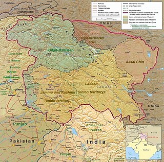
The Karakoram is a mountain range in the Kashmir region spanning the border of Pakistan, China, and India, with the northwestern extremity of the range extending to Afghanistan and Tajikistan. Most of the Karakoram mountain range falls under the jurisdiction of Gilgit-Baltistan, which is located in Pakistan. Its highest peak, K2, is located in Gilgit-Baltistan, Pakistan. It begins in the Wakhan Corridor (Afghanistan) in the west, encompasses the majority of Gilgit-Baltistan, Pakistan and extends into Ladakh and Aksai Chin. It is part of the larger Trans-Himalayan mountain ranges.

Baltistan also known as Baltiyul or Little Tibet, is a mountainous region in the Pakistani-administered territory of Gilgit-Baltistan and constitutes a northern portion of the larger Kashmir region that has been the subject of a dispute between India and Pakistan since 1947. It is located near the Karakoram and borders Gilgit to the west, China's Xinjiang to the north, Indian-administered Ladakh to the southeast, and the Indian-administered Kashmir Valley to the southwest. The average altitude of the region is over 3,350 metres (10,990 ft). Baltistan is largely administered under the Baltistan Division.

The Karakoram Highway, also known as the KKH, National Highway 35, N-35, and the China–Pakistan Friendship Highway, is a 1,300 km (810 mi) national highway which extends from Hasan Abdal in the Punjab province of Pakistan to the Khunjerab Pass in Gilgit-Baltistan, where it crosses into China and becomes China National Highway 314. The highway connects the Pakistani provinces of Punjab and Khyber Pakhtunkhwa plus Gilgit-Baltistan with China's Xinjiang Uyghur Autonomous Region. The highway is a popular tourist attraction and is one of the highest paved roads in the world, passing through the Karakoram mountain range, at 36°51′00″N75°25′40″E at maximum elevation of 4,714 m (15,466 ft) near Khunjerab Pass. Due to its high elevation and the difficult conditions under which it was constructed, it is often referred to as the Eighth Wonder of the World. The highway is also a part of the Asian Highway AH4.

Northern Pakistan is a tourism region in northern and north-western parts of Pakistan, comprising the administrative units of Gilgit-Baltistan, Azad Kashmir, Khyber Pakhtunkhwa, Islamabad Capital Territory and the Rawalpindi Division in Punjab. The first two territories are a part of the wider Kashmir region. It is a mountainous region straddling the Himalayas, Karakoram and the Hindu Kush mountain ranges, containing many of the highest peaks in the world and some of the longest glaciers outside polar regions. Northern Pakistan accounts for a high level of Pakistan's tourism industry.

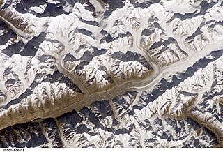
The Baltoro Glacier is a glacier located in the Shigar District of the Gilgit-Baltistan region in Pakistan. It stretches for 63 km (39 mi) in length. It is one of the longest glaciers outside the polar regions. It is home to some of the world’s highest mountains. It runs through the Karakoram mountain range, close to K2, which is the second highest peak in the world, reaching an elevation of 8,611 meters. Within a 20-kilometer radius, there are three more mountains with elevations exceeding 8,000 meters.

A glacial lake outburst flood (GLOF) is a type of outburst flood caused by the failure of a dam containing a glacial lake. An event similar to a GLOF, where a body of water contained by a glacier melts or overflows the glacier, is called a jökulhlaup. The dam can consist of glacier ice or a terminal moraine. Failure can happen due to erosion, a buildup of water pressure, an avalanche of rock or heavy snow, an earthquake or cryoseism, volcanic eruptions under the ice, or massive displacement of water in a glacial lake when a large portion of an adjacent glacier collapses into it.

The Hunza Valley is a mountainous valley located in the northern region of the Gilgit-Baltistan, Pakistan.

The Biafo Glacier Urdu: بیافو گلیشیر) is a glacier located within the Karakoram mountain range in the Hisper valley, Nagar District of Gilgit-Baltistan, Pakistan. It extends over a considerable distance, measuring 67 kilometers in length, and ranks as one of the largest glaciers in the entire Karakoram range. Flowing in a south-eastern direction from the central Karakoram crest, this glacier covers a basin area spanning 853 square kilometers, of which 628 square kilometers are characterized by permanent snow and ice. The accumulation zone alone contributes to 68% of the glacier's total area.

Hispar Glacier is a 49-km (30-mile) long glacier situated in the Karakoram Mountains of Gilgit–Baltistan, Pakistan. It converges with the Biafo Glacier, which extends for 67 kilometers, at the Hispar La (Pass), reaching an altitude of 5,128 meters. This confluence creates the world's longest glacial system outside of the polar regions.

The Saltoro Mountains form a subrange within the Karakoram Range and are situated in the southeastern part of the Karakoram. They lie on the southwest side of the Siachen Glacier, which is one of the two longest glaciers in the world outside the polar regions. The name "Saltoro" is also associated with the Saltoro Valley, located west of this range and descending on the Pakistani side of the Saltoro Range, which generally follows the Actual Ground Position Line (AGPL).

Nagar Valley once a princely state, now stands as one of the ten districts within the Gilgit-Baltistan region of Pakistan. This valley is situated along the renowned Karakoram Highway, as one travels northward from the city of Gilgit. The valley is home to many high mountain peaks including Rakaposhi (7788m), Diran Peak (7265m), Golden Peak and Rush Peak.

Gilgit-Baltistan is an administrative territory of Pakistan in the northern part of the country. It was given self-governing status on August 29, 2009. Gilgit-Baltistan comprises 14 districts within three divisions. The four districts of Skardu Kharmang Shigar and Ghanche are in the Baltistan Division, four districts of Gilgit Ghizer Hunza and Nagar districts which were carved out of Gilgit District are in the Gilgit Division and the third division is Diamir, comprising Chilas and Astore. The main political centres are the towns of Gilgit and Skardu.

Batura Glacier, 57 km (35 mi) long, is one of the largest and longest glaciers outside of the polar regions. It lies in the upper Hunza (Gojal) region of Hunza District, in Gilgit-Baltistan, Pakistan. It is just north of the massifs of Batura, at 7,795 metres (25,574 ft), and Passu, at 7,500 metres (24,600 ft). The glacier flows west to east. The lower portions can be described as a grey sea of rocks and gravelly moraine, bordered by a few summer villages and pastures with herds of sheep, goats, cows and yaks and where roses and juniper trees are common.

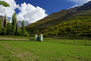
The Hopper Valley, also spelled Hopar Valley, is a section of the Nagar Valley in Gilgit-Baltistan, Pakistan. It is situated approximately 10 km from Nagar Khas, the main city of the Nagar Valley. Hopper Valley is known for the Spantik and Hopper glaciers.
Syed Yahya Shah سيد يحي was a Pakistani politician and scholar from Gilgit-Baltistan.

Gilgit-Baltistan, formerly known as the Northern Areas, is a region administered by Pakistan as an administrative territory and consists of the northern portion of the larger Kashmir region, which has been the subject of a dispute between India and Pakistan since 1947 and between India and China since 1959. It borders Azad Kashmir to the south, the province of Khyber Pakhtunkhwa to the west, the Wakhan Corridor of Afghanistan to the north, the Xinjiang region of China to the east and northeast, and the Indian-administered union territories of Jammu and Kashmir and Ladakh to the southeast.

The Braldu River flows in the Shigar District of Gilgit Baltistan in Pakistan. The Braldu River joins the Basha Basna River, and together they form the Shigar River, which is a tributary of the Indus River.

Tourism in Gilgit-Baltistan, an administered territory of Pakistan, focuses on its access to various mountain ranges and alpine terrain. Various tourist destinations attract millions of travelers from within Pakistan. On the other hand, tourists from other countries also routinely visit GB. An estimated 1.72 million tourists visited the region in 2017 according to the Pakistan Tourism Development Corporation (PTDC). Travelers had contributed Rs.300 million to the local economy in 2017. The authorities were expecting 2.5 million tourists in 2018 which would have meant an additional Rs.450 million to the economy.

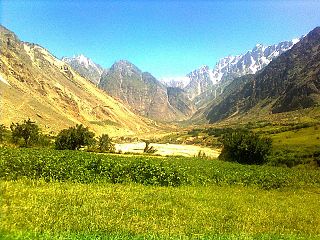
Stak Valley is a valley in the Roundu Subdivision of District Skardu, in the Gilgit-Balitistan territory of Pakistan. The valley is on the right bank of the Indus River, between the cities of Skardu and Giligit. The valley is the biggest valley in term of area and population in Roundu subdivision. The valley has been one of the very important regions of the area in term of in history and of geological formation as well.
With 7,253 known glaciers, including 543 in the Chitral Valley, there is more glacial ice in Pakistan than anywhere on Earth outside the polar regions, according to various studies.