List of mayors of Orange

Last updated

Mayor of Orange City Council
Incumbent
Cr. Jason Hamling
since 2021
Appointer Orange City Council
Term length 3 years
Inaugural holderAld. John Peisley
(Chairman)
Ald. Patrick Mulholland
(Mayor)
Formation9 February 1860 (as Chairman)
1865 (as Mayor)
DeputyCr Gerald Power
Website www.orange.nsw.gov.au

The Mayor of Orange, is the leader of the Council of the City of Orange, a local government area located in Orange, New South Wales, Australia. The official title of Mayors while holding office is: The Mayor of Orange. First incorporated on 9 January 1860 as the Municipality of Orange, on 10 July 1946, the Municipality of Orange was proclaimed as the City of Orange. First meeting on 18 February 1860, the legality of the Constitution of the Orange Municipal Council was questioned in 1866 and was suspended by order of the Supreme Court of New South Wales. With the Municipalities Act 1867, the Council was reconstituted and a new council was elected on 14 February 1868. In 1888, the Municipality of East Orange was proclaimed and merged with the Orange Municipality on 24 December 1912. [1] [2]

Contents

The current Mayor of Orange is Councillor Jason Hamling. A proposal to elect the mayor by a direct popular vote took effect at the 2017 Local Government Elections. [3] The directly-elected mayor will hold office until the next local government election, due in 2024.

Chairs/Mayors of the Municipality of Orange 1860–1946 [4]

#YearsChairmen
11860–1861 John Peisley
21862–1863 George McKay
31864James Dale
#YearsMayors
41865–1866Patrick Mulholland
1866–1868Council Suspended
1868James Dale
51869James Dalton
61870John Woodward
71871Patrick Kenna
81872Benjamin Nelson
91873George Weily
1874James Dale
101875Michael Casey
111876Joseph Windred
121877 Thomas Dalton
1878Patrick Kenna
131879–1880 James Torpy
141881James Stuart Leeds
151882Edward Nathan
1883Joseph Windred
1884Patrick Kenna
161885John McCutcheon Paul
171886Charles James Smith
1887John McCutcheon Paul
181888Patrick Joseph Flanagan
191889Elijah Eyles
201890Henry William Larance
211891Augustus Coulson
221892William Tanner
1893Charles James Smith
231894Andrew Edye
241895Simon Kearney
251896–1897George De Vial Pilcher
1898–1899Patrick Joseph Flanagan
1900–1902Charles James Smith
261903–1905Thomas Garrett Dalton
271906Roderick Plowman
1907Patrick Joseph Flanagan
281908–1909 John Swann Withington
291910Edwin Thomas McNeilly
301911Henry Kinghorne McKay
311912–1913Edwin Thomas McNeilly
321914 Sir Neville Howse
1914–1917Edwin Thomas McNeilly
331918William Earnest Bouffler
341919–1920George Treweeke
1921 Sir Neville Howse
351921–1922Valentine Henry Millard
361923–1924 Arthur Colvin
1924Valentine Henry Millard
1925–1929 Arthur Colvin
371930Samuel Whitmee
381931Stuart Lamrock
391932–1934A. W. Blowes
1935 Arthur Colvin
401936–1944Dr Walter Frederick Matthews
411945–1946John Percival Jaeger

Mayors of the Municipality of East Orange 1888–1912

#YearsMayors
11888–1889Josiah Parker
21890William Samuel Stabback
31891J. Middleton
1891–1893William Samuel Stabback
41894William Pulbrook
1895–1897William Samuel Stabback
51898–1899John Velvin
61900Thomas Charles Bowen
1901John Velvin
1902Thomas Charles Bowen
71903–1905J. W. Chalmers
81906–1909William Spurway
91911–1912J. McKeon
101912William H. Gow

Mayors of the City of Orange 1946–present [4]

#YearsMayors
1946–1947John Percival Jaeger
1948–1950Dr Walter Frederick Matthews
1951–1953John Percival Jaeger
421954–1955George Ernest Francis White
431956–1957 Alan Ridley
441958–1960Louie Cassey
451961Gordon Graham Machin
461962Clive Arthur Hamer
471963–1967Ronald John Hill
481968Reginald Joseph Cutcliffe
491969–1971Ronald Thomas
501972–1974Frederick Sinclair Dobbin
1974–1981Ronald Thomas
511981–1983Richard John Niven
521983–1991Timothy John Sullivan
531991–1996John Norman Davies
1996–2002Richard John Niven
542002–2004John Frederick Miller
552004–2008John Davis
562008–2009Reginald Allan Kidd
2009–2017John Davis
2017–2021Reginald Allan Kidd
572021–presentJason Hamling

Electoral results

2021

2021 New South Wales mayoral elections: Orange [5]
PartyCandidateVotes%±%
Team HamlingJason Hamling5,08220.9+20.9
For Our FutureTony Mileto4,69819.3+7.7
Independent Kevin Duffy3,94016.2+3.9
Greens Neil Jones3,77515.5+7.6
Independent Amanda Spalding3,36913.8+13.8
Independent Labor Jeff Whitton2,3499.6+2.4
Independent Lesley Smith1920.8+0.8
Total formal votes24,35595.9+0.5
Informal votes1,0544.1−0.5
Turnout 25,40984.4−1.1
Two-candidate-preferred result
Team HamlingJason Hamling7,08951.8+51.8
For Our FutureTony Mileto6,60248.2+48.2
Team Hamling gain from Independent Swing N/A

2017

2017 New South Wales mayoral elections: Orange [6]
PartyCandidateVotes%±%
Independent Reg Kidd5,19621.9+21.9
Independent National Russell Turner 4,52219.0+19.0
Independent Kevin Duffy2,92612.3+12.3
Independent Tony Mileto2,0178.5+8.5
Greens Stephen Nugent1,8857.9+7.9
Independent Scott Munro1,8427.8+7.8
Independent Labor Jeff Whitton1,7177.2+7.2
Independent Paula Townsend1,6216.8+6.8
Independent Chris Gryllis1,4626.2+6.2
Independent Ron Gander5762.4+2.4
Total formal votes23,76495.4N/A
Informal votes4.6N/A
Turnout 85.5N/A
Two-candidate-preferred result
Independent Reg Kidd7,15954.1+54.1
Independent National Russell Turner 6,08445.9+45.9
Independent win Swing N/A
  • This was the first time the position of mayor of Orange was directly-elected
  • John Davis (Independent) was the incumbent mayor, having been first elected in 2009

Related Research Articles

<span class="mw-page-title-main">City of Gosford</span> Former local government area in New South Wales, Australia

The City of Gosford was a local government area that was located in the Central Coast region in the state of New South Wales, Australia. The incorporation of Gosford dates back to 1886 when the Town of Gosford was proclaimed as the Borough of Gosford, becoming the Municipality of Gosford from 1906. In 1908, the Gosford Municipality merged into Erina Shire which covered the remaining Central Coast area outside of Gosford, but regained its independence in 1936. From 1 January 1947, local government in the Central Coast region was reorganised, creating Gosford Shire and Wyong Shire, and the final boundaries of Gosford City Council date from this period. From 1 January 1980, Gosford Shire was granted city status, becoming the City of Gosford. On 12 May 2016 the Minister for Local Government amalgamated the City of Gosford and Wyong Shire Councils. The Central Coast Council was established on the same day, covering the combined areas.

<span class="mw-page-title-main">City of Willoughby</span> Local government area in New South Wales, Australia

The City of Willoughby is a local government area on the Lower North Shore of Northern Sydney, in the state of New South Wales, Australia. It is located 6 kilometres (3.7 mi) north of the Sydney central business district. It was first proclaimed in October 1865 as the Municipality of North Willoughby.

<span class="mw-page-title-main">Municipality of Burwood</span> Local government area in New South Wales, Australia

The Municipality of Burwood is a local government area in the inner-west of Sydney, in the state of New South Wales, Australia. The mayor of the Municipality is Cr. John Faker, a member of the Labor Party. The municipality is 7 km2, making it the second smallest Local Government Area in New South Wales, being larger than only Hunter's Hill.

<span class="mw-page-title-main">Fairfield City Council</span> Local government area in New South Wales, Australia

The Fairfield City Council is a local government area in the west of Sydney, in the state of New South Wales, Australia. The council was first incorporated as the "Municipal District of Smithfield and Fairfield" on 8 December 1888, and the council's name was changed to the "Municipality of Fairfield" in 1920, before being proclaimed a city in 1979. The City of Fairfield comprises an area of 102 square kilometres (39 sq mi) and as of the 2021 census had a population of 208,475. The mayor of the City of Fairfield is Cr. Frank Carbone, the first popularly-elected independent mayor of Fairfield.

<span class="mw-page-title-main">Lane Cove Council</span> Local government area in New South Wales, Australia

The Lane Cove Council is a local government area located on the Lower North Shore of Sydney, New South Wales, Australia. The administrative seat of Lane Cove is located 10 kilometres (6.2 mi) north-west of the Sydney central business district.

<span class="mw-page-title-main">North Sydney Council</span> Local government area in New South Wales, Australia

North Sydney Council is a local government area on the Lower North Shore of Sydney, New South Wales, Australia, established on 29 July 1890 through the amalgamation of three boroughs.

<span class="mw-page-title-main">City of Parramatta</span> Local government area in New South Wales, Australia

The City of Parramatta, also known as Parramatta Council, is a local government area located to the west and north-west of Sydney CBD in the Greater Western Sydney region. Parramatta Council is situated between the City of Ryde and Cumberland, where the Cumberland Plain meets the Hornsby Plateau, approximately 25 kilometres (16 mi) west of the Sydney central business district, in New South Wales, Australia. The city occupies an area of 84 square kilometres (32 sq mi) spanning across suburbs in Greater Western Sydney including the Hills District, and a small section of Northern Sydney to the far north east of its area. According to the 2016 census, City of Parramatta had an estimated population of 226,149. The city houses the Parramatta central business district which is one of the key suburban employment destinations for the region of Greater Western Sydney.

<span class="mw-page-title-main">City of Ryde</span> Local government area in New South Wales, Australia

The City of Ryde is a local government area in the Northern Sydney region, in New South Wales, Australia. It was first established as the Municipal District of Ryde in 1870, became a municipality in 1906 and was proclaimed as the City of Ryde in 1992.

<span class="mw-page-title-main">City of Wollongong</span> Local government area in New South Wales, Australia

The City of Wollongong is a local government area in the Illawarra region of New South Wales, Australia. The area is situated adjacent to the Tasman Sea, the Princes Motorway and the Illawarra railway line.
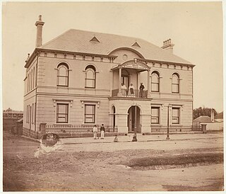
Russell William Turner, an Australian politician, is a councillor of the City of Orange Council, since 2012. Turner was previously a Member of the New South Wales Legislative Assembly representing Orange between 1996 and 2011 for the Nationals.

<span class="mw-page-title-main">Blayney Shire</span> Local government area in New South Wales, Australia

Blayney Shire is a local government area in the Central West region of New South Wales, Australia. The Shire is located adjacent to the Mid-Western Highway and the Main Western railway line, and is centred on the town of Blayney.

<span class="mw-page-title-main">City of Orange (New South Wales)</span> Local government area in New South Wales, Australia

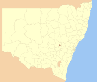
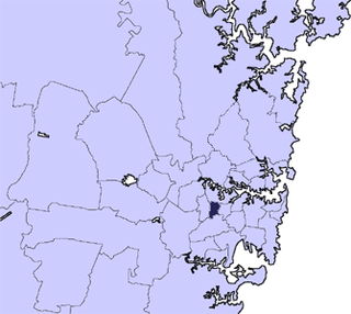
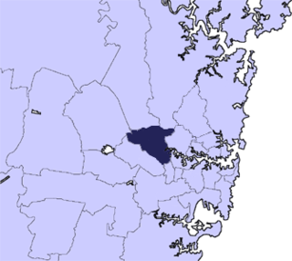
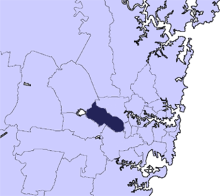
The City of Orange is a local government area in the Central West region of New South Wales, Australia. Based in Orange, the area is located adjacent to the Mitchell Highway and the Main Western railway line.

<span class="mw-page-title-main">Coolamon Shire</span> Local government area in New South Wales, Australia

Coolamon Shire is a local government area in the Riverina region of south-western New South Wales, Australia. The Shire comprises 2,433 square kilometres (939 sq mi) and is located adjacent to the Newell Highway and the Burley Griffin Way. The Shire includes the towns of Coolamon, Ganmain, and Ardlethan, and the villages of Matong, Marrar, and Beckom.

<span class="mw-page-title-main">Municipality of Alexandria</span> Former local government area in New South Wales, Australia

The Municipality of Alexandria was a local government area of Sydney, New South Wales, Australia. Originally part of the municipalities of Redfern from 1859 and Waterloo from 1860, the Borough of Alexandria was proclaimed on 27 August 1868. With an area of 4.2 square kilometres, it included the modern suburbs of Alexandria, Beaconsfield and parts of Eveleigh, St Peters and Erskineville. After a minor boundary change with the Municipality of Erskineville in 1908, the council was amalgamated with the City of Sydney, along with most of its neighbours, with the passing of the Local Government (Areas) Act 1948, although the former council area was later transferred in 1968–1982 and 1989–2004 to the South Sydney councils.

<span class="mw-page-title-main">Municipality of Redfern</span> Former local government area in New South Wales, Australia

The Municipality of Redfern was a local government area of Sydney, New South Wales, Australia. The small municipality was proclaimed in 1859 as one of the first municipalities proclaimed under the new provisions of the Municipalities Act, 1858, and was centred on the suburbs of Redfern, Eveleigh, Darlington and Surry Hills. The council was amalgamated, along with most of its neighbours, with the City of Sydney to the north with the passing of the Local Government (Areas) Act 1948. From 1968 to 1982 and from 1989 to 2004, the area was part of the South Sydney councils.

<span class="mw-page-title-main">Cumberland City Council</span> Local government area in New South Wales, Australia

Cumberland Council, trading as Cumberland City Council, is a local government area located in the western suburbs of Sydney in the state of New South Wales, Australia. The Council was formed on 12 May 2016 from the merger of parts of the Cities of Auburn, Parramatta, and Holroyd.

<span class="mw-page-title-main">City of Canterbury-Bankstown</span> Local government area in New South Wales, Australia

Canterbury-Bankstown Council, trading as the City of Canterbury Bankstown, is a local government area in the Canterbury-Bankstown region of Sydney, New South Wales, Australia. The council was formed on 12 May 2016 from a merger of the City of Canterbury and the City of Bankstown, after a review of local government areas by the NSW Government.

<span class="mw-page-title-main">Central Coast Council (New South Wales)</span> Local government area in New South Wales, Australia

The Central Coast Council is a local government area in the Central Coast region of New South Wales, Australia. It is adjacent to the Pacific Highway, Central Coast Highway, the Northern railway line and the Pacific Ocean. The council was formed on 12 May 2016 following the merger of the Gosford City and Wyong Shire Councils.

<span class="mw-page-title-main">Bayside Council</span> Local government area in New South Wales, Australia

Bayside Council is a local government area in Sydney, New South Wales, Australia. It is located around part of Botany Bay, 7 kilometres (4.3 mi) to 12 kilometres (7.5 mi) south of the Sydney CBD. It includes suburbs of Southern Sydney as well as a small portion in the Eastern suburbs, south-east of the Sydney CBD. It comprises an area of 50 square kilometres (19 sq mi) and as at the 2016 census had a population of 156,058.

<span class="mw-page-title-main">2017 New South Wales mayoral elections</span>

The 2017 New South Wales mayoral elections were held on 9 September 2017 to elect mayors or lord mayors to 13 of the 46 local government areas (LGAs) up for election in New South Wales. The elections were held as part of the statewide local elections.

References

  1. "Municipality of Orange (1860–1946) / City of Orange (1946- )". NSW State Records. NSW Government. Retrieved 8 February 2016.
  2. "A municipality is born". The Central Western Daily. 17 February 2010. Retrieved 8 February 2016.
  3. "Davis back on top: Orange's longest-serving mayor wins secret ballot". The Central Western Daily. 2 September 2015. Retrieved 8 February 2016.
  4. 1 2 "MAYORS OF ORANGE" (PDF). City of Orange. Orange City Council. Archived from the original (PDF) on 15 May 2018. Retrieved 8 February 2016.
  5. "City of Orange". ABC News.
  6. "City of Orange". ABC News.