Related Research Articles

Musashi Province was a province of Japan, which today comprises Tokyo Metropolis, most of Saitama Prefecture and part of Kanagawa Prefecture. It was sometimes called Bushū (武州). The province encompassed Kawasaki and Yokohama. Musashi bordered on Kai, Kōzuke, Sagami, Shimōsa, and Shimotsuke Provinces.

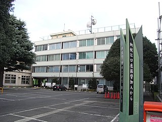
Hachiōji is a city located in the western portion of Tokyo Metropolis, Japan. As of 31 March 2021, the city had an estimated population of 561,344, and a population density of 3000 persons per km2. The total area of the city is 186.38 km2 (71.96 sq mi).

Ōme is a city located in the western portion of Tokyo, Japan. As of 1 May 2023, the city had an estimated population of 131,128, and a population density of 1300 persons per km2. The total area of the city is 103.31 square kilometres (39.89 sq mi).

Fuchū is a city located in western Tokyo Metropolis, Japan. Fuchū serves as a regional commercial center and a commuter town for workers in central Tokyo. The city hosts large scale manufacturing facilities for Toshiba, NEC and Suntory, as well as the Bank of Japan's main computer operations center. Local sporting attractions include the Tokyo Racecourse and the training grounds of Top League rugby teams Toshiba Brave Lupus and Suntory Sungoliath.

Akishima is a city located in the western portion of Tokyo Metropolis, Japan. As of 1 April 2021, the city had an estimated population of 113,542, and a population density of 6500 persons per km². The total area of the city is 17.34 square kilometres (6.70 sq mi).

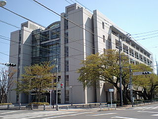
Chōfu is a city in the western side of Tokyo Metropolis, Japan. As of 1 April 2021, the city had an estimated population of 238,087, and a population density of 11,000 per km². the total area of the city is 21.58 square kilometres (8.33 sq mi).

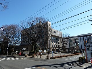
Machida is a city located in the western portion of Tokyo Metropolis, Japan. As of 1 April 2021, the city had an estimated population of 428,851, and a population density of 6,000 persons per km². The total area of the city was 71.80 square kilometres (27.72 sq mi).
Koganei is a city located in the western portion of Tokyo, Japan. As of 1 March 2021, the city had an estimated population of 123,698 in 61,832 households. The total area of the city is 11.30 square kilometres (4.36 sq mi) so the population density is about 11,000 persons per km².
Higashimurayama is a city located in the western portion of Tokyo Metropolis, Japan. As of 1 March 2021, the city had an estimated population of 148,275, and a population density of 8700 persons per km2. The total area of the city is 17.14 square kilometres (6.62 sq mi).

Higashiyamato is a city located in the western portion of Tokyo Metropolis, Japan. As of 1 April 2021, the city had an estimated population of 85,294, and a population density of 6400 persons per km². The total area of the city was 13.42 square kilometres (5.18 sq mi).

Tama is a city located in the western portion of Tokyo Metropolis, Japan. As of 11 March 2021, the city had an estimated population of 148,285 in 73,167 households, and a population density of 7,100 inhabitants per square kilometre (18,000/sq mi). The total area of the city was 21.01 square kilometres (8.11 sq mi).
Akiruno is a city located in the western portion of Tokyo Metropolis, Japan. As of 1 April 2021, the city had an estimated population of 80,177, and a population density of 1100 persons per km2. The total area of the city is 73.47 square kilometres (28.37 sq mi).

Sagamihara is a city in Kanagawa Prefecture, Japan. As of 1 May 2021, the city has an estimated population of 723,470, with 334,812 households, and a population density of 1,220 persons per km2. The total area of the city is 328.91 square kilometres (126.99 sq mi). Sagamihara is the third-most-populous city in the prefecture, after Yokohama and Kawasaki, and the fifth most populous suburb of the Greater Tokyo Area. Its northern neighbor is Machida, with which a cross-prefectural merger has been proposed.

Tokyo Prefecture was a Japanese government entity that existed between 1868 and 1943.

Moroyama is a town located in Saitama Prefecture, Japan. As of 1 January 2021, the town had an estimated population of 33,178 in 15,888 households and a population density of 970 persons per km². The total area of the town is 34.07 square kilometres (13.15 sq mi).

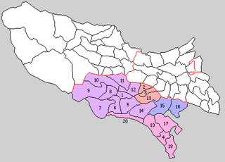
Western Tokyo, also known as the Tama area, Tama region or toka (都下), in the Tokyo Metropolis consists of 30 ordinary municipalities, unlike the eastern part which consists of 23 special wards.

Kawasaki is a city in Kanagawa Prefecture, Japan, one of the main cities of Greater Tokyo Area and Keihin Industrial Area. It is the second most populated city in Kanagawa Prefecture after Yokohama, and the eighth most populated city in Japan.

Kitatama was a district located in the Japanese Prefecture of Kanagawa from 1878 to 1893 and then in the Prefecture of Tokyo until 1970.
Minamitama was a district or county (gun) of Tokyo (Metropolis/{refecture), Japan. It was created in the early Meiji era when the old Tama District of Musashi Province was divided into four parts and split between Kanagawa and Tokyo. It lost its status as an administrative unit in the 1920s when county governments and councils were abolished across the country. As a geographical unit, it ceased to exist in 1971 when its last two remaining municipalities were promoted to independent cities.

Prefectural elections for the Tokyo Metropolitan Assembly were held on 2 July 2017. The 127 members were elected in forty-two electoral districts, seven returning single members elected by first-past-the-post, and thirty-five returning multiple members under single non-transferable vote. Four districts had their magnitude adjusted in this election to match population changes.
References
- ↑ Tokyo Metropolitan Government: History of Tokyo, p.233 (Note: The document doesn't specify how it treats dates before the introduction of the Gregorian calendar in 1873. The eleventh month of the Gregorian year 1871 is November 1871, but the eleventh month of the year Meiji 4 began in Gregorian December 1871 and ended in Gregorian January 1872.)
- ↑ Tokyo Metropolitan Archives: Documents related to the transfer of the seven Izu Islands (in Japanese)
- ↑ Ogasawara-mura/Ogasawara Village: History (in Japanese)
- ↑ National Archives of Japan: The incorporation of the three Tama into Tokyo prefecture (in Japanese)
- ↑ Nishitōkyō-shi (West Tokyo city)/Nishitokyo City, city history, Hōya section: 市のおいたち・地名の由来(保谷版)
- ↑ Kita-ku/Kita City: Kita-kusei yōran/Kita City Guide (bilingual Japanese/English; but the chronological table is Japanese only), p. 31
- ↑ Mizuho-machi/Mizuho Town: History
- ↑ Iruma-shi/Iruma City: City outline (in Japanese), p. 3
- 1 2 3 4 5 Hachiōji City: 都市体制編 [ permanent dead link ], p. 28
- 1 2 Tokyo Metropolitan Archives: 大東京35区物語~15区から23区へ~東京23区の歴史
- ↑ Miyake Village: 行政概要/沿革
- ↑ Machida City: 沿革
- ↑ Tachikawa City: 立川市の歴史(1950年から1970年まで) Archived 2013-10-24 at archive.today
- ↑ Higashiyamato City: 市の花、市の木、市章、市の名称>市の名称 「東大和」の名称について