List of national roads in Latvia

Last updated

A7 near Iecava Doroga Riga - Bauska Road Riga - Bauska.jpg
A7 near Iecava
A10 near Riga A10Latvia.jpg
A10 near Rīga
A9 near Skrunda A9-Latvia.jpg
A9 near Skrunda
A14 near Svente A14 near Svente.jpg
A14 near Svente
A2 near Garkalne A2-Bergi-LV.jpg
A2 near Garkalne

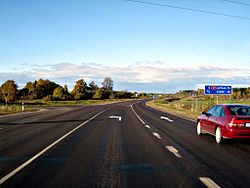
This is a list of national roads in Latvia :

State main roads

Number E-road RouteLength (km)
A1-LV.svg A1 E67-LV.svg E67 RīgaAinaži (EE border)101
A2-LV.svg A2 E77-LV.svg E77 RīgaSiguldaVeclaicene (EE border)196
A3-LV.svg A3 E264-LV.svg E264 InčukalnsValmieraValka (EE border)101
A4-LV.svg A4 E67-LV.svg E67 E77-LV.svg E77 Rīga ring road (BaltezersSaulkalne)20
A5-LV.svg A5 E67-LV.svg E67 E77-LV.svg E77 Rīga ring road (SalaspilsBabīte)40
A6-LV.svg A6 E22-LV.svg E22 E262-LV.svg E262 RīgaDaugavpilsKrāslavaPāternieki (BY border)307
A7-LV.svg A7 E67-LV.svg E67 RīgaBauskaGrenctāle (LT border)85
A8-LV.svg A8 E77-LV.svg E77 RīgaJelgavaMeitene (LT border)76
A9-LV.svg A9 Rīga (Skulte) – Liepāja 199
A10-LV.svg A10 E22-LV.svg E22 RīgaVentspils 190
A11-LV.svg A11 LiepājaRucava (LT border)57
A12-LV.svg A12 E22-LV.svg E22 E262-LV.svg E262 JēkabpilsRēzekneLudzaTerehova (RU border)166
A13-LV.svg A13 E262-LV.svg E262 Grebņeva (RU border)RēzekneDaugavpilsMedumi (LT border)163
A14-LV.svg A14 E262-LV.svg E262 Daugavpils ring road (TiltiKalkūne)15
A15-LV.svg A15 E262-LV.svg E262 Rēzekne ring road7

State regional roads

P12 near Salacgriva Road P12 in Latvia.JPG
P12 near Salacgrīva
P97 near Gardene P97Latvia.jpg
P97 near Gardene
P104 near Jaunpils P104Latvia.jpg
P104 near Jaunpils
RouteStartViaEndLength
P1-LV.svg P1 Riga (Jaunciems) Carnikava Ādaži 32.3 km
P2-LV.svg P2 Juglas papīrfabrika Upesciems 2.7 km
P3-LV.svg P3 Garkalne Alauksts 92.8 km
P4-LV.svg P4 Riga Ērgļi 101.3 km
P5-LV.svg P5 Ulbroka Ogre 26.0 km
P6-LV.svg P6 Saulkrasti Sēja Ragana 23.9 km
P7-LV.svg P7 Ragana Turaida 9.8 km
P8-LV.svg P8 Inciems Sigulda Ķegums 72.3 km
P9-LV.svg P9 Ragana Limbaži 38.9 km
P10-LV.svg P10 Inčukalns Ropaži Ikšķile 40.6 km
P11-LV.svg P11 Kocēni Limbaži Tūja 59.3 km
P12-LV.svg P12 Limbaži Salacgrīva 44.6 km
P13-LV.svg P13 Limbaži Aloja 31.6 km
P14-LV.svg P14 Umurga Cēsis 39.3 km
P15-LV.svg P15 Ainaži Matīši 60.3 km
P16-LV.svg P16 Valmiera Matīši Mazsalaca 45.3 km
P17-LV.svg P17 Valmiera Rūjiena Estonian border (Unguriņi)55.9 km
P18-LV.svg P18 Valmiera Smiltene 34.5 km
P19-LV.svg P19 Ape Estonian border4.9 km
P20-LV.svg P20 Valmiera Cēsis Drabeši 39.9 km
P21-LV.svg P21 Rūjiena Mazsalaca 21.5 km
P22-LV.svg P22 Valka Rūjiena 51.2 km
P23-LV.svg P23 Valka Vireši 48.0 km
P24-LV.svg P24 Smiltene Valka 41.8 km
P25-LV.svg P25 Smiltene Strenči 29.5 km
P26-LV.svg P26 Sedas access road2.5 km
P27-LV.svg P27 Smiltene Velēna Gulbene 64.1 km
P28-LV.svg P28 Priekuļi Rauna 19.0 km
P29-LV.svg P29 Rauna (Vidzemes Highway) Drusti Jaunpiebalga 32.0 km
P30-LV.svg P30 Cēsis Vecpiebalga Madona 86.5 km
P31-LV.svg P31 Ērgļi Drabeši 52.5 km
P32-LV.svg P32 Līgatne (Vidzemes Highway) Skrīveri 73.2 km
P33-LV.svg P33 Ērgļi Jaunpiebalga Saliņkrogs 61.2 km
P34-LV.svg P34 Sinole Zeltiņi Silakrogs 41.6 km
P35-LV.svg P35 Gulbene BalviViļaka Russian border (Vientuļi)69.5 km
P36-LV.svg P36 Rēzekne Gulbene 87.2 km
P37-LV.svg P37 Pļaviņas (Gostiņi) Madona Gulbene 90.9 km
P38-LV.svg P38 Cesvaine Velēna 37.6 km
P39-LV.svg P39 Alūksne Estonian border (Ape)30.3 km
P40-LV.svg P40 Alūksne Zaiceva 25.0 km
P41-LV.svg P41 Alūksne Liepna 33.0 km
P42-LV.svg P42 Viļaka Zaiceva Russian border (Pededze)47.4 km
P43-LV.svg P43 Litene Alūksne 27.0 km
P44-LV.svg P44 Ilzene Līzespasts 21.7 km
P45-LV.svg P45 Viļaka Kārsava 53.1 km
P46-LV.svg P46 Dubļeva Cērpene 22.8 km
P47-LV.svg P47 Balvi Kapūne 24.0 km
P48-LV.svg P48 Kārsava Tilža Dubļukalns 47.8 km
P49-LV.svg P49 Kārsava Ludza Ezernieki 75.9 km
P50-LV.svg P50 Kārsava Russian border (Aizgārša)15.2 km
P51-LV.svg P51 Ventspils access road2.5 km
P52-LV.svg P52 Zilupe Šķaune Ezernieki 59.2 km
P53-LV.svg P53 Duči Limbaži 26.8 km
P54-LV.svg P54 Rēzekne Greiškani 6.7 km
P55-LV.svg P55 Rēzekne Dagda 58.0 km
P56-LV.svg P56 Malta Kaunata 27.3 km
P57-LV.svg P57 Malta Sloboda 36.5 km
P58-LV.svg P58 Viļāni Preiļi Spoģi 62.4 km
P59-LV.svg P59 Viļāni Ružiņa Malta 28.9 km
P60-LV.svg P60 Dagda Aglona 35.3 km
P61-LV.svg P61 Krāslava Dagda 34.2 km
P62-LV.svg P62 Krāslava Preiļi Madona 141.8 km
P63-LV.svg P63 Līvāni Preiļi 35.6 km
P64-LV.svg P64 Višķi Nīcgale 31.5 km
P65-LV.svg P65 Stropi Krauja 5.0 km
P66-LV.svg P66 Tabore (Daugavpils bypass) Laucese 9.6 km
P67-LV.svg P67 Daugavpils Tilti 13.1 km
P68-LV.svg P68 Daugavpils Skrudaliena Belarusian border (Silene)29.5 km
P69-LV.svg P69 Skrudaliena Kaplava Krāslava 34.9 km
P70-LV.svg P70 Svente Lithuanian border (Subate)39.0 km
P71-LV.svg P71 (Crossed out in compliance with the Regulations of the Cabinet of Ministers of 20.11.2012., No. 788)
P72-LV.svg P72 Ilūkste Bebrene Birži 68.0 km
P73-LV.svg P73 Vecumnieki Nereta Subate 116.5 km
P74-LV.svg P74 Siliņi Aknīste 23.1 km
P75-LV.svg P75 Jēkabpils Lithuanian border (Nereta)60.6 km
P76-LV.svg P76 Aizkraukle Jēkabpils 46.0 km
P77-LV.svg P77 Ventspils Dundaga 56.2 km
P78-LV.svg P78 Pļaviņas Ērgļi 32.7 km
P79-LV.svg P79 Koknese Ērgļi 38.6 km
P80-LV.svg P80 Tīnuži Koknese 49.8 km
P81-LV.svg P81 Bērzaune Vestiena Ērgļi 27.2 km
P82-LV.svg P82 Jaunkalsnava Lubāna 56.6 km
P83-LV.svg P83 Lubāna Dzelzava 23.9 km
P84-LV.svg P84 Madona Varakļāni 49.1 km
P85-LV.svg P85 Rīgas HES Jaunjelgava 56.9 km
P86-LV.svg P86 Sērene Kalnieši 39.1 km
P87-LV.svg P87 Bauska Aizkraukle 83.0 km
P88-LV.svg P88 Bauska Linde 51.0 km
P89-LV.svg P89 Ķekava Skaistkalne 55.7 km
P90-LV.svg P90 Rīgas HES Pulkarne 2.3 km
P91-LV.svg P91 Mežvidi Baldone 3.2 km
P92-LV.svg P92 Iecava Stelpe 24.6 km
P93-LV.svg P93 Jelgava Iecava 31.9 km
P94-LV.svg P94 Jelgava Staļģene Code 35.5 km
P95-LV.svg P95 Jelgava Tērvete Lithuanian border (Žagarė)44.8 km
P96-LV.svg P96 Puri Auce Grivaiši 79.0 km
P97-LV.svg P97 Jelgava Dobele Annenieki 42.1 km
P98-LV.svg P98 Jelgava Tukums 48.7 km
P99-LV.svg P99 Jelgava Kalnciems 24.4 km
P100-LV.svg P100 Ozolnieki Dalbe 7.7 km
P101-LV.svg P101 Kalnciems Kūdra 11.6 km
P102-LV.svg P102 Dobele Jaunbērze 13.6 km
P103-LV.svg P103 Dobele Bauska 72.9 km
P104-LV.svg P104 Tukums Auce Lithuanian border (Vītiņi)69.0 km
P105-LV.svg P105 Saldus Ezere 34.2 km
P106-LV.svg P106 Ezere Embūte Grobiņa 81.2 km
P107-LV.svg P107 Skrunda Ezere 37.0 km
P108-LV.svg P108 Ventspils Kuldīga Saldus 106.4 km
P109-LV.svg P109 Kandava Saldus 52.6 km
P110-LV.svg P110 Liepāja Tāši 10.6 km
P111-LV.svg P111 Ventspils Grobiņa 95.6 km
P112-LV.svg P112 Kuldīga Aizpute Līči 68.6 km
P113-LV.svg P113 Grobiņa Bārta Rucava 51.8 km
P114-LV.svg P114 Priekule Lithuanian border (Plūdoņi)20.9 km
P115-LV.svg P115 Aizpute Kalvene 17.2 km
P116-LV.svg P116 Kuldīga Skrunda Embūte 61.5 km
P117-LV.svg P117 Skrunda Aizpute 26.8 km
P118-LV.svg P118 Kuldīgas bypass 9.4 km
P119-LV.svg P119 Kuldīga Alsunga Jūrkalne 40.3 km
P120-LV.svg P120 Talsi Stende Kuldīga 58.2 km
P121-LV.svg P121 Tukums Kuldīga 82.2 km
P122-LV.svg P122 Ventspils Piltene 24.0 km
P123-LV.svg P123 Zlēkas Ugāle 26.5 km
P124-LV.svg P124 Ventspils Kolka 75.4 km
P125-LV.svg P125 Talsi Dundaga Mazirbe 58.4 km
P126-LV.svg P126 Valdgale Roja 31.6 km
P127-LV.svg P127 Talsi Upesgrīva 34.3 km
P128-LV.svg P128 Sloka Talsi 73.8 km
P129-LV.svg P129 Talsu bypass 6.7 km
P130-LV.svg P130 Līgas Kandava Veģi 28.0 km
P131-LV.svg P131 Tukums ĶesterciemsMērsrags Kolka 107.7 km
P132-LV.svg P132 Riga Mārupe 9.1 km
P133-LV.svg P133 Access road to Riga International Airport 2.1 km
P134-LV.svg P134 Access road to Liepāja airport 2.4 km
P135-LV.svg P135 Priekule Vaiņode 19.9 km

State local roads

Approximately one thousand roads in Latvia are categorised under the state local road category. The total length of the local roads is 13,181.616 kilometres (8,190.676 mi), of which 10,570.151 kilometres (6,567.987 mi) are hard-surface and 2,611.465 kilometres (1,622.689 mi) are crushed stone or graveled.

Contents

These roads are designated by the letter V by the Latvian State Roads, [1] but this classification not used in signage.

Related Research Articles

<span class="mw-page-title-main">Latvia</span> Country in Northern Europe

Latvia, officially the Republic of Latvia, is a country in the Baltic region of Northern Europe. It is one of the Baltic states; and is bordered by Estonia to the north, Lithuania to the south, Russia to the east, Belarus to the southeast, and shares a maritime border with Sweden to the west. Latvia covers an area of 64,589 km2 (24,938 sq mi), with a population of 1.9 million. The country has a temperate seasonal climate. Its capital and largest city is Riga. Latvians belong to the ethno-linguistic group of the Balts; and speak Latvian, one of the only two surviving Baltic languages. Russians are the most prominent minority in the country, at almost a quarter of the population.

Transport in Lithuania relies mainly on road and rail networks.

<span class="mw-page-title-main">Transport in Malaysia</span>

Transportation in Malaysia started to develop during British colonial rule, and the country's transport network is now diverse and developed. Malaysia's road network is extensive, covering 290,099.38 kilometres, including 2,016.05 km of expressways. The main highway of the country extends over 800 km, reaching the Thai border from Singapore. Peninsular Malaysia has an extensive road network, whilst the road system in East Malaysia is not as well-developed. The main modes of transport in Peninsular Malaysia include buses, trains, cars, motorcycles and to an extent, commercial travel on airplanes.

<span class="mw-page-title-main">Valmiera</span> Republican city of Latvia

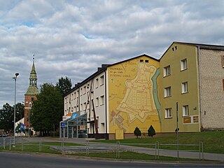
Valmiera is the largest city of the historical Vidzeme region, Latvia, with a total area of 19.35 square kilometres. As of 2002, Valmiera had a population of 27,323, and in 2020 – 24 879. It is a state city the seat of Valmiera Municipality.

<span class="mw-page-title-main">European route E67</span> Road in trans-European E-road network

European route E 67 is an E-road running from Prague in the Czech Republic to Helsinki in Finland by way of Poland, Lithuania, Latvia, and Estonia. It goes via Prague, Wrocław, Warsaw, Kaunas, Panevėžys, Riga, Tallinn and Helsinki.

<span class="mw-page-title-main">Irrigation Way</span>

The Irrigation Way is a major regional highway that runs approximately 81 kilometres (50 mi) through the Murrumbidgee Irrigation Area in south western New South Wales, Australia. Irrigation Way runs through three local government areas.

<span class="mw-page-title-main">Roads in India</span> Overview of roads in India

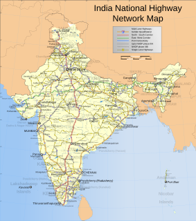
Roads are an important mode of transport in India. India has a network of over 6,215,797 kilometres (3,862,317 mi) of roads as of 1 December 2021. This is the second-largest road network in the world, after the United States with 6,853,024 kilometres (4,258,272 mi). At of roads per square kilometre of land, the quantitative density of India's road network is equal to that of Hong Kong, and substantially higher than the United States, China, Brazil and Russia. Adjusted for its large population, India has approximately 5.13 kilometres (3.19 mi) of roads per 1,000 people, which is much lower than United States 20.5 kilometres (12.7 mi) but higher than that of China 3.6 kilometres (2.2 mi). India's road network carries over 71 percent of its freight and about 85 percent of passenger traffic.

<span class="mw-page-title-main">Saulkrasti</span> Town in Saulkrasti municipality, Latvia

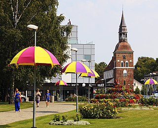
Saulkrasti is a town in Latvia on the east coast of the Gulf of Riga and the capital of the Saulkrasti municipality. Made up of a number of historic fishing settlements, the town stretches for some 17 km from the Inčupe river in the south to the village of Skulte in the north. The town itself spans across 4.8 square kilometres (1.9 sq mi) and includes an additional 42 square kilometres (16 sq mi) of fields and forests.

<span class="mw-page-title-main">Shire of Mukinbudin</span> Local government area in the Wheatbelt region in Western Australia

The Shire of Mukinbudin is a local government area in the Wheatbelt region of Western Australia, about 80 kilometres (50 mi) north of Merredin and about 300 kilometres (186 mi) east of the state capital, Perth. The Shire covers an area of 3,437 square kilometres (1,327 sq mi), and its seat of government is the town of Mukinbudin.

<span class="mw-page-title-main">Shire of Cranbrook</span> Local government area in Western Australia

The Shire of Cranbrook is a local government area in the Great Southern region of Western Australia, about 92 kilometres (57 mi) north of Albany and about 320 kilometres (200 mi) south-southeast of the state capital, Perth. The Shire covers an area of 3,277 square kilometres (1,265 sq mi), and its seat of government is the town of Cranbrook.

<span class="mw-page-title-main">Shire of Katanning</span> Local government area in Western Australia

The Shire of Katanning is a local government area in the Great Southern region of Western Australia, about 170 kilometres (106 mi) north of Albany and about 290 kilometres (180 mi) southeast of the state capital, Perth. The Shire covers an area of 1,518 square kilometres (586 sq mi), and its seat of government is the town of Katanning.

<span class="mw-page-title-main">Shire of Laverton</span> Local government area in Western Australia

The Shire of Laverton is a local government area in the Goldfields-Esperance region of Western Australia, about 370 kilometres (230 mi) northeast of the city of Kalgoorlie and about 950 kilometres (590 mi) east-northeast of the state capital, Perth. The Shire covers an area of 179,798 square kilometres (69,420 sq mi), and its seat of government is the town of Laverton.

<span class="mw-page-title-main">Latvian Railways</span>

JSC Latvian Railway was established on 2 September 1991 and is seen as the successor of the Latvian Railway Board which was established on 5 August 1919.

<span class="mw-page-title-main">Latvia–Russia border</span> International border

Latvia–Russia border is the state border between Republic of Latvia and the Russian Federation. The length of the border is 214 kilometres (133 mi). It is an external border of the European Union.

<span class="mw-page-title-main">Fitzroy Developmental Road</span>

The Fitzroy Developmental Road is a designated road in the Central Highlands Region of Queensland consisting of three separate sections. The general direction is from south to north.

<span class="mw-page-title-main">South Kurzeme Municipality</span> Municipality in Latvia

South Kurzeme Municipality is one of the 35 municipalities established in Latvia in 2021. It surrounds Liepāja, Latvia's third largest city. Its first elected municipal council will take office on 1 July 2021. Its seat is at Grobiņa.

<span class="mw-page-title-main">Augšdaugava Municipality</span> Municipality of Latvia

Augšdaugava Municipality is one of the 35 municipalities established in Latvia in 2021. It surrounds the independent city of Daugavpils and its municipal headquarters are located there. Its first elected municipal council has taken office on 1 July 2021.

<span class="mw-page-title-main">Valmiera Municipality</span> Municipality in Latvia

Valmiera Municipality is one of the 35 municipalities established in Latvia in 2021, located approximately 180 kilometres (110 mi) west of the national capital Riga. Its first elected municipal council took office on 1 July 2021. Its seat is the city of Valmiera.

Richmond–Winton Road is a continuous 145 kilometres (90 mi) road route in the Richmond and Winton local government areas of Queensland, Australia. It is a state-controlled district road rated as a local road of regional significance (LRRS). It is part of the shortest route from the Croydon / Georgetown area to Winton and Longreach. It is also part of the inland freight network linking cattle properties to major freight routes on the Landsborough and Flinders highways.

Bunya Mountains road network is a group of roads that provide access to the mountain community from various lowland localities. The network ensures continuity of access in times of flooding or other natural disasters, and during planned maintenance activities. The locality of Bunya Mountains includes the Bunya Mountains National Park and the enclosed locality of Mowbullan. The area hosts a smal residential community plus many tourism accommodation venues.

References