List of places in Alaska (S)

Last updated

This list of cities, towns, unincorporated communities, counties, and other recognized places in the U.S. state of Alaska also includes information on the number and names of counties in which the place lies, and its lower and upper zip code bounds, if applicable.

Name of placeNumber of countiesPrincipal countyLower zip codeUpper zip code
Sagwon 1 North Slope Borough   
St. George 1 Aleutians West Census Area 99591 
St. George 1 Aleutians West Census Area 99660 
Saint George Island 1 Aleutians West Census Area 99660 
St. John Harbor 1 Wrangell-Petersburg Census Area   
Saint Marys 1 Kusilvak Census Area 99658 
Saint Mary's 1 Kusilvak Census Area 99658 
St. Mary's 1 Kusilvak Census Area 99658 
Saint Marys Airport 1 Kusilvak Census Area 99658 
St. Marys City School District 1 Kusilvak Census Area   
Saint Michael 1 Nome Census Area 99659 
St. Michael 1 Nome Census Area 99659 
Saint Paul 1 Aleutians West Census Area 99660 
St. Paul 1 Aleutians West Census Area 99660 
Saint Paul Island 1 Aleutians West Census Area 99660 
Saint Paul Island Airport 1 Aleutians West Census Area 99660 
Saint Terese 1 City and Borough of Juneau   
Salamatof 1 Kenai Peninsula Borough   
Salcha 1 Fairbanks North Star Borough 99714 
Salchaket 1 Fairbanks North Star Borough 99701 
Salmon 1 Yukon-Koyukuk Census Area   
Salmon Creek 1 City and Borough of Juneau 99801 
Salmon Lake 1 Nome Census Area   
Salt Chuck 1 Prince of Wales-Outer Census Area   
Sanak 1 Aleutians East Borough   
Sand Bay 1 Aleutians East Borough   
Sand Lake 1 Municipality of Anchorage 99522 
Sand Point 1 Aleutians East Borough 99661 
Sand Point Airport 1 Aleutians East Borough 99661 
San Juan 1 Kodiak Island Borough   
Saulich 1 Yukon-Koyukuk Census Area   
Savonoski 1 Bristol Bay Borough   
Savoonga 1 Nome Census Area 99769 
Saxman 1 Ketchikan Gateway Borough 99901 
Saxman East 1 Ketchikan Gateway Borough   
Scammon Bay 1 Kusilvak Census Area 99662 
Scow Bay 1 Wrangell-Petersburg Census Area 99833 
Sealaska 8 Haines Borough   
Sealaska 8 City and Borough of Juneau   
Sealaska 8 Ketchikan Gateway Borough   
Sealaska 8 Prince of Wales-Outer Census Area   
Sealaska 8 City and Borough of Sitka   
Sealaska 8 Skagway-Hoonah-Angoon Census Area   
Sealaska 8 Wrangell-Petersburg Census Area   
Sealaska 8 City and Borough of Yakutat   
Section House 1 Matanuska-Susitna Borough   
Selawik 1 Northwest Arctic Borough 99770 
Seldovia 1 Kenai Peninsula Borough 99663 
Seldovia Village 1 Kenai Peninsula Borough   
Serpentine Hot Springs 1 Nome Census Area   
Seversens 1 Dillingham Census Area   
Seward 1 Kenai Peninsula Borough 99664 
Seward-Hope 1 Kenai Peninsula Borough   
Shageluk 1 Yukon-Koyukuk Census Area 99665 
Shaktolik 1 Nome Census Area   
Shaktoolik 1 Nome Census Area 99771 
Sheldon Point 1 Kusilvak Census Area 99666 
Sheldon Point 1 Kusilvak Census Area   
Shemya 1 Aleutians East Borough   
Shemya Island 1 Aleutians East Borough   
Shemya Station/Air Force Station 1 Aleutians West Census Area 98736 
Sherman 1 Matanuska-Susitna Borough   
Sheshalik 1 Northwest Arctic Borough   
Shishmaref 1 Nome Census Area 99772 
Shoal Cove 1 Ketchikan Gateway Borough   
Shoreline Drive 1 Ketchikan Gateway Borough   
Shungnak 1 Northwest Arctic Borough 99773 
Shungnak Village 1 Northwest Arctic Borough   
Silver Springs 1 Valdez-Cordova Census Area   
Silvertip 1 Kenai Peninsula Borough 99631 
Sinuk 1 Nome Census Area   
Sitka 1 City and Borough of Sitka 99835 
Sitka 1 City and Borough of Sitka   
Sitka Airport 1 City and Borough of Sitka 99835 
Sitka City and Borough School District 1 City and Borough of Sitka   
Sitka National Historical Park 1 City and Borough of Sitka   
Situk 1 City and Borough of Yakutat   
Skagway 1 Municipality of Skagway Borough 99840 
Skagway City School District 1 Municipality of Skagway Borough   
Skwentna 1 Matanuska-Susitna Borough 99667 
Slana 1 Valdez-Cordova Census Area 99586 
Slaterville 1 Fairbanks North Star Borough   
Sleetmute 1 Bethel Census Area 99668 
Snug Harbor 1 Kenai Peninsula Borough 99572 
Soldatna 1 Kenai Peninsula Borough   
Soldotna 1 Kenai Peninsula Borough 99669 
Solomon 1 Nome Census Area   
Sourdough 1 Valdez-Cordova Census Area 99586 
South 1 Municipality of Anchorage 99502 
South Bierremark 1 Fairbanks North Star Borough   
Southeast Fairbanks 1 Southeast Fairbanks Census Area   
Southeast Islands Regional Educational Attendance Ar 2 Prince of Wales-Outer Census Area   
Southeast Islands Regional Educational Attendance Ar 2 Wrangell-Petersburg Census Area   
South Fairbanks 1 Fairbanks North Star Borough 99701 
South Naknek 1 Bristol Bay Borough 99670 
Southwest Region Regional Educational Attendance Are 1 Dillingham Census Area   
Sparrevohn Station 1 Bethel Census Area   
Spenard 1 Municipality of Anchorage 99503 
Squaw Harbor 1 Aleutians East Borough 99661 
Standard 1 Fairbanks North Star Borough   
Stebbins 1 Nome Census Area 99671 
Steese 1 Fairbanks North Star Borough 99710 
Sterling 1 Kenai Peninsula Borough 99672 
Sterling Landing 1 Yukon-Koyukuk Census Area   
Stevens 1 Yukon-Koyukuk Census Area   
Stevens Village 1 Yukon-Koyukuk Census Area 99774 
Stony River 1 Bethel Census Area 99557 
Strawberry Point 1 Skagway-Hoonah-Angoon Census Area   
Strelna 1 Valdez-Cordova Census Area   
Stuyahok 1 Kusilvak Census Area   
Sulatna Crossing 1 Yukon-Koyukuk Census Area   
Sullivan Camp 1 Nome Census Area   
Summit 1 Denali Borough 99729 
Sunnyside 1 Skagway-Hoonah-Angoon Census Area 99832 
Sunrise 1 Kenai Peninsula Borough   
Sunshine 1 Matanuska-Susitna Borough 99501 
Suntrana 1 Denali Borough 99743 
Susitna 1 Matanuska-Susitna Borough   
Sutton 1 Matanuska-Susitna Borough 99674 
Sutton-Alpine 1 Matanuska-Susitna Borough   

Related Research Articles

The United States' Federal Information Processing Standards (FIPS) are publicly announced standards developed by the National Institute of Standards and Technology for use in computer systems by non-military American government agencies and government contractors.

ZIP Code Numeric postal code used in the United States and its territories

A ZIP Code is a postal code used by the United States Postal Service (USPS). Introduced in 1963, the basic format consisted of five digits. In 1983, an extended ZIP+4 code was introduced; it included the five digits of the ZIP Code, followed by a hyphen and four digits that designated a more specific location.

Placer County, California County in California, United States

Placer County, officially the County of Placer, is a county in the U.S. state of California. As of the 2020 census, the population was 404,739. The county seat is Auburn.

Yuba County, California County in California, United States

Yuba County is a county in the U.S. state of California. As of the 2020 U.S. Census, the population was 81,575. The county seat is Marysville. Yuba County is included in the Yuba City, California Metropolitan Statistical Area, which is also included in the Sacramento–Roseville, California Combined Statistical Area. The county is in the Central Valley region along the Feather River.
County (United States) Subdivision used by most states in the United States of America

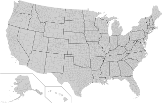
In the United States, a county is an administrative or political subdivision of a state that consists of a geographic region with specific boundaries and usually some level of governmental authority. The term "county" is used in 48 U.S. states, while Louisiana and Alaska have functionally equivalent subdivisions called parishes and boroughs, respectively.

Unincorporated area Region of land not governed by own local government

An unincorporated area is a region that is not governed by a local municipal corporation. Widespread unincorporated communities and areas are a distinguishing feature of the United States and Canada. Most other countries of the world have either no unincorporated areas at all, or these are very rare; typically remote, outlying, sparsely populated, or uninhabited areas.

A census-designated place (CDP) is a concentration of population defined by the United States Census Bureau for statistical purposes only. CDPs have been used in each decennial census since 1980 as the counterparts of incorporated places, such as self-governing cities, towns, and villages, for the purposes of gathering and correlating statistical data. CDPs are populated areas that generally include one officially designated but currently unincorporated community, for which the CDP is named, plus surrounding inhabited countryside of varying dimensions and, occasionally, other, smaller unincorporated communities as well. CDPs include small rural communities, edge cities, colonias located along the Mexico–United States border, and unincorporated resort and retirement communities and their environs.

This is a list of the more than 2,000 properties and historic districts in the U.S. state of Georgia that are listed on the National Register of Historic Places. Listings are distributed across all of Georgia's 159 counties. Listings for the city of Atlanta are primarily in Fulton County's list but spill over into DeKalb County's list.

National Register of Historic Places listings in Pittsburgh, Pennsylvania Wikipedia list article

The following properties are listed on the National Register of Historic Places in Pittsburgh, Pennsylvania.