List of places in Alaska (A)

Last updated

This list of cities, towns, unincorporated communities, counties, and other recognized places in the U.S. state of Alaska also includes information on the number and names of counties in which the place lies, and its lower and upper zip code bounds, if applicable.

Name of placeNumber of countiesPrincipal countyLower zip codeUpper zip code
Abyss Lake 1 Skagway-Hoonah-Angoon Census Area   
Adak 1 Aleutians West Census Area   
Adak Island 1 Aleutians West Census Area   
Adak Naval Security Group 1 Aleutians West Census Area 98777 
Adak Naval Station/Mitchell Field 1 Aleutians West Census Area 98791 
Afognak 1 Kodiak Island Borough   
Agaligamute 1 Bethel Census Area   
Agivavik 1 Dillingham Census Area   
Agowik 1 Nome Census Area   
Aguikchuk 1 Bethel Census Area   
Aguliagamiut 1 Bethel Census Area   
Ahtna 3 Matanuska-Susitna Borough   
Ahtna 3 Valdez-Cordova Census Area   
Ahtna 3 Yukon-Koyukuk Census Area   
Akhiok 1 Kodiak Island Borough 99615 
Akiachak 1 Bethel Census Area 99551 
Akiak 1 Bethel Census Area 99552 
Akolmiut 1 Bethel Census Area 99640 
Akulurak 1 Bethel Census Area   
Akumsuk 1 Kusilvak Census Area   
Akutan 1 Aleutians East Borough 99553 
Alaganik 1 Valdez-Cordova Census Area   
Alakanuk 1 Kusilvak Census Area 99554 
Alaska Gateway Regional Educational Attendance Area 3 Southeast Fairbanks Census Area   
Alaska Gateway Regional Educational Attendance Area 3 Valdez-Cordova Census Area   
Alaska Gateway Regional Educational Attendance Area 3 Yukon-Koyukuk Census Area   
Alatna 1 Yukon-Koyukuk Census Area 99720 
Alcan 1 Southeast Fairbanks Census Area   
Alcan Border 1 Southeast Fairbanks Census Area   
Aleknagik 1 Dillingham Census Area 99555 
Aleknagik Mission 1 Dillingham Census Area   
Aleksashkina 1 Kodiak Island Borough   
Aleneva 1 Kodiak Island Borough   
Aleut 2 Aleutians East Borough   
Aleut 2 Aleutians West Census Area   
Aleutian Islands 1undetermined borough/census area  
Aleutian Region Regional Educational Attendance Area 1 Aleutians West Census Area   
Aleutians East 1 Aleutians East Borough   
Aleutians East Borough School District1 Aleutians East Borough   
Aleutians West 1 Aleutians West Census Area   
Alexander 1 Matanuska-Susitna Borough 99501 
Alexanders Village 1 Yukon-Koyukuk Census Area   
Algaacig 1 Kusilvak Census Area   
Alitak 1 Kodiak Island Borough   
Allakaket 1 Yukon-Koyukuk Census Area 99720 
Alpine 1 North Slope Borough   
Alyeska 1 Municipality of Anchorage   
Ambler 1 Northwest Arctic Borough 99786 
Amchitka 1 Aleutians West Census Area   
Anaktuvuk Pass 1 North Slope Borough 99721 
Anchorage 1 Municipality of Anchorage 9950140
Anchorage International Airport 1 Municipality of Anchorage 99502 
Anchorage School District 1 Municipality of Anchorage   
Anchor Point 1 Kenai Peninsula Borough 99556 
Anderson 1 Denali Borough 99744 
Andreafsky 1 Kusilvak Census Area 99658 
Angoon 1 Skagway-Hoonah-Angoon Census Area 99820 
Aniak 1 Bethel Census Area 99557 
Aniak Airport 1 Bethel Census Area 99557 
Aniakchak National Monument and Preserve 1 Dillingham Census Area   
Annette 1 Prince of Wales-Outer Census Area 99926 
Annette Coast Guard Air Station 1 Prince of Wales-Outer Census Area 99920 
Annette Island 1 Prince of Wales-Outer Census Area   
Annette Island Regional Educational Attendance Area 1 Prince of Wales-Outer Census Area   
Annette Islands Reserve 1 Prince of Wales-Outer Census Area   
Anogok 1 Bethel Census Area   
Anvik 1 Yukon-Koyukuk Census Area 99558 
Arctic Slope 1 North Slope Borough   
Arctic Village 1 Yukon-Koyukuk Census Area 99722 
Arolik 1 Bethel Census Area   
Artesian Village 1 Municipality of Anchorage   
Atka 1 Aleutians West Census Area 99547 
Atka 1 Aleutians West Census Area 99502 
Atkasook 1 North Slope Borough   
Atmautluak 1 Bethel Census Area 99559 
Atqasuk 1 North Slope Borough 99791 
Attu 1 Aleutians West Census Area   
Attu Island 1 Aleutians West Census Area   
Attu Station 1 Aleutians West Census Area   
Auke Bay 1 City and Borough of Juneau 99821 
Aurora 1 Fairbanks North Star Borough 99709 
Aurora Lodge 1 Fairbanks North Star Borough 99714 

Related Research Articles

The United States' Federal Information Processing Standards (FIPS) are publicly announced standards developed by the National Institute of Standards and Technology for use in computer systems by non-military American government agencies and government contractors.

ZIP Code Numeric postal code used in the United States and its territories

A ZIP Code is a postal code used by the United States Postal Service (USPS). Introduced in 1963, the basic format consisted of five digits. In 1983, an extended ZIP+4 code was introduced; it included the five digits of the ZIP Code, followed by a hyphen and four digits that designated a more specific location.

Placer County, California County in California, United States

Placer County, officially the County of Placer, is a county in the U.S. state of California. As of the 2020 census, the population was 404,739. The county seat is Auburn.

Yuba County, California County in California, United States

Yuba County is a county in the U.S. state of California. As of the 2020 U.S. Census, the population was 81,575. The county seat is Marysville. Yuba County is included in the Yuba City, California Metropolitan Statistical Area, which is also included in the Sacramento–Roseville, California Combined Statistical Area. The county is in the Central Valley region along the Feather River.
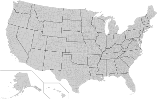
County (United States) Subdivision used by most states in the United States of America

In the United States, a county is an administrative or political subdivision of a state that consists of a geographic region with specific boundaries and usually some level of governmental authority. The term "county" is used in 48 U.S. states, while Louisiana and Alaska have functionally equivalent subdivisions called parishes and boroughs, respectively.

Unincorporated area Region of land not governed by own local government

An unincorporated area is a region that is not governed by a local municipal corporation. Widespread unincorporated communities and areas are a distinguishing feature of the United States and Canada. Most other countries of the world have either no unincorporated areas at all, or these are very rare; typically remote, outlying, sparsely populated, or uninhabited areas.

A census-designated place (CDP) is a concentration of population defined by the United States Census Bureau for statistical purposes only. CDPs have been used in each decennial census since 1980 as the counterparts of incorporated places, such as self-governing cities, towns, and villages, for the purposes of gathering and correlating statistical data. CDPs are populated areas that generally include one officially designated but currently unincorporated community, for which the CDP is named, plus surrounding inhabited countryside of varying dimensions and, occasionally, other, smaller unincorporated communities as well. CDPs include small rural communities, edge cities, colonias located along the Mexico–United States border, and unincorporated resort and retirement communities and their environs.

This is a list of the more than 2,000 properties and historic districts in the U.S. state of Georgia that are listed on the National Register of Historic Places. Listings are distributed across all of Georgia's 159 counties. Listings for the city of Atlanta are primarily in Fulton County's list but spill over into DeKalb County's list.

National Register of Historic Places listings in Pittsburgh, Pennsylvania Wikipedia list article

The following properties are listed on the National Register of Historic Places in Pittsburgh, Pennsylvania.