Aleneva, Alaska

Last updated

Aleneva, Alaska
USA Alaska location map.svg
Red pog.svg
Aleneva
Location within the state of Alaska
Coordinates: 58°3′49″N152°54′37″W / 58.06361°N 152.91028°W / 58.06361; -152.91028
Country United States
State Alaska
Borough Kodiak Island
Government
  Borough mayor Jerrol Friend [1]
   State senator Gary Stevens (R)
   State rep. Louise Stutes (R)
Area
[2]
  Total62.21 sq mi (161.12 km2)
  Land62.21 sq mi (161.12 km2)
  Water0.00 sq mi (0.00 km2)
Elevation
620 ft (189 m)
Population
 (2020)
  Total5
  Density0.08/sq mi (0.03/km2)
Time zone UTC-9 (Alaska (AKST))
  Summer (DST) UTC-8 (AKDT)
Area code 907
FIPS code 02-01560
GNIS feature ID1865543

Aleneva is a census-designated place in the Kodiak Island Borough in the U.S. state of Alaska. As of the 2010 census, the population was 37, [3] down from 68 in 2000.

Contents

Geography and climate

Aleneva is located at 58°00′51″N152°54′34″W / 58.01417°N 152.90944°W / 58.01417; -152.90944 (Sec. 18, T025S, R022W, Seward Meridian) in the Kodiak Recording District.

Aleneva is located on the southern coast of the island of Afognak, north of Kodiak Island. It is on the coast of Raspberry Strait, across from Little Raspberry Island.

The Kodiak Archipelago is warmed by the Japanese current. The climate is similar to Southeast Alaska, with less precipitation. January temperatures range from 14 to 46 °F (−10 to 8 °C). July temperatures range from 39 to 76 °F (4 to 24 °C). Average annual rainfall is 74 inches (187.96 cm).

According to the United States Census Bureau, the CDP has a total area of 62.2 square miles (161.1 km2), all land. [3]

History

Aleneva is a settlement of Russian Old Believers whose ancestors settled in Woodburn, Oregon, after the October Revolution forced them out of Russia.

The population consists of 1.5% Alaska Native or part Native. During the 2000 census, total housing units numbered 14, of which none were vacant. 2000 census data showed 21 residents as employed. The unemployment rate at that time was zero, although half of all adults were not in the work force. The median household income was $10,417 and the per capita income was $3,707, making Aleneva the place in Alaska with the lowest per capita income.[ citation needed ] 40.66% of residents were living below the poverty level.

Demographics

Historical population
CensusPop.Note
2000 68
2010 37−45.6%
2020 5−86.5%
U.S. Decennial Census [4]

Aleneva first appeared on the 2000 U.S. Census as a census-designated place (CDP). [5] Within its present boundaries is the former historic community of Afognak.

As of the census [6] of 2000, there were 68 people, 14 households, and 13 families residing in the CDP. The population density was 1.1 inhabitants per square mile (0.42/km2). There were 14 housing units at an average density of 0.2 per square mile (0.077/km2). The racial makeup of the CDP was 98.53% White and 1.47% Native American.

There were 14 households, out of which 57.1% had children under the age of 18 living with them, 92.9% were married couples living together, and 7.1% were non-families. No households were made up of individuals, and none had someone living alone who was 65 years of age or older. The average household size was 4.86 and the average family size was 5.08.

In the CDP, the population was spread out, with 52.9% under the age of 18, 14.7% from 18 to 24, 17.6% from 25 to 44, 10.3% from 45 to 64, and 4.4% who were 65 years of age or older. The median age was 17 years. For every 100 females, there were 119.4 males. For every 100 females age 18 and over, there were 88.2 males.

The median income for a household in the CDP was $10,417, and the median income for a family was $10,417. Males had a median income of $0 versus $0 for females. The per capita income for the CDP was $3,707. There were 47.6% of families and 40.7% of the population living below the poverty line, including 30.6% of under 18 and 25.0% of those over 64.

Facilities, utilities, schools and health care

There are no public facilities or services on the island. Electricity is provided by individual generators. There are no state-operated schools in the community.

Economy and transportation

There are a few small logging camps on Afognak Island, but no other source of employment. The economy is based on subsistence activities.

Transportation is provided by float plane from Kodiak.

Taxes: Sales: None, Property: 9.25 mills (Borough), Special: 5% Accommodations Tax (Borough); 0.925% Severance Tax (Borough)

Regional organizations

Related Research Articles

<span class="mw-page-title-main">Kodiak Island Borough, Alaska</span> Borough in Alaska, United States

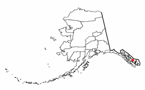
Kodiak Island Borough is a borough in the U.S. state of Alaska. At the 2020 census, the population was 13,101, down from 13,592 in 2010. The borough seat is Kodiak.

<span class="mw-page-title-main">Nanwalek, Alaska</span> Census-designated place in Alaska, United States

Nanwalek, formerly Alexandrovsk and later English Bay, is a census-designated place (CDP) in the Kenai Peninsula Borough, Alaska, United States, that contains a traditional Alutiiq village. The population was 254 at the 2010 census, up from 177 in 2000. There is one school located in the community, attended by 76 students.

<span class="mw-page-title-main">Ninilchik, Alaska</span> Census-designated place in Alaska, United States

Ninilchik is a census-designated place (CDP) in Kenai Peninsula Borough, Alaska, United States. At the 2010 census the population was 883, up from 772 in 2000.

<span class="mw-page-title-main">Akhiok, Alaska</span> City in Alaska, United States

Akhiok is a second-class city in Kodiak Island Borough, Alaska, United States. Akhiok is Kodiak's southernmost village. The population was 63 at the 2020 census. Akhiok, which does not have a post office, is a rural location in postal code 99615 that belongs to Kodiak. The village is sometimes called Alitak, after a nearby bay.

Chiniak is a census-designated place (CDP) in Kodiak Island Borough, Alaska, United States. The population was 47 at the 2010 census, down from 50 in 2000.

<span class="mw-page-title-main">Karluk, Alaska</span> Census-designated place in Alaska, United States

Karluk is a census-designated place (CDP) in Kodiak Borough, Kodiak Island, Alaska, United States. The population was 37 at the 2010 census, up from 27 in 2000.

Kodiak Station is a census-designated place (CDP) in Kodiak Island Borough, Alaska, United States. At the 2020 census the population was 1,673, up from 1,301 in 2010.

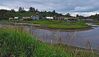
Larsen Bay is a city in Kodiak Island Borough, Alaska, United States. At the 2010 census the population was 87, down from 115 in 2000.

<span class="mw-page-title-main">Old Harbor, Alaska</span> City in Alaska, United States

Old Harbor is a city in Kodiak Island Borough, Alaska, United States. At the 2010 census the population was 218, down from 237 in 2000.

Ouzinkie, is a hamlet on Spruce Island in Kodiak Island Borough, Alaska, United States. At the 2010 census the population was 161, down from 225 in 2000.

<span class="mw-page-title-main">Port Lions, Alaska</span> City in Alaska, United States

Port Lions is a city located on Kodiak Island in the Kodiak Island Borough of the U.S. state of Alaska. As of the 2010 census, the population of the city was 194, down from 256 in 2000.

Womens Bay is a census-designated place (CDP) in Kodiak Island Borough, Alaska, United States. At the 2020 census the population was 743, up from 719 in 2010. The name is correctly spelled "Womens", without an apostrophe.

Kokhanok is a census-designated place (CDP) in Lake and Peninsula Borough, Alaska, United States. At the 2020 census the population was 152, down from 170 in 2000.

<span class="mw-page-title-main">Perryville, Alaska</span> Census-designated place in Alaska, United States

Perryville is a census-designated place (CDP) in Lake and Peninsula Borough, Alaska, United States. The population was 88 at the 2020 census, down from 113 in 2010.

<span class="mw-page-title-main">Lake Louise, Alaska</span> Census-designated place in Alaska, United States

Lake Louise is a census-designated place (CDP) in Matanuska-Susitna Borough, Alaska, United States. Although it is an isolated settlement and is close to Glennallen, it is considered part of the Anchorage Metropolitan Area, like all other locations in the Mat-Su Borough. At the 2020 census the population was 15, down from 46 in 2010 and 88 in 2000.

<span class="mw-page-title-main">Meadow Lakes, Alaska</span> CDP in Alaska, United States

Meadow Lakes is a census-designated place (CDP) in Matanuska-Susitna Borough, Alaska, United States. Located west of Wasilla, it is part of the Anchorage, Alaska Metropolitan Statistical Area. As of the 2020 census, the population was 9,197, up from 7,570 in 2010. It is the fifth-most populated CDP in Alaska and the third largest community in the borough.

<span class="mw-page-title-main">Point Lay, Alaska</span> CDP in Alaska, United States

Point Lay is a census-designated place (CDP) in North Slope Borough, Alaska, United States. At the 2020 census the population was 330, up from 189 in 2010.

<span class="mw-page-title-main">New Allakaket, Alaska</span> CDP in Alaska, United States

New Allakaket was a census-designated place (CDP) in Yukon-Koyukuk Census Area, Alaska, United States. The population was 66 at the 2010 census, up from 36 in 2000. In March 2015, neighboring Allakaket annexed New Allakaket.

<span class="mw-page-title-main">Afognak, Alaska</span> Village in Alaska, United States of America

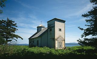
Afognak (; also Agw'aneq in Alutiiq was an Alutiiq village on the island of Afognak in Kodiak Island Borough, Alaska, United States. It was located on Afognak Bay on the southwest coast of the island, three miles north of Kodiak Island. The site is now within the CDP of Aleneva.

<span class="mw-page-title-main">Thoms Place, Wrangell</span> Former census-designated place in Alaska, United States

Thoms Place is a former census-designated place (CDP) on Wrangell Island in the city of Wrangell, Alaska, United States. The population was 22 at the 2000 census, at which time it was an unincorporated part of the former Wrangell-Petersburg Census Area, Alaska. It is now included in the City and Borough of Wrangell, which became a borough on June 1, 2008.

References

  1. 2015 Alaska Municipal Officials Directory. Juneau: Alaska Municipal League. 2015. p. 11.
  2. "2020 U.S. Gazetteer Files". United States Census Bureau. Retrieved October 29, 2021.
  3. 1 2 "Geographic Identifiers: 2010 Demographic Profile Data (DP-1): Aleneva CDP, Alaska". U.S. Census Bureau, American Factfinder. Archived from the original on February 12, 2020. Retrieved March 21, 2013.
  4. "U.S. Decennial Census". Census.gov. Retrieved June 6, 2013.
  5. U.S. Census Bureau. "2000 Census of Population and Housing - Alaska" (PDF). Archived from the original (PDF) on March 18, 2021. Retrieved October 13, 2019.
  6. "U.S. Census website". United States Census Bureau . Retrieved January 31, 2008.