Womens Bay, Alaska

Last updated

Womens Bay, Alaska
USA Alaska location map.svg
Red pog.svg
Womens Bay
Location in Alaska
Coordinates: 57°42′6″N152°34′20″W / 57.70167°N 152.57222°W / 57.70167; -152.57222
CountryUnited States
State Alaska
Borough Kodiak Island
Government
  Borough mayor Jerrol Friend [1]
   State senator Gary Stevens (R)
   State rep. Louise Stutes (R)
Area
[2]
  Total44.04 sq mi (114.07 km2)
  Land43.92 sq mi (113.76 km2)
  Water0.12 sq mi (0.31 km2)
Elevation
1,093 ft (333 m)
Population
 (2020)
  Total743
  Density16.92/sq mi (6.53/km2)
Time zone UTC-9 (Alaska (AKST))
  Summer (DST) UTC-8 (AKDT)
ZIP code
99615 [3]
Area code 907
FIPS code 02-85680
GNIS feature ID1866977

Womens Bay is a census-designated place (CDP) in Kodiak Island Borough, Alaska, United States. At the 2020 census the population was 743, [4] up from 719 in 2010. [5] The name is correctly spelled "Womens", without an apostrophe.

Contents

Geography

Womens Bay is located at 57°42′06″N152°34′20″W / 57.701742°N 152.572270°W / 57.701742; -152.572270 . [6]

According to the United States Census Bureau, the CDP has a total area of 44.0 square miles (114.0 km2), of which 43.9 square miles (113.7 km2) is land and 0.12 square miles (0.3 km2), or 0.28%, is water. [5]

Demographics

Historical population
CensusPop.Note
1990 620
2000 69011.3%
2010 7194.2%
2020 7433.3%
U.S. Decennial Census [7]

Womens Bay first appeared on the 1990 U.S. Census as a census-designated place (CDP).

As of the census [8] of 2000, there were 690 people, 251 households, and 175 families residing in the CDP. The population density was 15.8 inhabitants per square mile (6.1/km2). There were 269 housing units at an average density of 6.2 per square mile (2.4/km2). The racial makeup of the CDP was 85.80% White, 0.58% Black or African American, 6.09% Native American, 1.45% Asian, and 6.09% from two or more races. 1.74% of the population were Hispanic or Latino of any race.

There were 251 households, out of which 40.2% had children under the age of 18 living with them, 57.4% were married couples living together, 8.8% had a female householder with no husband present, and 29.9% were non-families. 23.9% of all households were made up of individuals, and 1.6% had someone living alone who was 65 years of age or older. The average household size was 2.75 and the average family size was 3.28.

In the CDP, the population was spread out, with 30.7% under the age of 18, 6.8% from 18 to 24, 36.1% from 25 to 44, 24.2% from 45 to 64, and 2.2% who were 65 years of age or older. The median age was 35 years. For every 100 females, there were 113.0 males. For every 100 females age 18 and over, there were 116.3 males.

The median income for a household in the CDP was $72,083, and the median income for a family was $71,250. Males had a median income of $49,792 versus $40,605 for females. The per capita income for the CDP was $27,746. None of the population was living below the poverty line.

Related Research Articles

<span class="mw-page-title-main">Twin Hills, Alaska</span> Census-designated place in Alaska, United States

Twin Hills is a census-designated place (CDP) in Dillingham Census Area, Alaska, United States. The population was 74 at the 2010 census, up from 69 in 2000.

<span class="mw-page-title-main">Fox River, Alaska</span> Census-designated place in Alaska, United States

Fox River is a census-designated place (CDP) in Kenai Peninsula Borough, Alaska, United States. At the 2010 census the population was 685, up from 616 in 2000. It was first reported by the U.S. Geological Survey in 1895. The Fox River, which flows by the CDP, might have been named for Theodore Fox, a local mining magnate.

<span class="mw-page-title-main">Nikiski, Alaska</span> Census-designated place in Alaska, United States

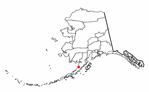
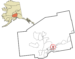
Nikiski is a census-designated place (CDP) in Kenai Peninsula Borough, Alaska, United States. The population was 4,456 at the 2020 census, down from 4,493 in 2010.

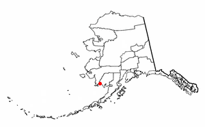
Seldovia Village is a census-designated place (CDP) in Kenai Peninsula Borough, Alaska, United States. At the 2010 census the population was 165, up from 144 in 2000. Seldovia Village is not to be confused with the adjacent city of Seldovia.

<span class="mw-page-title-main">Tyonek, Alaska</span> Census-designated place in Alaska, United States

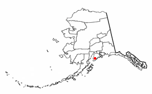
Tyonek or Present / New Tyonek is a census-designated place (CDP) in Kenai Peninsula Borough in the U.S. state of Alaska. As of the 2020 census the population was 152, down from 171 in 2010. In 1973, the community formed the Tyonek Native Corporation (TNC) under the Alaska Native Claims Settlement Act and is federally recognized.

Aleneva is a census-designated place in the Kodiak Island Borough in the U.S. state of Alaska. As of the 2010 census, the population was 37, down from 68 in 2000.

Chiniak is a census-designated place (CDP) in Kodiak Island Borough, Alaska, United States. The population was 47 at the 2010 census, down from 50 in 2000.

<span class="mw-page-title-main">Karluk, Alaska</span> Census-designated place in Alaska, United States

Karluk is a census-designated place (CDP) in Kodiak Borough, Kodiak Island, Alaska, United States. The population was 37 at the 2010 census, up from 27 in 2000.

Kodiak Station is a census-designated place (CDP) in Kodiak Island Borough, Alaska, United States. At the 2020 census the population was 1,673, up from 1,301 in 2010.

Kokhanok is a census-designated place (CDP) in Lake and Peninsula Borough, Alaska, United States. At the 2020 census the population was 152, down from 170 in 2000.

Pope-Vannoy Landing is a census-designated place (CDP) in the Lake and Peninsula Borough in the U.S. state of Alaska. The population was six at the 2020 census, same amount as in 2010.

<span class="mw-page-title-main">Ugashik, Alaska</span> Census-designated place in Alaska, United States

Ugashik is a census-designated place (CDP) in Lake and Peninsula Borough, Alaska, United States. The population was 4 at the 2020 census, down from 12 in 2010.

<span class="mw-page-title-main">Buffalo Soapstone, Alaska</span> CDP in Alaska, United States

Buffalo Soapstone is a census-designated place (CDP) in Matanuska-Susitna Borough, Alaska, United States. It is part of the Anchorage, Alaska Metropolitan Statistical Area. The population was 1,021 at the 2020 census, up from 855 in 2010.

<span class="mw-page-title-main">Sutton-Alpine, Alaska</span> Census-designated place in Alaska, United States

Sutton is a census-designated place (CDP) in the Matanuska-Susitna Borough in the U.S. state of Alaska. At the 2020 census the population was 1,038, down from 1,447 in 2010. The CDP includes the former coal mining community and road construction camp of Sutton, as well as the former mining camps of Eska and Jonesville.

<span class="mw-page-title-main">Port Protection, Alaska</span> CDP in Alaska, United States

Port Protection is a census-designated place (CDP) in Prince of Wales-Hyder Census Area, Alaska, United States. The population was 36 at the 2020 census, down from 48 in 2010 census.

<span class="mw-page-title-main">Cube Cove, Alaska</span> Unincorporated community in the state of Alaska, United States

Cube Cove was an unincorporated community and census-designated place on the northwestern side of Admiralty Island in the Hoonah-Angoon Census Area of the U.S. state of Alaska. The population was 72 at the 2000 United States Census, but it was not included in the 2010 census.

<span class="mw-page-title-main">Hobart Bay, Alaska</span> CDP in Alaska, United States

Hobart Bay is a census-designated place that was located in Hoonah-Angoon Census Area, Alaska during the 2010 United States Census, but is now part of Petersburg Borough. As of the 2010 Census, the population of the CDP was one, down from three in 2000.

<span class="mw-page-title-main">Beaver, Alaska</span> CDP in Alaska, United States

Beaver is a census-designated place (CDP) in Yukon-Koyukuk Census Area, Alaska, United States. At the time of the 2010 census the population was 84, unchanged from 2000, however the 2020 census reported a total population of 48.

<span class="mw-page-title-main">Lake Minchumina, Alaska</span> CDP in Alaska, United States

Lake Minchumina is a census-designated place (CDP) in Yukon-Koyukuk Census Area, Alaska, United States. As of the 2020 census, the population of the CDP is 30.

<span class="mw-page-title-main">New Allakaket, Alaska</span> CDP in Alaska, United States

New Allakaket was a census-designated place (CDP) in Yukon-Koyukuk Census Area, Alaska, United States. The population was 66 at the 2010 census, up from 36 in 2000. In March 2015, neighboring Allakaket annexed New Allakaket.

References

  1. 2015 Alaska Municipal Officials Directory. Juneau: Alaska Municipal League. 2015. p. 11.
  2. "2020 U.S. Gazetteer Files". United States Census Bureau. Retrieved October 29, 2021.
  3. "Womens Bay AK ZIP Code". zipdatamaps.com. 2023. Retrieved February 17, 2023.
  4. "2020 Census Data - Cities and Census Designated Places" (Web). State of Alaska, Department of Labor and Workforce Development. Retrieved October 31, 2021.
  5. 1 2 "Geographic Identifiers: 2010 Demographic Profile Data (DP-1): Womens Bay CDP, Alaska". U.S. Census Bureau, American Factfinder. Archived from the original on February 10, 2020. Retrieved March 21, 2013.
  6. "US Gazetteer files: 2010, 2000, and 1990". United States Census Bureau. February 12, 2011. Retrieved April 23, 2011.
  7. "U.S. Decennial Census". Census.gov. Retrieved June 6, 2013.
  8. "U.S. Census website". United States Census Bureau . Retrieved January 31, 2008.