Skwentna, Alaska

Last updated

Skwentna, Alaska
CDP
Matanuska-Susitna Borough Alaska incorporated and unincorporated areas Skwentna highlighted.svg
Location in Matanuska-Susitna Borough and the state of Alaska.
USA Alaska location map.svg
Red pog.svg
Skwentna, Alaska
Location within the state of Alaska
Coordinates: 61°52′46″N151°15′59″W / 61.87944°N 151.26639°W / 61.87944; -151.26639
CountryUnited States
State Alaska
Borough Matanuska-Susitna
Government
  Borough mayor Edna DeVries
   State senator Mike Shower (R)
   State rep. Kevin McCabe (R)
Area
[1]
  Total445.86 sq mi (1,154.77 km2)
  Land438.61 sq mi (1,136.00 km2)
  Water7.25 sq mi (18.77 km2)
Elevation
144 ft (44 m)
Population
 (2020)
  Total62
  Density0.14/sq mi (0.05/km2)
Time zone UTC-9 (Alaska (AKST))
  Summer (DST) UTC-8 (AKDT)
ZIP code
99667
Area code 907
FIPS code 02-70870
GNIS feature ID1866975

Skwentna is a census-designated place (CDP) on Iditarod Trail in Matanuska-Susitna Borough, Alaska, United States. Located 61 miles northwest of Wasilla along the Skwentna River, it is part of the Anchorage, Alaska Metropolitan Statistical Area. At the 2020 census the population was 62, up from 37 in 2010. [2] The town is served by Skwentna Airport.

Contents

Geography and climate

Skwentna is located at 61°52′46″N151°15′59″W / 61.87944°N 151.26639°W / 61.87944; -151.26639 (61.879482, −151.266455). [3]

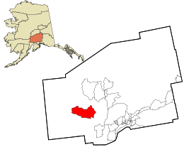
According to the United States Census Bureau, the CDP has a total area of 449.7 square miles (1,165 km2), of which, 442.8 square miles (1,147 km2) of it is land and 6.9 square miles (18 km2) of it (1.54%) is water.

Climate

As with much of South Central Alaska, Skwentna has a dry-summer subarctic climate (Köppen climate classification: Dsc), with long, cold, snowy winters and short, warm summers, although, as is more typical of the Alaska Interior, August averages cooler than June; the town is also located in USDA Plant Hardiness Zone 3, [4] indicating the coldest temperature of the year is typically in the −40 to −30 °F (−40 to −34 °C). In summer, temperatures reach 70 °F (21 °C) on 39 days and 80 °F (27 °C) on 4.6, with an average of 18 nights remaining above 50 °F (10 °C). August through October is the wettest period of the year, while snow typically falls from October to April (rarely May or September), accumulating 119 inches (3.02 m).

Climate data for Skwentna, Alaska, 1991-2020 normals, 1939-2020 extremes: 150ft (46m)
MonthJanFebMarAprMayJunJulAugSepOctNovDecYear
Record high °F (°C)44
(7)
50
(10)
55
(13)
68
(20)
85
(29)
95
(35)
90
(32)
88
(31)
78
(26)
69
(21)
47
(8)
42
(6)
95
(35)
Mean maximum °F (°C)34.8
(1.6)
37.6
(3.1)
46.3
(7.9)
55.6
(13.1)
71.9
(22.2)
79.6
(26.4)
80.7
(27.1)
77.5
(25.3)
66.4
(19.1)
52.6
(11.4)
37.1
(2.8)
34.9
(1.6)
81.5
(27.5)
Mean daily maximum °F (°C)16.8
(−8.4)
25.2
(−3.8)
34.2
(1.2)
46.3
(7.9)
59.6
(15.3)
68.6
(20.3)
70.1
(21.2)
65.9
(18.8)
55.7
(13.2)
41.2
(5.1)
24.4
(−4.2)
19.0
(−7.2)
43.9
(6.6)
Daily mean °F (°C)9.0
(−12.8)
16.1
(−8.8)
22.6
(−5.2)
35.8
(2.1)
47.8
(8.8)
56.7
(13.7)
59.8
(15.4)
56.1
(13.4)
46.7
(8.2)
33.7
(0.9)
17.9
(−7.8)
11.9
(−11.2)
34.5
(1.4)
Mean daily minimum °F (°C)1.3
(−17.1)
7.0
(−13.9)
10.9
(−11.7)
25.3
(−3.7)
36.0
(2.2)
44.8
(7.1)
49.5
(9.7)
46.3
(7.9)
37.7
(3.2)
26.2
(−3.2)
11.4
(−11.4)
4.8
(−15.1)
25.1
(−3.8)
Mean minimum °F (°C)−29.0
(−33.9)
−26.0
(−32.2)
−15.2
(−26.2)
3.9
(−15.6)
24.0
(−4.4)
33.3
(0.7)
38.9
(3.8)
33.8
(1.0)
21.5
(−5.8)
3.7
(−15.7)
−15.9
(−26.6)
−27.3
(−32.9)
−36.5
(−38.1)
Record low °F (°C)−52
(−47)
−53
(−47)
−43
(−42)
−40
(−40)
4
(−16)
28
(−2)
30
(−1)
25
(−4)
−6
(−21)
−19
(−28)
−32
(−36)
−50
(−46)
−53
(−47)
Average precipitation inches (mm)2.31
(59)
2.22
(56)
1.02
(26)
1.06
(27)
1.12
(28)
1.26
(32)
2.24
(57)
3.46
(88)
4.25
(108)
3.21
(82)
2.21
(56)
3.50
(89)
27.86
(708)
Average snowfall inches (cm)18.1
(46)
17.9
(45)
9.6
(24)
6.0
(15)
0.1
(0.25)
0.0
(0.0)
0.0
(0.0)
0.0
(0.0)
0.3
(0.76)
11.2
(28)
22.3
(57)
33.8
(86)
119.3
(302.01)
Average extreme snow depth inches (cm)38.6
(98)
44.7
(114)
42.1
(107)
36.5
(93)
9.1
(23)
0.0
(0.0)
0.0
(0.0)
0.0
(0.0)
0.2
(0.51)
8.1
(21)
18.3
(46)
32.1
(82)
48.5
(123)
Average precipitation days (≥ 0.01 in)8.86.86.25.96.98.310.312.212.610.78.910.8108.4
Average snowy days (≥ 0.1 in)8.05.84.62.90.10.00.00.00.23.67.09.541.7
Source 1: NOAA(1981-2010 precip/snowfall) [5] [6]
Source 2: XMACIS2 (records, 1981-2010 monthly max/mins & snow depth) [7]

Hayes River is a weather station near Skwentna to the northeast, at an elevation of 1000 feet (304.8 m). [8] Hayes River also has a subarctic climate (Köppen Dfc) but has a lower seasonal temperature variation and receives substantially more snow.

Climate data for Hayes River, Alaska, 1991-2020 normals, 1980-2020 extremes: 1000ft (305m)
MonthJanFebMarAprMayJunJulAugSepOctNovDecYear
Record high °F (°C)49
(9)
55
(13)
53
(12)
70
(21)
81
(27)
89
(32)
87
(31)
85
(29)
79
(26)
58
(14)
44
(7)
40
(4)
89
(32)
Mean maximum °F (°C)34.2
(1.2)
38.9
(3.8)
42.1
(5.6)
48.8
(9.3)
64.8
(18.2)
77.3
(25.2)
79.0
(26.1)
75.7
(24.3)
64.9
(18.3)
48.4
(9.1)
36.6
(2.6)
33.7
(0.9)
80.2
(26.8)
Mean daily maximum °F (°C)22.0
(−5.6)
28.2
(−2.1)
34.2
(1.2)
44.9
(7.2)
55.7
(13.2)
67.2
(19.6)
68.9
(20.5)
66.0
(18.9)
56.0
(13.3)
41.0
(5.0)
28.0
(−2.2)
23.2
(−4.9)
44.6
(7.0)
Daily mean °F (°C)13.6
(−10.2)
18.4
(−7.6)
22.2
(−5.4)
34.0
(1.1)
43.8
(6.6)
54.5
(12.5)
58.1
(14.5)
55.4
(13.0)
46.2
(7.9)
32.0
(0.0)
19.8
(−6.8)
14.9
(−9.5)
34.4
(1.3)
Mean daily minimum °F (°C)5.2
(−14.9)
8.6
(−13.0)
10.2
(−12.1)
23.1
(−4.9)
31.8
(−0.1)
41.8
(5.4)
47.3
(8.5)
44.7
(7.1)
36.4
(2.4)
23.0
(−5.0)
11.6
(−11.3)
6.7
(−14.1)
24.2
(−4.3)
Mean minimum °F (°C)−18.2
(−27.9)
−14.2
(−25.7)
−9.2
(−22.9)
1.5
(−16.9)
23.2
(−4.9)
32.2
(0.1)
39.6
(4.2)
33.9
(1.1)
23.2
(−4.9)
5.2
(−14.9)
−8.5
(−22.5)
−14.3
(−25.7)
−21.3
(−29.6)
Record low °F (°C)−34
(−37)
−32
(−36)
−26
(−32)
−21
(−29)
−5
(−21)
28
(−2)
35
(2)
26
(−3)
7
(−14)
−12
(−24)
−25
(−32)
−29
(−34)
−34
(−37)
Average precipitation inches (mm)4.86
(123)
3.12
(79)
1.92
(49)
1.37
(35)
1.23
(31)
1.55
(39)
2.46
(62)
3.57
(91)
4.42
(112)
3.27
(83)
2.92
(74)
4.43
(113)
35.12
(891)
Average snowfall inches (cm)48.1
(122)
33.3
(85)
24.3
(62)
12.4
(31)
1.7
(4.3)
0.0
(0.0)
0.0
(0.0)
0.0
(0.0)
0.6
(1.5)
10.4
(26)
34.1
(87)
57.3
(146)
222.2
(564.8)
Average extreme snow depth inches (cm)59.4
(151)
63.9
(162)
64.1
(163)
57.4
(146)
32.3
(82)
0.9
(2.3)
0.0
(0.0)
0.0
(0.0)
0.9
(2.3)
7.5
(19)
25.8
(66)
46.7
(119)
71.2
(181)
Average precipitation days (≥ 0.01 in)11.19.77.26.67.38.913.514.614.611.411.013.5129.4
Average snowy days (≥ 0.1 in)9.78.55.83.00.70.00.00.00.33.89.312.253.3
Source 1: NOAA(1981-2010 precip/snowfall) [9] [10]
Source 2: XMACIS2 (records, 1981-2010 monthly max/mins & snow depth) [11]

Demographics

Historical population
CensusPop.Note
1950 58
1990 85
2000 11130.6%
2010 37−66.7%
2020 6267.6%
U.S. Decennial Census [12]

Skwentna first appeared on the 1950 U.S. Census as an unincorporated village. It did not appear again until 1990, when it was made a census-designated place (CDP).

As of the census [13] of 2000, there were 111 people, 50 households, and 29 families residing in the CDP. The population density was 0.3 inhabitants per square mile (0.12/km2). There were 360 housing units at an average density of 0.8 per square mile (0.31/km2). The racial makeup of the CDP was 92.79% White, 6.31% Native American, and 0.90% from two or more races.

There were 50 households, out of which 22% had children under the age of 18 living with them, 48% were married couples living together, 6% had a female householder with no husband present, and 42% were non-families. 36% of all households were made up of individuals, and none had someone living alone who was 65 years of age or older. The average household size was 2.22 and the average family size was 2.90.

In the CDP, the population was spread out, with 22.5% under the age of 18, 5.4% from 18 to 24, 23.4% from 25 to 44, 44.1% from 45 to 64, and 4.5% who were 65 years of age or older. The median age was 45 years. For every 100 females, there were 164.3 males. For every 100 females age 18 and over, there were 168.8 males.

The median income for a household in the CDP was $16,250, and the median income for a family was $52,917. Males had a median income of $13,333 versus $18,750 for females. The per capita income for the CDP was $23,994. There were no families and 5.8% of the population living below the poverty line, including no under eighteens and none of those over 64.

Related Research Articles

<span class="mw-page-title-main">Stony River, Alaska</span> Census-designated place in Alaska, United States

Stony River is a census-designated place (CDP) in Bethel Census Area, Alaska, United States. The population was 54 at the 2010 census, down from 61 in 2000.

<span class="mw-page-title-main">Cantwell, Alaska</span> Census-designated place in Alaska, United States

Cantwell is a census-designated place (CDP) in Denali Borough, Alaska, United States. As of the 2020 census, the population of the CDP was 200.

<span class="mw-page-title-main">Two Rivers, Alaska</span> CDP in Alaska, United States

Two Rivers is a census-designated place (CDP) in Fairbanks North Star Borough, Alaska, United States. It lies between mile 13 and mile 25 on the Chena Hot Springs Road, northeast of Fairbanks. As of the 2010 United States Census, the CDP had a population of 719, up from 482 in 2000.

<span class="mw-page-title-main">Beluga, Alaska</span> Census-designated place in Alaska, United States

Beluga is a census-designated place (CDP) in Kenai Peninsula Borough, Alaska, United States. The population was 20 at the 2010 census, down from 32 in 2000.

<span class="mw-page-title-main">Cohoe, Alaska</span> Census-designated place in Alaska, United States

Cohoe (Dena'ina: Qughuhnaz’ut) is a census-designated place (CDP) in Kenai Peninsula Borough, Alaska, United States. At the 2010 census the population was 1,364, up from 1,168 in 2000.

<span class="mw-page-title-main">Nikolaevsk, Alaska</span> Census-designated place in Alaska, United States

Nikolaevsk is a census-designated place (CDP) in Kenai Peninsula Borough in the U.S. state of Alaska. As of the 2020 census, the population of the CDP is 328, up from 318 in 2010. Nikolaevsk School serves school-age children from the area.

<span class="mw-page-title-main">Tyonek, Alaska</span> Census-designated place in Alaska, United States

Tyonek or Present / New Tyonek is a census-designated place (CDP) in Kenai Peninsula Borough in the U.S. state of Alaska. As of the 2020 census the population was 152, down from 171 in 2010. In 1973, the community formed the Tyonek Native Corporation (TNC) under the Alaska Native Claims Settlement Act and is federally recognized.

<span class="mw-page-title-main">Lake Louise, Alaska</span> Census-designated place in Alaska, United States

Lake Louise is a census-designated place (CDP) in Matanuska-Susitna Borough, Alaska, United States. Although it is an isolated settlement and is close to Glennallen, it is considered part of the Anchorage Metropolitan Area, like all other locations in the Mat-Su Borough. At the 2020 census the population was 15, down from 46 in 2010 and 88 in 2000.

<span class="mw-page-title-main">Sutton-Alpine, Alaska</span> Census-designated place in Alaska, United States

Sutton is a census-designated place (CDP) in the Matanuska-Susitna Borough in the U.S. state of Alaska. At the 2020 census the population was 1,038, down from 1,447 in 2010. The CDP includes the former coal mining community and road construction camp of Sutton, as well as the former mining camps of Eska and Jonesville.

<span class="mw-page-title-main">Willow, Alaska</span> CDP in Alaska, United States

Willow is a census-designated place (CDP) in the Matanuska-Susitna Borough in the U.S. state of Alaska. Located 26 miles northwest from Wasilla along the George Parks Highway, it is part of the Anchorage, Alaska Metropolitan Statistical Area. At the 2020 census the population was 2,196, up from 2,102 in 2010.

<span class="mw-page-title-main">Kobuk, Alaska</span> City in Alaska, United States

Kobuk is a city in Northwest Arctic Borough, Alaska, United States. At the 2010 census the population was 151, up from 109 in 2000.

<span class="mw-page-title-main">Big Delta, Alaska</span> CDP in Alaska, United States

Big Delta is a census-designated place (CDP) in Southeast Fairbanks Census Area, Alaska, United States. The population was 591 at the 2010 census, down from 749 in 2000. Big Delta is at the confluence of the Delta River and the Tanana River and gets its name from the huge river delta formed by the confluence.

<span class="mw-page-title-main">Gulkana, Alaska</span> CDP in Alaska, United States

Gulkana is a census-designated place (CDP) in Copper River Census Area, Alaska, U.S. At the 2020 census the population was 110, down from 119 in 2010. It also has an airport.

Nelchina is a census-designated place (CDP) in Copper River Census Area, Alaska, United States. The population was 45 at the 2020 census, down from 59 in 2010.

Paxson is a census-designated place (CDP) in Copper River Census Area, Alaska, United States. As of the 2020 census, its population was 26, down from 40 in 2010. It is located on the Richardson Highway at the junction with the Denali Highway.

<span class="mw-page-title-main">Central, Alaska</span> CDP in Alaska, United States

Central is a census-designated place (CDP) in Yukon-Koyukuk Census Area, Alaska, United States. At the 2010 census the population was 96, down from 134 in 2000. Every February, Central hosts a checkpoint for the long-distance Yukon Quest sled dog race.

<span class="mw-page-title-main">Evansville, Alaska</span> CDP in Alaska, United States

Evansville is a census-designated place (CDP) in Yukon-Koyukuk Census Area, Alaska, United States. The population was 15 at the 2010 census, down from 28 in 2000. The community is adjacent to Bettles. The community is named after Wilford Evans, Sr, who took part in the founding of Bettles Lodge.

<span class="mw-page-title-main">Manley Hot Springs, Alaska</span> CDP in Alaska, United States

Manley Hot Springs is a census-designated place (CDP) in Yukon-Koyukuk Census Area, Alaska, United States. At the 2020 census the population was 169, up from 89 in 2010.

<span class="mw-page-title-main">Easton, Washington</span> Census-designated place in Washington, United States

Easton is an unincorporated community and census-designated place (CDP) in Kittitas County, Washington, United States. The population was 478 at the 2010 census. Easton is the annual site of the start/finish line for the Cascade Crest 100-mile ultra-running race.

<span class="mw-page-title-main">Powder River, Wyoming</span> Census-designated place in Wyoming, United States

Powder River is a census-designated place (CDP) in Natrona County, Wyoming, United States. It is part of the Casper, Wyoming Metropolitan Statistical Area. The population was 30 in the 2020 census and 44 in the 2010 census.

References

  1. "2020 U.S. Gazetteer Files". United States Census Bureau. Retrieved October 29, 2021.
  2. "2020 Census Data - Cities and Census Designated Places" (Web). State of Alaska, Department of Labor and Workforce Development. Retrieved October 31, 2021.
  3. "US Gazetteer files: 2010, 2000, and 1990". United States Census Bureau. February 12, 2011. Retrieved April 23, 2011.
  4. "Arbor Day Foundation - Buy trees, rain forest friendly coffee, greeting cards that plant trees, memorials and celebrations with trees, and more".
  5. "Skwentna, Alaska 1991-2020 Monthly Normals" . Retrieved January 21, 2024.
  6. "Skwentna, Alaska 1981-2010 Monthly Normals" . Retrieved January 21, 2024.
  7. "xmACIS". National Oceanic and Atmospheric Administration. Retrieved January 17, 2024.
  8. "Station Details - HAYES RIVER, AK US". NOAA. Retrieved January 21, 2024.
  9. "Hayes River, Alaska 1991-2020 Monthly Normals" . Retrieved January 21, 2024.
  10. "Hayes River, Alaska 1981-2010 Monthly Normals" . Retrieved January 21, 2024.
  11. "xmACIS". National Oceanic and Atmospheric Administration. Retrieved January 21, 2024.
  12. "U.S. Decennial Census". Census.gov. Retrieved June 6, 2013.
  13. "U.S. Census website". United States Census Bureau . Retrieved January 31, 2008.