Chase, Alaska

Last updated

Chase, Alaska
CDP
Matanuska-Susitna Borough Alaska incorporated and unincorporated areas Chase highlighted.svg
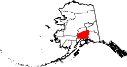
Location in Matanuska-Susitna Borough and the state of Alaska.
USA Alaska location map.svg
Red pog.svg
Chase, Alaska
Location within the state of Alaska
Coordinates: 62°25′20″N150°4′39″W / 62.42222°N 150.07750°W / 62.42222; -150.07750
Country United States
State Alaska
Borough Matanuska-Susitna
Government
  Borough mayor Edna DeVries
   State senator Mike Shower (R)
   State rep. Kevin McCabe (R)
Area
[1]
  Total169.46 sq mi (438.91 km2)
  Land168.76 sq mi (437.08 km2)
  Water0.71 sq mi (1.83 km2)
Elevation
545 ft (166 m)
Population
 (2020)
  Total19
  Density0.11/sq mi (0.04/km2)
Time zone UTC-9 (Alaska (AKST))
  Summer (DST) UTC-8 (AKDT)
Area code 907
FIPS code 02-12350
GNIS feature ID1866934

Chase is a census-designated place (CDP) in Matanuska-Susitna Borough, Alaska, United States. Located 9.2 miles north from Talkeetna, it is part of the Anchorage, Alaska Metropolitan Statistical Area. The population was 19 at the 2020 census, down from 34 in 2010. [2]

Contents

Geography

Chase is located at 62°25′20″N150°4′39″W / 62.42222°N 150.07750°W / 62.42222; -150.07750 (62.422316, -150.077553). [3]

According to the United States Census Bureau, the CDP has a total area of 93.5 square miles (242 km2), of which, 92.9 square miles (241 km2) of it is land and 0.6 square miles (1.6 km2) of it 0.66% is water.

Demographics

Historical population
CensusPop.Note
1990 38
2000 417.9%
2010 34−17.1%
2020 19−44.1%
U.S. Decennial Census [4]

Chase first appeared on the 1990 U.S. Census as a census-designated place (CDP). [5]

As of the census [6] of 2000, there were 41 people, 21 households, and 9 families residing in the CDP. The population density at that time was 0.4 per square mile (0.15/km2). There were 90 housing units at an average density of 1 per square mile (0.39/km2). The racial makeup of the CDP was 100.00% White.

There were 21 households, out of which 14.3% had children under the age of 18 living with them, 42.9% were married couples living together, 4.8% had a female householder with no husband present, and 52.4% were non-families. 42.9% of all households were made up of individuals, and 9.5% had someone living alone who was 65 years of age or older. The average household size was 1.95 and the average family size was 2.70.

In the CDP, the population was spread out, with 17.1% under the age of 18, 2.4% from 18 to 24, 17.1% from 25 to 44, 56.1% from 45 to 64, and 7.3% who were 65 years of age or older. The median age was 47 years. For every 100 females, there were 156.3 males. For every 100 females age 18 and over, there were 183.3 males.

The median income for a household in the CDP was $16,250, and the median income for a family was $0. Males had a median income of $0 versus $0 for females. The per capita income for the CDP was $16,000. There were no families and none of the population living below the poverty line, including no under eighteens and none of those over 64.

Related Research Articles

<span class="mw-page-title-main">Tuluksak, Alaska</span> CDP in Alaska, United States

Tuluksak is a census-designated place (CDP) in Bethel Census Area, Alaska, United States. At the 2010 census the population was 373, down from 428 in 2000.

<span class="mw-page-title-main">Fox River, Alaska</span> Census-designated place in Alaska, United States

Fox River is a census-designated place (CDP) in Kenai Peninsula Borough, Alaska, United States. At the 2010 census the population was 685, up from 616 in 2000. It was first reported by the U.S. Geological Survey in 1895. The Fox River, which flows by the CDP, might have been named for Theodore Fox, a local mining magnate.

<span class="mw-page-title-main">Funny River, Alaska</span> Census-designated place in Alaska, United States

Funny River is a census-designated place (CDP) in Kenai Peninsula Borough, Alaska, United States. At the 2010 census the population was 877, up from 636 in 2000.

<span class="mw-page-title-main">Kasilof, Alaska</span> Census-designated place in Alaska, United States

Kasilof is a census-designated place (CDP) in Kenai Peninsula Borough, Alaska, United States. At the 2020 census the population was 525, down from 549 in 2010.

Ridgeway is a census-designated place (CDP) in Kenai Peninsula Borough, Alaska, United States. At the 2020 census the population was 2,136, up from 2,022 in 2010.

<span class="mw-page-title-main">Sterling, Alaska</span> Census-designated place in Alaska, United States

Sterling is a census-designated place (CDP) in Kenai Peninsula Borough, Alaska, United States. At the 2020 census the population was 5,918, up from 5,617 in 2010. Sterling is the tenth-most populated CDP in Alaska.

<span class="mw-page-title-main">Petersville, Alaska</span> Census-designated place in Alaska, United States

Petersville is a census-designated place (CDP) in Matanuska-Susitna Borough, Alaska, United States. It is part of the Anchorage Metropolitan Area. The population was 27 at the 2020 census.

<span class="mw-page-title-main">Susitna, Alaska</span> Census-designated place in Alaska, United States

Susitna is a census-designated place (CDP) in Matanuska-Susitna Borough, Alaska, United States. It is part of the Anchorage Metropolitan Area. As of the 2020 census, the population of the CDP was 11.

<span class="mw-page-title-main">Tanaina, Alaska</span> CDP in Alaska, United States

Tanaina is a census-designated place (CDP) in the Matanuska-Susitna Borough in the U.S. state of Alaska. Located 4 miles north from Wasilla, it is part of the Anchorage, Alaska Metropolitan Statistical Area. At the 2020 census the population was 8,817, up from 8,197 in 2010. Tanaina is the sixth-most populated CDP in Alaska.

<span class="mw-page-title-main">Trapper Creek, Alaska</span> Census-designated place in Alaska, United States

Trapper Creek is a census-designated place (CDP) in Matanuska-Susitna Borough, Alaska, United States. It is part of the Anchorage Metropolitan Area and is known as the southern gateway to Denali State Park. According to the 2020 census the population of Trapper Creek was 499.

<span class="mw-page-title-main">Alcan Border, Alaska</span> Census-designated place in Alaska, United States

Alcan Border, also known as Port Alcan, is a census-designated place in the Southeast Fairbanks Census Area in the U.S. state of Alaska. Part of the Unorganized Borough, Alcan Border is the site of the Alcan - Beaver Creek Border Crossing, the main U.S. port of entry for persons arriving in Alaska by road. The population was 33 at the 2010 census, up from 21 in 2000.

<span class="mw-page-title-main">Northway Village, Alaska</span> CDP in Alaska, United States

Northway Village was a census-designated place (CDP) in Southeast Fairbanks Census Area, Alaska, United States. It was merged with Northway CDP prior to the 2020 Census. The population was 98 at the 2010 census, down from 107 in 2000.

Copperville is an unincorporated community and former census-designated place in the Copper River Census Area of the U.S. state of Alaska. The population was 179 at the 2000 United States Census, but it was consolidated into the Tazlina CDP as of the 2010 census.

<span class="mw-page-title-main">Mendeltna, Alaska</span> CDP in Alaska, United States

Mendeltna is a census-designated place (CDP) in Copper River Census Area, Alaska, United States. The population was 36 at the 2020 census, down from 39 in 2010.

<span class="mw-page-title-main">Mentasta Lake, Alaska</span> CDP in Alaska, United States

Mentasta Lake is a census-designated place (CDP) in Copper River Census Area, Alaska, United States. At the 2010 census the population was 112, down from 142 in 2000.

Silver Springs is a census-designated place (CDP) in Copper River Census Area, Alaska, United States. At the 2020 census the population was 111, down from 114 in 2010.

Tolsona is a census-designated place (CDP) in Copper River Census Area, Alaska, United States. The population was 12 at the 2020 census, down from 30 in 2010.

<span class="mw-page-title-main">Livengood, Alaska</span> CDP in Alaska, United States

Livengood is a census-designated place (CDP) in Yukon-Koyukuk Census Area, Alaska, United States. The population was 16 at the 2020 census, compared to 13 in 2010 and 29 in 2000.

<span class="mw-page-title-main">Rampart, Alaska</span> CDP in Alaska, United States

Rampart is a census-designated place (CDP) in Yukon-Koyukuk Census Area, Alaska, United States. The population was 24 at the 2010 census, down from 45 in 2000.

<span class="mw-page-title-main">Takotna, Alaska</span> Census-designated place in Alaska, United States

Takotna(Tochotno’) IPA:[tʰot͡ʃʰoʔno] in Upper Kuskokwim) is a census-designated place (CDP) in the Yukon-Koyukuk Census Area, Alaska, United States. The population was 52 as of the 2010 Census, an increase of 4% from 50 at the 2000 Census.

References

  1. "2020 U.S. Gazetteer Files". United States Census Bureau. Retrieved October 29, 2021.
  2. "2020 Census Data - Cities and Census Designated Places" (Web). State of Alaska, Department of Labor and Workforce Development. Retrieved October 31, 2021.
  3. "US Gazetteer files: 2010, 2000, and 1990". United States Census Bureau. February 12, 2011. Retrieved April 23, 2011.
  4. "U.S. Decennial Census". Census.gov. Retrieved June 6, 2013.
  5. "1990 Census of Population and Housing - Summary Social, Economic, and Housing Characteristics - Alaska" (PDF). United States Census Bureau. Archived from the original (PDF) on February 23, 2014.
  6. "U.S. Census website". United States Census Bureau . Retrieved January 31, 2008.