List of places in East Renfrewshire

Last updated

Map of places in East Renfrewshire compiled from this list
See the list of places in Scotland for places in other counties.

This is a list of articles about places/areas in the East Renfrewshire council area of Scotland.

Contents

B

C

E

G

N

P

S

T

U

W

See also


Related Research Articles

East Renfrewshire Council area of Scotland

East Renfrewshire is one of 32 council areas of Scotland. Until 1975, it formed part of the county of Renfrewshire for local government purposes along with the modern council areas of Renfrewshire and Inverclyde. Although no longer a local authority area, Renfrewshire still remains the registration county and lieutenancy area of East Renfrewshire.

This armorial of sovereign states shows the coat of arms, national emblem, or seal for every sovereign state. Although some countries do not have an official national emblem, unofficial emblems which are de facto used as national emblems are also shown below.

St Ninians High School, Giffnock Secondary school in Giffnock, East Renfrewshire, Scotland

St Ninian's High School is a six-year co-educational Roman Catholic state high school in Giffnock, East Renfrewshire, Scotland. The school, which opened in 1984, serves Giffnock, Clarkston, Thornliebank, Newton Mearns, Eaglesham, Netherlee, Waterfoot, Netherplace, Millhall and Busby in East Renfrewshire. The school roll was 1,714 as of September 2005, and the Head Teacher is Gerry O’Neil. The school's motto is "Floreat Iuventus" which translates as "Let youth Flourish".

Netherlee Human settlement in Scotland

Netherlee is a suburban residential area in East Renfrewshire, Scotland. It is situated on the west bank of the White Cart Water about 4 miles (6.5 km) south of Glasgow city centre. Part of the Greater Glasgow conurbation, it is mostly contiguous with the city, and is just beyond the boundary of its local authority area. It is a separate census locality from Glasgow, like other areas such as neighbouring Giffnock and Clarkston. Netherlee is directly contiguous with Stamperland. It is also in a council ward with Clarkston and its neighbour Busby. As of 2012, Netherlee has a population of 4,550.

Muirend Human settlement in Scotland

Muirend is an area on the South side of the city of Glasgow, Scotland. It is situated about 4 miles (6.5 km) south of Glasgow city centre. Muirend became extensively urbanised in the 20th century, developing into an affluent commuter suburb. In a 2014 Royal Mail survey, the G44 postcode – which includes Muirend – was rated as the most desirable area of Scotland to live in. Neighbouring areas include Cathcart, Merrylee and Newlands in Glasgow, and Netherlee and Giffnock in East Renfrewshire. Some buildings that are locally associated with Muirend, including the main row of shops, as well as Hazelden Park and Muirend Pavilion, are located in East Renfrewshire.

Eastwood (Scottish Parliament constituency) Scottish Parliament constituency

Eastwood is a constituency of the Scottish Parliament (Holyrood) covering part of the council area of East Renfrewshire. It elects one Member of the Scottish Parliament (MSP) by the first past the post method of election. It is also one of ten constituencies in the West Scotland electoral region, which elects seven additional members, in addition to the ten constituency MSPs, to produce a form of proportional representation for the region as a whole.
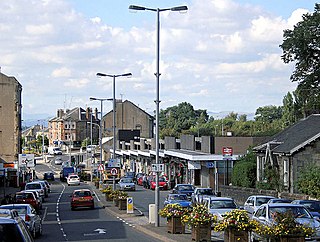
Clarkston, East Renfrewshire Human settlement in Scotland

Clarkston is a suburban town in East Renfrewshire, in the Central Lowlands of Scotland. A dormitory town with a population of around 10,000, Clarkston is on the southern fringe of the Greater Glasgow conurbation and directly adjoins the neighbouring suburban villages of Busby and Netherlee, as well as the towns of Newton Mearns and Giffnock.

2017 East Renfrewshire Council election

The 2017 East Renfrewshire Council elections took place on 4 May 2017 to elect members of East Renfrewshire Council.

Millhall is a hamlet in East Renfrewshire, in the Central Lowlands of Scotland. It lies 0.8 miles (1.3 km) southeast of Eaglesham, 8.3 miles (13.4 km) northwest of Strathaven and 3.6 miles (5.8 km) southwest of East Kilbride.