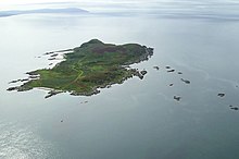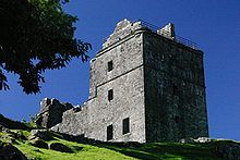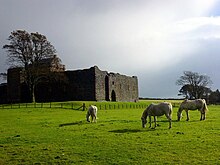
Argyll and Bute is one of 32 unitary council areas in Scotland and a lieutenancy area. The current lord-lieutenant for Argyll and Bute is Jane Margaret MacLeod. The administrative centre for the council area is in Lochgilphead at Kilmory Castle, a 19th-century Gothic Revival building and estate. The current council leader is Councillor Jim Lynch.

Dunoon is the main town on the Cowal Peninsula in the south of Argyll and Bute, west of Scotland. It is located on the western shore of the upper Firth of Clyde, to the south of the Holy Loch and to the north of Innellan. As well as forming part of the council area of Argyll and Bute, Dunoon also has its own community council. Dunoon was a burgh until 1976.
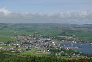
Campbeltown is a town and former royal burgh in Argyll and Bute, Scotland. It lies by Campbeltown Loch on the Kintyre Peninsula. Campbeltown became an important centre for Scotch whisky, and a busy fishing port.

The County of Bute, also known as Buteshire, is a historic county and registration county of Scotland.
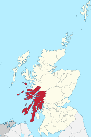
Argyll, sometimes called Argyllshire, is a historic county and registration county of western Scotland.

Kintyre is a peninsula in western Scotland, in the southwest of Argyll and Bute. The peninsula stretches about 30 miles, from the Mull of Kintyre in the south to East and West Loch Tarbert in the north. The region immediately north of Kintyre is known as Knapdale.

The A83 is a major road in the south of Argyll and Bute, Scotland, running from Tarbet, on the western shore of Loch Lomond, where it splits from the A82, to Campbeltown at the southern end of the Kintyre peninsula. The road is best known for its section across the Rest and be Thankful pass through the Arrochar Alps between the heads of Loch Long and Loch Fyne.
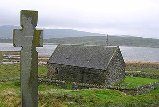
Knapdale forms a rural district of Argyll and Bute in the Scottish Highlands, adjoining Kintyre to the south, and divided from the rest of Argyll to the north by the Crinan Canal. It includes two parishes, North Knapdale and South Knapdale. The area is bounded by sea to the east and west, whilst the sea loch of West Loch Tarbert almost completely cuts off the area from Kintyre to the south. The name is derived from two Gaelic elements: Cnap meaning hill and Dall meaning field.
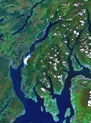
Cowal is a rugged peninsula in Argyll and Bute, on the west coast of Scotland. It is connected to the mainland to the north, and is bounded by Loch Fyne to the west, by Loch Long and the Firth of Clyde to the east, and by the Kyles of Bute to the south.

Loch Long is a body of water in the council area of Argyll and Bute, Scotland. The Sea Loch extends from the Firth of Clyde at its southwestern end. It measures approximately 20 miles in length, with a width of between one and two miles. The loch also has an arm, Loch Goil, on its western side.

Loch Fyne, is a sea loch off the Firth of Clyde and forms part of the coast of the Cowal Peninsula. Located on the west coast of Argyll and Bute, west of Scotland. It extends 65 kilometres (40 mi) inland from the Sound of Bute, making it the longest of the sea lochs in Scotland. It is connected to the Sound of Jura by the Crinan Canal. Although there is no evidence that grapes have grown there, the title is probably honorific, indicating that the river, Abhainn Fìne, was a well-respected river.

Tarbert is a village in the west of Scotland, in the Argyll and Bute council area. It is built around East Loch Tarbert, an inlet of Loch Fyne, and extends over the isthmus which links the peninsula of Kintyre to Knapdale and West Loch Tarbert. Tarbert had a recorded population of 1,338 in the 2001 Census.

Tarbet is a small village in Argyll and Bute, Scotland. Located within the Loch Lomond and The Trossachs National Park.

Strachur and Strathlachlan are united parishes located on the Cowal Peninsula, in Argyll and Bute, west of Scotland. Strachur is a small village on the eastern coast of Loch Fyne.
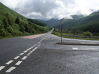
The A815 is a major road located on the Cowal peninsula, in Argyll and Bute, Scotland. It runs for about 35.7 miles (57.5 km) from the A83, near Cairndow, in the north to Toward in the south. It passes beside three lochs, while its final stretch is along the Firth of Clyde.

West Coast Motors is a bus, coach and ferry operator, based in Campbeltown, Scotland. The company also operates under the name Borders Buses in the Scottish Borders and formerly under the Glasgow Citybus brand in Greater Glasgow.

Rosneath Peninsula is a peninsula in Argyll and Bute, western Scotland, formerly in the historic county of Dunbartonshire. The peninsula is formed by the Gare Loch in the east, and Loch Long in the west, both merge with the upper Firth of Clyde.

The Loch Lomond and Cowal Way is a waymarked footpath through the Cowal Peninsula, in Argyll and Bute, between Portavadie on Cowal and Inveruglas on Loch Lomond side. It was formerly known as the Cowal Way, but was renamed in December 2018 to reflect the fact that half of the route lies with the Loch Lomond and The Trossachs National Park. The way is 92 kilometres (57 mi) long, and is suitable for both walkers and mountain bikers. Much of the route is also suitable for experienced horseriders, although in some places steps, narrow footbridges and gates may restrict access for horses. A review to identify these obstacles and suggest alternative routes and/or remedial measures was undertaken in 2016.


