
Orkney, also known as the Orkney Islands, is an archipelago in the Northern Isles off the north coast of Scotland. Orkney is 10 miles (16 km) north of Caithness and has about 70 islands, of which 20 are inhabited. The largest island, the Mainland, has an area of 523 square kilometres (202 sq mi), making it the sixth-largest Scottish island and the tenth-largest island in the British Isles. Orkney's largest settlement, and also its administrative centre, is Kirkwall.
Firth is a word in the English and Scots languages used to denote various coastal waters in the United Kingdom, predominantly within Scotland. In the Northern Isles, it more often refers to a smaller inlet. It is linguistically cognate to fjord, which has a more constrained sense in English. Bodies of water named "firths" tend to be more common on the Scottish east coast, or in the southwest of the country, although the Firth of Clyde is an exception to this. The Highland coast contains numerous estuaries, straits, and inlets of a similar kind, but not called "firth" ; instead, these are often called sea lochs. Before about 1850, the spelling "Frith" was more common.

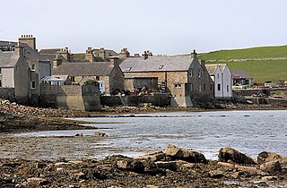
The Mainland, also known as Hrossey and Pomona, is the main island of Orkney, Scotland. Both of Orkney's burghs, Kirkwall and Stromness, lie on the island, which is also the heart of Orkney's ferry and air connections.

Sanday is one of the inhabited islands of Orkney that lies off the north coast of mainland Scotland. With an area of 50.43 km2 (19.5 sq mi), it is the third largest of the Orkney Islands. The main centres of population are Lady Village and Kettletoft. Sanday can be reached by Orkney Ferries or by plane from Kirkwall on the Orkney Mainland. On Sanday, an on-demand public minibus service allows connecting to the ferry.

Stronsay is an island in Orkney, Scotland. It is known as Orkney's 'Island of Bays', owing to an irregular shape with miles of coastline, with three large bays separated by two isthmuses: St Catherine's Bay to the west, the Bay of Holland to the south and Mill Bay to the east. Stronsay is 3,275 hectares in area, and 44 metres in altitude at its highest point. It has a usually resident population of 349. The main village is Whitehall, home to a heritage centre.

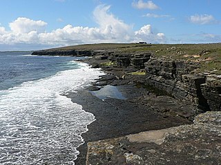
Eday is one of the islands of Orkney, which are located to the north of the Scottish mainland. One of the North Isles, Eday is about 24 kilometres from the Orkney Mainland. With an area of 27 km2 (10 sq mi), it is the ninth-largest island of the archipelago. The bedrock of the island is Old Red Sandstone, which is exposed along the sea-cliffs.
South Ronaldsay is one of the Orkney Islands off the north coast of Scotland. It is linked to the Orkney Mainland by the Churchill Barriers, running via Burray, Glimps Holm and Lamb Holm.
Papa Westray, also known as Papay, is one of the Orkney Islands in Scotland, United Kingdom. The fertile soil has long been a draw to the island.

The Bishop of Orkney was the ecclesiastical head of the Diocese of Orkney, one of thirteen medieval bishoprics of Scotland. It included both Orkney and Shetland. It was based for almost all of its history at St Magnus Cathedral, Kirkwall.

Prehistoric Orkney refers only to the prehistory of the Orkney archipelago of Scotland that begins with human occupation. Although some records referring to Orkney survive that were written during the Roman invasions of Scotland, “prehistory” in northern Scotland is defined as lasting until the start of Scotland's Early Historic Period.
Coastal fortifications in Scotland played a vital role during the World Wars, protecting shipping as they mustered to convoy. New fortifications were built and old defences were also rebuilt or strengthened around the Scottish coast in case of invasion. New technologies like Radar were also deployed.
This page is based on this
Wikipedia article Text is available under the
CC BY-SA 4.0 license; additional terms may apply.
Images, videos and audio are available under their respective licenses.


