North Ronaldsay

Last updated • 5 min readFrom Wikipedia, The Free Encyclopedia

North Ronaldsay
Scottish Gaelic nameRaghnallsaigh a Tuath
Scots nameNorth Ronalshee [1]
Old Norse nameRínansey [2]
Meaning of nameOld Norse, possibly "Ringa's Isle" [3]
Garso, North Ronaldsay - geograph.org.uk - 341429.jpg
A view of the house and loch at Garso on North Ronaldsay, with the lighthouse in the distance
Location
Orkney Islands UK relief location map.jpg
Red pog.svg
North Ronaldsay
North Ronaldsay shown within Orkney
OS grid reference HY759542
Coordinates 59°22′N2°25′W / 59.37°N 2.42°W / 59.37; -2.42
Physical geography
Island group Orkney
Area690 hectares (2.7 sq mi) [3]
Area rank64 [4]
Highest elevation20 metres (66 ft) [3]
Administration
Sovereign state United Kingdom
Country Scotland
Council area Orkney Islands
Demographics
Population72 [5]
Population rank50 [4]
Population density10.4 people/km2 [3] [5]
Largest settlementHollandstoun
Lymphad3.svg
References [6] [7]

North Ronaldsay ( /ˈrɒnəlts/ , also /ˈrɒnəldz/ , Scots : North Ronalshee) is the northernmost island in the Orkney archipelago of Scotland. With an area of 690 hectares (2.7 sq mi), it is the fourteenth-largest. [8] It is mentioned in the Orkneyinga saga ; in modern times it is known for its historic lighthouse, migratory bird life and unusual breed of sheep.

Contents

Name

The name comes from the Norse Rinansey, meaning the island of St Ninian. By the 1300s the name was being confused with Rognvaldsey, the island of St Ronald, in the south of Orkney that they were named North Ronaldsay and South Ronaldsay to distinguish them from the other. [9]

Geography

North Ronaldsay lies around 4 kilometres (2.5 mi) north of its nearest neighbour, Sanday, at grid reference HY759542 . It is around 5 kilometres (3.1 mi) long and is defined by two large sandy bays; Linklet Bay on the eastern shoreline and South Bay at the south. The west of the island is very rocky, with many skerries. North Ronaldsay is low-lying and exposed; its climate is extremely changeable and frequently inclement. The surrounding waters are stormy and treacherous, and have been a notorious "graveyard" for ships (hence the unusually early provision of a lighthouse on the island).

Hollandstoun at the south of the island is the most sizable settlement; it lies roughly equidistant from the airfield and the pier. North Ronaldsay is also home to a bird observatory.

A 1.8 m (6 ft) dry stone dyke has been built to surround the island, the purpose of which is to keep the seaweed-eating local sheep off the arable land. [10]

History

Blaeu's Atlas of Scotland, published 1654 North Ronaldshay Blaeu - Atlas of Scotland 1654.jpg
Blaeu's Atlas of Scotland, published 1654

A well-preserved Iron Age broch, known as the Broch of Burrian, is located on the southern tip of the island. [11] Excavations in 1870–71 uncovered a large number of Iron Age and Pictish artefacts, with occupation continuing up to the Norse occupation of the Orkney islands in the 9th century. [11]

According to the Orkneyinga saga , Torf-Einarr, the 10th-century Norse Earl of Orkney, killed Hálfdan Longlegs on North Ronaldsay in revenge for Hálfdan and his brother Gudrød Ljome's slaying of Rögnvald Eysteinsson, Torf-Einarr's father. Hálfdan and Gudrød, who were the sons of King Harald Finehair of Norway, had trapped Rögnvald in his house and set it alight. Harald, apparently appalled by his sons' actions, overthrew Gudrød and restored Rögnvald's lands to his son, Thorir Rögnvaldarson, while Hálfdan fled westwards to Orkney and displaced Torf-Einarr. From a base in Caithness, Torf-Einarr resisted Hálfdan's occupation of the islands. After a battle at sea, and a ruthless campaign on land, Torf-Einarr spied Hálfdan hiding on North Ronaldsay. The sagas claim that Hálfdan was captured, and sacrificed to Odin as a blood-eagle. [12] [13]

The Joseph of King's Lynn was wrecked on Bride's Ness beach in April 1586. The crew salvaged the brass guns but they were confiscated by the Earl of Orkney. [14]

Holland House was built in 1727; the Old Beacon, dating from 1789, was the third lighthouse to be built by Thomas Smith for the Commissioners of the Northern Lights.

Overview of population trends: [15]

Year178717911811184118811891193119611981199120012011
Population384 [16] 420384 [17] 481547501298161109927072 [5]

Transport

Flights from North Ronaldsay Airport link the island with Kirkwall on the Orkney Mainland, as does a weekly ferry operated by Orkney Ferries. In the summer there are ferries on Tuesdays and Fridays. Flights are subsidized to £36 return, or £21 return for those who stay for at least one night.

Economy

The unique local sheep, which eat seaweed North ron sheep.jpg
The unique local sheep, which eat seaweed

The main industries on the island are crofting and sheep farming, where unique North Ronaldsay sheep are mostly farmed collectively. Tourism also plays an important role. The island has a population of 60, roughly half of whom are descended from native islanders, and new islanders who have come to live there. There is great interest in attracting new families with young children in order to keep the school open.

Wildlife

The main purpose of the island's bird observatory, established in 1987, is to conduct long-term monitoring of bird populations and migration. North Ronaldsay is well known as one of the best birdwatching sites in the country during the spring and autumn migration periods. The quantity and variety of birds that can be seen at these times is often spectacular. [18]

The great auk (Alca impennis) was a North Atlantic flightless bird about the size of a goose; it became extinct in 1844. North Ronaldsay was one habitat for the great auk which was quite abundant until then. At one Neolithic site, great auk bones make up nearly 14% of bird bones. [19]

North Ronaldsay was also a habitat for the Atlantic walrus through the mid-16th century. [20]

Lighthouse

Old Beacon

Dennis Head, in the northeast of the island, is home to a historic lighthouse known as the Old Beacon. The light was first established in 1789 by Thomas Smith. It was to be the first of many island lighthouses for Smith (he had previously worked on the lights at Kinnaird Head and Mull of Kintyre). Smith received assistance with the North Ronaldsay light from his stepson Robert Stevenson, and from Ezekiel Walker.

In 1809, with the construction of other nearby lighthouses, it was decided that the North Ronaldsay light was no longer required, and it was extinguished. The round stone tower was retained as a sea-mark, however, and the original beacon chamber at the top replaced by a vaulted roof, capped by a remarkable ball finial. The stone spiral staircase which once led to the beacon was demolished. The original keepers' houses, roofless but largely complete, survive below the tower. In 2006, it was one of the neglected buildings selected for the TV series Restoration .

Modern lighthouse

A new lighthouse was built nearby just 43 years later in 1852. The modern lighthouse lies at the north of the island at Point of Sinsoss, and boasts Britain's tallest land-based lighthouse tower. The old fog siren with notable red trumpet was replaced by an electric diaphragm-type horn. That horn was discontinued in favour of a Tyfon horn consisting of 8 mini-trumpets installed on the building that once housed the fog siren. The Tyfon horn gives three blasts every 60 seconds. The electric beeper horn now lies flat on the ground next to the fog signal building. The fog signal is still in service today.

Education

The community has a single school, North Ronaldsay Primary School. It had a single student until July 2017, when its sole student graduated. Various organizations use the school building. [21]

See also

Notes

  1. "Map of Scotland in Scots - Guide and gazetteer" (PDF).
  2. Anderson (1873) pdf p. 176
  3. 1 2 3 4 Haswell-Smith (2004) p. 400
  4. 1 2 Area and population ranks: there are c.300 islands over 20ha in extent and 93 permanently inhabited islands were listed in the 2011 census.
  5. 1 2 3 National Records of Scotland (15 August 2013). "Appendix 2: Population and households on Scotland's Inhabited Islands" (PDF). Statistical Bulletin: 2011 Census: First Results on Population and Household Estimates for Scotland Release 1C (Part Two) (PDF) (Report). SG/2013/126. Retrieved 14 August 2020.
  6. Orkney Placenames Orkneyjar. Retrieved 28 August 2013.
  7. Ordnance Survey: Landranger map sheet 5 Orkney (Northern Isles) (Map). Ordnance Survey. 2008. ISBN   9780319228111.
  8. Haswell-Smith (2004) p. 334
  9. Schei, Liv Kjørsvik (2000). The islands of Orkney. Internet Archive. Grantown-on-Spey, Scotland : Colin Baxter. ISBN   978-1-84107-064-3.
  10. Booth, David; Perrott, David (1981). The Shell Book of the Islands of Britain. London: Guideway Publishing. p. 34. ISBN   0 7112 0087 4.
  11. 1 2 "Site Record for North Ronaldsay, Broch Of Burrian Burrian Broch; Strom Ness; Stromness; Burrian Brough". RCAHMS . Retrieved 4 September 2014.
  12. Pálsson and Edwards (1981) Chapter 8. "Troublemakers from Norway". pp. 29-33.
  13. Heimskringla, Harald Harfager's saga, chapters 30 and 31.
  14. William Boyd, Calendar State Papers Scotland, vol. 8 (Edinburgh, 1914), p. 354 no. 383.
  15. Haswell-Smith (2004) p. 400 unless otherwise stated
  16. Statistical Account of Scotland, 1791
  17. Ordnance Gazetteer of Scotland, Frances Groome, 1884
  18. Haswell-Smith (2004) pp. 400-02
  19. Searjeantson, Dale (2001). "The Great Auk and the Gannet: a Prehistoric Perspective on the Extinction of the Great Auk". International Journal of Osteoarchaeology. 11 (1–2): 43–55. doi:10.1002/oa.545.
  20. "Trichecodon huxlei (Mammalia: Odobenidae) in the Pleistocene of southeastern United States". Bulletin of the Museum of Comparative Zoology. 122: 129–142.
  21. "North Ronaldsay Primary School loses its only pupil". BBC News. BBC. 28 July 2017. Retrieved 30 July 2017.

Related Research Articles

<i>Orkneyinga saga</i> Scandinavian-Scottish literary work

The Orkneyinga saga is a narrative of the history of the Orkney and Shetland islands and their relationship with other local polities, particularly Norway and Scotland. The saga has "no parallel in the social and literary record of Scotland" and is "the only medieval chronicle to have Orkney as the central place of action". The main focus of the work is the line of jarls who ruled the Earldom of Orkney, which constituted the Norðreyjar or Northern Isles of Orkney and Shetland and there are frequent references to both archipelagoes throughout.

Rognvald Eysteinsson was the founding Jarl of Møre in Norway, and a close relative and ally of Harald Fairhair, the earliest known King of Norway. In the Norse language he is known as Rǫgnvaldr Eysteinsson (Mǿrajarl) and in modern Norwegian as Ragnvald Mørejarl. He is sometimes referred to with bynames that may be translated into modern English as "Rognvald the Wise" or "Rognvald the Powerful".

<span class="mw-page-title-main">Earl of Orkney</span> Norwegian, then Scottish, noble title over the Northern Isles and northern Scotland

Earl of Orkney, historically Jarl of Orkney, is a title of nobility encompassing the archipelagoes of Orkney and Shetland, which comprise the Northern Isles of Scotland. Originally founded by Norse invaders, the status of the rulers of the Northern Isles as Norwegian vassals was formalised in 1195. Although the Old Norse term jarl is etymologically related to "earl", and the jarls were succeeded by earls in the late 15th century, a Norwegian jarl is not the same thing. In the Norse context the distinction between jarls and kings did not become significant until the late 11th century and the early jarls would therefore have had considerable independence of action until that time. The position of Jarl of Orkney was eventually the most senior rank in medieval Norway except for the king himself.

<span class="mw-page-title-main">Bressay</span> Island in the Shetland Islands of Scotland

Bressay is a populated island in the Shetland archipelago of Scotland.

<span class="mw-page-title-main">South Ronaldsay</span> Island in southeast Orkney, Scotland, UK

South Ronaldsay is one of the Orkney Islands off the north coast of Scotland. It is linked to the Orkney Mainland by the Churchill Barriers, running via Burray, Glimps Holm and Lamb Holm.

<span class="mw-page-title-main">Auskerry</span>

Auskerry is a small island in eastern Orkney, Scotland. It lies in the North Sea south of Stronsay and has a lighthouse, completed in 1866.

<span class="mw-page-title-main">Papa Stronsay</span> Island in Orkney, Scotland

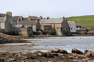
Papa Stronsay is a small island in Orkney, Scotland, lying north east of Stronsay. It is 74 hectares in size, and 13 metres (43 ft) above sea level at its highest point. After being largely abandoned, the island was bought at the end of the 20th century by traditionalist Catholic monks of the Sons of the Most Holy Redeemer, who operate a monastery and farm there.

Einarr Rognvaldarson, often referred to by his byname Torf-Einarr, was one of the Norse earls of Orkney. The son of the Norse jarl Rognvald Eysteinsson and a concubine, his rise to power is related in sagas which apparently draw on verses of Einarr's own composition for inspiration. After battling for control of the Northern Isles of Scotland and a struggle with Norwegian royalty, Einarr founded a dynasty which retained control of the islands for centuries after his death.

Thorfinn Torf-Einarsson also known as Thorfinn Skull-splitter was a 10th-century Earl of Orkney. He appears in the Orkneyinga saga and briefly in St Olaf's Saga, as incorporated into the Heimskringla. These stories were first written down in Iceland in the early 13th century and much of the information they contain is "hard to corroborate".

<span class="mw-page-title-main">Earldom of Orkney</span> Medieval Norse earldom

The Earldom of Orkney was a Norse territory ruled by the earls of Orkney from the ninth century until 1472. It was founded during the Viking Age by Viking raiders and settlers from Scandinavia. In the ninth and tenth centuries it covered the Northern Isles (Norðreyjar) of Orkney and Shetland, as well as Caithness and Sutherland on the mainland. It was a dependent territory of the Kingdom of Norway until 1472, when it was absorbed into the Kingdom of Scotland. Originally, the title of Jarl or Earl of Orkney was heritable.

Sigurd Hlodvirsson, popularly known as Sigurd the Stout from the Old Norse Sigurðr digri, was an Earl of Orkney. The main sources for his life are the Norse Sagas, which were first written down some two centuries or more after his death. These engaging stories must therefore be treated with caution rather than as reliable historical documents.

<span class="mw-page-title-main">Rögnvald Kali Kolsson</span> Earl of Orkney

Rögnvald Kali Kolsson, also known as Saint Ronald of Orkney, was a Norwegian earl of Orkney who came to be regarded as a Christian saint. Two of the Orkney Islands are named after Rögnvald, namely North Ronaldsay and South Ronaldsay.

<span class="mw-page-title-main">Harald Maddadsson</span> Earl of Orkney and Mormaer of Caithness

Harald Maddadsson was Earl of Orkney and Mormaer of Caithness from 1139 until 1206. He was the son of Matad, Mormaer of Atholl, and Margaret, daughter of Earl Haakon Paulsson of Orkney. Of mixed Norse and Gaelic blood, and a descendant of Scots kings, he was a significant figure in northern Scotland, and played a prominent part in Scottish politics of the twelfth century. The Orkneyinga Saga names him one of the three most powerful Earls of Orkney along with Sigurd Eysteinsson and Thorfinn Sigurdsson.

<span class="mw-page-title-main">Sigurd Eysteinsson</span> Norse Jarl of Orkney

Sigurd Eysteinsson, or Sigurd the Mighty, was the second Earl of Orkney—a title bequeathed to Sigurd by his brother Rognvald Eysteinsson. A son of Eystein Glumra, Sigurd was a leader in the Viking conquest of what is now northern Scotland.

Tarbat Ness is headland that lies at the end of the Tarbat peninsula in Easter Ross, Scotland. The name is from the Gaelic tairbeart meaning "isthmus" and the Old Norse ness, meaning "headland". It lies at the south of the entrance to the Dornoch Firth.

<span class="mw-page-title-main">Helliar Holm</span> Uninhabited tidal island off the coast of Shapinsay in the Orkney Islands, Scotland

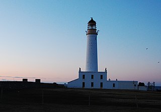
Helliar Holm is an uninhabited island off the coast of Shapinsay in the Orkney Islands, Scotland. It is home to a 42-foot-tall (13 m) lighthouse, which was built in 1893 and automated in 1967. It is a tidal island that used to be connected to Shapinsay. It is still possible to walk across from the mainland during very low tides.

<span class="mw-page-title-main">Earls of Møre</span> Dynasty of noblemen in Norway

The Earls of Møre were a dynasty of powerful noblemen in Norway dating to the unification of Norway in the 9th century. The first earl of Møre was Rognvald Eysteinsson, a close friend and ally of King Harald I of Norway. He is called by the byname Rognvald Mørejarl in the Heimskringla and Orkneyinga saga.

Halfdan Long-Leg was a Viking-Age warrior who lived in the latter half of the 9th century. He was the son of King Harald Fairhair and a Sami woman named Snæfrithr Svásadottir.

Thórir 'the Silent' Rǫgnvaldsson was a ninth-century Viking and the second Jarl of Møre.

<span class="mw-page-title-main">North Ronaldsay Lighthouse</span> Lighthouse

North Ronaldsay Lighthouse was built in 1852 on the island of North Ronaldsay in the Orkney Islands, Scotland, 43 years after Dennis Head Old Beacon was deactivated. It lies at the north of the island at Point of Sinsoss , and boasts Britain's tallest land-based lighthouse tower. The old fog siren with notable red trumpet was replaced by an electric diaphragm-type horn. That horn was discontinued in favour of a Tyfon horn consisting of 8 mini-trumpets installed on the building that once housed the fog siren. The Tyfon horn gives three blasts every 60 seconds. The electric beeper horn now lies flat on the ground next to the fog signal building, and is still in service today.

References