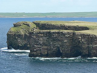
Rousay is a small, hilly island about 3 km (1.9 mi) north of Mainland, the largest island in the Orkney Islands of Scotland. It has been nicknamed "Egypt of the north", due to its archaeological diversity and importance.

The Orkneyinga saga is a narrative of the history of the Orkney and Shetland islands and their relationship with other local polities, particularly Norway and Scotland. The saga has "no parallel in the social and literary record of Scotland" and is "the only medieval chronicle to have Orkney as the central place of action". The main focus of the work is the line of jarls who ruled the Earldom of Orkney, which constituted the Norðreyjar or Northern Isles of Orkney and Shetland and there are frequent references to both archipelagoes throughout.

Saint Magnus Erlendsson, Earl of Orkney, sometimes known as Magnus the Martyr, was Earl of Orkney from 1106 to about 1117.

The Brough of Birsay is an uninhabited tidal island off the north-west coast of The Mainland of Orkney, Scotland, in the parish of Birsay. It is located around 13 miles north of Stromness and features the remains of Pictish and Norse settlements as well as a modern lighthouse.

Bressay is a populated island in the Shetland archipelago of Scotland.

East Burra is one of the Scalloway Islands, a subgroup of the Shetland Islands in Scotland. It is connected by a bridge to West Burra.

Wyre is one of the Orkney Islands, lying south-east of Rousay. It is 311 hectares (1.20 sq mi) and 32 metres (105 ft) at its highest point. It is one of the smallest inhabited islands in the archipelago.

North Ronaldsay is the northernmost island in the Orkney archipelago of Scotland. With an area of 690 hectares (2.7 sq mi), it is the fourteenth-largest. It is mentioned in the Orkneyinga saga; in modern times it is known for its historic lighthouse, migratory bird life and unusual breed of sheep.

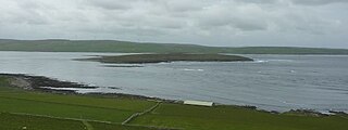
Eynhallow is a small, presently uninhabited island in Eynhallow Sound, between Rousay and the Mainland of Orkney, off the north coast of mainland Scotland. It is 75 hectares in area. There is an unnamed skerry about 100 metres to the north-east of the island, separated by Fint Sound. Sheep Skerry adjoins the southern end of the island.

The Calf of Eday is an uninhabited island in Orkney, Scotland, lying north east of Eday. It is known for its wildlife and its prehistoric ruins.

Graemsay is an island in the western approaches to Scapa Flow, in the Orkney Islands of Scotland. The island has two lighthouses. Graemsay lies within the parish of Stromness.

Fara is a small island in Orkney, Scotland, lying in Scapa Flow between the islands of Flotta and Hoy. It has been uninhabited since the 1960s.

Papa Stronsay is a small island in Orkney, Scotland, lying north east of Stronsay. It is 74 hectares in size, and 13 metres (43 ft) above sea level at its highest point. After being largely abandoned, the island was bought at the end of the 20th century by traditionalist Catholic monks of the Sons of the Most Holy Redeemer, who operate a monastery and farm there.

The Earldom of Orkney was a Norse territory ruled by the earls of Orkney from the ninth century until 1472. It was founded during the Viking Age by Viking raiders and settlers from Scandinavia. In the ninth and tenth centuries it covered the Northern Isles (Norðreyjar) of Orkney and Shetland, as well as Caithness and Sutherland on the mainland. It was a dependent territory of the Kingdom of Norway until 1472, when it was absorbed into the Kingdom of Scotland. Originally, the title of Jarl or Earl of Orkney was heritable.

Gairsay is a small island in Orkney, Scotland, located in the parish of Rendall, 1.5 miles (2.4 km) off the coast, astride one of the approaches to the bays of Firth and Kirkwall. It is about 2 miles (3.2 km) long and 1 mile (1.6 km) wide and includes one conical hill and a small harbour called Millburn Bay, which is sheltered by the peninsula known as the Hen of Gairsay.
Haakon Paulsson was a Norwegian jarl who ruled the earldom of Orkney together with his cousin Magnus Erlendsson from 1105 to 1123. Their lives and times are recounted in the Orkneyinga saga, which was first written down in the early 13th century by an unknown Icelandic author.

Kili Holm is a tidal island in the Orkney Islands, linked to Egilsay. Unusually, like its neighbour Egilsay, it may have a partly Gaelic etymology, in this case from cille meaning a monk's cell. This may make it another “Papey” or island of the papar or culdees.

Rendall is a parish on Mainland, Orkney, Scotland. It is in the north west of the island and lies east of the parishes of Birsay and Evie and north east of Harray. The island of Gairsay is also in the parish.

St Magnus Church is a ruined medieval round-tower church located on the island of Egilsay, in Orkney, Scotland. The site is recognized as the place of execution of Saint Magnus Erlendsson, Earl of Orkney, in the 12th century. The roofless structure dates back to the 12th century, and has been described by Historic Environment Scotland (HES) as second only to St Magnus Cathedral, Kirkwall, as a surviving Norse church in Scotland.
Helga Moddansdóttir was the mistress of Haakon Paulsson who was Earl of Orkney from 1105 to 1123.


