Braeswick | |
---|---|
Sanday Light Railway, formerly Britain's most northerly passenger carrying railway, in Braeswick | |
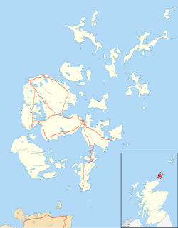
Location within Orkney | |
OS grid reference | HY608369 |
Civil parish | |
Council area | |
Lieutenancy area | |
Country | Scotland |
Sovereign state | United Kingdom |
Post town | ORKNEY |
Postcode district | KW17 |
Dialling code | 01856 |
Police | Scotland |
Fire | Scottish |
Ambulance | Scottish |
UK Parliament | |
Scottish Parliament | |
Braeswick is a settlement on the island of Sanday, in Orkney, Scotland. The settlement is within the parish of Cross and Burness, [1] and is situated on the B9070. [2]
Orkney, also known as the Orkney Islands, is an archipelago in the Northern Isles of Scotland, situated off the north coast of the island of Great Britain. Orkney is 10 miles (16 km) north of the coast of Caithness and has about 70 islands, of which 20 are inhabited. The largest island, Mainland, is often referred to as "the Mainland", and has an area of 523 square kilometres (202 sq mi), making it the sixth-largest Scottish island and the tenth-largest island in the British Isles. Orkney’s largest settlement, and also its administrative centre, is Kirkwall.
Sanday may refer to:
Sanday is one of the inhabited islands of Orkney that lies off the north coast of mainland Scotland. With an area of 50.43 km2 (19.5 sq mi), it is the third largest of the Orkney Islands. The main centres of population are Lady Village and Kettletoft. Sanday can be reached by Orkney Ferries or by plane from Kirkwall on the Orkney Mainland. On Sanday, an on-demand public minibus service allows connecting to the ferry.
Stronsay is an island in Orkney, Scotland. It is known as Orkney's 'Island of Bays', owing to an irregular shape with miles of coastline, with three large bays separated by two isthmuses: St Catherine's Bay to the west, the Bay of Holland to the south and Mill Bay to the east. Stronsay is 3,275 hectares in area, and 44 metres in altitude at its highest point. It has a usually resident population of 349. The main village is Whitehall, home to a heritage centre.
Unstan ware is the name used by archaeologists for a type of finely made and decorated Neolithic pottery from the 4th and 3rd millennia BC. Typical are elegant and distinctive shallow bowls with a band of grooved patterning below the rim, a type of decoration which was created using a technique known as "stab-and-drag". A second version consists of undecorated, round-bottomed bowls. Some of the bowls had bits of volcanic rock included in the clay to make them stronger. Bone tools were used to burnish the surfaces to make them shiny and impermeable.
The Bishop of Orkney was the ecclesiastical head of the Diocese of Orkney, one of thirteen medieval bishoprics of Scotland. It included both Orkney and Shetland. It was based for almost all of its history at St Magnus Cathedral, Kirkwall.
Orcadians are the indigenous inhabitants of the Orkney islands of Scotland. Historically, they are descended from the Picts, Norse, and Scots.
The Orkney vole is a population of the common vole found in the Orkney Islands, off the northern coast of Scotland, as well as in the Channel Island of Guernsey. Orkney voles are about 10% larger than voles from other populations of the common vole. The common vole is absent from the rest of the British Isles.
Sanday Airport is located 20 NM north northeast of Kirkwall Airport on Sanday, Orkney Islands, Scotland.
Broughtown is a village on the island of Sanday, in Orkney, Scotland. The settlement is within the parish of Cross and Burness. Sanday Airport is adjacent to the eastern side of the village and Kettletoft is to the south. The B9068 road runs south to north, through Broughtown, connecting Kettletoft with Scar. Meanwhile, the B9070 road runs south-west from Broughtown, and south beyond Braeswick, to the Sanday ferry terminal at Spur Ness.
Otterswick on the island of Yell in the Shetland Islands, on the inlet of Otters Wick. It is on the east side of the island. There is also an "Otterswick" on Sanday in the Orkney Islands.
Prehistoric Orkney refers only to the prehistory of the Orkney archipelago of Scotland that begins with human occupation. Although some records referring to Orkney survive that were written during the Roman invasions of Scotland, “prehistory” in northern Scotland is defined as lasting until the start of Scotland’s Early Historic Period (around AD 600.
The Quoyness chambered cairn is located on Sanday in Orkney, Scotland. It is approximately 5,000 years old and is located on the shoreside.
The Scar boat burial is a Viking boat burial near the village of Scar, on Sanday, in Orkney, Scotland. The burial, which dates to between 875 and 950 AD, contained the remains of a man, an elderly woman, and a child, along with numerous grave goods. Although the site had to be excavated quickly because of the threat of coastal erosion owing to bad weather conditions, it yielded many important finds.
The Eday Group is a Devonian lithostratigraphic group in Orkney, northern Scotland. The name is derived from the island of Eday where the strata are exposed in coastal cliffs.
Kettletoft is a settlement on the island of Sanday in Orkney, Scotland. The B9068 road runs from Kettletoft to Scar and the B9069 from Kettletoft to Northwall. Kettletoft pier, including the slipway, is a B listed building and was inscribed on 16 September 1999.
Scar is a village and farm complex on the island of Sanday in Orkney, Scotland. The B9068 road runs from Scar to Kettletoft. The Scar boat burial was found at the Crook Beach in 1985 and discovered in September 1991. Scar House, former windmill and former water mill are B listed buildings.
Wikimedia Commons has media related to Braeswick . |