Backaland

Last updated

Backaland
Farm overlooking Bay of Backaland, Eday. - geograph.org.uk - 531449.jpg
A farm overlooking the Bay of Backaland, Eday
Orkney Islands UK location map.svg
Red pog.svg
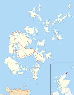
Backaland
Location within Orkney
OS grid reference HY565302
Civil parish
Council area
Lieutenancy area
Country Scotland
Sovereign state United Kingdom
Post town ORKNEY
Postcode district KW17
Dialling code 01856
Police Scotland
Fire Scottish
Ambulance Scottish
UK Parliament
Scottish Parliament
List of places
UK
Scotland
59°09′25″N2°45′32″W / 59.157°N 2.759°W / 59.157; -2.759

Backaland is a settlement on the island of Eday in Orkney, Scotland. The settlement is also within the parish of Eday, [1] and it is located to the south west of the island. [2] Backaland is situated at the southern end of the B9063. [3]

Related Research Articles

<span class="mw-page-title-main">Chambered cairn</span> Burial monument (Usually Neolithic)

A chambered cairn is a burial monument, usually constructed during the Neolithic, consisting of a sizeable chamber around and over which a cairn of stones was constructed. Some chambered cairns are also passage-graves. They are found throughout Britain and Ireland, with the largest number in Scotland.

<span class="mw-page-title-main">Orkney</span> Archipelago, county and council area in northern Scotland

Orkney, also known as the Orkney Islands, is an archipelago in the Northern Isles of Scotland, situated off the north coast of the island of Great Britain. Orkney is 10 miles (16 km) north of the coast of Caithness and has about 70 islands, of which 20 are inhabited. The largest island, the Mainland, has an area of 523 square kilometres (202 sq mi), making it the sixth-largest Scottish island and the tenth-largest island in the British Isles. Orkney's largest settlement, and also its administrative centre, is Kirkwall.

<span class="mw-page-title-main">Menhir</span> Large upright standing stone

A menhir, standing stone, orthostat, or lith is a large upright stone, emplaced in the ground by humans, typically dating from the European middle Bronze Age. They can be found individually as monoliths, or as part of a group of similar stones. Menhirs' size can vary considerably, but they often taper toward the top.

<span class="mw-page-title-main">Stronsay</span>

Stronsay is an island in Orkney, Scotland. It is known as Orkney's 'Island of Bays', owing to an irregular shape with miles of coastline, with three large bays separated by two isthmuses: St Catherine's Bay to the west, the Bay of Holland to the south and Mill Bay to the east. Stronsay is 3,275 hectares in area, and 44 metres in altitude at its highest point. It has a usually resident population of 349. The main village is Whitehall, home to a heritage centre.

<span class="mw-page-title-main">Eday</span> Island in the Orkney Islands, Scotland

Eday is one of the islands of Orkney, which are located to the north of the Scottish mainland. One of the North Isles, Eday is about 24 kilometres from the Orkney Mainland. With an area of 27 km2 (10 sq mi), it is the ninth-largest island of the archipelago. The bedrock of the island is Old Red Sandstone, which is exposed along the sea-cliffs.

<span class="mw-page-title-main">Calf of Eday</span>

The Calf of Eday is an uninhabited island in Orkney, Scotland, lying north east of Eday. It is known for its wildlife and its prehistoric ruins.

<span class="mw-page-title-main">Aith</span> Human settlement in Scotland

Aith,, is a village on the Northern coast of the West Shetland Mainland, Scotland at the southern end of Aith Voe, some 21 miles west of Lerwick.

<span class="mw-page-title-main">Eday Airport</span> Airport in Eday, Orkney

Eday London Airport is located on Eday in Orkney, Scotland. As it is close to the Bay of London it is known locally as just London Airport. The Bay of London may have been so called because of puffins breeding there: Old Norse lundi = "puffin", Old Norse á Lundunum = "at the puffins".

Mochrum is a coastal civil and Church of Scotland parish situated to the east of Luce Bay on the Machars peninsula and 8 miles (13 km) southwest of Wigtown and in the historical county of Wigtownshire in Galloway, Scotland. It covers 22,000 acres (8,900 ha) and is approximately 10 miles (16 km) in length and 5 miles (8.0 km) in breadth. The parish contains the eponymous village of Mochrum, as well as Port William and the clachan of Elrig.

<span class="mw-page-title-main">Cava, Orkney</span>

Cava is an uninhabited island in the Orkney archipelago in Scotland. It is 107 hectares (0.41 sq mi) in extent and rises to 38 metres (125 ft) above sea level. The literal meaning of the name is calf island, a terminology often used to designate a small island near to a larger one. Cava is unusual in that it includes a small peninsula joined to the main body of the island by a narrow isthmus, which is in turn called Calf of Cava.

<span class="mw-page-title-main">Bimbister</span> Human settlement in Scotland

Bimbister is a village on the Orkney Islands, Scotland. The A986 is the main road through the village. The Bronze Age cemetery, the Knowes of Trotty, which includes twelve surviving burial mounds, lies to the east of the village. Bimbister is within the parish of Birsay and Harray.

<span class="mw-page-title-main">Prehistoric Orkney</span> Overview of the prehistoric period on the Orkney Islands, Scotland

Prehistoric Orkney refers only to the prehistory of the Orkney archipelago of Scotland that begins with human occupation. Although some records referring to Orkney survive that were written during the Roman invasions of Scotland, “prehistory” in northern Scotland is defined as lasting until the start of Scotland's Early Historic Period.

<span class="mw-page-title-main">Geology of Orkney</span>

The geology of the Orkney islands in northern Scotland is dominated by the Devonian age Old Red Sandstone (ORS). In the southwestern part of Mainland, this sequence can be seen to rest unconformably on a Moinian type metamorphic basement.

<span class="mw-page-title-main">Eyre, Skye</span> Human settlement in Scotland

Eyre is a settlement on the eastern shore of Loch Snizort Beag on the northern coast of Skye in Scotland.

<span class="mw-page-title-main">Eday Group</span> Group in Orkney Islands, Scotland, UK

The Eday Group is a Devonian lithostratigraphic group in Orkney, northern Scotland. The name is derived from the island of Eday where the strata are exposed in coastal cliffs.

<span class="mw-page-title-main">Hoxa, Orkney</span> Human settlement in Scotland

Hoxa is a small settlement on the island of South Ronaldsay in the Orkney Islands north of mainland Scotland. Hoxa is located 1+14 miles (2.0 km) west of St Margaret's Hope at the end of the B9043 road.

<span class="mw-page-title-main">Vinquoy chambered cairn</span> Neolithic chambered cairn on Eday in the islands of Orkney

Vinquoy chambered cairn is a Neolithic chambered cairn located on the island of Eday, in Orkney, Scotland. The tomb probably dates to the early third millennium BC, and is similar in design to Maeshowe Neolithic tomb found on Mainland Orkney. Historic Environment Scotland established the site as a scheduled monument in 1936.

References

  1. "Details of Backaland". Gazetteer for Scotland . Retrieved 1 January 2015.
  2. "Get-a-map". Ordnance Survey. Archived from the original on 27 July 2015. Retrieved 26 February 2012.
  3. "B9063". Sabre. Retrieved 1 January 2015.