List of rock formations of New Zealand

Last updated

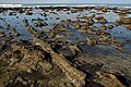
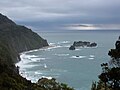
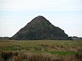
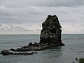
This is a list of rock formations in New Zealand based on their aesthetic and cultural importance. New Zealand's geomorphology is formed through an interaction between uplift, erosion and the underlying rock type. Most of the notable examples listed here are formed by selective erosion, for example waves and rivers can more easily erode sandstone than basalt and can also exploit joints or faults in the rock-mass. [1] Some rocks like limestone (Waitomo Caves) and marble (Takaka Hill) can also be dissolved in water which forms a distinctive karst geomorphology. Notable rock formations are also formed through constructive processes such as geothermal and volcanic deposits, and sedimentary deposition.

Contents

North Island formations

PhotoFormationRegionTypeSummaryLocation
Cape Kidnappers from south.jpg
Cape Kidnappers Hawke's BayWave erosion, sea stack 39°38′51″S177°05′12″E / 39.647473°S 177.086699°E / -39.647473; 177.086699
Castle Craig Hill.jpg
Castle Craig Rock WaikatoTerrestrial erosion 38°15′35″S174°49′15″E / 38.25972°S 174.82083°E / -38.25972; 174.82083
Castlepoint, Wellington Region, New Zealand (18).JPG
Castlepoint Wellington, WairarapaWave erosion 40°53′55″S176°13′14″E / 40.89861°S 176.22056°E / -40.89861; 176.22056
Cathedral Cove, Coromandel.JPG
Cathedral Cove Waikato, Coromandel PeninsulaWave erosion, cave, sea stack 36°49′42″S175°47′24″E / 36.82833°S 175.79000°E / -36.82833; 175.79000
St Paul, Whangaroa.JPG
The Dome of Saint Paul Northland, WhangaroaTerrestrial erosion, igneous rock 35°03′03″S173°44′59″E / 35.050731°S 173.749623°E / -35.050731; 173.749623
Hole In The Rock In Bay Of Islands.jpg
Hole in the RockNorthland, Piercy Island Wave erosion, Natural archLimestone island with a natural arch. Significant tourist attraction. 35°09′56″S174°20′21″E / 35.165437°S 174.339061°E / -35.165437; 174.339061
Wairere boulders2.jpg
Horeke basalts, Wairere Boulders NorthlandTerrestrial erosion, igneous rockLava flow broken up as lower strata removed by erosion. Notable corrugation on basalt boulders. [2] 35°22′29″S173°35′47″E / 35.374687°S 173.596301°E / -35.374687; 173.596301
Kupe's Sail-20070331.jpg
Kupe's Sail Wellington, Wairarapa, Palliser BayA dipping bed of slightly more resistant rock protruding above weaker rock. 41°36′16″N175°15′58″E / 41.60448°N 175.26616°E / 41.60448; 175.26616
Koutu boulder4.jpg
Koutu Boulders NorthlandWave erosion 35°27′29″S173°24′53″E / 35.458139°S 173.414767°E / -35.458139; 173.414767
Lion Rock, Piha.png
Lion Rock Auckland, PihaWave erosion, sea stackProminent islet with shear cliffs of volcanic conglomerate 36°57′13″S174°27′57″E / 36.953685°S 174.465880°E / -36.953685; 174.465880
Bottom rock arch of Mangapohue Natural Bridge over Mangapohue Stream.jpg
Mangapohue Natural Bridge WaikatoTerrestrial erosion, karst 38°15′40″S174°53′57″E / 38.261043°S 174.899301°E / -38.261043; 174.899301
Coromandel-natural vase.JPG
Natural Vase [ citation needed ]Wave erosion
Orakei Korako.jpg
Orakei Korako (including Golden Fleece Terrace and Rainbow Terrace)Bay of PlentyGeothermalGeothermal terraces formed by minerals precipitating as the water cools. 38°28′25″S176°08′55″E / 38.47361°S 176.14861°E / -38.47361; 176.14861
Pink and White Terraces, New Zealand; terraced thermal pools Wellcome V0038492.jpg
Pink and White Terraces Bay of Plenty, Mount TaraweraGeothermalSignificant geothermal terraces formed by minerals precipitating as the water cools.These terraces were thought destroyed by the 1886 eruption of Mount Tarawera, however they may have just been buried. [3] 38°15′40″S176°25′50″E / 38.26111°S 176.43056°E / -38.26111; 176.43056
The Pinnacles (New Zealand).jpg
The Pinnacles Waikato, Coromandel PeninsulaTerrestrial erosion, volcanic rockAndesite lava spires preserved when the weaker neighbouring pyroclastic rocks were eroded. [4] 37°02′36″S175°43′34″E / 37.043223°S 175.726249°E / -37.043223; 175.726249
Cathedral Rocks, Ruapehu, New Zealand 21.JPG
Pinnacle Ridge and Cathedral RocksWanganui-Manawatu, Mount RuapehuTerrestrial erosion, volcanic rockRock spires of andesite near summit of Mount Ruapehu. 39°14′30″S175°34′00″E / 39.24167°S 175.56667°E / -39.24167; 175.56667
Rock arch at Archway Island.jpg
Poor Knights Islands NorthlandWave erosion, natural arch 35°30′S174°45′E / 35.500°S 174.750°E / -35.500; 174.750
Afternoon view over Putangirua Pinnacles area.jpg
Putangirua Pinnacles Wellington, WairarapaTerrestrial erosion, sedimentary rock 41°27′05″S175°13′20″E / 41.45139°S 175.22222°E / -41.45139; 175.22222
Te Kaukau Point Wellington, WairarapaWave erosion 41°34′20″S175°25′50″E / 41.57222°S 175.43056°E / -41.57222; 175.43056
Three Sisters and Elephant Rock [5] TaranakiWave erosion, sea stacks and natural archNotable for their well documented partial destruction from wave erosion. 38°49′11″S174°34′51″E / 38.819608°S 174.580815°E / -38.819608; 174.580815
Hot spring at Warbrick Terrace.jpg
Waimangu Volcanic Rift Valley (including Cathedral Rocks and Warbrick Terrace)Bay of PlentyGeothermal 38°17′10″S176°23′15″E / 38.28611°S 176.38750°E / -38.28611; 176.38750
Limestone rock formations at Waro, 1923 ATLIB 300303.png
Waro Limestone Reserve Northland, HikurangiTerrestrial erosion, sedimentary rock 35°35′15″S174°17′10″E / 35.58750°S 174.28611°E / -35.58750; 174.28611
Young Nick's Head from Kaiti Beach.jpg
Young Nick's Head GisborneWave erosion 38°45′25″S177°57′50″E / 38.75694°S 177.96389°E / -38.75694; 177.96389

South Island formations

PhotoFormationRegionTypeSummaryLocation
Blackhead, Dunedin, New Zealand.jpg
Blackhead Otago, DunedinWave erosion, volcanic rock and sea stacksRock spires with basaltic columnar jointing 45°55′50″S170°26′00″E / 45.93056°S 170.43333°E / -45.93056; 170.43333
Start of Boulder Bank.jpg
Boulder Bank NelsonWave erosion and deposition 41°14′S173°18′E / 41.233°S 173.300°E / -41.233; 173.300
Castle Hill New Zealand.jpg
Castle Hill CanterburyTerrestrial erosion, sedimentary rock 43°13′45″S171°43′00″E / 43.22917°S 171.71667°E / -43.22917; 171.71667
Cathedral Caves - panoramio.jpg
Cathedral Caves Otago, The CatlinsWave erosion, cave 46°36′30″S169°22′50″E / 46.60833°S 169.38056°E / -46.60833; 169.38056
Cooks head overview.JPG
Cook's Head Rock OtagoWave erosion 46°12′05″S170°04′50″E / 46.20139°S 170.08056°E / -46.20139; 170.08056
Petrified tree in Curio Bay.jpg
Curio Bay Southland, The CatlinsWave erosionPetrified forest [2] 46°39′45″S169°05′55″E / 46.66250°S 169.09861°E / -46.66250; 169.09861
Elephant Rocks in Waitaki Valley, New Zealand.jpg
Elephant Rocks Otago, Waitaki ValleyTerrestrial erosion, sedimentary rock 44°53′35″S170°39′20″E / 44.89306°S 170.65556°E / -44.89306; 170.65556
Farewell spit.jpg
Farewell Spit TasmanWave erosion and deposition 40°31′S172°52′E / 40.517°S 172.867°E / -40.517; 172.867
Huriawa Peninsula Karitane Otago.jpg
Huriawa Peninsula Otago, KaritaneWave erosion, natural arch and sea stacks 45°38′30″S170°40′00″E / 45.64167°S 170.66667°E / -45.64167; 170.66667
Ficinia spiralis Kaitorete Spit NZ 1.JPG
Kaitorete Spit CanterburyWave erosion and deposition 43°50′S172°33′E / 43.833°S 172.550°E / -43.833; 172.550
Knight's Point, West Coast.jpg
Knights Point West CoastWave erosion, sea stacksCliff and sea stacks formed by combination of uplift on the Alpine Fault and high erosion. [6] 43°42′45″S169°13′30″E / 43.71250°S 169.22500°E / -43.71250; 169.22500
Lion's Head Rock Otago, Sandfly Bay Wave erosion, sea stacks 45°54′18″S170°39′04″E / 45.90500°S 170.65111°E / -45.90500; 170.65111
Lovers Leap on Otago Peninsula.jpg
Lovers Leap and The Chasm [7] Otago, Sandymount Wave erosion, natural arch 45°53′35″S170°40′44″E / 45.89306°S 170.67889°E / -45.89306; 170.67889
NZL-moeraki-boulder.jpg
Moeraki Boulders OtagoWave erosionStong calcite concreations eroded out of a weak marine mudstone. Boulders also present in the cliff face and nearby streams. [2] 45°20′55″S170°49′40″E / 45.34861°S 170.82778°E / -45.34861; 170.82778
NevisBluff.jpg
Nevis Bluff Otago, Kawarau ValleySeismic uplift, river erosionSteep mica schist cliff face. 45°02′15″S168°59′50″E / 45.03750°S 168.99722°E / -45.03750; 168.99722
Nugget Point on Sunny Day.JPG
Nugget Point Otago, The CatlinsWave erosion, sea stacksSeveral sea stacks at the end of a prominent headland. The near vertical sandstone bedding creating steep planar cliffs. 46°26′50″S169°48′55″E / 46.44722°S 169.81528°E / -46.44722; 169.81528
The Obelisk (The Old Man; Kopuwai) [8] Otago, Old Man Range / Kopuwai Freeze thaw weathering 45°20′31″S169°12′36″E / 45.34194°S 169.21000°E / -45.34194; 169.21000
Buller River near Berlins.jpg
The Old Man of the BullerWest Coast, Buller River 41°57′00″S172°17′50″E / 41.95000°S 172.29722°E / -41.95000; 172.29722
Omarama Clay Cliffs.jpg
Omarama Clay Cliffs Otago, Ahuriri ValleyGlacial erosion 44°29′20″S169°52′00″E / 44.48889°S 169.86667°E / -44.48889; 169.86667
Onawe Peninsula, 2007.jpg
Ōnawe Peninsula Canterbury, Banks PeninsulaWave erosion 43°46′30″S172°55′30″E / 43.77500°S 172.92500°E / -43.77500; 172.92500
Oparara River flowing out of Moria Gate arch.jpg
Oparara Basin Arches West CoastTerrestrial erosion, natural archGround water erosion along the boundary of the basement granite and overlying limestone has formed caves and archers. 41°08′45″S172°11′15″E / 41.14583°S 172.18750°E / -41.14583; 172.18750
Organ pipes columnar joints Dunedin.jpg
The Organ Pipes Otago, DunedinTerrestrial erosion, volcanic rockRock spire with basaltic columnar jointing 45°48′30″S170°34′00″E / 45.80833°S 170.56667°E / -45.80833; 170.56667
Punakaiki - looking south.jpg
Pancake Rocks West Coast, PunakaikiWave erosion, natural archA coastal karst geomorphology. The apparent bedding within the limestone may be due to pressure solution of calcite during burial. [2] 42°06′50″S171°19′35″E / 42.11389°S 171.32639°E / -42.11389; 171.32639
Pyramids Otago Peninsula.jpg
The Pyramids Otago, DunedinWave erosion, seas stack 45°49′25″S170°43′15″E / 45.82361°S 170.72083°E / -45.82361; 170.72083
ShagRockSumner.JPG
Rapanui (Shag Rock) Canterbury, ChristchurchWave erosion, Sea StackSea stack partially destroyed in the February 2011 Christchurch earthquake. 43°33′50″S172°45′00″E / 43.56389°S 172.75000°E / -43.56389; 172.75000
The split apple rock (4448821244).jpg
Split Apple Rock TasmanWave erosion, igneous rockA spheroidal granite block divided on a joint. [9] 41°01′05″S173°01′15″E / 41.01806°S 173.02083°E / -41.01806; 173.02083
Te Anau glacial erratic New Zealand.jpg
Te Anau glacial erraticSouthland, Te Anau Glacial depositionA Geological Reserve. During a past glacial advance this boulder was carried c. 50 km from the Fiordland mountains. [10] 45°31′28″S167°48′37″E / 45.52444°S 167.81028°E / -45.52444; 167.81028
Flax-covered rock stack off beach at the end of Truman Track near Punakaiki.jpg
Truman Track [11] West Coast, PunakaikiWave erosionSea cliffs in sandstone and mudstone with a raised shore platform. 42°05′31″S171°20′20″E / 42.09194°S 171.33889°E / -42.09194; 171.33889
Rock arch forming a natural bridge at Tunnel Beach, ca 2 km west of St Clair, Dunedin. ATLIB 273680.png
Tunnel Beach Otago, DunedinWave erosion, Natural archSandstone sea cliffs and natural bridge, with man made tunnel. 45°55′15″S170°27′30″E / 45.92083°S 170.45833°E / -45.92083; 170.45833
Wharariki Beach (212987255).jpeg
Wharariki Beach TasmanWave erosion, natural arch 40°30′10″S172°40′43″E / 40.50278°S 172.67861°E / -40.50278; 172.67861

Formations elsewhere

PhotoFormationRegionTypeSummaryLocation
Gog and Magog Stewart Island / Rakiura Volcanic plugs 47°11′45″S167°33′45″E / 47.19583°S 167.56250°E / -47.19583; 167.56250
Ohira Bay basalt columns Chatham Island Terrestrial erosion, volcanic rock 43°48′22″S176°38′55″W / 43.80611°S 176.64861°W / -43.80611; -176.64861

Maps

NZ-NI plain map.png
Disc Plain red.svg
Young Nick's Head
Disc Plain red.svg
Cathedral Cove
Disc Plain red.svg
Dome of Saint Paul
Disc Plain red.svg
Waro Limestone Reserve
Disc Plain red.svg
Putangirua Pinnacles
Disc Plain red.svg
Cape Kidnappers
Disc Plain red.svg
Pink and White Terraces
Disc Plain red.svg
Lion Rock
Disc Plain red.svg
Wairere Boulders
Disc Plain red.svg
Hole in the Rock
Disc Plain red.svg
Koutu Boulders
Disc Plain red.svg
Kupe's Sail
Disc Plain red.svg
Orakei Korako
Disc Plain red.svg
Pinnacle Ridge
Disc Plain red.svg
Castle Craig Rock & Mangapohue Natural Bridge
Disc Plain red.svg
Te Kaukau Point
Disc Plain red.svg
Waimangu Valley
Disc Plain red.svg
The Pinnacles
Disc Plain red.svg
Three Sisters and Elephant Rock
Disc Plain red.svg
Castlepoint
Disc Plain red.svg
Poor Knights Islands
NZ-SI plain map.png
Disc Plain red.svg
Blackhead & Tunnel Beach
Disc Plain red.svg
Kaitorete Spit
Disc Plain red.svg
Old Man of the Buller
Disc Plain red.svg
Huriawa Pen.
Disc Plain red.svg
Split Apple Rock
Disc Plain red.svg
Oparara River Arches
Disc Plain red.svg
Rapanui Rock
Disc Plain red.svg
Pancake Rocks & Trueman Track
Disc Plain red.svg
Boulder Bank
Disc Plain red.svg
Moeraki Boulders
Disc Plain red.svg
Pyramids & Lovers Leap
Disc Plain red.svg
Organ Pipes
Disc Plain red.svg
Onawe Pen.
Disc Plain red.svg
Nugget Pt.
Disc Plain red.svg
Omarama Clay Cliffs
Disc Plain red.svg
Cook's Head
Disc Plain red.svg
Elephant Rocks
Disc Plain red.svg
Curio Bay
Disc Plain red.svg
Cathedral Caves
Disc Plain red.svg
Castle Hill
Disc Plain red.svg
Te Anau glacial erratic
Disc Plain red.svg
Wharariki Beach
Disc Plain red.svg
Farewell Spit
Disc Plain red.svg
Knights Point
Disc Plain red.svg
Obelisk
Disc Plain red.svg
Gog and Magog

See also

Related Research Articles

<span class="mw-page-title-main">Boulder</span> Natural rock fragment larger than 10 inches

In geology, a boulder is a rock fragment with size greater than 25.6 centimetres (10.1 in) in diameter. Smaller pieces are called cobbles and pebbles. While a boulder may be small enough to move or roll manually, others are extremely massive. In common usage, a boulder is too large for a person to move. Smaller boulders are usually just called rocks or stones. The word boulder derives from boulder stone, from the Middle English bulderston or Swedish bullersten.

<span class="mw-page-title-main">Geomorphology</span> Scientific study of landforms

Geomorphology is the scientific study of the origin and evolution of topographic and bathymetric features generated by physical, chemical or biological processes operating at or near Earth's surface. Geomorphologists seek to understand why landscapes look the way they do, to understand landform and terrain history and dynamics and to predict changes through a combination of field observations, physical experiments and numerical modeling. Geomorphologists work within disciplines such as physical geography, geology, geodesy, engineering geology, archaeology, climatology, and geotechnical engineering. This broad base of interests contributes to many research styles and interests within the field.

Landforms are categorized by characteristic physical attributes such as their creating process, shape, elevation, slope, orientation, rock exposure, and soil type.

The Llano Uplift is a geologically ancient, low geologic dome that is about 90 miles (140 km) in diameter and located mostly in Llano, Mason, San Saba, Gillespie, and Blanco counties, Texas. It consists of an island-like exposure of Precambrian igneous and metamorphic rocks surrounded by outcrops of Paleozoic and Cretaceous sedimentary strata. At their widest, the exposed Precambrian rocks extend about 65 miles (105 km) westward from the valley of the Colorado River and beneath a broad, gentle topographic basin drained by the Llano River. The subdued topographic basin is underlain by Precambrian rocks and bordered by a discontinuous rim of flat-topped hills. These hills are the dissected edge of the Edwards Plateau, which consist of overlying Cretaceous sedimentary strata. Within this basin and along its margin are down-faulted blocks and erosional remnants of Paleozoic strata which form prominent hills.

<span class="mw-page-title-main">Raised beach</span> Emergent coastal landform

A raised beach, coastal terrace, or perched coastline is a relatively flat, horizontal or gently inclined surface of marine origin, mostly an old abrasion platform which has been lifted out of the sphere of wave activity. Thus, it lies above or under the current sea level, depending on the time of its formation. It is bounded by a steeper ascending slope on the landward side and a steeper descending slope on the seaward side. Due to its generally flat shape, it is often used for anthropogenic structures such as settlements and infrastructure.

<span class="mw-page-title-main">Poor Knights Islands</span> Group of islands and marine reserve off the east coast of New Zealands North Island

The Poor Knights Islands are a group of islands off the east coast of the Northland Region of the North Island of New Zealand. They lie 50 kilometres (31 mi) to the northeast of Whangārei, and 22 kilometres (14 mi) offshore halfway between Bream Head and Cape Brett. Uninhabited since the 1820s, they are a nature reserve and popular underwater diving spot, with boat tours typically departing from Tutukaka. The Poor Knights Islands Marine Reserve surrounds the island.

<span class="mw-page-title-main">Glacial erratic</span> Piece of rock that has been moved by a glacier

A glacial erratic is a glacially deposited rock differing from the type of rock native to the area in which it rests. Erratics, which take their name from the Latin word errare, are carried by glacial ice, often over distances of hundreds of kilometres. Erratics can range in size from pebbles to large boulders such as Big Rock in Alberta.

<span class="mw-page-title-main">Terrace (geology)</span> A step-like landform

In geology, a terrace is a step-like landform. A terrace consists of a flat or gently sloping geomorphic surface, called a tread, that is typically bounded on one side by a steeper ascending slope, which is called a "riser" or "scarp". The tread and the steeper descending slope together constitute the terrace. Terraces can also consist of a tread bounded on all sides by a descending riser or scarp. A narrow terrace is often called a bench.

<span class="mw-page-title-main">Knickpoint</span> Point on a streams profile where a sudden change in stream gradient occurs

In geomorphology, a knickpoint or nickpoint is part of a river or channel where there is a sharp change in channel bed slope, such as a waterfall or lake. Knickpoints reflect different conditions and processes on the river, often caused by previous erosion due to glaciation or variance in lithology. In the cycle of erosion model, knickpoints advance one cycle upstream, or inland, replacing an older cycle. A knickpoint that occurs at the head of a channel is called a headcut. Headcuts resulting in headward erosion are hallmarks of unstable expanding drainage features such as actively eroding gullies.

<span class="mw-page-title-main">Sea cave</span> Cave formed by the wave action of the sea and located along present or former coastlines

A sea cave, also known as a littoral cave, is a type of cave formed primarily by the wave action of the sea. The primary process involved is erosion. Sea caves are found throughout the world, actively forming along present coastlines and as relict sea caves on former coastlines. Some of the largest wave-cut caves in the world are found on the coast of Norway, but are now 100 feet or more above present sea level. These would still be classified as littoral caves. By contrast, in places like Thailand's Phang Nga Bay, solutionally formed caves in limestone have been flooded by the rising sea and are now subject to littoral erosion, representing a new phase of their enlargement.

<span class="mw-page-title-main">Geology of England</span> Overview of the geology of England

The geology of England is mainly sedimentary. The youngest rocks are in the south east around London, progressing in age in a north westerly direction. The Tees–Exe line marks the division between younger, softer and low-lying rocks in the south east and the generally older and harder rocks of the north and west which give rise to higher relief in those regions. The geology of England is recognisable in the landscape of its counties, the building materials of its towns and its regional extractive industries.

<span class="mw-page-title-main">Geology of New Zealand</span> Overview of the geology of New Zealand

The geology of New Zealand is noted for its volcanic activity, earthquakes and geothermal areas because of its position on the boundary of the Australian Plate and Pacific Plates. New Zealand is part of Zealandia, a microcontinent nearly half the size of Australia that broke away from the Gondwanan supercontinent about 83 million years ago. New Zealand's early separation from other landmasses and subsequent evolution have created a unique fossil record and modern ecology.

<span class="mw-page-title-main">Balancing rock</span> Naturally occurring precariously balanced rock

A balancing rock, also called a balanced rock or precarious boulder, is a naturally occurring geological formation featuring a large rock or boulder, sometimes of substantial size, resting on other rocks, bedrock, or on glacial till. Some formations known by this name only appear to be balancing, but are in fact firmly connected to a base rock by a pedestal or stem.

<span class="mw-page-title-main">Danxia landform</span> Various landscapes found in China

The Danxia landform refers to various landscapes found in southeast, southwest and northwest China that "consist of a red bed characterized by steep cliffs". It is a unique type of petrographic geomorphology found in China. Danxia landform is formed from red-coloured sandstones and conglomerates of largely Cretaceous age. The landforms look very much like karst topography that forms in areas underlain by limestones, but since the rocks that form danxia are sandstones and conglomerates, they have been called "pseudo-karst" landforms. They were formed by endogenous forces and exogenous forces.

<span class="mw-page-title-main">Wairere Boulders</span> Nature reserve and tourist attraction in New Zealand

Wairere Boulders is a privately-owned nature reserve and tourist attraction at Horeke in the south Hokianga region of Northland, New Zealand. The property contains geologically rare rock formations. Visitors to the property can walk around the various trails, kayak down the boulder river and stay at the campsite.

<span class="mw-page-title-main">Geology of North Dakota</span> Overview of the geology of the U.S. state of North Dakota

The geology of North Dakota includes thick sequences oil and coal bearing sedimentary rocks formed in shallow seas in the Paleozoic and Mesozoic, as well as terrestrial deposits from the Cenozoic on top of ancient Precambrian crystalline basement rocks. The state has extensive oil and gas, sand and gravel, coal, groundwater and other natural resources.

<span class="mw-page-title-main">Geology of the West Coast Region</span> Overview of the geology of the West Coast region

The geology of the West Coast of New Zealand's South Island is divided in two by the Alpine Fault, which runs through the Region in a North-East direction. To the West of the fault Paleozoic basement rocks are interluded by plutones and both are unconformably covered in a sedimentary sequence. To the East of the Alpine Fault are the Mesozoic Alpine Schist and Greywacke of the Southern Alps. There are numerous active faults throughout the region.

The geology of the Gower Peninsula in South Wales is central to the area's character and to its appeal to visitors. The peninsula is formed almost entirely from a faulted and folded sequence of Carboniferous rocks though both the earlier Old Red Sandstone and later New Red Sandstone are also present. Gower lay on the southern margin of the last ice sheet and has been a focus of interest for researchers and students in that respect too. Cave development and the use of some for early human occupation is a further significant aspect of the peninsula's scientific and cultural interest.

<span class="mw-page-title-main">Ward Beach</span> Beach in New Zealand

Ward Beach is a section of rugged coastline in the Marlborough Region of New Zealand that is known for unusual rock formations. The geological features include the exposed reef platforms that were uplifted by 2 m or more during the 2016 Kaikōura earthquake, and the spherical concretions known as the Ward Beach boulders. Another formation known as the Chancet Rocks is located in a scientific reserve about 1.5 km to the north of the Ward Beach roadend. They contain unusual trace fossils and provide amongst the best on-land evidence of the Cretaceous–Paleogene boundary in marine sediments in the Southern Hemisphere.

<span class="mw-page-title-main">Pancake Rocks and Blowholes</span> Coastal rock formation in New Zealand

The Pancake Rocks and Blowholes are a coastal rock formation at Punakaiki on the West Coast of the South Island of New Zealand. They are a popular visitor attraction.

References

  1. Cotton, Charles Andrew (1949). Geomorphology: an introduction to the study of landforms. Wiley.
  2. 1 2 3 4 Thornton, Jocelyn (2009). The Field Guide to New Zealand Geology: An Introduction to Rocks, Minerals and Fossils. Penguin. ISBN   9780143202592.
  3. Bunn and Nolden, Rex and Sascha (December 2016). "Te Tarata and Te Otukapuarangi: Reverse engineering Hochstetter's Lake Rotomahana Survey to map the Pink and White Terrace locations". Journal of New Zealand Studies. NS23: 37–53.
  4. William), Hayward, Bruce W. (Bruce (1971). The geology and eruptive history of the Table Mountain region, Coromandel Peninsula (Thesis).{{cite thesis}}: CS1 maint: multiple names: authors list (link)
  5. "Memory is all that's left of Elephant Rock, now trunk-less". Stuff. Retrieved 21 November 2018.
  6. Cooper, Alan F.; Kostro, Fabian (2006). "A tectonically uplifted marine shoreline deposit, Knights Point, Westland, New Zealand". New Zealand Journal of Geology and Geophysics. 49 (2): 203–216. doi:10.1080/00288306.2006.9515160. ISSN   0028-8306. S2CID   128895227.
  7. "Hidden Otago". hiddenotago.co.nz. Retrieved 21 November 2018.
  8. "History and culture". www.doc.govt.nz. Retrieved 12 December 2018.
  9. "Split Apple Rock: Sitting pretty just off..." The Earth Story. Retrieved 21 November 2018.
  10. Hayward, Bruce; Hayward, Bruce; Taonga, New Zealand Ministry for Culture and Heritage Te Manatu. "Glacial erratic at Te Anau" . Retrieved 19 November 2018.
  11. Wilson, Kerry-Jayne (2013). West Coast Walking: A Naturalist's Guide. Canterbury University Press. ISBN   9781927145425.