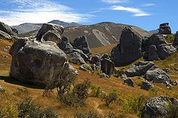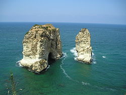
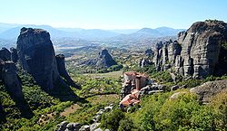
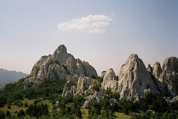
A rock formation is an isolated, scenic, or spectacular surface rock outcrop. Rock formations are usually the result of weathering and erosion sculpting the existing rock. The term rock formation can also refer to specific sedimentary strata or other rock unit in stratigraphic and petrologic studies.
A rock structure can be created in any rock type or combination:
Geologists have created a number of terms to describe different rock structures in the landscape that can be formed by natural processes:
Here is an incomplete list of rock formations by continent.
A canyon, gorge or chasm, is a deep cleft between escarpments or cliffs resulting from weathering and the erosive activity of a river over geologic time scales. Rivers have a natural tendency to cut through underlying surfaces, eventually wearing away rock layers as sediments are removed downstream. A river bed will gradually reach a baseline elevation, which is the same elevation as the body of water into which the river drains. The processes of weathering and erosion will form canyons when the river's headwaters and estuary are at significantly different elevations, particularly through regions where softer rock layers are intermingled with harder layers more resistant to weathering.
A natural arch, natural bridge, or rock arch is a natural landform where an arch has formed with an opening underneath. Natural arches commonly form where inland cliffs, coastal cliffs, fins or stacks are subject to erosion from the sea, rivers or weathering.
At all geography and geology, a cliff or rock face is an area of rock which has a general angle defined by the vertical, or nearly vertical. Cliffs are formed by the processes of weathering and erosion, with the effect of gravity. Cliffs are common on coasts, in mountainous areas, escarpments and along rivers. Cliffs are usually composed of rock that is resistant to weathering and erosion. The sedimentary rocks that are most likely to form cliffs include sandstone, limestone, chalk, and dolomite. Igneous rocks such as granite and basalt also often form cliffs.
A petroglyph is an image created by removing part of a rock surface by incising, picking, carving, or abrading, as a form of rock art. Outside North America, scholars often use terms such as "carving", "engraving", or other descriptions of the technique to refer to such images. Petroglyphs, estimated to be 20,000 years old are classified as protected monuments and have been added to the tentative list of UNESCO's World Heritage Sites. Petroglyphs are found worldwide, and are often associated with prehistoric peoples. The word comes from the Greek prefix petro-, from πέτρα petra meaning "stone", and γλύφω glýphō meaning "carve", and was originally coined in French as pétroglyphe.
A monolith is a geological feature consisting of a single massive stone or rock, such as some mountains. Erosion usually exposes the geological formations, which are often made of very hard and solid igneous or metamorphic rock. Some monoliths are volcanic plugs, solidified lava filling the vent of an extinct volcano.
The Colorado Plateau is a physiographic and desert region of the Intermontane Plateaus, roughly centered on the Four Corners region of the southwestern United States. This plateau covers an area of 336,700 km2 (130,000 mi2) within western Colorado, northwestern New Mexico, southern and eastern Utah, northern Arizona, and a tiny fraction in the extreme southeast of Nevada. About 90% of the area is drained by the Colorado River and its main tributaries: the Green, San Juan, and Little Colorado. Most of the remainder of the plateau is drained by the Rio Grande and its tributaries.
A hoodoo is a tall, thin spire of rock formed by erosion. Hoodoos typically consist of relatively soft rock topped by harder, less easily eroded stone that protects each column from the elements. They generally form within sedimentary rock and volcanic rock formations.
The Cheile Bicazului - Hășmaș National Park is located in north-eastern Romania, in the Eastern Carpathians mountain chain. The reservation territory is part of Neamț and Harghita counties.
The Bicaz Gorge is a gorge in Romania, located in the north-east part of the country, in Neamț and Harghita counties. It is situated in the central part of the Hășmaș Mountains, and it is part of the Cheile Bicazului-Hășmaș National Park.
The Piedra River is a river in the U.S. state of Colorado. It drains parts of Archuleta, Hinsdale, and Mineral counties along a mainstem length of about 40 miles (64 km). The river flows through a series of isolated box canyons, emptying into the San Juan River at Navajo Lake. Its name stems from the Spanish word, piedra, meaning rock.
A balancing rock, also called a balanced rock, precariously balanced rock (PBR), or precarious boulder, is a naturally occurring geological formation featuring a large rock or boulder, sometimes of substantial size, resting on other rocks, bedrock, or on glacial till. Some formations known by this name only appear to be balancing, but are in fact firmly connected to a base rock by a pedestal or stem.
Fossiliferous limestone is a type of limestone that contains noticeable quantities of fossils or fossil traces. If a particular type of fossil dominates, a more specialized term can be used as in "Crinoidal", "Coralline", "Conchoidal" limestone. If seashells, shell fragments, and shell sand form a significant part of the rock, a term "shell limestone" is used.
Isis Temple is a prominence in the Grand Canyon, Arizona, Southwestern United States. It is located below the North Rim and adjacent to the Granite Gorge along the Colorado River. The Trinity Creek and canyon flow due south at its west border; its north, and northeast border/flank is formed by Phantom Creek and canyon, a west tributary of Bright Angel Creek; the creeks intersect about 3 mi (4.8 km) southeast, and 1.0 mi (1.6 km) north of Granite Gorge. The Isis Temple prominence, is only about 202 ft (62 m) lower than Grand Canyon Village, the main public center on Grand Canyon’s South Rim.
Windows Spotlight is a feature included with Windows 10 and Windows 11 which downloads images and advertisements from Bing and displays them as background wallpapers on the lock screen. In 2017, Microsoft began adding location information for many of the photographs.
The Ocetá Páramo is a páramo, which means an ecosystem above the continuous forest line yet below the permanent snowline. This particular páramo is located at altitudes between 2,950 metres (9,680 ft) and 3,950 metres (12,960 ft) in the Eastern Ranges of the Colombian Andes. It covers parts of the municipalities Monguí, Mongua and Tópaga, belonging to the Sugamuxi Province, Boyacá. The Ocetá Páramo is known for its collection of small shrubs called frailejones, as well as other Andean flora and fauna. Hiking tours from Monguí or Mongua to the páramo take a full day.
Kigilyakh or kisiliyakh are pillar-like natural rock formations looking like tall monoliths standing more or less isolated. Usually they are composed of granite or sandstone shaped as a result of cryogenic weathering. Most kigilyakhs formed during the Cretaceous period and are about 120 million years old.
Piatra Craiului National Park is a protected area of national interest in Romania corresponding to IUCN category II, located on the territories of Argeș and Brașov counties. Located on the Piatra Craiului Massif, it is largely karstic.