List of tourist attractions in Somerset

Last updated

Key
AP Icon.svg Abbey/Priory/Cathedral
UKAL icon.svg Accessible open space
Themepark uk icon.png Amusement/Theme Park
CL icon.svg Castle
Country parks.svg Country Park
EH icon.svg English Heritage
Forestry Commission
HR icon.svg Heritage railway
HH icon.svg Historic House
AP Icon.svg Places of Worship
Museum icon.svg
Museum icon (red).svg
Museum (free/not free)
NTE icon.svg National Trust
Drama-icon.svg Theatre
Zoo icon.jpg Zoo

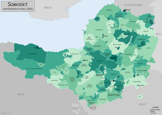
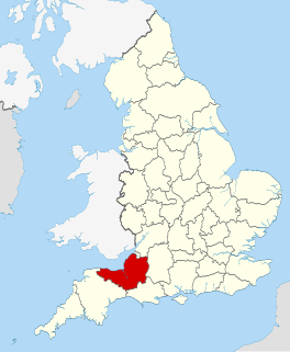
Tourist attractions in the English county of Somerset include:

See also

Related Research Articles

Somerset County in South West England

Somerset is a county in South West England which borders Gloucestershire and Bristol to the north, Wiltshire to the east, Dorset to the south-east and Devon to the south-west. It is bounded to the north and west by the Severn Estuary and the Bristol Channel, its coastline facing southeastern Wales. Its traditional border with Gloucestershire is the River Avon. Somerset is currently formed of six council areas, of which two are unitary authorities, until the four second-tier district councils are merged on 1 April 2023, after which the county will comprise of three unitary authorities. Its county town is Taunton.

Bath and North East Somerset Non-metropolitan district in England

Bath and North East Somerset (B&NES) is a unitary authority district in England. Bath and North East Somerset Council was created on 1 April 1996 following the abolition of the county of Avon. It is part of the ceremonial county of Somerset.

Mendip Hills Range of limestone hills to the south of Bristol and Bath in Somerset, England

The Mendip Hills is a range of limestone hills to the south of Bristol and Bath in Somerset, England. Running from Weston-super-Mare and the Bristol Channel in the west to the Frome valley in the east, the hills overlook the Somerset Levels to the south and the Chew Valley and other tributaries of the Avon to the north. The hills give their name to the local government district of Mendip, which administers most of the area. The higher, western part of the hills, covering 198 km2 (76 sq mi) has been designated an Area of Outstanding Natural Beauty (AONB), which gives it a level of protection comparable to a national park.

History of Somerset Aspect of history

Somerset is a historic county in the south west of England. There is evidence of human occupation since prehistoric times with hand axes and flint points from the Palaeolithic and Mesolithic eras, and a range of burial mounds, hill forts and other artefacts dating from the Neolithic, Bronze and Iron Ages. The oldest dated human road work in Great Britain is the Sweet Track, constructed across the Somerset Levels with wooden planks in the 39th century BCE.

Geology of Somerset

Somerset is a rural county in the southwest of England, covering 4,171 square kilometres (1,610 sq mi). It is bounded on the north-west by the Bristol Channel, on the north by Bristol and Gloucestershire, on the north-east by Wiltshire, on the south-east by Dorset, and on the south west and west by Devon. It has broad central plains with several ranges of low hills. The landscape divides into four main geological sections from the Silurian through the Devonian and Carboniferous to the Permian which influence the landscape, together with water-related features.

Bristol and Exeter Railway Former English railway company

The Bristol & Exeter Railway (B&ER) was an English railway company formed to connect Bristol and Exeter. It was built on the broad gauge and its engineer was Isambard Kingdom Brunel. It opened in stages between 1841 and 1844. It was allied with the Great Western Railway (GWR), which built its main line between London and Bristol, and in time formed part of a through route between London and Cornwall.

Culture of Somerset

Somerset is a county in the south west of England. It has a varied cultural tradition ranging from the Arthurian legends to The Wurzels, a band specialising in Scrumpy and Western music.

Economy of Somerset Regional economy

Somerset is a county in the south west of England. It is a rural county and transport infrastructure has been significant in industrial development. There is some heavy industry particularly related to the defence technologies and the county has several centres for stone quarrying, although the coalfield is now closed.

Grade I listed buildings in Somerset Buildings of exceptional interest in Somerset

The Grade I listed buildings in Somerset, England, demonstrate the history and diversity of its architecture. The ceremonial county of Somerset consists of a non-metropolitan county, administered by Somerset County Council, which is divided into five districts, and two unitary authorities. The districts of Somerset are West Somerset, South Somerset, Taunton Deane, Mendip and Sedgemoor. The two administratively independent unitary authorities, which were established on 1 April 1996 following the breakup of the county of Avon, are North Somerset and Bath and North East Somerset. These unitary authorities include areas that were once part of Somerset before the creation of Avon in 1974.

Transport in Somerset Overview of transport in Somerset

The earliest known infrastructure for transport in Somerset is a series of wooden trackways laid across the Somerset Levels, an area of low-lying marshy ground. To the west of this district lies the Bristol Channel, while the other boundaries of the county of Somerset are along chains of hills that were once exploited for their mineral deposits. These natural features have all influenced the evolution of the transport network. Roads and railways either followed the hills, or needed causeways to cross the Levels. Harbours were developed, rivers improved, and linked to sources of traffic by canals. Railways were constructed throughout the area, influenced by the needs of the city of Bristol, which lies just to the north of Somerset, and to link the ports of the far south-west with the rest of England.

Geography of Somerset

The county of Somerset is in South West England, bordered by the Bristol Channel and the counties of Bristol and Gloucestershire to the north, and Wiltshire to the east, Dorset to the south, and Devon to the west. The climate, influenced by its proximity to the Atlantic Ocean and the prevailing westerly winds, tends to be mild, damp and windy.

Scheduled monuments in Somerset Nationally important sites in Somerset, England

There are over 670 scheduled monuments in the ceremonial county of Somerset in South West England. The county consists of a non-metropolitan county, administered by Somerset County Council, which is divided into five districts, and two unitary authorities. The districts of Somerset are West Somerset, South Somerset, Taunton Deane, Mendip and Sedgemoor. The two administratively independent unitary authorities, which were established on 1 April 1996 following the breakup of the county of Avon, are North Somerset and Bath and North East Somerset. These unitary authorities include areas that were once part of Somerset before the creation of Avon in 1974.