Ruakura is a semi-rural suburb of Hamilton City, in the Waikato region of New Zealand. The University of Waikato is nearby.
Fairfield is a suburb to the northeast of central Hamilton, New Zealand. Fairfield is named after the dairy farm of John Davies, who bought 100 acres from F. R. Claude. This area experienced rapid growth in the 1950s and 60s.

Hillcrest is a suburb in southeastern Hamilton in New Zealand. The suburb is home to the University of Waikato and consequently has a large student population. It is located on the east side of the Hamilton Town Belt, a series of public parks that run from the Hamilton Gardens to Ruakura in its eastern section.

Silverdale is a suburb in south-eastern Hamilton in New Zealand.

Flagstaff is a suburb in north-east Hamilton, New Zealand. It was originally called Dulverton on council plans, but it was officially named Flagstaff in 1986 when it was declared as a suburb. The area was heavily developed in the 1990s. The name "Flagstaff" comes from the flagstaff that was located on the hillock at the western end of Sylvester Road in the 1870s. A flag was raised by the local farmer when a steamer passed to alert the port authorities in the settlement 7 km further south. Flagstaff is connected to Pukete by a 5 m wide pedestrian bridge that connects with a series of walkways on both banks of the Waikato River. The suburb is served by a shopping centre with parks for 50 cars. It has 18 shops and a gym.

Rototuna is a suburb in northern Hamilton, New Zealand, east of Flagstaff. It was built on what was previously the bed of an ancient lake of which Rototuna was a tiny remnant. It is one of the newest and fastest-growing suburbs in Hamilton, along with Neighbouring Huntington and Flagstaff.

Western Heights is a suburb on the western boundary of the city of Hamilton in the Waikato region of the North Island of New Zealand.

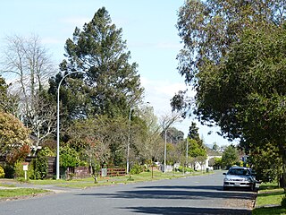
Riverlea is a suburb in south-eastern Hamilton in New Zealand. It is located south of Hillcrest. The suburb is primarily residential, with a small section of light industrial land along Riverlea Road.

Crawshaw is a compact suburb, close to Te Rapa railway depot, in western Hamilton in New Zealand, and extended in the 2018 census to cover 0.86 km2. Although sometimes referred to as a suburb in its own right, it is often described as being part of Nawton.

Deanwell is a suburb in south-western Hamilton in New Zealand. It is named after Deanwell Properties, the developers who subdivided the area. It was defined as a suburb of Hamilton in 1974.

Grandview Heights is a suburb in western Hamilton in New Zealand.

Hamilton West, also known as Hamilton Lake, is a suburb in western Hamilton in New Zealand.

Melville is a suburb in southern Hamilton in New Zealand. It is named after James Dougal Melville. Many of the streets in Melville are named after war heroes, including Douglas Bader, Bernard Montgomery, Odette Hallowes, David Beatty and William Slim. Melville was named after the districts pioneer J Melville who lived in 1904 opposite the site of Melville Primary School. The Hospital paved the way for a great deal of development throughout the Melville area. Opened in 1887 the area quickly became known as Hospital Hill although it was not added to the Hamilton Borough until 1936. Hamilton city extended its boundaries to Collins Road, Melville in 1954 and again in 1962 to Houchens Road, Glenview and Dixon Road, Glenview. In 1960 Melville gained Hamiltons 4th suburban post office which was followed in 1964 with the opening of Melville High School. The facilities in Melville reflected the significant growth of Melville / Glenview throughout the 1950s. Melville lends its name to one of Hamilton's top association football teams, Melville United who compete in the Lotto Sport Italia NRFL Premier.
Nawton is a suburb in western Hamilton in New Zealand.

Pukete is a 1970s riverside suburb in northwestern Hamilton in New Zealand.
Thornton is a name sometimes used for part of a suburb in western Hamilton in New Zealand.

Ashmore is a name used for a suburb in north-eastern Hamilton in New Zealand by Hamilton City Council on its 2010 map and by the developer, CDL Land New Zealand Limited. It is more commonly described as being part of Rototuna North. It is in Rototuna Central census area.

Harrowfield is a suburb in eastern Hamilton in New Zealand. It was built in about 1991.

Magellan Rise is a new suburb in north-eastern Hamilton in New Zealand. In the 2018 census it is at the boundaries of Flagstaff North, East and South areas and is described by others as Flagstaff.

St Petersburg is a suburb in north-eastern Hamilton in New Zealand. In the 2013 census it was in meshblock 0951707, which was part of Sylvester area and had a population of 822 in 240 houses. In 2018 that meshblock was split into 4 meshblocks and is part of Flagstaff South. Others also describe it as part of Flagstaff.
