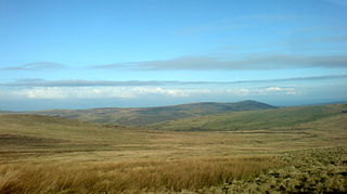
The Preseli Hills, known locally and historically as the Preseli Mountains, is a range of hills in western Wales, mostly within the Pembrokeshire Coast National Park.

Nevern is both a parish and a community in Pembrokeshire, Wales. The community includes the settlements of Felindre Farchog, Monington, Moylgrove and Bayvil. The small village lies in the Nevern valley near the Preseli Hills of the Pembrokeshire Coast National Park 2 miles (3 km) east of Newport on the B4582 road.
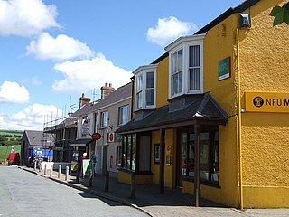
Crymych is a village of around 800 inhabitants and a community in the northeast of Pembrokeshire, Wales. It is situated approximately 800 feet (240 m) above sea level at the eastern end of the Preseli Mountains, on the old Tenby to Cardigan turnpike road, now the A478.
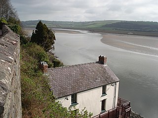
The River Taf is a river in West Wales. It rises in the Preseli Hills, Pembrokeshire, and continues through Carmarthenshire to Laugharne. It is one of the three rivers to enter the sea on the east side of Carmarthen Bay. The other two are the River Gwendraeth and River Tywi.
The A478 road is a major road in Wales. The route is from its junction with the A487 at Cardigan, Ceredigion, to Tenby, Pembrokeshire. It crosses the Preseli Hills and winds through farmland for almost all of its route. The road just touches the very west of Carmarthenshire.

Dinas Cross is both a village, a community and a former parish in Pembrokeshire, Wales. Located between Fishguard and Newport in the Pembrokeshire Coast National Park, it is a popular holiday destination on the A487 road. The two hamlets, Cwm-yr-Eglwys and Pwllgwaelod, are in the community. The community has an elected community council and until 2022 gave its name to an electoral ward of Pembrokeshire County Council which covered the communities of Dinas Cross, Cwm Gwaun and Puncheston.
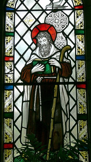
Saint Brynach was a 6th-century Welsh saint. He is traditionally associated with Pembrokeshire, where several churches are dedicated to him.

Carew is a village, parish and community on an inlet of Milford Haven in the former Hundred of Narberth, Pembrokeshire, West Wales, 4 miles (6.4 km) east of Pembroke. The eastern part of the parish is in the Pembrokeshire Coast National Park.

Llanboidy is a village and community in the principal area and historic county of Carmarthenshire, West Wales. The community includes the village of Llanglydwen.
Manordeifi is a parish and community in the hundred of Cilgerran, in the northeast corner of Pembrokeshire, Wales. The population of the community in 2001 was 478. It has an elected community council and is part of the Cilgerran electoral ward for the purposes of elections to Pembrokeshire County Council.
Cilymaenllwyd is a community on the extreme northwest of Carmarthenshire in Wales. The community population at the 2011 census was 742. It lies about 25 miles (40 km) west of Carmarthen, 12 miles (19 km) southeast of Fishguard and 15 miles (24 km) northeast of Haverfordwest. The A478 road runs through the community.

Llanwnda is a rural village and parish to the north of the Welsh county of Pembrokeshire and part of the community of Pencaer. It lies some two miles northwest of the port of Fishguard and is inside the boundaries of the Pembrokeshire Coast National Park.

Boncath is a village, community and postal district in north Pembrokeshire, Wales, about 5 miles (8.0 km) west of Newcastle Emlyn.

Eglwyswen is a scattered rural settlement and parish in Pembrokeshire, Wales. It is on the north slopes of the Preseli Hills, 2.5 miles (4.0 km) northwest of Crymych. The south-western part of the parish is in the Pembrokeshire Coast National Park and includes the settlements of Pontyglasier and Penygroes. The parish is part of the community of Crymych.

Pontfaen is a small rural village and parish in the community of Cwm Gwaun, north Pembrokeshire, Wales. It is 3 miles (4.8 km) southeast of the port of Fishguard.
Daniel John Davies was a Welsh Independent (Congregationalist) minister and Welsh language poet. He published under the name 'D.J. Davies' and was also well known as 'Davies Capel Als'.

Glandwr is a small rural village in the parish of Llanfyrnach and the community of Crymych, Pembrokeshire, Wales. The village appears on a pre-1850 parish map as Glan-dwr. It is linked by unclassified roads to adjacent settlements and to the A478 road.
Pentre Galar is a small settlement in the Preseli Mountains south of the village of Crymych, north Pembrokeshire, Wales, on the A478 Cardigan to Tenby road. The western part of the settlement lies in the parish of Mynachlog-ddu and the eastern part in Llanfyrnach parish.
Llanychaer is a small rural village and parish in the community of Cwm Gwaun, north Pembrokeshire, Wales. It is 2 miles (3.2 km) southeast of the port of Fishguard.


